Bush Explorers Encyclopaedia
Name:
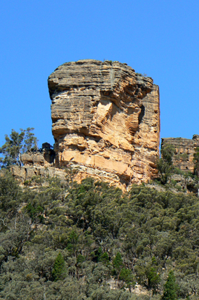
Baal Bone Point *
Description:
Was also first shown on the same map as Baal Bone Gap. Baal Bone Point is the terminal point of land at northern end of the escarpment 2.5km south west of Pantoneys Crown.
Maps:
- Ben Bullen
Grid Reference:
- 272 223
Location:
Gardens of Stone National Park
Status:
Protected
Related Names:
Read More In:
Walks:
- GOS1.14: Rowans Hole West to East
- GOS1.15: Murdocks Trail to Baal Bone Point via Coco Creek
- GOS1.23: The Eastern Extension of Mount Genowlan
- GOS1.25: South of Hecates Cauldron
- GOS2.24: Traversing Pantoneys Crown
- GOS5.01: North and west of Murdocks Creek
- GOS5.02: Gaudis Walls
- GOS5.04: Tara Slot
Photos: