Bush Explorers Encyclopaedia
Name:
Long Swamp *
Description:
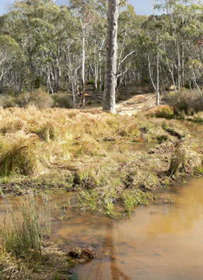
Through which the Coxs River flows, is parallel to the Wolgan Road and is 500m west of Angus Place. This is a descriptive name, as the swamp is 1.7km long and 50 to 300m wide. Swamp shown (no name) on Baker, William. Map of the County of Cook, c1843.
Maps:
- Cullen Bullen
Grid Reference:
- 293 059
Location:
private land
Status:
Related Names:
Read More In:
Walks:
- GOS1.07: McLeans Pass and further east
- GOS5.05: Exploring Cape Horn
- GOS5.08: Exploring Skittle Row
- GOS5.12: Wolgan Gap Trig
- GOS5.13: Wolgan Gap cliff line
- GOS5.21: Long Swamp
- GOS5.22: Ben Bullen Pillars
Photos: