Bush Explorers Encyclopaedia
Name:
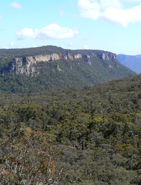
Wolgan Gap *
Description:
Is the break in the cliff line that provides road access to Newnes from Lidsdale. Before the present road descended down Wolgan Gap, the road was on the eastern side of this gap and that path was called Donkey Steps. It was used to bring in the first cattle prior to 1880. Ref: Joe Bird, past resident of the Wolgan Valley, oral history to Brian Fox, 17th June 2009. Survey Plan R587.1603r, dated 3rd March 1866. The Survey Plan 6-2062, dated October 1874, shows the road through "The Gap." The name Wolgan Gap is shown on the map Parish of Cox, 1884. The Sydney Morning Herald,14th July 1877, p. 3, records, "Road grant at Wolgan Gap, 250 pounds."
Maps:
- Cullen Bullen
Grid Reference:
- 312 099
Location:
Status:
Related Names:
Read More In:
Walks:
- GOS1.12: Collett Gap and Woolpack Rock
- GOS2.02: Mount Dawson and Gindantherie Pinnacle
- GOS3.03: Donkey Mountain 3
- GOS5.05: Exploring Cape Horn
- GOS5.11: Cullen Bullen Cemetery to Wolgan Gap
- GOS5.12: Wolgan Gap Trig
- GOS5.13: Wolgan Gap cliff line
- GOS5.20: Alois Spur
- GOS5.21: Long Swamp
- GOS5.23: Blackfellows Hand Rock
- GOS5.26: Lambs Creek and Kangaroo Creek
- GOS6.01: The Temples of Doom
- GOS6.02: Last Crusade Point and Holy Grail Ravine
- GOS6.03: Indiana Gorge and Indiana Slot
- GOS6.06: Cliff Lines above the Wolgan River
- GOS6.08: Rockflower Ridge and Creek
- GOS7.04: Clerestory Spurs No. 1 and No. 2
Photos: