Bush Explorers Encyclopaedia
Name:
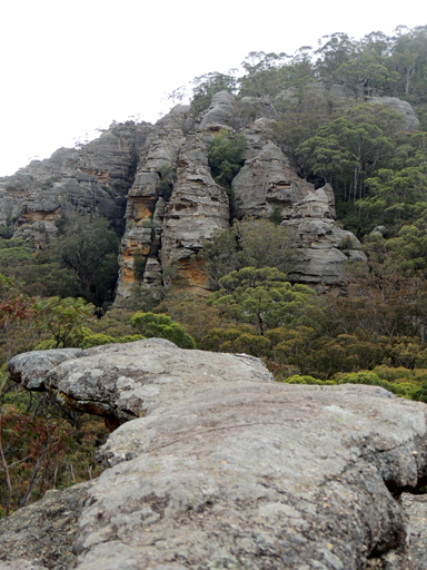
Airly Turret *
Description:
Is a rocky peak about 2km south east of Mount Airly. Airly Turret is shown on the map Parish of Airly, 1st edition, 1884.
Maps:
- Glen Alice
Grid Reference:
- 243 321
Location:
Mugii Murum-ban State Conservation Area
Status:
Threatened
Walks:
- GOS1.01: Blacks Corner
- GOS1.02: Genowlan Mountain
- GOS1.05: East Mount Airly
- GOS1.09: Passes of East Genowlan Mountain
- GOS1.11: Point Hattera and Ladders Defile
- GOS1.22: The Valley of the Kings
- GOS1.23: The Eastern Extension of Mount Genowlan
- GOS1.24: Genowlan Canyon, Mothers Arms and the Dragons Mouth
Photos: