Bush Explorers Encyclopaedia
Name:
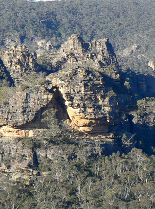
Bungleboori Lookout
Description:
A local name, is located 2.6km northeast of Bald Trig Station. Access is via 4WD firetrails to a mine airshaft GR 444 975 and walking north east to the end of the ridge line. Bungleboori Lookout is highlighted in Karen McLaughlin's pamphlet, short walks on the Newnes Plateau. Compiled for the Blue Mountains Conservation Society, June 2009. There are spectacular views from a narrow ridge line towards north and east of Bungleboori Creek and surrounding area. The three Aboriginal named creeks, Bungleboori, Dumbano and Yarramun, are shown on the Wallerawang one inch to the mile Army Topo Map, March 1933, most likely named by Lt. Col. Hugh Powell Gough 'Major' Clews when he compiled this map sheet.
Maps:
- Wollangambe
Grid Reference:
- 453 980
Location:
Newnes State Forest
Status:
Threatened
Related Names:
Read More In:
Walks:
Photos: