Bush Explorers Encyclopaedia
Name:
Blacks Corner *
Description:
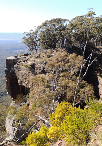
Is a local name recorded by Eardley and Stephens, "The ramparts of Airly Mountain are located on the western portion of the Morandurey (or Genowlan) Range and its rugged escarpments and out-jutting spurs, in plan view, resemble a three-leafed shamrock bending towards the east, a narrow-necked western extension, curling around northwards provided the shamrock shape with a figurative stalk which terminates in a headland known as Black's Corner." Ref: Eardley, G H. and Stephens, E M. The Shale Railways of NSW, 1974, p. 88. Within the chapter, The Genowlan Shale Company, Airly. The headland is located at approximately GR 230 360 with a height of just over 1020m.
Maps:
- Glen Alice
Grid Reference:
- 230 360
Location:
Status:
Related Names:
Read More In:
Walks:
- GOS1.11: Point Hattera and Ladders Defile
- GOS1.22: The Valley of the Kings
- GOS1.24: Genowlan Canyon, Mothers Arms and the Dragons Mouth
Photos: