Bush Explorers Encyclopaedia
Name:
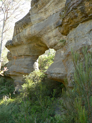
Bungleboori Arch
Description:
Is located 1.3km, 10 degrees west of south from Mount Horne. It is oriented north west to south east. Bungleboori Creek flows around the Arch to the north west, not through it. The dimensions of the actual Arch are thickness 3m, reasonably uniform, width 12m at the base and height 9m.
Maps:
- Lithgow
Grid Reference:
- 425 000
Location:
Newnes State Forest
Status:
Threatened
Related Names:
Read More In:
Walks:
- GOS4.12: Bungleboori Creek and Clwydd Pass
- GOS4.16: Bungleboori Creek - Paddys Creek
Photos: