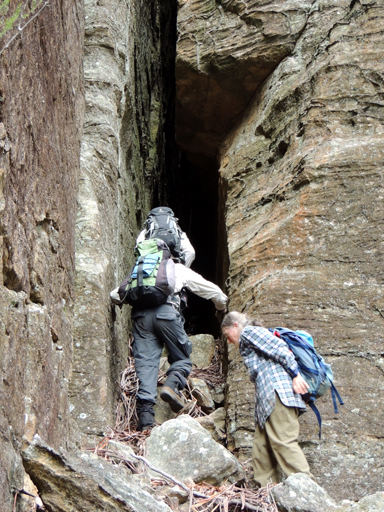
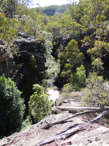
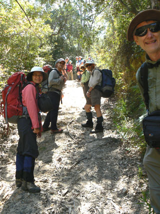
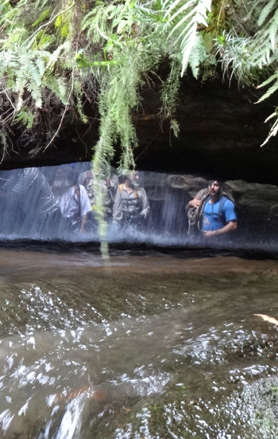
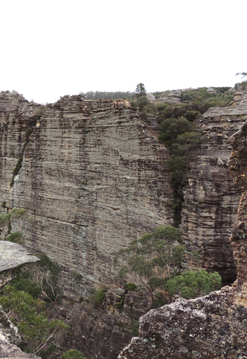
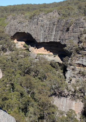
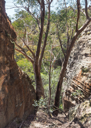
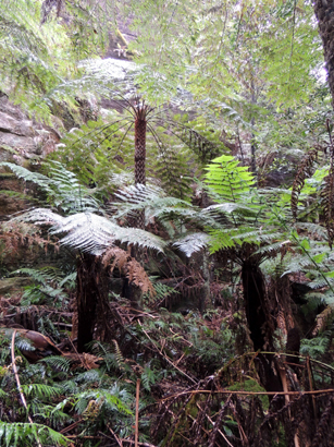
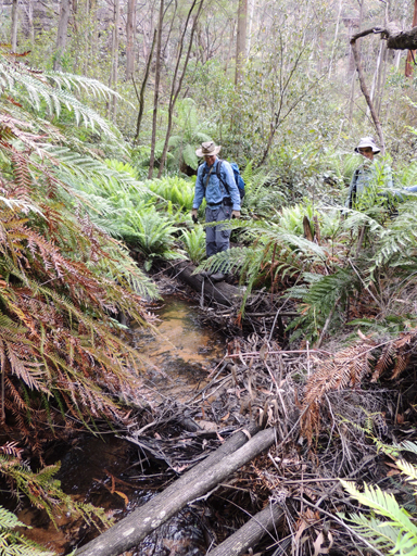
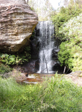
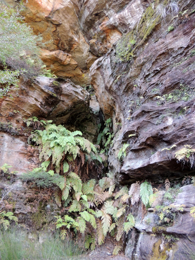
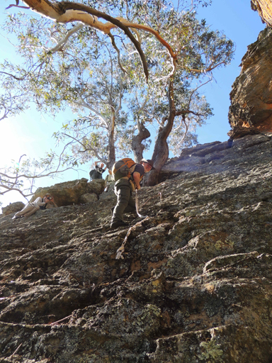
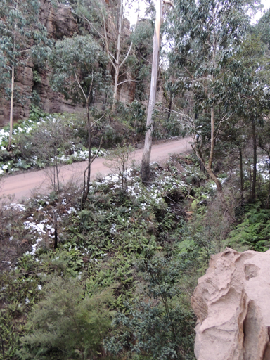
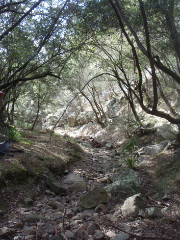
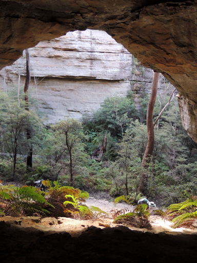
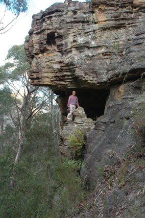
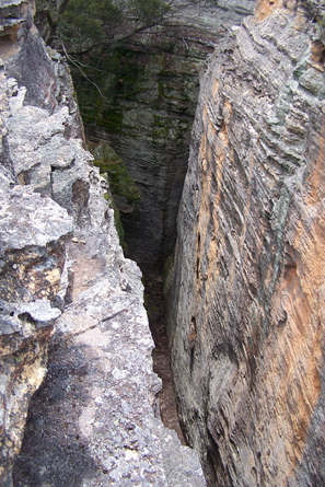
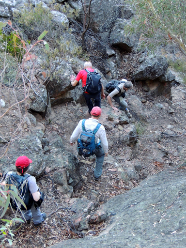
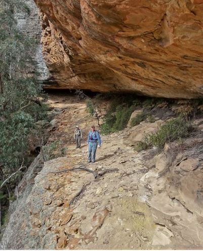
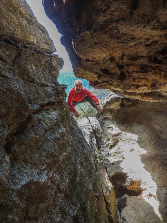
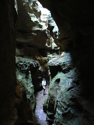
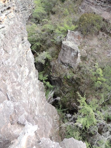
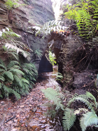
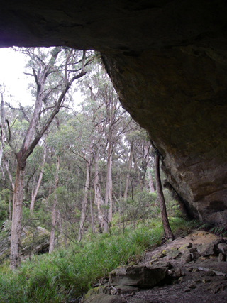
Is not obvious until you are up close to the starting point. A fold in the slot itself gives the appearance of a short natural adit. When you are up close then the full wonder is revealed. It is very narrow, 50cms for most of the 50m length and it comes complete with an internal graded ramp that leads down some 30m to the base of the top cliff line.There was some banter about the slot going all the way through the cliffs to the talus slope and provide a back entry to the Wolgan Valley Resort and the absurd possibility of ordering coffees all round. No way was this going to happen and so because of this, this huge slot has been called Delusional Slot by Michael Keats on a Bush Club walk 10th January 2014. Delusional Pass refers to the access to below the cliff line via Delusional Slot so named by Brian Fox on a Bush Club walk, 19th May 2014. Base of pass 401 175.
Bush Explorers Encyclopaedia
Was named by Wilf Julius Hilder, former employee of the Department of Lands. Wilf named features in this area based on a steam railway theme; this was due to the existence of the former Wolgan Valley Railway Line. The name was originally rejected by GNB in 1975 and much later assigned by GNB. Ref: Government Gazette, 29th September 2006. Derailment Hill is located 1.4km near due south of Mount Norris and has a height of 994m. This hill is on top of a small spur, which in turn is on the southern side of Railmotor Ridge.
Refers to the cliff line on the south western side of Mystery Mountain. Name recorded with map in Taylor, Pete. The Wolgan Valley A Rockclimber's Guide, 1st ed; 1974, p. 17. The first climbers in this area were Roland Pauligk and Tony Nemec in January 1975.
Is a steep section of land close to and on the south bank of the Wolgan River, located 4.6km downstream from Newnes and 5.6km upstream from the Wolgan River and Rocky Creek junction. This point also marks the eastern end point of the Wolgan Valley. Devils Pinch was a descriptive name for the notorious narrowing of the valley which made travelling through the area difficult. It refers to the narrow tight squeeze for the bridle track between the river and high ground. The Parish Map of Barton, County of Cook, 1st edition, 1884 shows a bridle track along the Wolgan River from present day Newnes to the junction of Annie Rowan Creek and Wolgan River. Midway along this track, the Parish Map shows the name, The Devils Pinch. Shown on Mount Morgan Topo Map, GR 470 265, but correct location is GR 463 262.
So named as the water rushing down Camp Creek enters a circular, 2 to 4m diameter shaft of about 15m in height and pours out at the base via horizontal slot hole in the rock, before cascading down another 15m drop. It is as if the devil's head is upside down and water pours down its throat and out of its mouth. Named by Michael Keats on a Bush Club walk, 22nd March 2007. Devils Throat is also the bottom part of Alcatraz Canyon.
Gives an easy access in a cliff lined area from the western end of Fire Trail No. 1 via Glowworm Tunnel Road and Carne Creek. So named by Brian Fox and Michael Keats on a Bush Club walk, 10th April 2015 as it gives the easiest and quickest access to Devils Throat within Camp Creek.
See entry Tarrapalat
Are located above Adrenalin Creek. They were named by Yuri Bolotin during a Bush Club walk in this area, 8th April 2013. These caves are on two distinct levels and are slightly offset from one another. It is not possible without some significant risk to climb from the upper to the lower cave. Both caves have a single curved overhang which is over 100m.
Is located on the western side of Adrenalin Creek and 500m east of Fire Trail No. 6 off Sunnyside Ridge Road. Named by Chris Sterling and described on Michael Keats walk report on the 27th November 2012 as,"we entered a huge and cavernous eroded area. Slot is not quite the right word. A cavern is best description. The mouth was tapered from both the top and bottom giving a rough pinched diamond shape to the aperture. The cavern widens inside and the floor rises rapidly towards the back, some 40m in from the opening."
Is located within the Eldorado Slots above Eldorado Walls, 1.6km due south of the old Newnes Hotel. This ramp led to the top of an extremely eroded pagoda, with three evenly spaced ravine/slots of great dimensions stretched out below at 90 degree angles to each other. Jointly named by Yuri Bolotin, Michael Keats and Brian Fox on a Bush Club walk, 10th October 2016 in keeping with the Eldorado theme, plus a Diamond Python was photographed at the base of the ramp.
Is one of the oldest and finest Dicksonia antarctica Tree Fern forests a person is ever likely to come across. Located within a northern tributary of Dingo Creek, 1.4km south west of Deep Pass. This name was coinedby David Dash and Michael Keats on a Bush Club walk, 16th November 2012.
Rises on Waratah Ridge, north east side of Glowworm Tunnel Road and Waratah Ridge Road. It is about 17km in length and flows north and east into Bungleboori Creek. Name assigned by GNB, Government Gazette, 29th September 2006. Originally, Dingo Creek only referred to the first 4km of the creek from its headwaters; the eastern section of this creek was known as the North Branch Bungleboori Creek.
Located on Dingo Creek, 940m south east of Cockatoo Hill. These falls have a drop of about 10m into a small rocky pool with a depth of 1.5m. Named by Brian Fox 28th November 2014 on a Bush Club walk.
Is located 800m south east of Eastern Boundary Road and Deep Pass Trail. This narrow defile between two large gullies gives access from a northern tributary cliff line towards Dingo Creek. Named by Brian Fox on a Bush Club walk, 28th November 2014. The vertical difference is 65m. A squeeze midway via a tunnel opens into a narrow, fern filled defile.
Is located 800m south east of Eastern Boundary Road and Deep Pass Trail. Named by Michael Keats on a Bush Club walk, 28th November 2014. "U" shaped over hang in which the western wall is more than 105m in length. The back wall about 50m and the eastern wall 50m. In the centre at the northern end a finely divided waterfall some 15m high cascades onto a rocky platform. It appears to be a permanent water source.
Is a water courserising about 7km west, south west of Rock Hill. It flows for about 2km generally north, north east into Budgary Creek. Mount Cameron Trail passes midway along Dinner Gully. Name gazetted on 30th May 1975 as Dinner Gully. Previous name Dinner Creek. Lt. Col. Hugh Powell Gough Clews, known as "The Major" (1890-1980), Australian Survey Corps, named Dinner Creek after the place where they had lunch (dinner). Ref: Kameruka Magazine, Vol: 16; No. 2, July 1978. Note: Clews chapter, The Bad Bit across the River, records,"Lunch at the appropriately named Dinner Creek." The bridle track to Mount Cameron was in use from 1903 and Clews (in the 1930s) most likely was just referring to the already local name.
During a walk on 18 July 2020, after spending some time at the lookout on the edge of the Valley of the Dinosaurs, we did not return to the road but walked south, following the rim of the valley. At GR 2529 3201, 996 m, we located a stunning slot, 50 m long and only about half a metre wide, that ends up on the valley floor, at GR 2536 3203, 980 m. Yuri Bolotin named this dramatic alternative entry to the valley, Dinosaur Slot.
Is located 900m north east of Invincible Trig Station. Named by Michael Keats on a Bush Club walk, 30th August 2103. This most unusual slot and waterfall combination has two breaks and morphs into a contorted, sculptured canyon like form. It then reverts to a fern backed waterfall before again becoming a sculptured form, terminating in a flat and usually dry quartz gravel terrace.
Is an access point from the top to the base of the cliff line on the eastern side of Carne Creek and on the southern side of Nobles Canyon. It cannot legitimately be called a "pass" as only a few could ever do it without a tape or rope, and a "pass" should be negotiable in both directions without aids. Named by Michael Keats on a Bush Club walk, 19th May 2014.
Originally referred to the State Mine entry but now locally refers to the steep section of road on State Mine Gully Road, 1.8km north of the railway workshops. The gully in which the State Mine was located was locally known by a number of names - Steak Knife Gully, Permafrost Gully, Dobbs Drift and The Drift. Dobbs Drift is located 1.5km north of State Mine Museum referred to in the entry under the State Mine. A drift is an incline access into a mine, i.e. not vertical or horizontal. The mine entrance, built in 1948, was named after John Phillip (Jack) Dobbs who was the State Mine Miners Federation Lodge Secretary. Ref: Lithgow Mercury, 12th June 2001, 3rd January 2002 and Stephen Imrie's correspondence, 5th January 2010.
Is located off State Mine Gully Road, 2.1km north of the railway museum, State Mine Gully, Lithgow. This unfenced lookout gives easy accessible views back towards Lithgow and the surrounding rock pagodas.
Is a suburb on the eastern side of Lithgow. The original track cut by Thomas Brown in 1834 came via Bells Line of Road and southern end of the old landing strip off Scenic Hill. (midway along the old track). Most likely named after Dr Walter Fawkes Mackenzie, (died 1886). He owned land covering 400ha between Lithgow and Hartley Valley. He was a medical doctor, Ref: SMH 9th August 1872, p. 1. He and his brother John held coal leases in this region. Ref: Carne, J F. The Kerosene Shale Deposits of NSW, 1903, p. 244.
Is located 200m below Dingo Defile and eastern side of a small tributary. A scramble up a slot leads to a rumpled platform below a higher cliff line. Named by Michael Keats on a Bush Club walk, 28th November 2014 in keeping with the Dingo theme of the area.
Is a non perennial stream rising about 4km south by west of Genowlan Mountain. It flows generally east for about 6km into Coco Creek. All of Dog Trap Creek tributaries are on the northern side of Glen Davis Road. Most likely, the name would have originated from the use of traps to catch Dingos in this area.
Named so because its domed ceiling is naturally decorated by a series of almost perfect concentric circles, as successive layers of ironstone banded sandstone have been uniformly removed in a circular manner. The floor is loose sand and is at an angle of almost 45 degrees. The dimensions are grand, 18m across the front, 16m from the drip line to the back wall and 12m high, also measured at the drip line. Named by Yuri Bolotin on a Bush Club walk, 16th May 2013.
Is an unusual pagoda 2.4km due south of the junction of Two Trees Road and Waratah Ridge Road. It contains an arch of fine proportions with the sunlight reflecting on a small, centrally disposed natural plinth within, like a flaming votive symbol, and secondly, when you enter the arch, it opens out as a great internal dome. Michael Keats and Brian Fox on a Bush Club walk, 21st May 2012, named this the Dome of St Peters, continuating the heavenly theme of features within this locality. The dimensions are: height 4m, width 6m and arch width 3m. The dome interior is larger, nearly 5m in diameter, as it extends beyond the arch.
See Donkey Mountain, north east section
Is a dissected mesa 8km south, south west of Newnes. This large, isolated mountain, 950m in height, is 350m above Wolgan Road. The mesa has at its southern end Mount Wolgan. Extensive views over the greater part of the Wolgan Valley can be seen from the top of this mountain. A note in Surveyor Robert Hoddle's diary, dated 12th November 1825, "Mr Walker J.P. and party in that quarter (Capertee area) A she ass foaled: being the first bred in theColony."Ref: Colville, Berres Hoddle. Robert Hoddle Pioneer Surveyor 1794-1881, 2004, p. 92. Annabella Boswell's Journal, 1839, records, that James Walker (who owned the outstation Wolgan) had quite a few donkeys. The mountain was first shown (but with no name) on the Survey Plan B4.691r, dated 3rd January 1831 Originally spelt on the early parish maps as The Donkey Mountain, for example, Parish of Wolgan, 1884. It was not until the recent parish maps of the early 1960s that the word "The" was dropped. Locals referred to the mesa as Big Donkey and Little Donkey (Little Donkey is Mount Wolgan). Ref: Joe Bird, oral history to Brian Fox, 15th June 2009. Joe also spoke to me about a path cut into the Wolgan Valley, called the Donkey Steps. Joe's great, great grandfather, Edward (Ned) Murray (1791-1862), was one of the earliest farmers in the Wolgan (he worked for the property owner, James Walker from 1824) and he had a donkey that he called Neddy. Thomas Archer records in his diary on the 17th June 1866, "Mule arrived last night from Wolgan." Ref: Morgan, MacLeod. A short history of the Wolgan Valley, 1959. RAHS Journal, Vol. 45, Pt. 2, p. 88. Geoff Fox, a bushwalker with The Bush Club, has explored, mapped and named many of the individual features within Donkey Mountain.
North East Maze section: Grand Entrance, The Freeway, Kents Crevasse, Two Storey Cave, The Green Room, Fairy Cave, Eagle Rock, Eagle Nest, The Grand Hall, Fig Trees Green Room Portal, Jenny Craig, QANTAS Drop, Fire Ramp, Wide Ramp, Scrubby Ramp, Lighthouse, Arrow, Gum Tree Room, Treeway, Cowpasture, Donkey Canyon, High Cave, Low Cave, Mossy Rocks, Long Passage, Too Tight Crevasse, Wolgan Window.
Middle Donkey Mountain section: Window,Titanic Canyon, Fern Gully, Eastern Lookout, Tayan View, Kents Ascent, Sticky Ramp, Port Canyon and Terrace Canyon.
The South West End: Sun Ledge, The Columns, Python Point, Top Slot, Fence, and The Stile.
Note: Donkey Mountain is a very fragile environment. Please help protect it by refraining from camping on the mountain and by only using fuel stoves; no lighting of wood fires.This pathway was on the eastern side of the present day Wolgan Road near Wolgan Gap; it was locally named the Donkey Steps. This area is currently used as access for the telephone line into the Wolgan Valley. The road down this steep section was surveyed on 3rd March 1866, but the present road down Wolgan Gap was found to be a better alternative. Ref: Road Plan R587.1603r. Referred to as the original access into the Wolgan, it was here that the first cattle were brought into the valley. Ref: Joe Bird, whose great, great grandfather lived and worked in the Wolgan Valley, oral account to Brian Fox, 17th June 2009. Also; Ref: Morgan, MacLeod. A short history of the Wolgan Valley, 1959. RAHS Journal, Vol. 45, Pt. 2,p. 93. Anything too large was lowered directly over the cliffs on rope. It was not until 1897 that the present Wolgan Road was constructed. Ref: Wolgan Valley Homestead Complex - Conservation Management Plan, prepared by Conybeare Morrison International, 2006. The Survey Plan C2323-1507 shows "permanent spring" near the top of the Donkey Steps.
Is a natural pass giving access through the cliffs to the top of a long, thin peninsula located at the northern extremity of Firetrail No. 7 off Sunnyside Ridge Road. Named by Michael Keats on his Bush Club walk, 28th October 2009.The choice of name was derived from the dominant view across the Wolgan Valley to Donkey Mountain.
See Sentinel Rock
See Twin Arch Cave.
Is located underneath the Wolgan Valley’s top cliff line, 2.3km north east of the propertyKoopartoo. This two storey overhang has dimensions of about 60m in length by 5m high by 10m wide. Named by Yuri Bolotin and Craig Flynn on a bushwalk on 30 September 2017.
Is a useful way of route up some 190m from the Wolgan Valley that terminates at the spectacular Double Decker Cave. Named by Yuri Bolotin and Craig Flynn on a bushwalk, 30 September 2017.
Is located high above the western side of Genowlan Creek, 1.1km south, south east of Point Hatteras. This very narrow 50cm wide and 5m high slot extends for about 30m. Because of many chockstones, this slot also has a second storey passage that can be walked to the top of the slot, hence the name. Named by Brian Fox and Yuri Bolotin on a bushwalk of 2 August 2019.
Is a promising cluster of pagodas, photogenic and waiting to be explored, 400m south of Point Hatteras. Named by David Blackwell, November 1984. Ref: Correspondence with David Blackwell, 2nd May 2010.
Is located on the edge of an overhang, on a northern side creek off Rocky Creek,1.5km north east of Mount Budgary. Named by Michael Keats on his Bush Club walk, 25th March 2009. This unusual rock, about 1m cube in size,reverberates when struck, producing a rhythmic, drum like sound.
Is so named as this large overhang has the name, R Drury 1938, written in it on the back wall. In a visitor's book in an Aboriginal cave in this vicinity, there is an entry which reads, 'site was discovered in 1928 by Nelson Mason and Robert Drury'. Nelson's grandson related that they discovered this area while fox hunting, which they did regularly during those days, to sell the fox skins.
See Nobles Canyon.
See Coxs River
This aboriginal name according to Helen Riley, Wiradjuri Elder and Sharon Riley, Wiradjuri representative means, Emu. Ref: Oral history 3rd May 2016.
See King Georges Head
Has its headwaters on the eastern side of the township of Portland. It flows in a generally northerly direction for over 16km to join Williwa Creek at GR 771172, which in turns flows into Jews Creek and the Turon River. The first land grant of Cullen Bullen, (2000ac), was taken up by Robert Venour Dulhunty. His brother, Lawrence Vance Dulhunty, also took a large grant of land nearby. For more information on the Dulhuntys, see Cullen Bullen entry.
Now known as (see) Rowans Hole. This was the shortest route into and out of Capertee Valley. Note: Shown on the map Parish of Ben Bullen, 1885, as Dulhuntys Hole and the latter maps as Rowans Hole. See Cullen Bullen entry re the Dulhuntys.
Also see Suboir Canyon. A watercourse, about 14km long. It rises about 3.5km east of Bald Trig Station and generally flows north east into Bungleboori Creek. One of the first bush walking clubs to explore Dumbano Canyon was the Sydney University Bush Walkers. Early walkers from the SUBW were John Paynter and others, who on 24th - 26th December 1961 went as least as far as the upper and middle constrictions. Ref: www.subw.org.au/archives. The three Aboriginal named creeks in this area, Dumbano, Bungleboori and Yarramun, were most likely named by Major Clews when he surved this area in 1932 for the Wallerawang one inch to the mile Army Topo Map.
See Suboir Canyon.
Is a large sandstone overhang located at the junction of Camp Creek and a tributary that flows into Carne Creek. Named by Michael Keats on his Bush Club walk, 7th March 2007, because the old and odd shaped animal dung was found in this overhang.
Is located on the western slopes of Genowlan Mountain, 1.5km south of Genowlan Point. Ref: Correspondence with David Blackwell, 2nd May 2010, who records , "this is really just a default name, it being a most distinctive and beautiful pin cushion forest, waist high. The area is completely covered with Allocasuarina nana, with occasional, taller protruding Xanthorrhorea." Named c1984.
See Donkey Mountain, north east section