Bush Explorers Encyclopaedia
Flat Bottom Creek
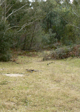
Has its headwaters between Fire Trails No. 7 and 8 off Sunnyside Ridge Road.This creek flows generally north for 7km to its junction with the Wolgan River.Named by Michael Keats on a Bush Club walk, 18th July 2007. A motor bike trail crosses the headwaters of this creek at GR 360 118.
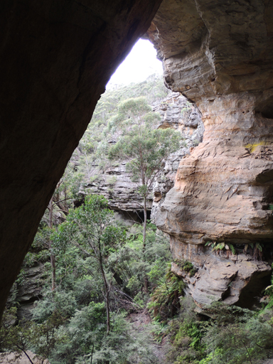
Flat Bottom Creek Tunnels
Are located on Flat Bottom Creek just before this creek plunges over the cliff line. Named by Michael Keats on a Bush Club walk, 22nd November 2013.
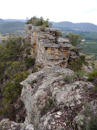
Flat Top
Is as the name suggests. Located on the ridge north of Dumbano Tunnels. This is a flat scrubby area of about half a square kilometre above 1020m. Named by Peter Fox, National Parks Association bushwalker, 1995-1998.
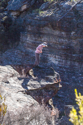
Flying Carpet
As that was what it felt like when we stood there. A flat projecting rock platform midway (about 60m) up the eastern cliff face of Carne Creek, between the features known as, The Gurgler and Long Zig Zag Pass. Named by Yuri Bolotin on a Bush Club walk, 9th May 2014. Yuri recods, "Stood on the top and looked down. 50m below between the tight, almost vertical narrow walls, the Tree Fern crowns looked miniscule."
Forge Point
Is located 1km north, north west of the Glowworm Tunnel on the cliff line, where the old Wolgan Valley Railway Line at the base of this cliff line changed direction from north west to north east. Ref: Eardley, G H. and Stephens, EM. The Shale Railways of NSW, 1974, p. 139. This name relates to a forge used to fabricate the railway lines.Herbert Sidney Rosewarne records,"Forge Point was also called Cable Point. Cable was the employed railway construction ganger."Ref: Stephens, Eric. Wolgan Railway Notebook, 1934-1937.
Fort Ridge
Trends in a generally north west and northerly direction from above Airly Creek in the south, having the Hut Trail along its spine from the Glen Davis Road. Its northern extent traverses what is known as The Fort (from which the ridge derives its name) to the south western side of Mount Airly. The southern section is within the Gardens of Stone National Park, whereas the northern section is in Mugii Murum-ban State Conservation Area. Named by Yuri Bolotin and Peter Medbury on a bushwalk 14 June 2021.
Fossil Ridge
Trends in a generally north south direction for 2.2km from the Great Dividing Range at the intersection of Moffitts Trail and Murdocks Creek Trail. Named by Brian Fox on a Bush Club walk, 21st January 2013 due to the abundance of plant fossils in the rocks along this ridge.
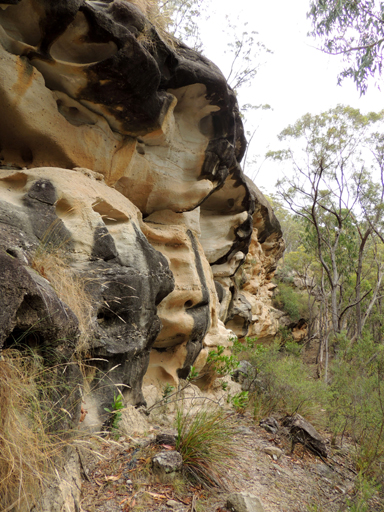
Four Level Cave
Is so named as four distinct sandstone overhangs are located one above the other. The top two are impossible to access, the lower two can be walked. Located 1.9km north east of Invincible Trig Station. Named by Yuri Bolotin on a Bush Club walk, 2nd August 2013.
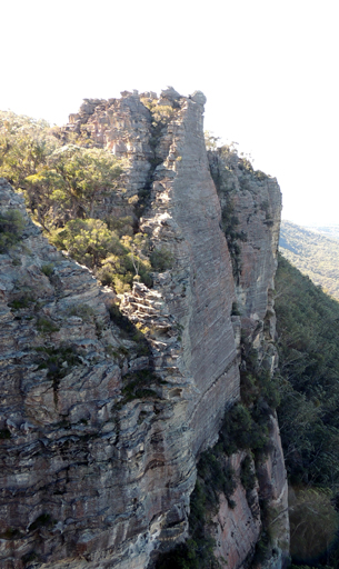
Foxs Wedge
Is a 50cm wide crest to the ultimate high point on a wedge shaped rock jutting out and overlooking the Wolgan Valley. Located 1.2km south east of Cape Pinnacle. Named after Brian Fox, who walked out to the tip of this seemingly impossibly narrow promontory, by Michael Keats on a Bush Club walk, 27th June 2011.
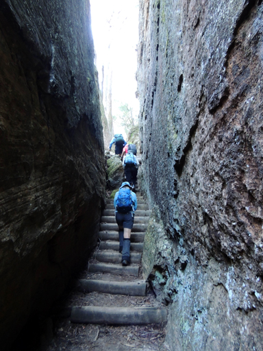
Frenulum Pass
Is a bush walking pass 1.5km north, north east of Mount Budgary which leads into Budgary Creek. Named by Michael Keats, 5th August 2009. This pass together with Lanceolate, Ocellus, Pheromone and Spiracle Passes, all near Mount Budgary, is named after an anatomical part of a moth. Michael had encountered large numbers of moths during his walks on Mount Budgary Plateau.
Freshwater Creek *
Is a non perennial stream that, rises about 4km south east of Glen Davis. It flows generally north east for about 4km into the Capertee River. Freshwater Creek name was approved by the GNB on 30th October 1970. The name does not appear on any parish maps and was first used on the 1st edition topographical map of Mount Morgan.

Friday Canyon
Is a ‘wet’ canyon, about 150 meters in length, a tributary that flows into Wollangambe River. Located 1.5km near due south of Goochs Crater. Namedby Freda Moxom, Nick Collins and Paul Ma during a bushwalk, Friday 11 March 2016.
Galadriel Gorge
Is just one of the many side canyons located on the northern side of the junction of the Great Dividing Range and the Ben Bullen Range. At the head of this gorge there is an exquisite chamber, called the Hall of Galadriel. Galadriel is a key character in the Lord of the Rings. She was the beautiful Elven Queen and the mother of Celebrian. Played in the film by Cate Blanchett. Named by Yuri Bolotin on a Bush Club walk, 26th July 2013. Yuri named it so in keeping with the theme of Lord of the Rings that inspired him to name other features in this area.
Galah Mountain *
Is an insignificant hill on Daniels Ridge located between Deanes Creek and Rocky Creek. 1040m in height.
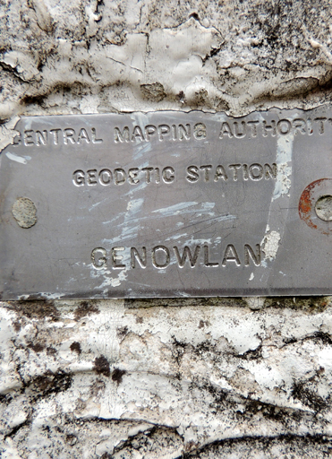
Galah Mountain Trig Station *
Is now known as Galah Trig Station. Elevation 1042.30m. Located on a small basalt hill, on the southern side of Galah Mountain. Accessed via GlowwormTunnel Road and Galah Mountain Road. Established by the Royal Australian Survey Corps, 1930. Ref: Trig Summary Cards, Department of Lands, Bathurst. Two trig stations in this area are named after the local birdlife; the other one is Cockatoo Hill Trig Station.

Galaxies Gully
Galaxies Gully is located on the southern side of the Wolgan River and the eastern side of the Newnes industrial site. This gully has remains of the buildings and a cave house which were in use during the period when Newnes was in operation as an oil shale town (1907-1920). This gully has its headwaters on the far western side of Island Mountain and is a double pronged gully which flows south for 1.5km to join the Wolgan River. The eastern branch gives access to Galaxies Traverse. Named by Yuri Bolotin and Brian Fox on a Bush Club walk, 1st July 2016.
Galaxies Gully East Pass
Is accessed via the Wolgan River Trail, Newnes. It is a useful way of route to the top of the ridge, leading to Firefly Point, as well as Looking Glass Canyon. This pass was shown to Yuri Bolotin by Tom Brennan on 19 February 2017. Named by Yuri in keeping with the name of the gully where the pass is located on a walk of 8 September 2017.
Galaxies Traverse
Galaxies Traverse is a ledge between two cliff lines above the Wolgan River. Located 2km from the locked gate on the ruins side of the Wolgan River at Newnes. The ledge runs for over two kilometres and is accessed via a gully on its western side. The name was coined by Brian Fox and Yuri Bolotin on a Bush Club walk, 1st July 2016 after the name of the main cliff line known by the rock climbing fraternity as Exploding Galaxies.
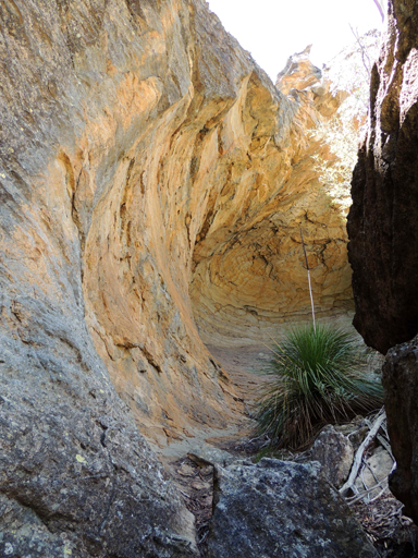
Gandalf Slot
Is a beautiful dead end slot. Gandalf is a good wizard in the Lord of the Rings and you probably need to be a wizard to be able to climb this slot all the way to the top. Named by Yuri Bolotin on a Bush Club walk, 15th August 2013, in keeping with his Lord of the Rings themed names in this area. Located 1.3km north east of Invincible Trig Station.
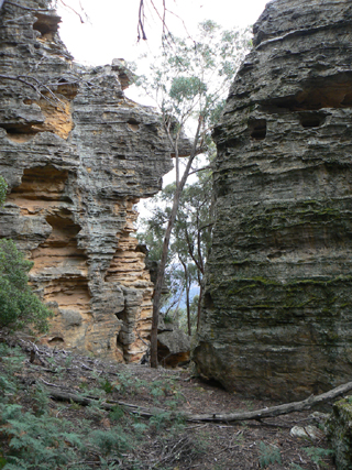
Gang Gang Canyon
Is about 500m long, its width varies between 5m to 25m. The cliffs on either side vary from 20 to 40m. The creek and canyon were named by Michael Keats on a Bush Club walk, 12th November 2012.
Gang Gang Caves
Are located within Gang Gang Canyon, part of Gang Gang Creek so named for a number of hemispherical chambers in this section of the creek. One cave in particular had a steep sloping floor and measured 30m wide, 35m from the back wall to the drip line and an estimated height of 60m. It also features an inaccessible second storey. Named by Yuri Bolotin and Brian Fox on a Bush Club walk, 16th January 2016.
Gang Gang Creek
Has its headwaters on the eastern side of Carne Creek and western side of Gang Gang Road. This road was named by Eric Lane, former Newnes State Forest foreman in the early 1980s, due to the large flocks of Gang Gang Cockatoos,Callocephalon fimbriatum, in this locality. Gang Gang Creek flows in a generally north east and northerly direction for 4.9km to its junction with Carne Creek.
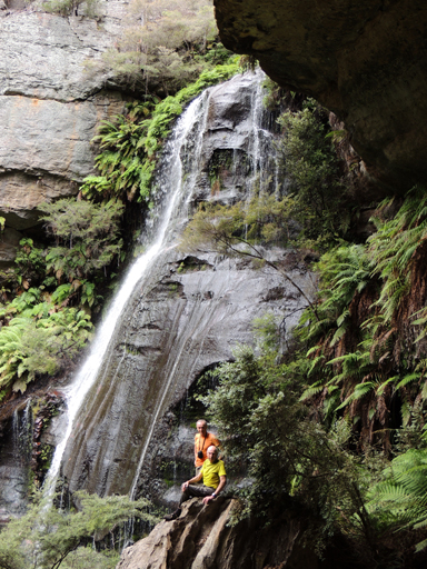
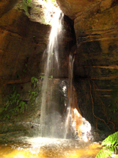
Gang Gang Falls
Are located within the eastern tributary of Gang Gang Creek, 380m upstream from Gang Gang Tunnels. About 40m in height the water flows over the rock face like a bridal grown. Named by Brian Fox, Michael Keats and Yuri Bolotin after the creek in which they are located, 24th July 2015.
Gang Gang Minor
Refers to a rising side canyon on the eastern side of Gang Gang Canyon. This side canyon contains a huge hemispherical chamber with a steep sloping floor. This chamber is 20m high, 20m deep and the opening about 20m across, an almost perfect sphere. Named by Michael Keats on Bush Club walk, 12th November 2012.
Gang Gang Playground
Is an area encompassed by the mid section of Gang Gang Creek. Named by Michael Keats on a Bush Club walk, 27th April 2012 after the road and creek with this name and the playground of the pagoda bedecked cliff line and views.
Gang Gang Swamp
Is located on the creek tributaries within the radius of Gang Gang Road. 2km north north east of Bungleboori Camping Ground.
Gang Gang Tunnels
Are located within Gang Gang Creek, access via North Ridge Road via Bungleboori. It would appear that at least two very large creek side sculptured pagodas had partly collapsed across the creek, falling in such a way as to provide caverns and slots. Named by Brian Fox, Michael Keats and Yuri Bolotin after the creek in which they are located, 24th July 2015.
Gannon Cave
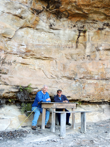
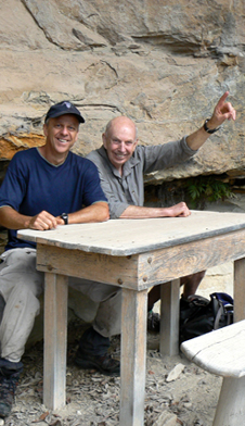
Is located at Hassans Walls, Lithgow and is the first rock overhang on the lower track (Undercliff Track) on the right hand (western) side of Hassans Glen. Named after Samuel Hodge Gannon (1834-1913), who was a very active member of the Lithgow community. Within this overhang is the seats and table like an old school desk placed there in 1915. Ref: Lithgow Mercury, 14th May 1915, p. 4.
Gap Creek *
Is a non perennial stream rising on the eastern slopes of Mount Airly. It flows generally north, north east for about 4km into Genowlan Creek. The name is descriptive for this creek that flows between Mount Airly and the cliff line of Point Hatteras. This creek also flowed through the former Town of Airly.
Garage Cave
Is located halfway up the steep section of a 4WD track between Genowlan Creek and the south west end of Genowlan Mountain. Named by Colin (Col) Maxwell Ribaux, former local land owner, in the l990s.
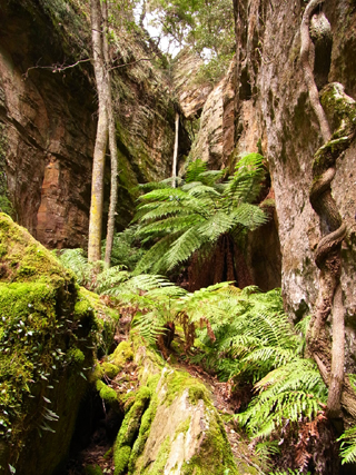
Garden of Eden
Is a feature within Coach Wood Forest. At its entry, it is almost totally filled with the Soft Tree Fern, Dicksonia antarctica. Within this enchanted forest, there is a mature Anchor Vine,Palmeria scandens, that has a girth of 20cm and has wrapped itself around a tree very tightly so it formed a spiral ribbed tube nearly one metre high, before it climbed 20m plus into the tree canopy above. This amazing natural sculpture has been dubbed The Serpent. Both features named by Michael Keats and Brian Fox on a Bush Club walk, 20th August 2012. This ravine is located 500m south east of Galah Trig, access via Galah Mountain Road.
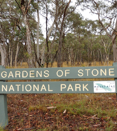
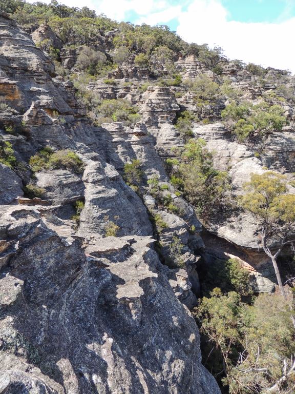
Gardens of Stone National Park *
Covers 15,080ha. The irregular boundaries roughly extend in the north to the Glen Davis Road, eastern boundary with the Wollemi National Park, western side to Castlereagh Highway at Ben Bullen and southern side, Sunnyside Ridge Road. The majority of the park is located on the Ben BullenTopo Map. Described by the NPWS as, "Pagoda rock formations cluster near sandstone escarpments, where erosion has sculpted bee hive shaped domes and other forms. Banksia, dwarf casuarinas and other wind pruned heathland plants give the area its garden like appearance. This park forms an important part of the Greater Blue Mountains World Heritage Area." Stage one of the Gardens of Stone National Park was created on the 29th November 1994. Stage two was proposed by the Colong Foundation in 2005 and is yet to be approved. It will cover an additional area of nearly 40,000ha. Credit is given to Rodney Falconer for coining the name, Gardens of Stone, November 1984. Ref: Correspondence with Rodney Falconer and David Blackwell, March 2010."I gave it the name Gardens of Stone, which stuck, following an October trip during which the place became a flowery garden studded with rock statues (mint bushes and banksias were particularly prolific that season and the scent of massed flowering Calytrix tetragona shrubs was so overwhelming that you were walking through honey coated air for hours on end. As Haydn Washington was in South America at the time, David Blackwell was frantically busy with work and I was in the process of moving to Canberra, we passed it onto the Colong Foundation (of which both Haydn and I were or had been Directors at the time) who did the longer term leg work and saw it into fruition, particularly thanks to Keith Muir with Peter Prineas and Alex Colley giving great support as well." Ref: Correspondence to Michael Keats from Rodney Falconer, 15th March 2010.

Gardiners Gap *
Is a break in the Great Dividing Range about 3km north west of Wolgan Gap and about 5km due east of the town of Cullen Bullen. Gardiners Gap is shown on the map Parish of Ben Bullen, 1885. William Wolf Gardiner (c1809-1887) took out a Conditional Purchase for 40ac in this area on the 28th February 1867. Later his grandsons, Thomas William Gardiner (1866-1940) and Charles Livingstone Gardiner (1886-1952), purchased land in 1883 and 1913 respectively. Ref: Survey Plans 719, 1411, 1502, 1832, 1870 and 3753- 1496. NSW BDMs. Gardiners Gap was the quickest way for drovers to move cattle and sheep from Ben Bullen to Bell, simultaneously avoiding the toll at Blackmans Flat from 1876. Ref: Brown, Jim.Bent Backs, 1989, pp. 275-276. Wilson, Alex. Map showing the various attempts to find the best route from Mount Victoria to the Western Country NSW, 1914. This map shows a dotted line from Gardiners Gap to Newnes Junction (connects to Bells Line of Road). Text reads,"Route suggested by delegates of Richmond Committee for road Mudgee to Wellington Valley." Also text, "stock route Cullen Bullen to Bells Line opened by Thomas Maddox. "
Gardiners Hill *
Is a hill about 4.2km south east of Ben Bullen that has Jews Creek on its western and southern side. Platform Rock is on the southern end of Gardiners Hill.
Gardiners Point
Is a point of land off a narrow spur, having the last 200m consisting of a rocky bluff which overlooks Jews Creek and Baal Bone Colliery. Named by Michael Keats after Gardiners Hill which is 600m to the west, on a Bush Club walk, 14th March 2016.

Gaudis Sentinel, Gaudis Stairs.
This isolated sandstone pinnacle on the southern side of Gaudis Wall and a nearby negotiable natural staircase were also named after Antoni Gaudi. Access via Ben Bullen, Moffitts Trail.
Gaudis Wall
Is a 300m long three dimensionally sculptured cliff face. It was given this name by Graham Conden on a Bush Club walk, 21st January 2013. Graham likened it to the work of Spanish architect, Antoni Gaudi. Located 2.6km north north east of Ben Bullen Railway Station. Access via Hutchinson Road and Moffitts Trail.
Gemini Cave
Also see Michelangelo Cave. This large twin overhang was named by Bob Whiting in December 2009. Ref: The journal of The Sydney Speleological Society, 2011, 55 (3): 64. Not being aware of this former name, Michael Keats named this cave Michelangelo Cave on a Bush Club walk, 16th January 2012.
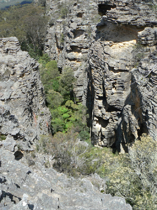
Genowlan Canyon
Is located 2.4km north east of Genowlan Trig and 2.5km south east of Point Hatteras. It is about 50m deep, 200m long. Genowlan Canyon was named by Brian Fox and Michael Keats on a Bush Club walk, 27th October 2010. Described by Michael as follows,"Stood on the top and looked down. 50m below between the tight, almost vertical narrow walls, the Tree Fern crowns looked miniscule."
Genowlan Castle
Is located 700m north east of Genowlan Trig. It is a massive grouping of pagodas likened to a wall of battlements immediately below a top turret. Named by Michael Keats on Bush Club walk, 1st June 2015.
Genowlan Creek *
Is a non perennial stream rising at Genowlan Trig Station. It flows generally north, east and north east for about 12km into the Capertee River. Genowlan Mountain and Genowlan Creek are shown on the Parish of Morundurey 1894 Map. Survey Plan R1164.1496, dated 1873, shows it as Genowlan Peak. Genowlan Mountain was also known as Morandurey Range. Ref: Eardley, G H. and Stephens, E M. The Shale Railways of NSW, 1974, p. 88. The name Genowlan has similar syntax with the word Jenolan, which in turn was an Aboriginal name meaning "high place". Ref: Cook, Samuel. The Jenolan Caves, 1889, pp. 14-15.
Genowlan Guardian
Is located on the eastern side of Genowlan Mountain, 1.9km south of Genowlan Point. Named by Yuri Bolotin and Brian Fox on a Bush Club walk 22 December 2017 because of the prominence of this giant pagoda jutting out over the top cliff line and the profile of a human head on top; it is clearly visible from all directions.
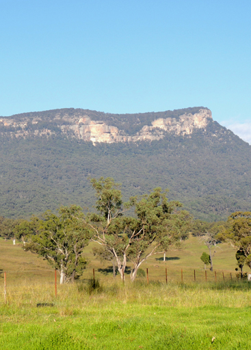
Genowlan Mountain *
Is located on the northern side of a large mesa between the Capertee River and Coco Creek, 3.5km north east of Airly. Genowlan Mountain and Genowlan Creek are shown on the Parish of Morundurey 1894 Map. Survey Plan R1164.1496, dated 1873, shows it as Genowlan Peak. Genowlan Mountain was also known as Morandurey Range. Ref: Eardley, G H. and Stephens, E M. The Shale Railways of NSW, 1974, p. 88. The name Genowlan has similar syntax with the word Jenolan, which in turn was an Aboriginal name meaning "high place". Ref: Cook, Samuel. The Jenolan Caves,1889, pp. 14-15.
Genowlan Oculus
A pagoda rests precariously on the cliff edge above the norther side of the area known as The Hammer. That is nothing unusual. What is unusual is the huge horizontal, cylindrical perforation, large enough to crawl through. The views looking east are unique. Named by Michael Keats on a Bush Club walk, 21st March 2016.
Genowlan Pinch
Is a narrow defile is only 300mm wide and 10m long. Located 340m due west of the communication tower at Airly and 30m south of Airly Frustum. Named by Michael Keats on a Bush Club walk, 16th November 2015.
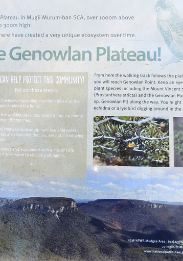
Genowlan Plateau
Signage erected by NPWS on the track to Genowlan Mountain, 2km south of Genowlan Point reads,“You are now standing on the top of Genowlan plateau in Mugii Murum-ban SCA, over 1000m above sea level, surrounded by sandstone cliffs up to 300m high.”
Genowlan Trig Station *
Is a trigonometrical station on same mesa, elevation 1040m, and is 3.8km south, south west of Genowlan Mountain. Established by the Department of Lands, 1912. Ref: Trig Summary Cards, Department of Lands, Bathurst.
Georgina Canyon
is located 2 km south east of Mount Dawson. On its eastern end, it appears as a thin black line from aerial photographs. In one place, it is so small, you can step over it as it is less than 50 cm wide. Some four metres below that point, the canyon bellows out into a Fern-filled cavernous void complete with limpid pools that looked very cold. This canyon is in two distinct sections. The first of about 200 m is tight, mysterious and flanked by pagodas, the second section is much broader, extends for maybe a further 300 m and discharges over the cliff edge. Named by Brian Fox, Michael Keats and Yuri Bolotin on a Bush Club walk 30th August 2016. Georgina Lyon Wolgan Walker (1843-1906) had married Edwin Barton in 1865. Edwin and Georgina’s father were the earliest property owners in the Wolgan Valley.
Gindantherie Pinnacle
Is an imposing isolated sandstone pinnacle, about 70m high. Located on the escarpment 4km due west of Newnes and midway between Point Nicholson and Mount Dawson. Gindantherie Pinnacle was named by Michael Keats and submission sent to the GNB on 9th October 2006. It is highly likely that the name is of Aboriginal origin. Lithgow Council Minutes, 6th August 2007, raised no objections to this name. Other recorded names are Lost Sister (Tom Brennan, October 2010) and the Fourth Sister. The Parish of Gindantherie is a land administrative district within the County of Cook.
Girdwood Ridge
Trends east west and divides the watersheds of upper Dumbano Creek and Wollangambe River. Clarence Firetrail runs along this ridge. Named by Peter Fox, National Parks Association bushwalker, between the years 1995-1998, after Kathleen (Kate) Olive Girdwood, a bushwalker and member of the Upper Blue Mountains Bushwalking Club.
Glen Alice *
Is a small village on Umbiella Creek about 11km north west of Glen Davis and about 37km from Capertee. Dr James Innes (1796-1846) married Jane Alicia McLeod in 1828. James was granted 1760ac in July 1825, but it was not officially gazetted until October 1831 at 14 pound per annum. He named his cattle station, "Glen Alice". Jane Alicia was born c1800 and died on 2nd December 1881. James's brother George (1802-1839) took over the property a few years later, and when he died, his wife Georgianna Lorn Moorshead sold the property. It was the property name that became the name of the settlement of Glen Alice. Glen Alice was notified as a village on the 22ndJuly 1878 and gazetted as a village on the 14th September 1901. Ref: Sydney Gazette, 28th May 1831, p. 2 and 12th January1832, p. 3, Survey Plan 89.691, dated 23rd October 1833 and Annabella Boswell's Journal (Annabella was the daughter of George and Georgianna Innes). .
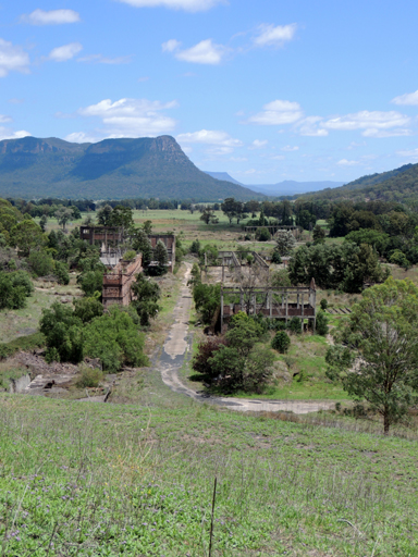
Glen Davis *
Is a village about 38km east of Capertee on the Capertee River. Situated on Portions 1 and 2 and on part of Portion 3, Parish of Gindantherie, County of Cook. Land District of Lithgow. An area of 198ac (80ha) was resumed for the Town of Glen Davis and about 294ac (119ha) was also resumed for town extension purposes under the Glen Davis Act No. 38, 1939, which came into force via proclamation in the Government Gazette, dated 15th December 1939. Acquisition of land, Government Gazette 32 of 23rd February 1940. Named after Sir George Francis Davis (1883-1947). The Federal Government's Senator A J McLachlan persuaded George and Chris Davis to form a subsidiary of Davis Gelatine - National Oil Pty Ltd in 1937. George gave up most of his other business activities to lead this new enterprise.The new industrial complex in the Capertee Valley was named Glen Davis after him. Ref: Australian Dictionary of Biography - Online Edition.
Note: Originally this location was known as Newnes North (Newnes South was at the present location of Newnes). Plan of Portion ML 12, dated 30th May 1908 shows Newnes North with significant buildings and tunnels into the shale mines. Lithgow Mercury 1st March 1907, p. 8, records the bridle path linking Newnes North to Newnes South.
Glen Day Defile
is located on one of the western tributaries of Glen Day Gully 2 km south, south west of Newnes. Midway along the gully, when descending, you enter a shallow constriction, which quickly becomes deeper and deeper. In a few more minutes, after carefully negotiating a 2.5 m drop, you enter a small, very dry canyon, with deeply eroded walls, only about half a metre apart, covered in green moss. A couple of metres later, the walls, now over 20 m high, open up to a magnificent overhang on the right-hand side, some 30 m long and 6-7m deep. Here, the ‘room’ is sufficient to accommodate several Coachwood and Sassafras trees. The canyon continues until the second overhang of equal size to the first one, is reached. The constriction is about 250 m long. Named by Yuri Bolotin and Brian Fox on a bushwalk of 27 September 2019.
Glen Day Gully
Is a three pronged gully system, 1.7km in length, on the southern side of Little Capertee Creek directly above the inlier of Glen Day's property. Named by Michael Keats on a Bush Club walk, 1st November 2013.
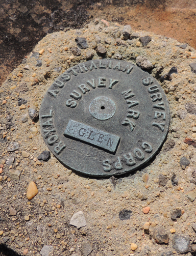
Glen Trig
Is the highest point on the Wolgan - Capertee Divide, 2.1km due south of Glen Davis Camping Ground. A rocky, smooth outcrop has a round brass survey marker, embedded in concrete, with the inscription,"Royal Australian Survey Corps, Survey Mark, Glen Davis." Elevation 938m.
Glory Box
Is a 250m long cliff lined ravine and a tributary of Carne Creek. It is filled with tree ferns, felt ferns, numerous fungi species in season and boxed in by 90m cliffs. Walking access can be gained to this ravine with one difficult spot, where rope assist is handy. Named by Brian Fox on a Bush Club walk, 2nd April 2013.
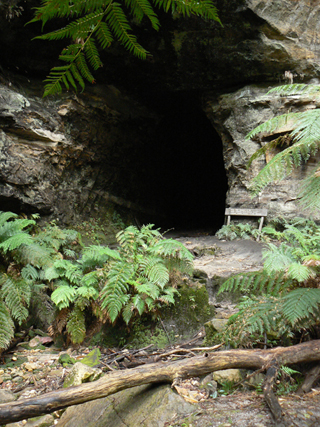
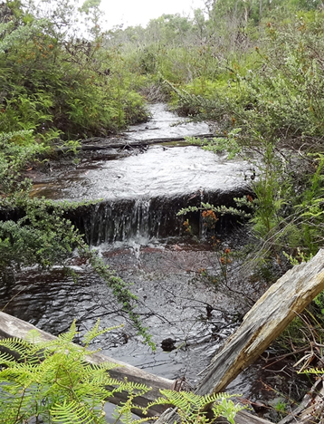
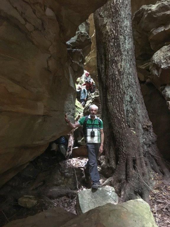
Glowworm Tunnel
Is located at the northern end of Glowworm Tunnel Road, accessed via Clarence or State Mine Gully, Lithgow. It was here that the old Wolgan Valley Railway line wound around the base of the cliffs, then through a tunnel approximately 400m long. The creek near this tunnel is called Tunnel Creek and has also been referred to as Penrose Creek. This was the second tunnel constructed in 1907 for the railway to Newnes from Newnes Junction, off the Main Western Line. The first tunnel is now vehicular access to the Glowworm Tunnel and about 3km closer towards Lithgow. The Glow Worms are a larval stage of a harmless, luminous species of fungus gnat, family Arachnocampa. Spelling has varied on different maps, such as Gloworm Tunnel; Ben Bullen Topo, first edition, Glowworm Tunnel Road; Cullen BullenTopo, second edition, as well as Glow Worm Tunnel and Glow-worm Tunnel, websites.
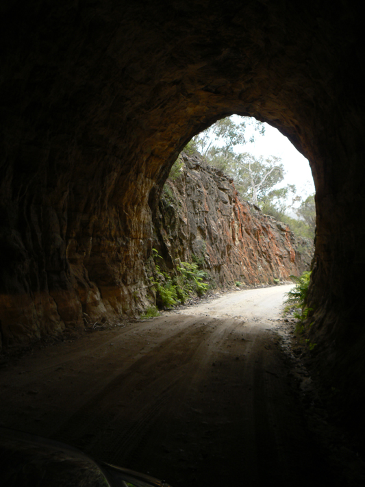
Glowworm Tunnel Road
Glowworm Tunnel Road starts at the junction ofthe Old Bells Line of Road and the State Mine Gully Road and generally heads north to the end point which is the car park and start of the Glowworm Tunnel Track to the Glowworm Tunnel. All unsealed. Part of the way the road follows the alignment of the old Wolgan Valley Railway and two tunnels.
Golden Bowl
Is a sunlit almost spherical overhang on one of the upper tributaries of Dingo Creek, 900m north east of Mount Norris. Named by Rodney Nelson on a Bush Club walk, 28th November 2007.
Gollum Canyon
Is a narrow, twisting, treacherous, slimy canyon. Within the story of Lord of the Rings, Gollum is a small, slimy creature that lived in the caves underground and he was very treacherous. Named by Yuri Bolotin on a Bush Club walk, 15th August 2013, in keeping with his Lord of the Rings themed names in this area. Located 1.4km north east of Invincible Trig Station.
Gonzo Rock
Within Hecates Cauldron a rock face was so named because of its likeness to Gozo the Muppet, by Jafar Calley on a Bush Club walk, 29th August 2015.
Goochs Crater *
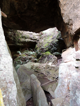
Is a natural amphitheatre located on a tributary of Wollangambe River 7.5km north east of ClarenceTrig Station and 6km north west of Wollangambe Crater in the locality of Newnes Plateau. It is a unique, crater like swamp feature, ringed by deeply under cut pagodas, roughly oval in shape, approximately 105m long by 65m wide at the northern end, narrowing to approximately 35m at the southern end. The northern end slopes steeply and evenly to the ridge top above the crater. The sides are formed by the vertical walls of deeply under cut pagodas varying from 20 to 30m high. The southern end is formed by what appears to be the remains of a collapsed pagoda. The swamp itself has typical sedge vegetation and associated plant communities. Named in memory of Nicholas Andrew Gooch (28.3.1947 -18.7.2003), who originally discovered this feature in 1978. The name has become widely known by the bushwalking fraternity Australia wide. Ref: Rae Gooch and Springwood Bushwalking Club members.
Originally named by Nicholas Andrew Gooch as Cave Swamp Crater 31 December 1978.Goollooinboin *
Is the name of a land administrative district, Parish of Goollooinboin, within the County of Cook.

Gordian Knot
Is a mass of contorted ironstone. Named by Haydn Washington, one of the triumvirate who explored and named the Gardens of Stone National Park. The knot is also a platform to view the Wolgan Valley. Located 25m east of the walking track between Mount Horne Trail and Mount McLean. Ref: Correspondence with Haydn Washington, 30th May 2010.
Grand Balcony
Is one of the most remarkable locations in the Wollemi National Park. It is a ledge of gargantuan proportions, approximately 400 metres long. What makes it particularly amazing are the cliffs above and below. Below, the drop is 35 m+; above, the cliffs are at least 50 m high. Adding to the splendour, is the array of colours - shades of pink, through to apricot, orange to deep purple. Located on the eastern side of a cliff-lined, V shaped gully, a southern tributary of Capertee Creek on the western end of the property Red Cliffs, Newnes. Named by Michael Keats, Brian Fox and Yuri Bolotin on a bushwalk, 6 May 2016.
Great Dividing Range *
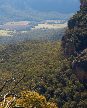
Extends the entire length of the east coast of Australia, generally in a north south direction. This range was also referred to as The Dividing Range and Main Range. In the scope of this work, the range extends from near Capertee, Ben Bullen, Moffitts Trail, The Bicentennial National Trail and Gardiners Gap to the Castlereagh Highway 4km south of Cullen Bullen. Great Diving Range was shown on Survey Plan by Robert Dixon, September 1830. Ref: Surveyor General, select list of Maps and Plans, 2517. Early references to Great Dividing Range appeared in the SMH in 1835 as part o fadvertisements for land and stock, and the words " Dividing Range" - in the SMH on 10th July 1823, p. 2.
Great Wall of China
Refers to the north south line of rocky pagodas on the western side of Mount Airly. This wall of pagodas is bisected by many deep slots otherwise walking along them is relatively easy. Named by Dr Haydn Washington c1984.
Great Wall of China
Refers to a small rocky ridge line and part of the road leading up to Genowlan Trig Station. Named by Colin (Col) Maxwell Ribaux,former landowner of Airly. Named in the 1970s.
Green Gully *
Is a non perennial stream rising 4.5km south, south west of Glen Davis. It flows generally north for about 5km into the Capertee River.The descriptive name of this north south facing gully refers to the dense green ferns at its headwaters. Within this gully, is the Pipeline Track that connects the villages of Newnes and Glen Davis. Numerous examples of old infrastructure of the former pipeline still exist in the gully. Shown as Green Gully on on the Plan of Portion ML 8; Survey Plan, M10825, dated 27th July 1895. The Survey Plan M13826, dated 9th May 1908, records on the eastern side of Green Gully, "Horse Track to Glen Alice".
Green Room
Is a descriptive name for this fern enclosed gully on the northern side of Nayook Creek and eastern side of Mini Standley Chasm, Deep Pass. This name was known and in use by National Parks Association member, Max Reinel, in the year 2000.
Greens Camp
Is located about 200m east of the track intersection of Pagoda Track and the main track to the Glowworm Tunnel, and about 38km from Clarence. Initials F R and a date 7/1/1907 are carved into a rock face rediscovered by Mark Langdon, September 2013. On 1st May 1907, a post office was set up at Greens Camp with Mr E. Sheared as postmaster. Ref: Taylor, Greg. J. Newnes, History of a Blue Mountains Oil-Shale town, undated, p. 34. Greens Camp was the name of a railway construction camp for the Wolgan Valley Railway. During construction, this camp housed up to 600 people. Ref: Letter from Henry Martin, storekeeper, The Gorge via Clarence, dated April 1907.
Greens Spur
Is 1.3 km in length. It trends in a southerly direction off Sunnyside Ridge Road near Fire Trail No. 8 and has at its southern end Point Green. This narrow southern end contains pagodas which overlook both the eastern and the western side the Wolgan River. This spectacular spur and point above the Wolgan Falls, with 360-degree views, was one of the last major areas which Richard Green photographed late June 2015 for the Gardens of Stone: In Focus photographic competition. Named by Yuri Bolotin in honour of his achievements on a bushwalk, 20 November 2015. Richard Green, a renowned Australian landscape and nature photographer, tragically died in a helicopter crash in November 2015.
Grevillea Ridge
Extends from Dominic Dellalibera's property, Ngamperi, which is located below and on the north eastern side of Pantoneys Crown, to the talus slope of Pantoneys Crown. The middle section of this ridge is covered with Xanthorrhoeas, but Dominic gave it the name Grevillea Ridge owing to the rare Grevillea obtusiflora subsp. fecunda which also grows there.
Grottos
Also called The Grottos. Located in side creek 800m west, south west of Rock Hill. There are various entries of this name in the Yah Hut Log Book, late 1970s.
Grove Firetrail
Is now known as Beecroft Firetrail. The section of this firetrail which joined the Wolgan Road to Kangaroos Creek Road was also known and signposted as Grove Firetrail after the Thomas Henry (1883-1952) and Nellie Adelaide Grove (1889-1967) who lived in this vicinity prior to the 1930s. Ref: Correspondence Danny Whitty local resident and historian, 3rd June 2014. Nellie Adelaide Grove held a Special Lease in 1922 over the portion of land in which the current Beecroft Firetrail intersects with Masons Lane, Lidsdale. Ref: Parish of Cox, County of Cook 7th edition, 1930.
Gundangaroo Trig Station *
Has an elevation of 845m, located between Mount Gundangaroo and Mount Canobla. The trig is named for its location on Mount Gundangaroo and was established in December 1984 by Patrick Potts, a piling overseer employed by the then Central Mapping Authority of Bathurst. A piling overseer is the person who does all the hard work for the surveyor when erecting and clearing for a trig station.
Guzzlers Gulch
Extends1.5km from the saddle known as Natural Bridge in a south east direction to the junction of Nayook Creek. So named after Guzzlers Hut, now in ruins, that lies within this gully. Name recorded in the Yah Hut Log Book entry, 18th November 1972. Within this gully, at GR 499 090, is a natural arch. This unique geomorphologic feature is about 5m high, 5m wide and about 4m thick. Named Guzzlers Gulch Arch on a Bush Club walk, 28th January 2013 by Brian Fox and Michael Keats.
Guzzlers Gulch Arch
Guzzlers Gulch extends 1.5km from the saddle known as Natural Bridge in a south east direction to the junction of Nayook Creek. So named after Guzzlers Hut, now in ruins, that lies within this gully. Within this gully, at GR 499 090, is a natural arch. This unique geomorphologic feature is about 5m high, 5m wide and about 4m thick. Named Guzzlers Gulch Arch on a Bush Club walk, 28th January 2013 by Brian Fox and Michael Keats.
Hades Ridge
Is a north south trending ridge on the eastern side of Moffitts Trail and the eastern side of Poseidon Arena. There is an Upper Hades Ridge and a Lower Hades Ridge. Named by Michael Keats and Brian Fox on a Bush Club Walk, 16th April 2010, after the Greek god Hades. Two other nearby ridges, trending north south, were given the names of Poseidon and Zeus, the brothers of Hades.
Hagar Castle
Is a 300m high rocky outcrop on the eastern side of Rocky Creek, 1.6km south of the junction of Rocky Creek and Deanes Creek. This massive bluff was named by IanThorpe, a member of The Bush Club, on 1st October 2008, as he likened it to Hagar, The Horrible's Castle.
Hailstorm Retreat
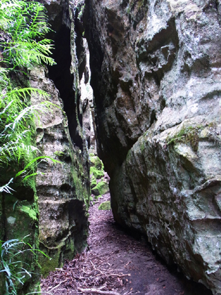
Is a 300m long negotiable slot varying in width from half a metre to five metres and cutting through 140m of vertical cliff line. Access is via the barrier at the eastern end of Waratah Ridge Road. Recorded in Jamieson, Rick. Canyons Near Sydney, 4th edition, 2001, p. 55. A pagoda at the northern end defining the entry/ exit to this slot is at GR 510 012.
Hair of the Dog Ravine
Is a 700m dramatic knife like cleft surrounded by 50m cliffs. It is located 1.5km south west of Derailment Hill. Access via the end of Waratah Ridge Road. So named by Yuri Bolotin, 8th April 2011, as this ravine joins Dingo Creek.This ravine can be negotiated from both the top and the bottom. It is a pass.
Halfway Hollow *
is a non perennial stream rising 2.6km north of MountHarvey. It flows generally north, north west for about 4.6km into Crown Creek. So named as it is halfwaybetween Capertee and Glen Alice. Name recorded in NSW Government Gazette, 26thFebruary 1875 as Half-way Hollow. Shown on Carne, Joseph. Geological Map of theCapertee and Wolgan Valleys, 1901.
Hall of Celebrian
Is located 3.1km east, south east of Cullen Bullen, below and on the northern side of the junction of the Great Dividing Range and Ben Bullen Range. Described as, "A cavern of great dimensions, estimated to be 30m across, 15m high and the same depth. Rounding a natural, web like rock partition, there is a second cave of similar dimensions, the two forming a huge conjoined overhang cavern complex." Named by Yuri Bolotin on a Bush Club walk, 28th June 2012. an is a fictional character and wife of Elrond created by J.R.R. Tolkien in the book The Lord of the Rings.
Hall of Elrond
Is located on the Ben Bullen Range, 2.7km east, south east of Cullen Bullen. Named by Yuri Bolotin, following his walk on 16th December 2011. Yuri recorded,"starting as a mere crack in the sandstone, it plunges down to the bottom of the valley, 30m below, whilst opening up first to 2-3m and then to a 15-20m wide, 60m long mini canyon, with side branches and a balcony level above the Fern studied floor. As I made my way down, I felt as though I was descending from the high bastions and lookouts of the fantasy city above, to the majestic palace chamber of the city's king. I called this place the Hall of Elrond (the Lord of Rivendell)." Yuri used visual references provided by J.R.R. Tolkien's Lord of the Rings.
Hammer Pass
Gives access via a natural slot in the cliff line to, The Hammer, which is the narrow peninsula of land surrounded by cliff lines on the eastern extremity of Genowlan Mountain. Named by Brian Fox on a Bush Club walk, 21st March 2016.
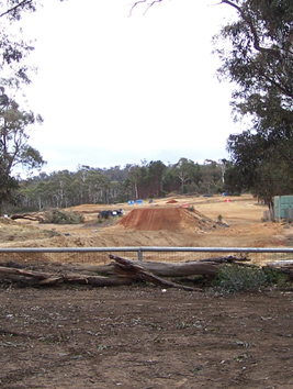
Happy Valley Springs *
Is a locality about 1km north west of Bald Trig Station and about 4km north of Clarence. This valley name applies to the headwaters of Farmers Creek. Originally, the name applied to the small swamp and associated natural springs that gave rise to the area being reserved for a travelling stock route. This area at present is owned by, "The Lower Mountains Motorcycle Club", which built a complex on the site, 1973-1974. Originally this area was surveyed in 1877 for a 123ac (50ha) lot and used as a Travelling Stock Route, (TSR No. 59). The track to and from this TSR was known as Maddox's Line. Ref: Survey Plan C734.1507. Thomas Maddox had purchased 30ac on the Coxs River at Lidsdale in 1853. Ref: Survey Plan C38-1507. Maddox Lane in Lidsdale carries the family name. The name Happy Valley Springs appears on the 1890 edition of the Parish Map of Marangaroo.
