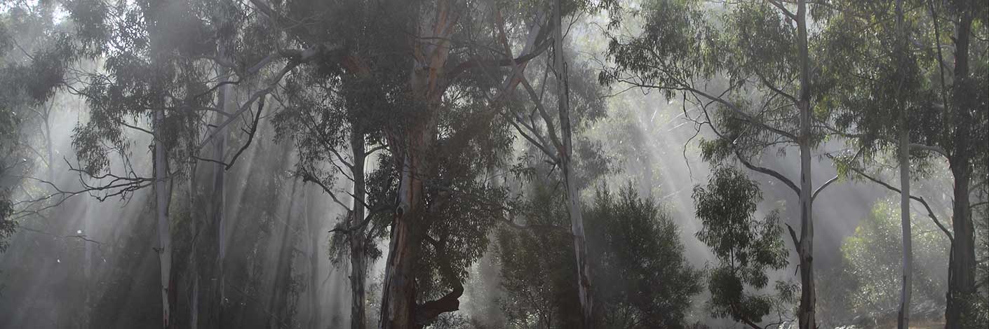
The Boss is a large, isolated rock within the saddle of Hughes Defile.
Bush Explorers Encyclopaedia
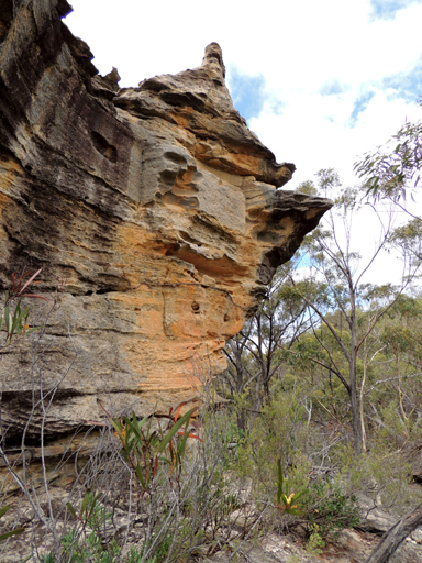
See entry Moffitts Pagodas.
Is located near the mid section of Genowlan Mountain plateau 2.4km south of Genowlan Point. Walking access is via the 4WD track that traverses the spine of Genowlan Mountain plateau. Named by Colin (Col) Maxwell Ribaux, former local land owner, after the geographical feature The Breadknife located in the Warrumbungle National Park.
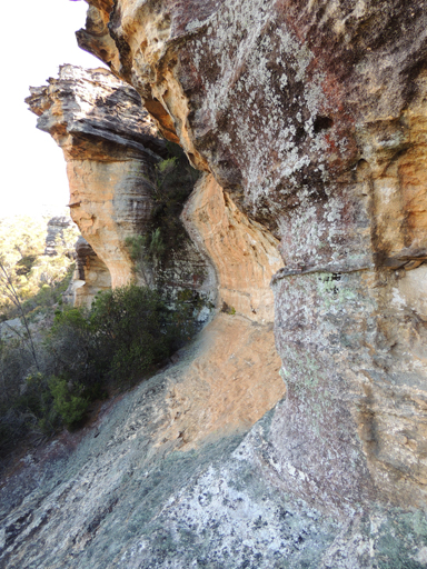
Refer to an impressive series of wind eroded overhangs above the headwaters of Tunnel Creek. Access via the Old Coach Road. Named by Michael Keats on Bush Club walk, 11th January 2016.
See Capstan Spur
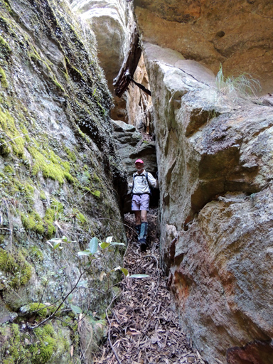
Is the place where Temple Creek enters a series of tunnels that twist and wind and rise and fall. Some are dry and some are just damp. All are totally captivating. This tunnel complex extends for about 200m downstream to GR 329 097. In keeping with The Temple of Doom theme, Michael Keats so named it on a Bush Club walk, 4th June 2013. Beyond The Catacombs is (see) The Sacristy.
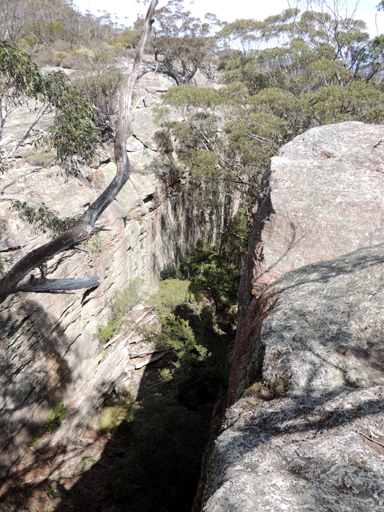
See Jamison Pass
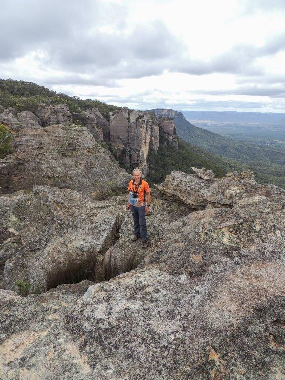
Is a descriptive name for a prominent rock formation on the southernmost extremity of the Genowlan Mountain and the highest point on Citadel Spur. Named by Dr Haydn Washington, November 1984. Ref: Correspondence with David Blackwell, 27th April 2010 and personal correspondence from Haydn Washington 3rd February 2018.
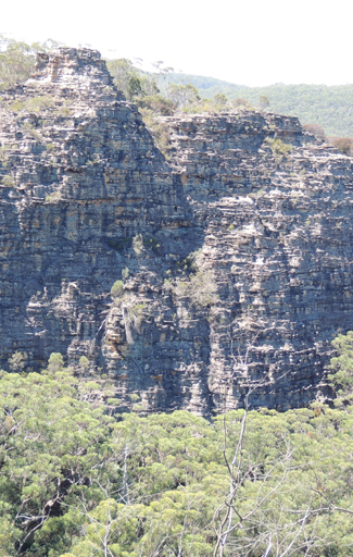
Are the northern cliffs which form Constance Gorge and Deanes Creek. Most likely named by Peter Harris, National Parks Association walker, who wrote a report on the area in the NPA journal in the mid 1970s and labelled the photo "The Cliffs of Mars". Peter was also a past president of the Confederation of Bushwalking Clubs. Ref: Correspondence with David Warren Noble, 14th October 2009.
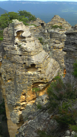
See Donkey Mountain, south west section
See Holy Grail Ravine.
Is located 500m north of the Wolgan River between the Pipeline Track and Petries Gully, Newnes. This area morphs from being a cliff surrounded basin to a graduated valley where the cliffs and floor are a continuum. Structurally, The Crater is a hanging valley that enjoys locally higher rainfall and protection from desiccating winds. It is not volcanic in origin and does not even have clay soil. The Tree Ferns areCyathea australis, a species that is more drought tolerant than Dicksonia antarctica. Other common species are Coachwood and Sassafras. Named by Thomas Ebersoll, owner of the Old Newnes Hotel, 2005.
Of Donkey Mountain refers to the southern side of Donkey Mountain, as in winter it is cold and in shadow for the majority of the daylight hours. This area includes: Impossible Cave, Masterpiece Wall and The Spire. Named by Geoff Fox and Yuri Bolotin on a bushwalk 31 August 2017.
See Land of the Stone Dragon.
See Permafrost Gully.
See King Georges Head
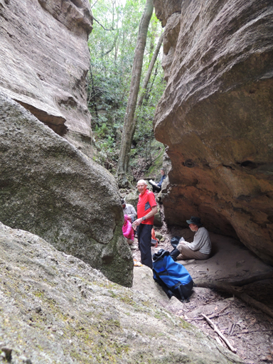
Is the converging point of five narrow passage ways within (see) Hecates Cauldron
See Deanes Lookout. which was possibly named by David Warren Noble. David also had heard it called The End of the World by local Lithgow people who had previously taken 4WD vehicles into the area. Ref: Correspondence with David Warren Noble, 14th October 2009.
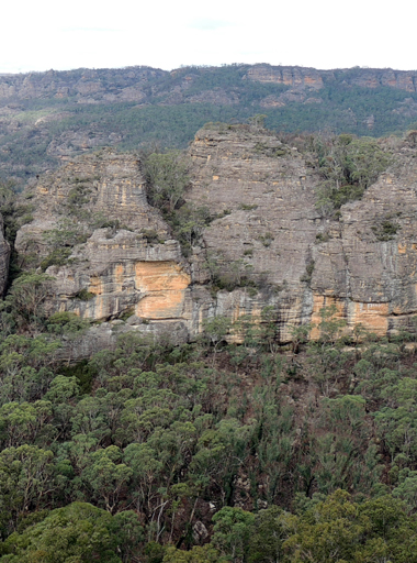
Refers to five pagodas clustered together on the northern side of Bungleboori Creek with an elevation of 959m. Named by Hugh Speirs 24th February 2014, in recognition of five ladies from his Bushrangers walking group, Alice Terry, Barb Carfrae, Lotti Heinz, Elaine Browning, and Elizabeth Stark.
See Little Capertee Creek Camping Ground.
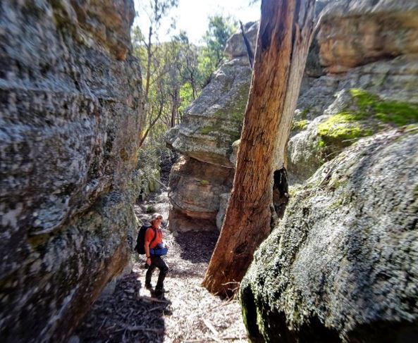
Is an area of natural rock formations located 2 km south west of Mount Airly and 500m above the Glen Davis Road. Named by Yuri Bolotin and Peter Medbury on a bushwalk 14 June 2021. Yuri recorded, "On top of this natural fortress, marked on the topographic map as spot height 935 m, is a paradise of pagodas, slots, ramps, narrow twisting corridors, dark hidden rooms and unexpected vistas".
See Browns Gap
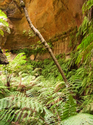
Is a small, intimate canyon located in a tributary of Rocky Creek, 1.2km north east of Mount Budgary. Michael Keats on a Bush Club walk, 28th February 2009 recorded, " This place deserves a name commensurate with its glory."
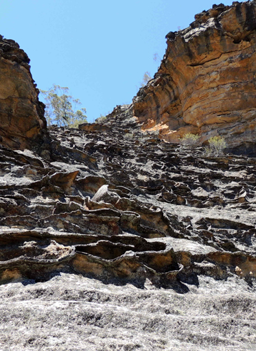
Is a long, 40m high pagoda slope which includes Michaels Chair. It is located 750m west of the road intersection of GlowwormTunnel Road and Fire Trail No. 7. Named by Michael Keats on a Bush Club walk, 21st September 2007. Name relates to the steam railway days, when the Glowworm Tunnel Road was the steam line to Newnes (Wolgan Valley Railway). A governor is a regulator mechanism fitted to stationary steam engines.
Runs along the cliff edge above Gindantherie Pinnacle. Ref: Tom Brennan's photo gallery, 25-26 September 2004.
Also known as Zig Zag Historical Railway, is located between Clarence and Lithgow. It is a historic railway line by which the Main Western Line could scale down the western escarpment of the Blue Mountains Range via a series of reversals or "Zig Zags". Opened in 1869, the Zig Zag was a major civil engineering feat for its day. Steam locomotives had to work hard to climb its steep grades. Over time, due to the dependence on rail traffic, this section was a liability and became an operational bottle neck. The Zig Zag was by passed in 1910 by a ten tunnel deviation.
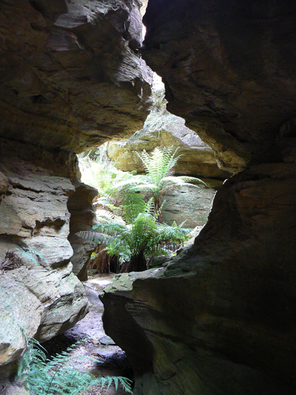
Is a short 200m canyon located on the Airly - Genowlan mesa. The top end of the canyon is 460m east of the communications tower, the lower end, accessed from the 4WD track, is 560m east of the tower. Colin (Col) Maxwell Ribaux, former local land owner, had set up a number of successive handrails and planks within this canyon. The Grotto is a small waterfall and would have been the end of this canyon, if it were not for the ladder Col constructed against a tree to negotiate the exit out of this canyon. Note: the ladder was removed in May 2013 by NPWS.
see Grottos
See Plimsoll Ledge
Is located 1.1km north west of the road intersection of Glowworm Tunnel Road and Old Coach Road. Named by Michael Keats on a Bush Club walk, 21st September 2007, due to this little valley being amazingly tight.
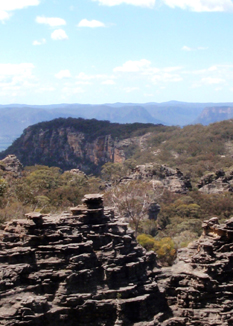
Refers to an area of land shaped like a hammer head, located on the eastern extremity of Genowlan Mountain mesa. Named by Michael Keats on a Bush Club walk, 9th - 11th November 2010. The aerial view is like the head of a claw hammer.
See Hatch Spur
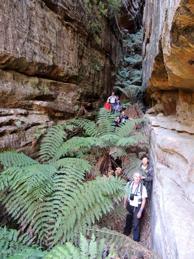
Resembling the keel of a ship is about 80m long, 2m wide and drops about 25m from the plateau into an unnamed tributary of December Creek. So named by Michael Keats and Yuri Bolotin on the 18th January 2013 in keeping with the theme (see) The Barnacles.
Is a 500sqm maze centred around the ridge that runs across the northern section of Koopartoo Mesa. It is centred at GR 418 235. Eldorado Traverse is on the north western side, Silver Slot and Diamond Ramp are on the north eastern side and the top of Ariadne Thread on the southern side. Named by Yuri Bolotin on a Bush Club walk 6th April 2017.
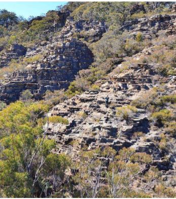
The Labyrinth is a 500sqm maze positioned around the ridge that runs across the northern section of Koopartoo Mesa. Yuri Bolotin on a bushwalk on 22 August 2017 named The Labyrinth View East as an exceptional view point located on the eastern side of The Labyrinth. Named in keeping with the mythology theme names related to the Minotaur, Ariadne Thread, etc.
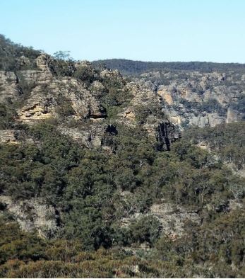
The Labyrinth is a 500sqm maze positioned around the ridge that runs across the northern section of Koopartoo Mesa. Yuri Bolotin on a bushwalk on 22 August 2017 named The Labyrinth View West as an exceptional view point located on the western side of The Labyrinth. Named in keeping with the mythology theme names related to the Minotaur, Ariadne Thread, etc.
Is so named due to the remoteness of the pagodas and resemblance to a lost city. Named by Col Ribaux during his diamond mine construction period, 1961-1975. Ref: letter from Col to Capertee Valley Alliance March 2011.
Refers to the maze of pagodas and area of domes near Point Cameron on the Wolgan – Capertee Divide. Ref: David Noble’s blog, 9th July 2013.
Is a 4WD track, 7.5km in length, joining the Crown Creek Trail and leading to Red Rock Trail. Named after the property name,The Meadows , as the trail roughly follows its eastern and southern boundaries.
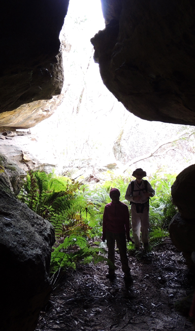
within the Hecates Cauldron is a small glen where two watercourses discharge into a bowl-like valley that includes a rock mound supporting an enormous old Eucalypt. The two watercourses have undercut soft strata and created two different and special cavernous places or grottoes. Both feature non-perennial waterfalls. The eastern one has a mosaic of coloured waterworn pebbles on the floor. The western one has a moss-covered floor. Named by Yuri Bolotin and Michael Keats, 25 September 2015.
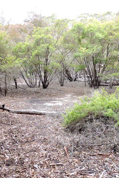
Is located roughly midway between Point Cameron and Mount Davidson (Wolgan Trig). So named due to the flat sandy area about 40m x 25m formed in a depression. Usually dry, but during the very heavy rains in early 2012 it filled to a depth of hal fa metre. Most likely named by Coast and Mountain Bushwalking Club member Jeff Howard, c1987. He records,"The place always looked like a dried up Pond with its large dead trees (some of which have now collapsed)."This feature has also been recorded as Newnes Pondage and Dead Tree Camp.
The Pondage Canyon is is located 600 meters north west of Mount Davidson and 600 meters south of Point Cameron and 100 meters south west of The Pondage. It is about 150 metres long. The first 100 metres can be walked quite easily until the canyon floor drops suddenly at a waterfall. The canyon drains water from an area behind Point Cameron known as The Pondage. It appears to be a fairly reliable source of water for bushwalkers exploring the area. The canyon entrance is through a large overhang that would provide excellent shelter in bad weather. There are some very nice canyon formations in the canyon. There are excellent views into the canyon from the cliffs above. Ref: dingogap.net.au/places/the-pondage-canyon
Is an isolated rocky viewing platform that gives views to the features of Gardens of Stone National Park on the west and to Wollemi National Park on the east. Named by Michael Keats on his Bush Club walk, 31st August 2006. Michael recorded this place was so special that his 'spiritual fibres started to tingle."
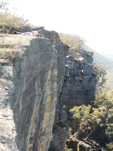
The Roaring Forties Cliff Line
Refers to the 7km long cliff line on the western side of the upper Wolgan Valley from GR 310 137 northwards to Cape Horn. Name recorded in Taylor, Pete and Penney, Andrew. The Wolgan Guide, 1984, p.132.
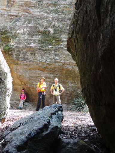
Refers to a small flat level area within a pagoda like "room" near Point Nicholson. This "room" has been used for camping as it is near the top of the Wolgan - Capertee Divide and is sheltered from the wind. Ref: Tom Brennan's photo gallery, 1-2nd June 2013. 70.
See Hatch Spur
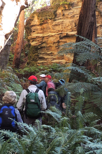
Is located on the western side and 800m from the start of The Temples of Doom track. Michael Keats, who named this feature on a Bush Club walk, 4th June 2013 in keeping with the temple theme, described it as,"A room, perhaps 20m x15m in area, with 20m high walls. It certainly is a place where nature keeps her sacred vessels and utensils. We were in awe of this magic place. The mosses literally draped over the rocks, the sunlight shone through cracks and bounced off honey coloured rocks, filling the entire space with golden light."
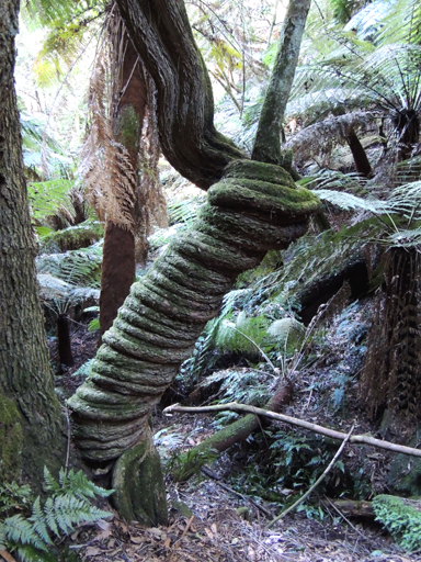
See Garden of Eden
Garden of Eden is a feature within Coach Wood Forest. At its entry, it is almost totally filled with the Soft Tree Fern, Dicksonia Antarctica. Within this enchanted forest, there is a mature Anchor Vine, Palmeria scandens,that has a girth of 20cm and has wrapped itself around a tree very tightly so it formed a spiral ribbed tube nearly one metre high, before it climbed 20m plus into the tree canopy above. This amazing natural sculpture has been dubbed The Serpent. Both features named by Michael Keats and Brian Fox on a Bush Club walk, 20th August 2012. This ravine is located 500m south east of Galah Trig, access via Galah Mountain Road.
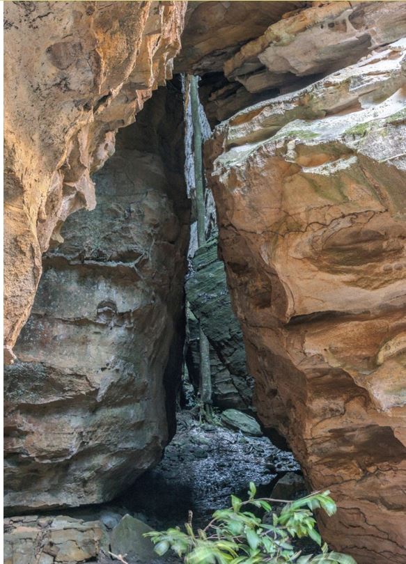
Is a huge slot, 150 m+ long, with multiple chambers, and within it, is a giant 15 m high human figure-like sculpture. Located 1.1 km west of the Wolgan River and Zobels Gully junction. Named by Yuri Bolotin on a bushwalk, 22 August 2017, in keeping with the mythology theme names related to the Minotaur, Ariadne Thread, etc. Yuri recorded,“Theseus was Ariadne’s lover, whom she gave a ball of red thread so that he could safely find his way back from The Labyrinth, after slaying the Minotaur. It is his statue that adorns the main, middle chamber of the space.”
The Sign of the Ark of the Covenant
Is located within Lost Ark Ravine, 700m north east of the feature, Temples of Doom. An image of a cross is a rock window like aperture within a dome, that when viewed from the correct angle creates the crucifix illusion. Named by Daryl Watson In keeping with local nomenclature on a Bush Club walk, 4th September 2015.