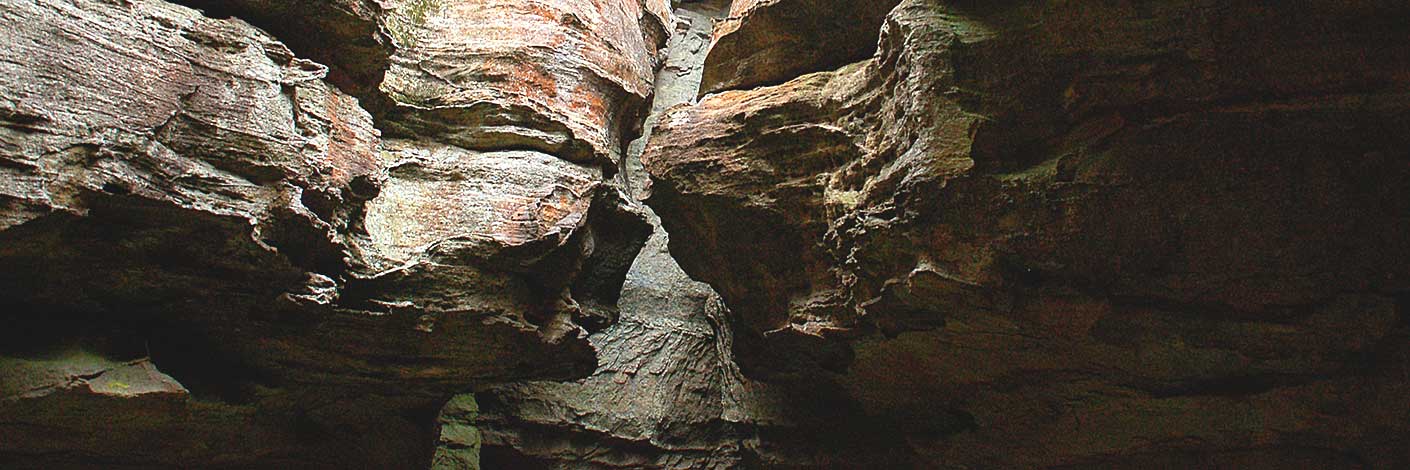
One of the construction camps on the Wolgan Valley Railway near the modern day Glowworm Tunnel was called Greens Camp. This camp housed up to 600 workers. It was large enough to have its own temporary post office. It was also a place prone to squalor and misery. Carved deep into a rock outside the camp on the current Pagoda Track, are the framed letters RATSCASTLE. On discovering this graffiti, Brian Fox undertook research. There is a strong emotive correlation between this location and the rebellious and infamous outlawed Kelly Gang. Keith Maxwell, another passionate researcher, wrote a sobering piece,“we cannot forget changes to the working week. Early in the 20th century you had the ‘eight hour day’ campaign – eight hours work, eight hours sleep and eight hours relaxation. The aim was a 48 hour week (6 days x 8 hours). Further campaigns were the 44 hours week, (4 hours only on Saturday) before the 40 hour week.” Hence our 600 men from the railway camp were almost certainly on a six day working week of days longer than eight hours. We suspect the signage was a form of protest against inhuman conditions.
Bush Explorers Encyclopaedia
Refers to the main cliff line on the northern side of Capertee Creek. The property below this cliff line in the1960s was owned by three brothers, Les, Neil and Geoff Taylor, their property was called Red Cliffs. Ref: Deborah Taylor.
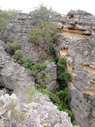
Brown, Jim. Bent Backs, 1989, pp. 145-146, records, " old maps that refer to the eastern cliffs which rim Capertee as Red Cliffs, as they frequently display a glowing reddish ochre appearance towards evening as the sun sets in the west." This is an unofficial name, for the Geographical Names Board has approved the name, Red Rocks.
Is a small hill on the Wolgan Road, 1.5km west of Cape Horn. The hill was named not because of the summit but due to the gradient on the northern side, as before the road was sealed the red clay base in the wet made many a vehicle to be bogged. Ref: Lithgow Mercury 24th February 1908, p. 1 records, “Passing Wolgan Station, the road for a short distance is quite red.”
Is on the Old Bells Line of Road, 1.5km north west of Bungleboori Camping Ground. Ref: Correspondence, Danny Whitty, local historian, 3rd July 2010. Local usage name, c1960s. Named due to the red soil.
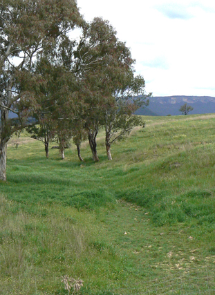
Is a non perennial creek rising at Woolpack Rock. It flows generally north east and north for about 15km into Coco Creek. Red Rock Creek is shown on the map Parish of Wolgan, 1884.
Is a gently sloping area of land alongside and midway along Red Rock Creek, 5.7km west of Newnes. The name Red Rock Flat is recorded under County Land Sales, SMH, 11th May 1858, p. 3. Access via Red Rock Trail.
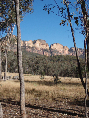
Is the name of the cliff face between Point Anderson and Point Nicholson. The name Red Rocks is shown on Survey Plan dated, 5th February 1856. Original name, The Red Rocks, is a descriptive name of the colour of the rock face in this area.
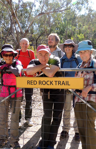
Is a1.1km trail leading from The Meadows Trail towards Red Rock Creek. Carne, J E. Field Book, State Records, 2/653-654, 1900-1903, records, "Red Rock Track."
Is a watercourse rising about 1km east of Kirbys Hill and 3km north, north west of Cullen Bullen. It flows for about 3km generally south west into Dulhuntys Creek. Shown as, "The Red Spring" on the Survey Plan 255.1496, Parish of Cullen Bullen, dated, 30th November 1861.
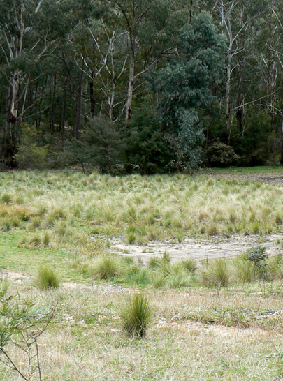
Is a non perennial creek rising 2.5km south east of Mount Airly. It flows generally south for about 5km into Airly Creek. This is a descriptive name. Shown on the map Parish of Coco, 1883.
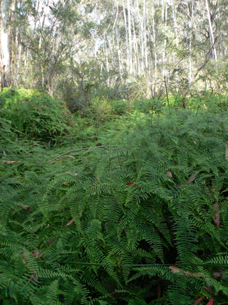
Is a partly perennial creek rising near Mount Sinai 1km west of the Clarence Railway Station. It flows generally in a southerly direction for about 6.5km to its junction with the River Lett. So named, as near the junction with River Lett the ground is swampy. Ref: Parish of Lett, 2nd edition, 1890.
Was part of the upper reaches of Bungleboori Creek, south of Mount Horne. The current Lithgow Topo Map does not show any swamp in this area. GR 426 000. Most likely named after Harry Richardson (1848-1915), Outdoor Superintendent, NSW Government Railways, of the north and west railway lines. At his death, 23rd June 1915, he was Commissioner for Railways. SMH 25.06.1915, p. 5. Ref: Tramway from Wolgan to Clarence. Survey Plan M12435. Surveyed by John Haydon Cardew, 13th December 1905.
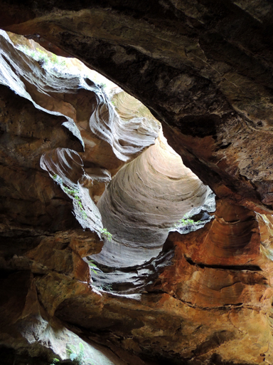
Are located on Budgary Creek, 1.5km south east of Mount Budgary. Access is via Mount Cameron Trail to barrier and walking north west down to the creek. Also known as River Caves Canyon. The River Caves were noted by two brothers, Alan and Russell May, and John Norris in c1948; they called it, The Water Tunnel. They found it by walking down Budgary Creek. Ref: Correspondence with David Warren Noble, 14th October 2009. Oral history with Ken Poppett, 24 February 2012 records,"The May brothers referred to it as RiverTunnels, they did not like the feature referred to as the River Caves," which is the current usage.
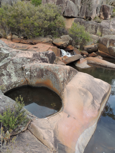
Dargans Creek and Kangaroo Corner Creek join to form the creek known as River Lett. This is a partly perennial creek which flows west, south west for about 6km into the Coxs River. This name was originally recorded by George Evans as Rivulett and repeated twice on his map. Ref: Surveyor G. W. Evans. Plan of route over the Blue Mountains from Emu Ford to Fish River Crossing. In 3 sheets, Sheet 3, scale 40 chains to an inch, 1815. LDI. 215 (3). When Surveyor Henry Butler was requested to survey the proposed reserve for a Court House and Gaol, (Hartley Court House), 25th July 1834, he recorded on his Survey Plan the spelling as River Lett. Ref: Survey Plan B228.691. Note: the spelling on the Great Western Highway at Hartley is shown incorrectly as Lett River.
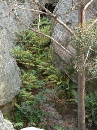
This creek is 4.2km long, has its headwaters between the western extremity of Sunnyside Ridge Road and Cape Pinnacle. It flows north, north west for 1.6km before dropping over the cliff line and then flowing into the Wolgan River at the locality called Jacks Camp. Name coined by Brian Fox, 9th September 2011, in keeping with the name Rockflower Ridge.
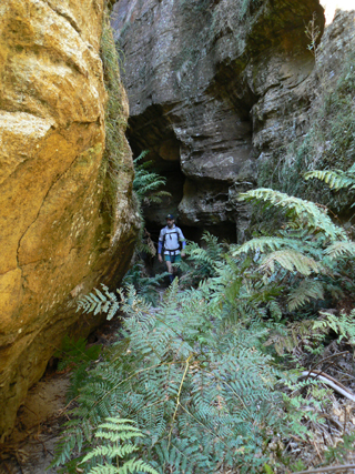
Is a 200m fern decked passage that follows the upper section of Rockflower Creek from the Gardens of Stone National Park boundary to the cliff line overlooking the Wolgan Valley. So named by Yuri Bolotin, on a Bush Club walk, 5th September 2011. This passage goes through part of the western side of Rockflower Ridge studded with pagodas.
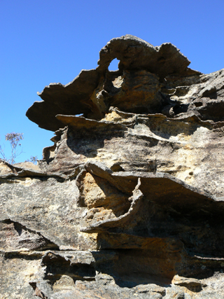
Extends off the western extremity of Sunnyside Ridge Road and trends north, north west and north towards Cape Pinnacle. Named by Yuri Bolotin on a Bush Club walk, 5th September 2011 and described by Yuri as,"we found all kinds of incredible rock formations coming into our view. Not many of them were more than a meter tall, but they were exquisite in form and reminded me of beautiful weirdly shaped flowers one may encounter while walking through an enchanted garden. It is for this reason that I named this place Rockflower Ridge."
Is located 5km north east of Deep Pass and 3.8km south of Mount Cameron. It is shown on the map Parish of Rock Hill, 1st edition, 1882. Elevation of 965m.
Michael Keats records, " The arch shaped rock is an ironstone residual that has more perforations than actual support rock holding it together. There are three major support points and these are all fluted, decorated and fenestrated like no other rock I have seen before. The interior of the arch is large enough to crawl into, and through if you are so inclined." Located above the cliff line on the northern side of the headwaters of Capertee Creek, 1.4km north east of Mount Dawson. Named by Yuri Bolotin on a Bush Club walk, 28th October 2013.
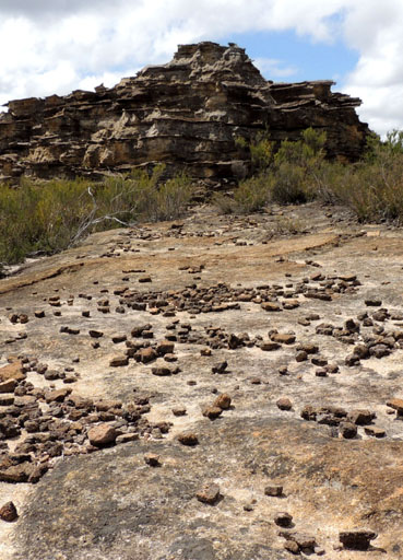
An aerial photograph taken in c1948 showed the whole area appearing as single rock. The "island" is surrounded on the north, east and south sides by the tributaries of Deanes Creek. The "island" is located principally in the south west corner of the Mount Morgan Topographic Map. Using the 900m contour, the south west corner is at GR 436 178 and the north east corner at GR 443 189. The name was created by the original three who proposed the Gardens of Stone National Park, Rodney Falconer, David Blackwell and Dr Haydn Washington, November 1984. Ref: Correspondence with David Blackwell, 2nd May 2010, who records,"This name was given when spotted from the air making a flight / air survey of the areas rich with Pagodas. Rock Island was extremely distinctive with low heath type vegetation, which was laid out with the most distinctive top surface contours of the island just like a "contour" topographical model. Small trees have grown some but the surface has so little soil the island is still distinctive from the landscape around."In 2012, the area was covered with Allocasuarina nana and the name is not quite so apposite.
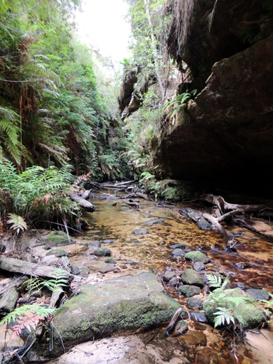
Is a perennial creek rising north of Cockatoo Hill. It flows generally north east and north for about 20km into the Wolgan River, about 8.5km south east of Newnes. This is a descriptive name. Shown on the map Parish of Gindantherie, 1892.
On the Wolgan Valley Railway was the site of a mill for cutting railway sleepers, c1908. It was located about 150m from the GlowwormTunnel on the western (Newnes) side. Ref: Notes of Sid Rosewarne within Stephens, Eric. Wolgan Railway Notebook, 1934-1937. Thomas Rodwell was listed as a Newnes resident.
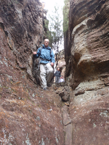
This slot is located 400m a bit north of west from the barrier on the Old Coach Road and 450 m north of the Glowworm Tunnel.Named by Michael Keats on a Bush Club walk, 12th August 2011.
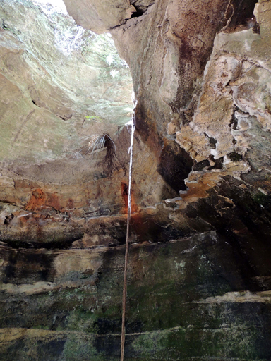
Is about 15m in three dimensions of almost totally enclosed space and was highlighted by a natural rope of tree roots that had grown down from the centre of the creek above and become rooted in the pool below. Located at the southern end of Sunnyside Gully. Access via Sunnyside Ridge, Fire Trail No. 7. Named by Michael Keats on Bush Club walk 7th February 2014, Mike recorded, "I can see Romeo climbing that rope to Juliet's Balcony."
Was located within Pavilion Gully, Hassans Walls Reserve, Lithgow. Rock falls have destroyed this overhang. Named after Captain Ronald Burns, who lost his life at the landing on Gallipoli on April 25th 1915 – the first soldier from Lithgow to die at Gallipoli. Lithgow Mercury, 8th December 1916, p. 6.
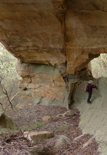
See Twin Arch Cave.
Is a a saddle located south west of Rowans Hole and at the junction of Rowans Hole Trail and Moffitts Trail. Ben Bullen Topo Map, GR 253 192. Ref: Carne, Joseph. The Kerosene Shale Deposits of New South Wales, 1903, p. 176. Applied for by Walter Rowan. Portion 41, 23rd December 1875 as Conditional Purchase. Portion 37 and 40, 30th December 1875 as Conditional Purchase. Scale 20 Chains to an Inch. Date of Survey 26th January 1877.
The Index to the Unassisted Arrivals in NSW records, “Mr W Rowan arrived in Sydney as an unassisted passenger on the ship ‘Pluto’ from Melbourne on the 22nd February 1855.”NSW BDM records, “Walter Rowan married Sarah Murdock, district Hartley, 1863, two children, Sarah born 1864 and Thomas born 1866. Walter died 1882.” Ref: NSW BDM Rego No. 8800/1882.When Walter died, the leases were transferred to wife, Sarah. She died in 1879. Ref: NSW BDM, Conditional Purchases Register Book, State Records, Kingswood and Survey Plan R1460-1496.
Certificate of Title records, “Jonathan McLean purchased Portion 40 and 41. Portion 41 was purchased for £60.” His Title was Recorded and Enrolled in the Registrar General’s Office, Sydney, 23rd June 1904. Jonathan McLean’s grandparents, John and Marion McLean, were among the earliest settlers in the Glen Alice, Capertee Valley in 1837. Mount McLean and McLeans Pass are named after this family.
Portion 41 passed onto Kate Augusta McLean on the death of her husband Jonathan McLean on 23rd November 1907. On Kate’s death, the land was passed onto her son William John McLean, a Sydney solicitor on the 18th March 1932. On the same day, William sold to Thomas William Wolfe Gardiner, a grazier of Ben Bullen. The geographical features, Gardiners Hill and Gardiners Gap, were named after Thomas Gardiner’s father Thomas, and grandfather William.
The next owner was Ronald Horace Lillyman, a grazier from Molong, 9th October 1956, then the property was sold to Virginia Gai McCann of Ben Bullen on 16th January 1961. Ref: Volume 1540; Folio 70. Virginia Gai McCann passed the land onto Matthew Anthony McCann on 30th July 1973. It was then sold to Merevn Jack Crane on 23rd September 1977. Ref: Vol. 8268; Fol. 159. The next five owners held the land for a short amount of time each, before the land was sold to the current owners, John Christian Murray and Katherine Lynne McFarlane on the 29th May 2007.
Note: from the original Survey Plan, this Portion has never been further subdivided and is described as Lot 41, Deposited Plan 755759.
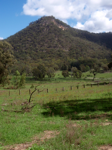
Is a basin like valley at the headwaters of Coco Creek within the Capertee Valley. Road access is via Castlereagh Highway at Ben Bullen, Hutchinson Road and Moffitts Trail. Ben Bullen Topo Map, GR 257 202.
Rowans Hole was part of the shortest stock route into and out of Capertee Valley. Annabella Boswell's Journal, p. 24, records in 1839,"One of these roads was known as, ‘The Hole’....was the best as well as the shortest way, but only available for persons walking or on horseback for there was one tremendous hill up and down.”
Before the lease of this land to Walter Rowan, the area was known as Dulhuntys Hole. Ref: Parish of Ben Bullen, 1885. Subsequent parish maps recorded the name as Rowans Hole. Robert Venour Dulhunty had selected 2000ac in 1824 and his property was called Cullen Bullen.
The Survey Plan 1460-1496 has “Note: In the advent of the Conditional Purchase becoming Lapsed or Forfeited the plan should be forwarded to the Reserve Branch with a view of including the area in Railway Reserve 180; Notified 5th December 1883.”Portions 40, 60 acres and 41, 40 acres, show the name Coco or Cooks Creek and swamp through the western side of these Portions.
Note: as the survey was completed two years after the Conditional Purchase, the plan shows the outline of Corn Paddock on Portion 41, a hut in the centre and garden on the north side of the hut. The plan records, “Value of Improvements, Hut £26, Fencing £30, Clearing £20, Ringbarking £2, Total £78.” Ref: Survey Plan 1460-1496.
Carne, Joseph. Geology and Mineral Resources of the Western Coalfield, 1908, p. 68 describes Holes as“streams heading in volcanic necks have sawn through encircling precipitous cliffs, producing a resemblance to frying pans with long crooked handles; such are discriminated as ‘round topped arms’, arm being synonymous with creek or stream. Holes are also suggestive appellations for the circular heads of those channels.”
Is the administrative area of the County of Roxburgh. It adjoins the northern side of the County of Cook, with Glen Alice being on its southern end. When Dr James Innes (1796-1846) was granted 1760ac in October 1831, the location was recorded as Parish unnamed at Capertee. James ancestor, was James Innes-Ker 3rd Duke of Roxburgh (1736-1823). Ref: web site,www.absoluteastronomy.com
Are a group of pagodas above the western side of Neubecks Creek, 1km south east of Invincible Trig.“I am running day trips to another area….. I call it the Ruined Castles”. Vic Widman, Great Divide Tours. Named 2014. Vic had in the 1989 named Lost City (Lithgow Topo Map, 371 988) and this name is in keeping with the similar theme.
Is a watercourse rising 1.5km north east of Capertee. It flows generally south east and north east for about 2.5km into Airly Creek. Shown as Russells Waterhole Creek on the map Parish of Bandamora, 1882. Captain William Russell (1807-1866) married Jane Rebecca Griffiths Jamison in 1841. Jane was the daughter of Sir John Jamison. They had 3 daughters and 8 sons. Along with his father in law and Dulhuntys, he was one of the first landowners in the Cullen Bullen, Ben Bullen area. His first purchase of 11 Portions of Land was on 4th September 1852. Russell was also a Member of the Legislative Assembly, June 1859 - November 1860. Ref: Survey Plans 57 and 58-1496, 891-1496. NSW Parliament Former Members website.
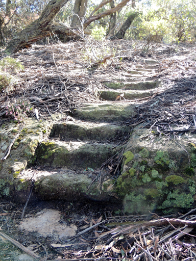
Is located 600m north west of Padleys Pedestal Trig Station, within Hassans Walls Reserve, Lithgow. Named after James Rutherford (1827-1911). In 1873, with Daniel Williams and others he started the Eskbank Ironworks at Lithgow. Ref: Lithgow Mercury, 18th May 1917, p. 6. This glen has a walking track which connects to the Undercliff Track. The first overhang from the top is known as Hurley Cave.
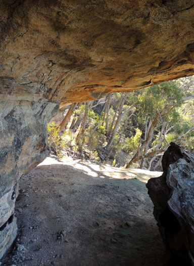
Is located within Hassans Glen, it is the last rock overhang on the upper track on the western side of Hassans Glen about 40 metres past Hoskins Cave within Hassans Walls Reserve, Lithgow. Named after James Ryan (1863-1940), who was a former editor of the Lithgow Mercury, Member of the Legislative Council and Hassans Walls Trustee. Ref: Lithgow Mercury, 14th May 1915, p. 4. Former Members of Parliament website.
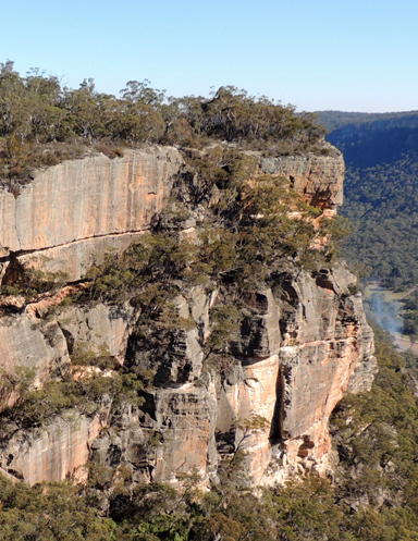
Is the westernmost end of Sunnyside Ridge Road. Named by rock climbers who have been climbing from this point since 1975. So named as there is not a drop of water in this area. Overlooks the upper escarpment of the Wolgan Valley. Name recorded in Taylor, Pete and Penney, Andrew. The Wolgan Guide, 1984, p. 116.
So named by John Fox on a Bush Club walk, 16th June 2014. This cave with faint Aboriginal drawings and European usage would have provided an ideal sanctuary for them. Located on the southern side of Beecroft Firetrail. 820m southeast of Beecroft Trig.
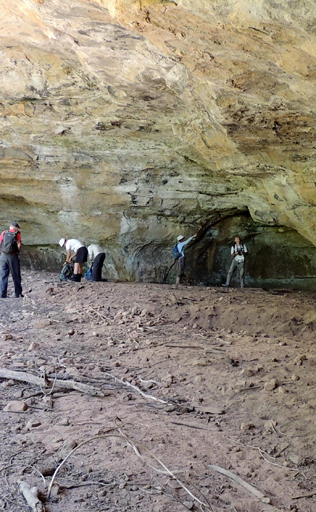
Is located just above the main cliff line about 800m due west of the junction of Fire Trail No. 7 and Glowworm Tunnel Road. It has a more or less level floor and in times of heavy rain water washes sand through the cave. This cave is 40m long, 10m high and 18m deep.
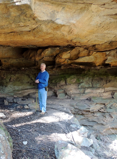
Is the first overhang when descending into Hassans Glen at Hassans Walls Reserve, Lithgow. Named after William Sandford by the Lithgow Progress Association Lithgow Mercury, 14th May 1915, p. 4. Hartley Topo Map, GR 355 883. Sandford took over the iron works at Lithgow in 1886 and was a pioneer in the Australia’s steel making industry. The ledge from Sandford Cave leads to Pillans Lookout and above the rock formation was the original 1915 Bracys Lookout and the feature known as Natural Throne.
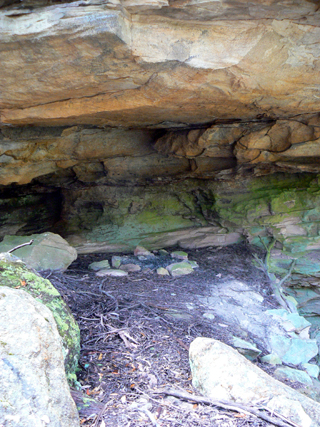
See Hassans Walls
Is a 3km non perennial creek rising on Glen Davis Road. It is the next gully south west of Nuggety Gully. It flows south east into Coco Creek. Named by Alexander McLean, a local resident who found gold in this gully, the largest nugget being 30 ounces. Ref: Carne, Joseph. The Kerosene Shale Deposits of New South Wales, 1903, p. 132. Name not shown on any Topo Map.
Is a locality about 1.5km north west of Mount Harvey and about 3.5km north east of Mount Stewart. Sapling Flat is recorded under County Land Sales, SMH, 11th May 1858, p. 3. The word sapling refers to a young tree.
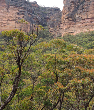
Is a non perennial creek rising at Hughes Defile. It flows generally north, north east and north, north west for about 7km into Crown Creek at Crown Swamp. Sapling Flat Creek was recorded as Sapling Flat Gully in the NSW Government Gazette, 26th February 1875.
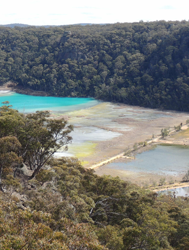
Lies at the headwaters of an ash settlement dam at Kerosene Vale, 3.5km west of Lidsdale. The Sydney Morning Herald, 22 August 1854, p. 5, records, "County Lots for sale, 34 acres at Sawyers Swamp, at the upset price of one pound per acre."Survey Plan C121-1507, dated 13th October 1856, records the name Sawyers Swamp.
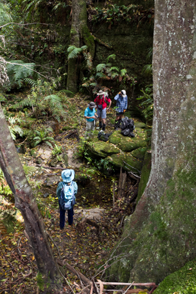
See Scatters Creek
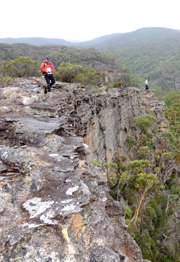
Is a spur, 1.4km in length, off the southern side of Waratah Ridge. Named by Peter Fox, National Parks Association bushwalker, between the years 1995-1998. Peter had it named it after Scatters Canyon, which is a side canyon off the northern side of Bungleboori Creek. Wollangambe Topo Map, creek junction GR 506 006. Scatters Canyon is recorded in Jamieson, Rick. Canyons Near Sydney, 4th edition, 2001.
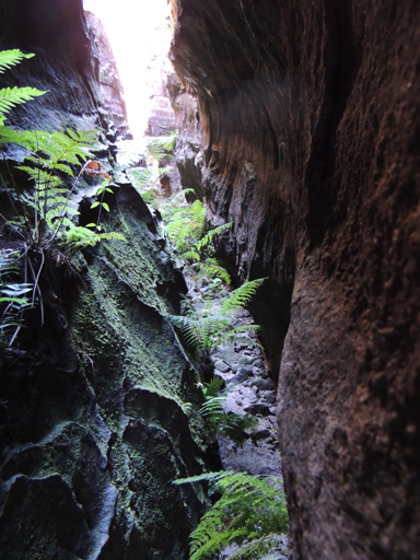
Is a 150m slot canyon located 3.9km north east of the junction of Glowworm Tunnel Road and Old Coach Road and close to and above the junction of Henry Creek and Deanes Creek. So named by Michael Keats on a Bush Club walk, 10th August 2012. Michael recorded,"This name reflects the shape, the curvature and the precise deep cut that this landform makes in the terrain at the end of the Henry Creek, Deanes Creek peninsula."
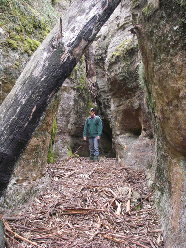
Is a natural pass giving access from the plateau off Glowworm Tunnel Road towards Carne Creek, 2km east, north east of Wolgan Pinnacle. This descriptive name was coined by Michael Keats on his Bush Club walk, 10th October 2007.
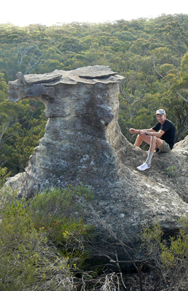
See Poseidon Arena.
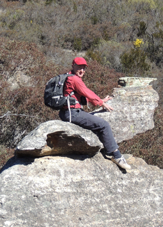
So named as this rock formation is poised like a seal seating on top of a rock waiting to be fed fish after a performance. Located 1.3km north east of Invincible Trig Station. Named by Daryl Watson, a bushwalker, on a Bush Club walk, 15th August 2013.