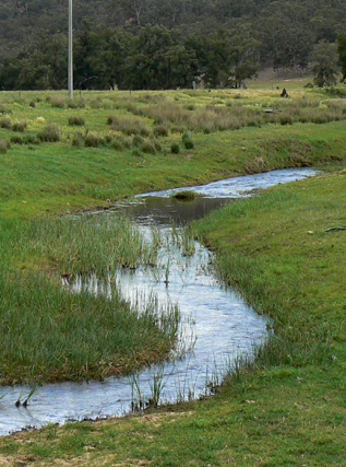
Is a non perennial stream rising east of Mount Dawson. It flows generally south east and north east for about 6km into the Wolgan River at Newnes. Capertee Creek is shown as Capertee Gully on the map, Parish of Gindantherie,1892.
Is a non perennial stream rising east of Mount Dawson. It flows generally south east and north east for about 6km into the Wolgan River at Newnes. Capertee Creek is shown as Capertee Gully on the map, Parish of Gindantherie,1892.
Refers to the cliff line on the northern side of Capertee Creek. Name recorded in Taylor, Pete andPenney, Andrew. The Wolgan Guide, 1984, p. 173 and shown on a hand drawn map The Newnes Area, 2005, compiled by Thomas Ebersoll, owner of the old Newnes Hotel. But note: the older name and current local usage name is (see) Red Cliffs.
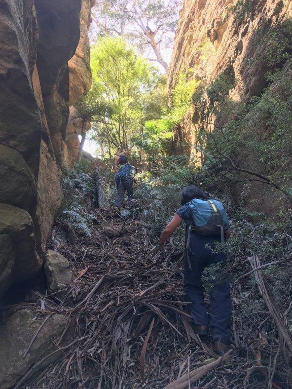
Is located 1.8km north east of Mount Dawson in the high cliffs above the northern side of Capertee Creek. The slot slowly tapers from about 15m to less than 5m wide, is 200m in length and a vertical displacement of 55m. Named by Yuri Bolotin and Brian Fox and on a bushwalk of 27 September 2019.
An older name of (see) Capertee Creek. Ref: Lithgow Mercury 16th January 1933, p. 4.
Is a perennial river rising on the Great Dividing Range south of Mount Gangang. It receives its identity at the confluence of Tea Tree and Brymair Creeks. It flows in a meandering course generally south, east and south east for about 92km to its confluence with Wolgan River to form the Colo River. It passes Glen Alice and Glen Davis. Bogee. Capertee River is shown on the map published on 1st September 1833 for The Australian Agriculture Company. Surveyor Frederick Robert D'Arcy surveyed the Capertee River in mid 1831 from below Mount Gundangaroo about 5km west of Glen Davis downstream for about 46km. Ref: Andrews, Alan E J. Major Mitchell's Map,1834 and Macqueen, Andy. Frederick Robert D'Arcy, colonial surveyor explorer and artist, c1809-1875, 2010.
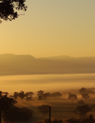
Is nearly 30km across. It is the largest enclosed valley in Australia.
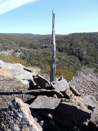
Is a very narrow spur 400m in length at the southern end of The Barnacles and is capped at its northern end by a generally squat circular pagoda. In keeping with the nautical theme commenced by Ian Thorpe in 2010, this feature was named by Michael Keats on a bushwalk 14th September 2015. The Capstan is located at, GR 490 910. Capstan Spur contains an old cairn and upright stick in the centre, GR 490 909. Capstan Spur terminates above Bell Creek.
Refers to the surveyed trial line for the Wolgan Valley Railway from Newnes Junction to Newnes via Island Mountain by John Haydon Cardew (1852-1941). The surveyed line appeared on a map prepared by geologist Joseph Edmund Carne in 1906. Cardew’s line involved the construction of a massive bridge across Constance Gorge and an incline ropeway some 1200 feet high to connect from the high level terminus to the mine entrance in Newnes. This option was abandoned by Engineer Henry Deane in favour of a route that took the railway into Newnes via tunnels and steep grades. Cardews Line was used to construct a telephone service as it was the most direct route. See Gardens of Stone National Park and beyond. Book 7, pp 84- 88 and pp 180-189.
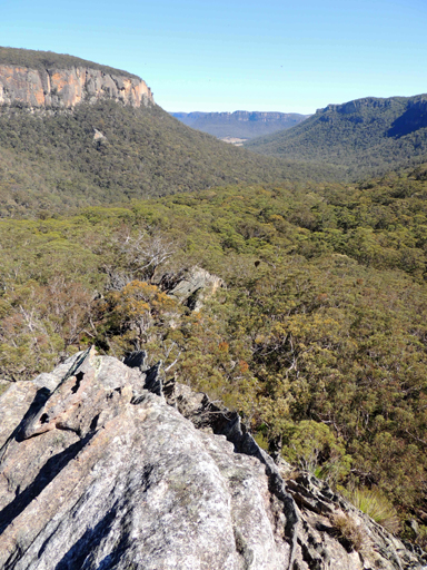
Is a watercourse about 19.5km long. It rises 2.5km north, north west of the Bungleboori Camping Ground and flows generally north into the Wolgan River. Carne Creek and the Wolgan River join at the northern edge of the Cullen Bullen Topo Map. Previously these two major drainage patterns were known as the Eastern and Western Branches of the Wolgan River. The Eastern Branch was officially renamed Carne Creek, 1970. Ref: GNB notes, 5th March 1970. It was first named Carne Creek in 1965 by Myles Dunphy. Joseph Edmund Carne (1855-1922), geologist. His major works are The Kerosene Shale Deposits of New South Wales, 1903, Geology and Mineral Resources of the Western Coal Field, 1908 and, with L. J. Jones, the classic Limestone Deposits of New South Wales, 1919. In all Carne's writings and maps, he combined clarity with meticulous scholarship. Carne carried out careful investigation of the Wolgan Valley and its environs, including the Newnes oil shale field. Carne Creek runs roughly parallel to the old Wolgan Valley Railway line constructed to the shale oil field.
Is located above the cliff line on the northern end of a firetrail opposite Lurline Jack Lookout and above Carne and Camp Creek junction. From this view point, the cliff lined walls of Carne Creek are viewed downstream. Named by Karen McLaughlin and shown on her map The Gardens of Stone Stage 2 Proposal State Conservation Areas and National Park Extensions. Compiled by Karen McLaughlin for Blue Mountains Conservation Society and Colong Foundation for Wilderness, December 2010.
Is located 1km west of Glowworm Tunnel Road and 2.4km east of Wolgan Pinnacle. From this vantage point on top of the cliff line, one has views directly up the cliff lined Carne Creek. Named by Michael Keats on his Bush Club walk, 10th October 2007.
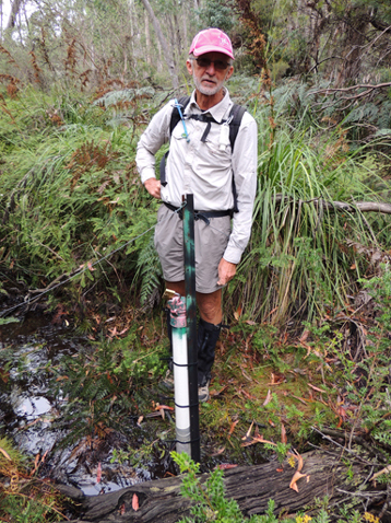
Is located at the headwaters Gang Gang Creek.
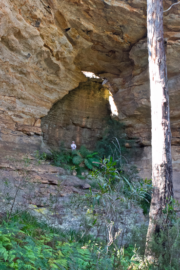
An imposing natural overhang with an arched window at the top, is on the south eastern side of Goochs Crater. Named by Brian Graetz on bushwalk, 23rd May 2012.
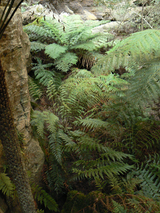
Is a canyon within a non-perennial gully which rises above the north western side of Little Capertee Creek Camping Ground, 1.7km due north of the old Newnes Hotel. Cathedral Canyon was named by Thomas Ebersoll in 2005 due to the cathedral of fern trees within the central section of this canyon. This canyon and / or pass also gives access to Old Baldy, the cliff face overlooking the camping ground at Newnes. Near the base of this canyon is a small waterhole known by Thomas Ebersoll, owner of Newnes Hotel as The Bathtub, GR 424 265. Ben Bullen Topo Map, Top of pass, 421 274, base 424 266.
Is a non-perennial gully which rises above the north western side of Little Capertee Creek Camping Ground, 1.7km due north of the old Newnes Hotel. It flows in a south and south easterly direction for 1.1km into the Wolgan River. Named after Cathedral Canyon which is located within the top section of this gully. This gully and canyon and / or pass also gives access to Old Baldy, the cliff face overlooking the camping ground at Newnes.
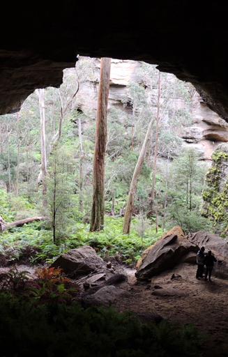
Is located 1.7km north, north west of Birds Rock Trig. It is 50 metres wide, 50 metres high and 30 metres deep. The back wall has an outline of a near perfect cupola and a large fallen rock is centrally disposed and elevated. The floor has a rake of about 30 degrees, is sandy and has areas of duricrust, a secondary product of weathering. Named by Yuri Bolotin on a Bush Club walk, 26th November 2012.
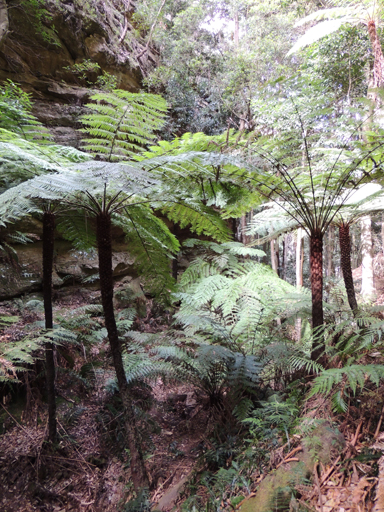
Is the access between Little Capertee Creek Camping Ground to the top of the cliff line at Mount Tricky. A rock climbers name as this pass also gives access to Old Baldy, the cliff face overlooking the camping ground at Newnes. Near the base of this pass is a small waterhole known by Thomas Ebersoll, owner of Newnes Hotel as, The Bathtub GR 425 264.
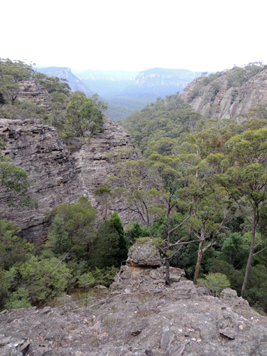
See entry, Celestial Chamber.
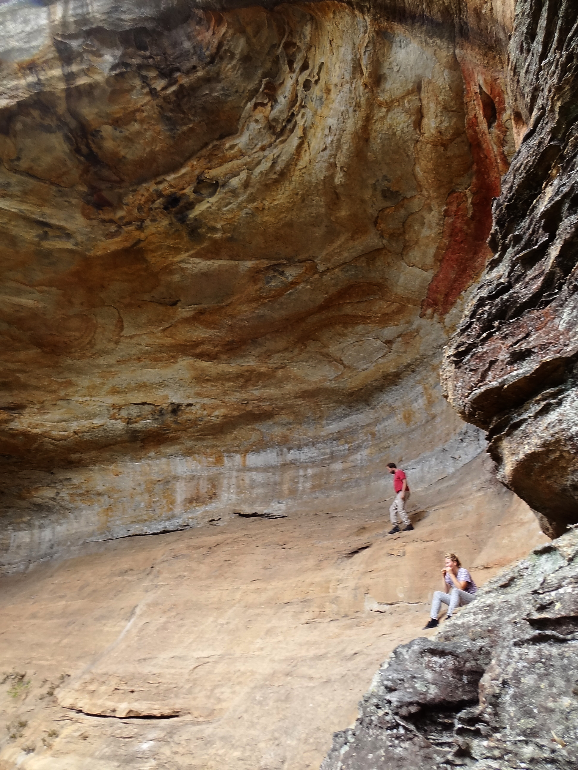
Is one of the largest semi enclosed overhangs in the Greater Blue Mountains. It is more than 80m across, at least 30m high and 20m deep. Located in HenryCreek, 1.9km north east of the junction of Glowworm Tunnel Road and Old Coach Road. The area had a number of overhangs which Michael Keats on a Bush Clubwalk on 23rd July 2012 named Cave Galleries and Yuri Bolotin named the main cave Celestial Chamber.
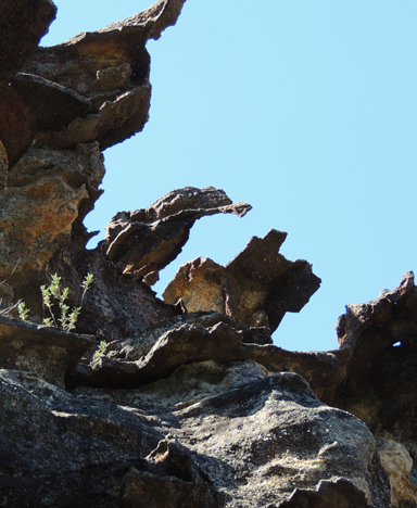
Are located on top of the cliff line 1.5km north north east of the property, Penrose. The pagodas have reached an advanced stage of erosion with the contorted ironstone forming fantastical shapes. One such shape is of a large horse shoe. It was named by Yuri Bolotin on a Bush Club walk 24th March 2016 in keeping with the mythical creatures denominated in this area. Centaur is the mythical Greek half horse half man.
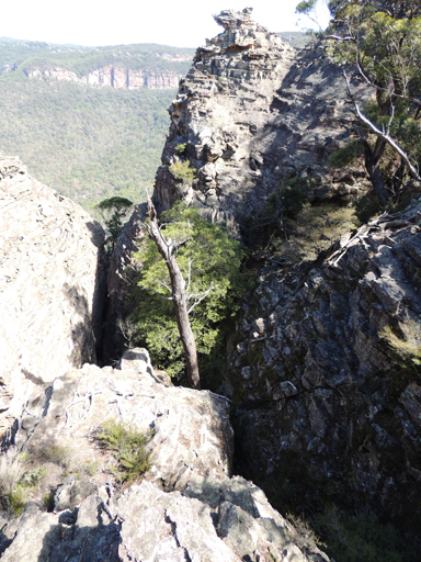
Is a very deep incised weathered Y shaped slot directly below Centaur Rocks. It is located high up on the cliff line above the north north eastern side ofPenrose.This slot is non negotiable without abseiling gear. Named by Yuri Bolotin on a Bush Club walk, 24th March 2016.
Located 1km north of Wolgan River and midway between the Pipeline Track and Petries Gully. Named by Yuri Bolotin on a bushwalk 17 July 2017. Yuri recorded,“The first objective was to descend into the headwaters of a prominent ravine to the west, which begins at the watershed we were currently standing on and continues all the way down into Petries Gully. It is the most significant gully within the Petries Slots area, and is located roughly in the middle of it, at about the same distance from The Crater to the south and Petries Slots Pass to the north. I called this feature Central Gorge.”
Is the name given to a group of prominent pagodas 3.2km south east of Goochs Crater. Marked on the topo map as spot height 994. Known by this name by bushwalkers prior to 1990s. Graham Conden records the name in 1999 as Submarine Rocks, because when walking in from the Bells Line of Road, he felt as though you were on the conning tower of a submarine in the middle of the ocean.
Has its headwaters on the south east side of Two Trees Road and Waratah Ridge Road, GR 452 019. It flows generally north east for 5.3km into Dingo Creek, GR 483 046. A lower section of this creek forms a canyon that includes six 's' bends as it wends its way through towering cliffs and extends for more than one sinuous kilometre. Named by Michael Keats on a Bush Club walk,7th May 2010. Michael recorded,"at the foot of these cliffs the dry sandy floor was covered in hundreds of dog foot prints. Is that why the main creek is called Dingo Creek? This creek needed a name with dog connotations and so Cerberus Creek was named, Cerberus was the gigantic three headed hound that guarded the gates of Hades. He was posted there to prevent ghosts of the dead from leaving the underworld. He is described as a three headed dog with a serpent's tail, a mane of snakes, and a lion's claws."
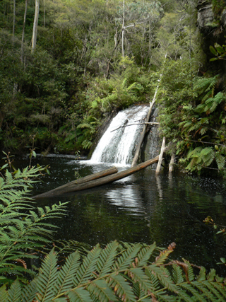
Is a 5m waterfall which flows into a large, 20m, sandy bottom, round pool. Named by Brian Fox on a Bush Club walk, 26th March 2012.
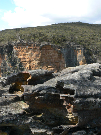
The three Cerberus heads include: one, the high promontory between Dingo Creek and Cerberus Creek, two, the narrow high promontory between Cerberus Creek and Little Cerberus Creeks and three, the extended rugged promontory between Little Cerberus Creek and Dingo Creek. Cerberus Heads were named on 24th January 2011 by Michael Keats.
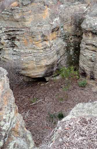
A part of the Moffitts Pagodas complex. Located 2.75km north of Gardiners Hill and 1km west of Rowans Hole. Named after the Moffitts (see Moffitts Trail). When entering Moffitts Pagodas, you walk through a level encircled rock walled area. It was named the Ceremonial Room by Michael Keats on a Bush Club walk, 14th July 2010, due to the feeling that Aboriginal initiations could have taken place here.
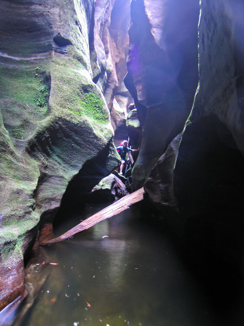
See Cesspit Creek
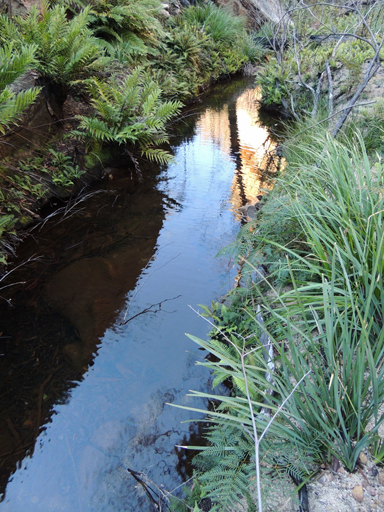
Has its multi stemmed headwaters on the northern side of Girdwood Ridge. The western side is in the Newnes State Forest and the eastern side is in the Blue Mountains National Park. It flows in a generally north east direction, the last 1.5km being known as Cesspit Canyon. Joins Dumbano Creek. This name was derived from the name Cesspit Canyon as recorded in Jamieson, Rick. Canyons Near Sydney, 1993, p. 39.
Trends south, south east from Bungleboori Creek for 2.5km towards Dumbano Creek. Named by Frank Leyden, Sydney Bushwalkers on 11th November 1967 due to "the many minarets, creeks and cliffs on top of it." Ref: The Sydney Bushwalker, December 1967, pp. 12-14.
See Poseidon Arena
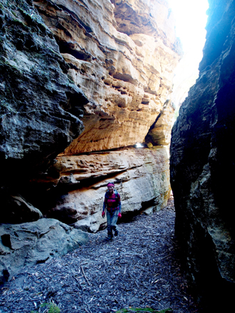
Is located above the main cliff line 1.5km north north east of the property Penrose. A number of small slots radiate off the main passageway, which is about 5m wide and extends on a flat floor for about 80m. Named by Yuri Bolotin on a Bush Club walk, 24th March 2016.
Refers to the southern point of the cliff line above the property, Penrose,which is directly below. Access is via Barton Pass. Named by Michael Keats on a Bush Club walk 24th March 2016.
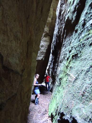
There are three of them in very close proximity to each other. One of which give access to the plateau above. They each are narrow and contain doglegs and a small room. Located above the main cliff line 1.5km north north east of the property Penrose. Named by Yuri Bolotin on a Bush Club walk, 24th March 2016. Chimera in Greek mythology is monstrous fire-breathing hybrid creature composed of the parts of more than one animal. So named in keeping with the Greek theme of the Minotaur Lair to the east of this plateau.
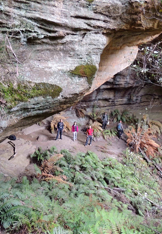
Located 900m south east of Beecroft Trig and accessed via Beecroft Firetrail and part of Clerestory Spurs No. 1. Being 40m around the curved perimeter it contained some old graffiti and glass fragments. Directly above was the Choir Loft Cave, 30m around the perimeter which contained an old hearth. Named by John Fox on a Bush Club walk 13th June 2014 in keeping with the church architecture terms of this area such as Clerestory Spurs.
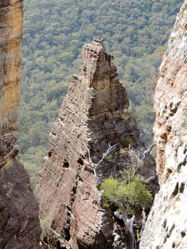
Is part of Minotaur Watch complex. Located 900m south west of the Wolgan River / Zobels Gully junction. Named by Yuri Bolotin on a Bush Club walk, 10th September 2016. Yuri recorded,“One part of the split pinnacle has become a separate monolith that ends up with a giant pyramid shaped top. That structure is strangely reminiscent of the famous Chrysler Building in New York.”
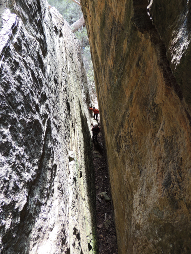
Is a narrow 50m slot and part of Minotaur Watch complex on the southern side of the pyramid shaped rock formation known as the Chrysler Building, hence this name. Located 900m south west of the Wolgan River / Zobels Gully junction. The top of this slot has views back down over the Chrysler Building. Named by Michael Keats and Yuri Bolotin on a Bush Club walk, 7th October 2016.
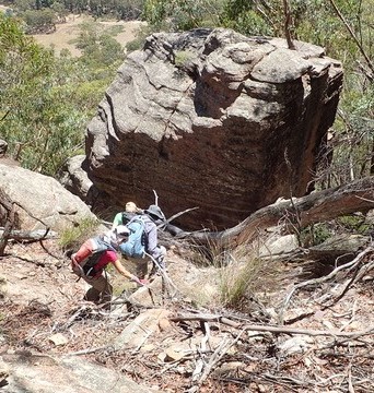
Gives walking access between Glen Davis Road and Citadel Spur on the western side and southern end of Genowlan Mountain. 500m further south along this cliff line is Citadel Pass South. Named by Yuri Bolotin, Michael Keats and Brian Fox, 20th February 2017-2 February 2018.
Gives walking access between Glen Davis Road and Citadel Spur on the western side and southern end of Genowlan Mountain. 500m further north along this cliff line is Citadel Pass North. Named by Yuri Bolotin, Michael Keats and Brian Fox 20th February 2017-2 February 2018.
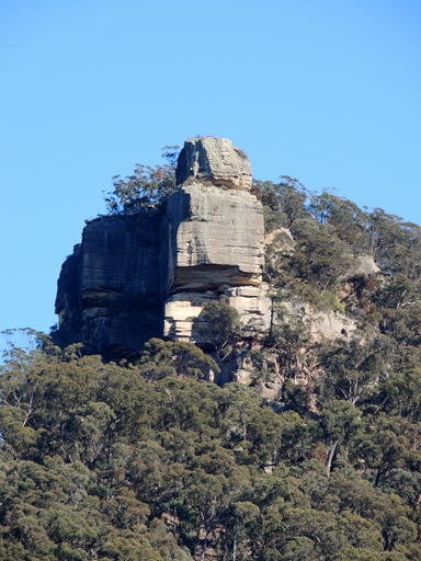
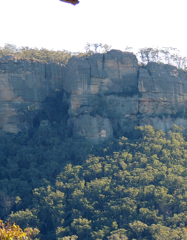
Is a prominent spur above the Glen Davis Road, Capertee. Extending from Genowlan Trig in a generally southern direction to the highest point, The Citadel and the southern point, Citadel Point. Named by Michael Keats on a Bush Club walk, 2nd March 2015.
Is located 900m north, north east of Genowlan Trig Station, Named by Dr Haydn Washington who had named it in reference to Ball, Duncan. Emily Eyefinger and the City in the Sky, 2006. Ref: Correspondence with David Blackwell, 27th April 2010 and Haydn’s map.
Is a locality about 7km east of the City of Lithgow. Boundaries are within the Lithgow Council area. GR 417 922. Clarence would have taken its name from Mount Clarence, which is located 2.5km south west of the railway station. Governor Macquarie in his trip across the Blue Mountains to Bathurst in 1815 named Clarences Hilly Range in honour of H.R.H. the Duke of Clarence. Ref: Macquarie's journal. Mount Clarence would have been derived from this name.
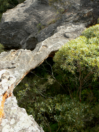
Is located 450m south west of the intersection of Donald Road and Ray Crescent, Clarence. This arch is about 15m high, 14m long and 1.5m wide. It is easy to walk on and off at the northern end but the southern end involves a pagoda climb. The southern end also is undercut with a very pleasant, ochre coloured, curved semi cave. This arch and the area below it came into prominence during the construction of the Main Western Line in the early 1900s.
Extends generally in a west east direction along Girdwood Ridge from Bald Trig Station to the Blue Mountains National Park barrier. This trail gives access to Goochs Crater, Holts Heaven and the Dumbano Creek system.
Opened in 1874 and closed in 1910. Reopened as part of the Zig Zag tourist attraction. On 18th October 1975, the tourist railway carried its first passengers between Top and Bottom Points. The extension of the tourist railway to Clarence was opened on 29th October 1988. The Zig Zag and Clarence Railway Station closed in 2012 after failure to complywith WHS requirements. A reopening date has been put back due to the 2013 bush fires that destroyed some of the track and rolling stock.