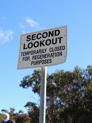
Second Lookout
Is located off a side track from Hassans Walls Road, Lithgow. Midway between Padleys Pedestal Trig and Browns Gap. A shelter shed constructed in 1939 and Hartley Trig are also located in this vicinity. So named as this area was the second reserve added to Hassans Walls Reserve in 1938. The far southern point of land is known as Finnigans Point.
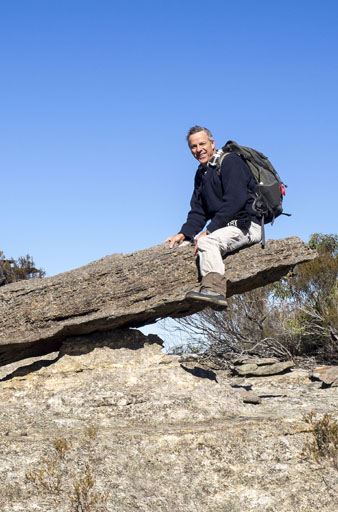
See-Saw Point
Is located 500m east of Genowlan Trig above the Glen Davis Road. A natural rock formation likened to a see saw was acted out by Brian Fox and Yuri Bolotin on Bush Club walk, 1st June 2015. Another walk on the 26th June 2015 noted the extensive views from this location and hence the name coined by Yuri Bolotin. Genowlan Trig which is at a higher elevation has no views owing to the regrowth of vegetation.
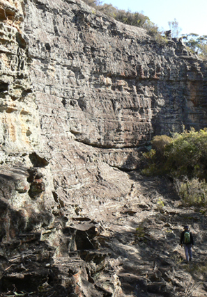
Semicircular Wall
is located within the Sinusoidal Ravine off Birds Rock Creek. This natural rock wall is about 100 m across the chord and has a sloping fore-apron of exposed rock beneath that averages 20 m in height. Named by Michael Keats on a bushwalk, 11 July 2011.
Sentinel Chasm
Named by Hugh Speirs 6th June 2013 part of (see) Twin Heads
Sentinel Pass
Sentinel Pass gives access from Glowworm Tunnel Road towards Koan Cave, the Flying Carpet and Carne Creek. Named on a bushwalk by Brian Fox and Yuri Bolotin, 12 July 2019. So named due to the distinguishing 15m high sentinel rock pagoda near the top of the pass.
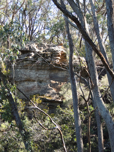
Sentinel Rock or Dooleys Lookout
Is above the upper track and in the centre of Hassans Glen within Hassans Walls Reserve, Lithgow. Lithgow Mercury, 14th May 1915, p. 4. Named after James Thomas Dooley (1877-1950) Member of the Legislative Assembly and former Premier of NSW. Ref: Former Members of Parliament website.
Shale Gully
Sheedys Gully
*
Has its headwaters on the southern side of Hassans Walls, Lithgow and the western and southern side is ringed by Hassans Walls Road. This four pronged gully flows generally northwards towards Farmers Creek. Named after the Sheedy family, who owned a 132 acre farm in this area in the 1860s. Thomas (1815-1890) and Johanna (1812-1882) had eight children. Ref: The Sydney Morning Herald, 30th March 1870, p. 8 and Lithgow Mercury 14th July 1920, p. 2. Bowenfels Cemetery inscription. The name Sheedys Gully was recorded in the Australian Star 30th October 1889, p. 5.
Shepherds Gully
Is officially known as (see entry) Capertee Creek. Ref: Interview with Dick Bird and Ron Bourke, 29th January 2010. Local usage name. Named after the property owners, Shepherd. Described as, a beautiful enclosed valley.
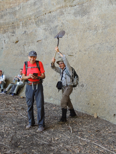
Shovel Cave
Is located just above the main cliff line about 800m due west of the junction of Fire Trail No. 7 and Glowworm Tunnel Road. So named because of an old, round nose shovel leaning up against its back wall. This cave is 30m long, 15m high and 7m deep. Close by is an overhang known as the Sand Cave.
Shunt Pass
Forms a natural staircase leading in from the vicinity of The Governor, all the way to the top cliff line, 750m west of the road intersection of Glowworm Tunnel Road and Fire Trail No. 7. Named by Michael Keats on a Bush Club walk, 21st September 2007. This name relates to the steam railway days, when the Glowworm Tunnel Road was the track of the steam driven trains on the Wolgan Valley Railway line to Newnes.
Shunt Track
Is the unformed walking track which follows the base of the cliff line below The Governor.
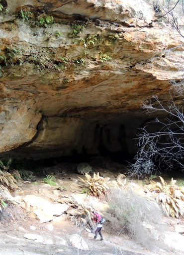
Signature Cave
Is located 1km north east of Invincible Trig Station at the easternmost end of a small valley. Measuring about 50m across, 18m wide from the back wall to the drip line, and 25m high, it has presence from sheer size alone. It also is the location of a lot of fading graffiti. It includes an internal natural spring, many glass shards dating from the 1930s and a cut log for a seat. Named by Brian Fox and Michael Keats on a Bush Club walk,15th August 2013.
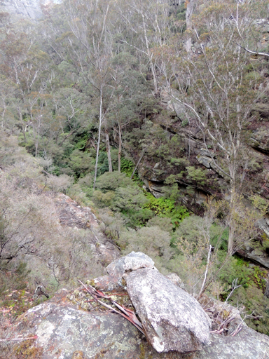
Silkpod Creek
Has its headwaters on the eastern side of the intersection of Sunnyside Ridge Road and Fire Trail No. 4. This creek flows in a generally eastern direction for 2.7km to its junction with Carne Creek.
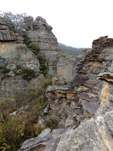
Silkpod Gorge
Silkpod Creek has its headwaters on the eastern side of the intersection of Sunnyside Ridge Road and Fire Trail No. 4. This creek flows in a generally eastern direction for 2.7km to its junction with Carne Creek at GR 410 071. Within Silkpod Creek is Silkpod Gorge, and Silkpod Slot, GR 411 072. All so named by Yuri Bolotin and Michael Keats on a Bush Club walk, 6th September 2013 due to the profusion of the rare Mountain Silkpod,Parsonsia brownii.
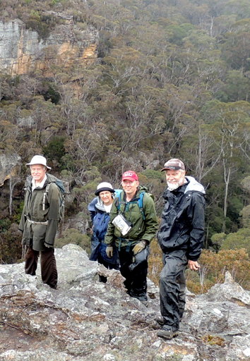
Silkpod Point
Is the northern point of a small spur that is above the junction of Silkpod and Carne Creeks. Within Silkpod Creek is Silkpod Gorge, GR 409 074, and Silkpod Slot, GR 411 072. All so named by Yuri Bolotin and Michael Keats on a Bush Club walk, 6th September 2013 due to the profusion of the rare Mountain Silkpod, Parsonsia brownii.
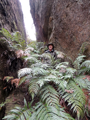
Silkpod Slot
Silkpod Creek has its headwaters on the eastern side of the intersection of Sunnyside Ridge Road and Fire Trail No. 4. This creek flows in a generally eastern direction for 2.7km to its junction with Carne Creek. Within Silkpod Creek is Silkpod Gorge, GR 409 074, and Silkpod Slot. All so named by Yuri Bolotin and Michael Keats on a Bush Club walk, 6th September 2013 due to the profusion of the rare Mountain Silkpod,Parsonsia brownii.

Silver Slot
Is located within the Eldorado Slots above Eldorado Walls, 1.5km due south of the old Newnes Hotel. This slot is about 160 metres in length and has a variable width from one to six metres. Jointly named by Yuri Bolotin, Michael Keats and Brian Fox on a Bush Club walk, 10th October 2016 in keeping with the Eldorado theme.
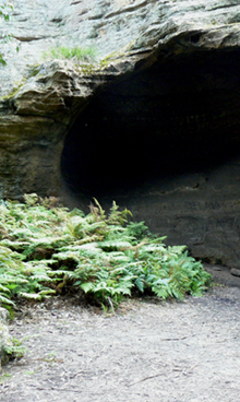
Singing Cave
Access is via Wolgan Road and off Blackfellows Hand Trail. Situated about 800m east, south east of Wolgan Gap. Named by the Woody Pear Walking Group in 1990. They visited this area a number of times and sang in this overhang. This group started due to an Outdoors TAFE course led by Margaret Baker. Ref: Olive Noble's track notes from Woody Pear Walking Group, 22nd July and 3rd November 1990.
Sinnamon Creek
Is now known as (see entry) Penrose Gully. This name was recordedon the original linen tracing for the Wolgan Valley Railway. Ref: Stephen, Eric. Wolgan Valley Railway Notebook. The railway line crossed this creek at 426 208.
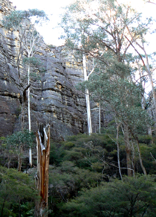
Sinusoidal Ravine
Is within the lower section of Birds Rock Creek. As the name suggests, the last 1km of this creek system before it reaches Carne Creek sharply winds back and forth within a cliff lined ravine. Named by Michael Keats on a Bush Club walk, 11th July 2011.
Sir Johns Mouth
*
Refers to the area where the wide portion of Capertee Valley and River narrows between two headlands. Descriptive of the valley and river narrowing into a mouth. Sir Johns Point and Mount Gundangaroo form the southern side and Mount Iris is on the northern side. It is also the area where the present Glen Alice Road from the north and Glen Davis Road from the west intersect. Named after Sir John Jamison (1776-1844), physician, landowner and constitutional reformer. Shown on Map of the Colony of New South Wales by Thomas Mitchell, 1834. "Sir Johns Mouth, the river has eroded its channel though both the Hawkesbury Series and the Coal measures, and for some depth into the Upper Marine strata, leaving on either hand bold headlands capped with sandstone cliffs." Ref: Carne, Joseph. The Kerosene Shale Deposits of New South Wales, 1903, p. 166.
Sir Johns Point
*
Is a bluff on the southern side of Capertee River. It is the northern extremity of Mount Gundangaroo. See Mount Jamison for more details re John Jamison. Named after Sir John Jamison, who held extensive land holdings in Capertee Valley. RAHS Journal Vol. 45; Pt. 2; p. 92.
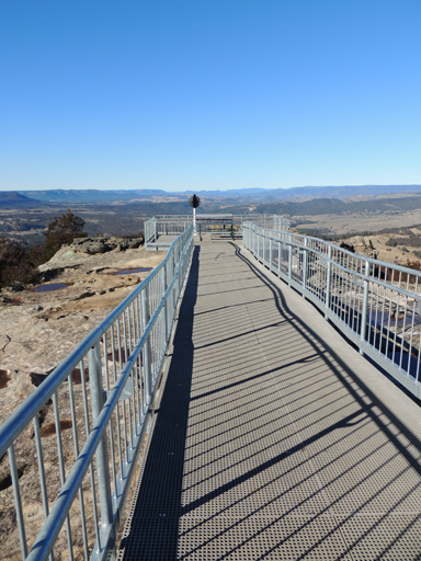
Sir Joseph Cook Boardwalk
Was named and constructed in 2013 by Lithgow City Council on the centenary of Sir Joseph Cook’s appointment as prime Minister of Australia. Located at Hassan Walls Reserve, it extends from near the shelter shed for 80 metres towards Padleys Pedestal Trig. Magnificent views over Hartley Valley.
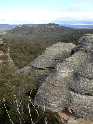
Sisyphean Ridge
Roughly parallels the Moffitts Trail on the west and Zeus Ridge on the east, and both sides contain tributaries of Jews Creek. It is just one kilometre in length, trending north east. The name reflects the Greek mythological references of the ridges to the east, Zeus, Poseidon and Hades. Sisyphus was a Greek Titan who was condemned eternally to roll a huge stone up a hill that rolled back as soon as it reached the top. The name was applied to this ridge after observing a massive chock stone that stands poised to crash into the valley below, Sisyphus Rock is the highest point at GR 276 187. So named on a Bush Club walk, 25th July 2011 by Adrian Cooper, a bush walker and canyoner.
Size 8 Canyon
This canyon is 200m in length, and shaped as the letter "C". Located 1.1km east of Wolgan River and the junction with Tunnel Creek. Named by Michael Keats on a Bush Club walk, 8th April 2009. The tight access to this canyon would require any explorers, male or female, to be that dress size or less.
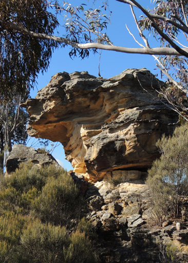
Skittle Row
Is a line of pagodas set up as a "row of skittles" in the Ben Bullen State Forest,midway between the headwaters of the Coxs River and Ben Bullen Creek. The Cullen Bullen Topo Map shows four of them, GR 286 130, GR 286 132, GR 286 133 and GR 286 134. The northernmost is at GR 286 138. This is a descriptive name proposed by Michael Keats on a bush walk into the area, 22nd August 2008. If careless underground mining continues, it is likely to send the skittles tumbling.
Skywalker Defile
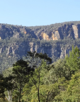
Is 180m long and drops 90m through the cliffs between the top of Old Baldy and the lower plateau. As it leads to within 100m of the western end of Skywalker Traverse, Yuri Bolotin and Brian Fox on a bushwalk 14 July 2017 called it, Skywalker Defile.
Skywalker Traverse
So named by Yuri Bolotin on a bushwalk, 2nd October 2015. Yuri successfully led and found a traverse along the tree covered ledge midway up the cliff face known as Old Baldy, which overlooks the Newnes historic hotel and camping ground directly below.
Slice of Heaven
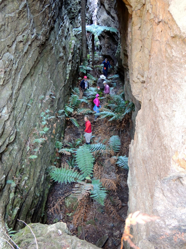
Refers to a pagoda studded area which lies between two magnificent, 50 to 100m wide, parallel slots. It is within the general region of Holts Heaven, hence the name, which was coined by Michael Keats on a Bush Club walk, 7th January 2012. Access via Girdwood Ridge, eastern side of Bald Trig Station.
Snake Gully
See Permafrost Gully. This is a descriptive name. Ref: Christison, Ray. Lithgow State Mine - A Pictorial History, 2009.
Snake Hill
Is located on Coopers Ridge, at an elevation of 1015m, 2.5km north east of Bald Trig Station. Peter Fox, a member of the National Parks Association, named this hill in the late 1990s, after a confrontation with a snake. In subsequent walks, snakes were also seen in this vicinity.
Snow Gum Flora Reserve
*
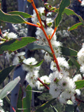
Is located 2.5km south west of Bungleboori Camping Ground and in the vicinity of the Lost City. It lies within Newnes State Forest. Named afterEucalyptus gregsoniana, commonly known as Wolgan or Mallee Snow Gum, that are growing in this area. This is part of the Bathurst Forest Management Area. It covers 102ha. The area was suggested for preservation in December 1984 and the proposal was accepted in February 1985. Ref: Working Plan, Snow Gum Flora Reserve No. 166, Part of Newnes State Forest No. 748. Gazettal Notice, 22nd July 1994.
Solo Gully
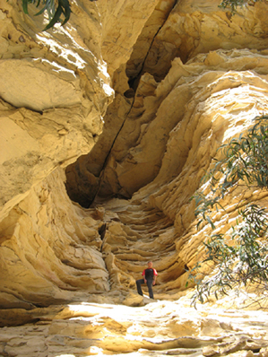
Is the east west descending gully for rock climbers off Old Baldy, Newnes. This gully is 800m in length and joins Petries Gully. Name recorded in Stephens, Wade. Wolgan Valley Selected Climbing Areas, 2001.
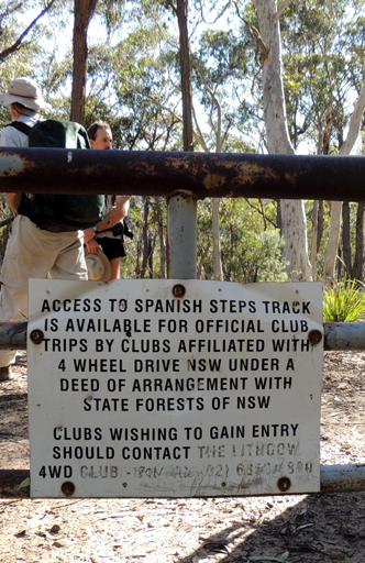
Spanish Steps
Refers to the succession of sandstone benches on Fire Trail No. 5, which joins the Blackfellows Hand Trail to Sunnyside Ridge Road. The Wolgan River is crossed at the lowest point on the trail. The Spanish Steps are located on the northern side about 100m after crossing the Wolgan River. Named after the Spanish Steps of Piazza di Spagna in Rome, Italy. It is a descriptive name of the sandstone rock layered step formation. State Forests with the assistance of 4WD clubs closed vehicle access to the Spanish Steps in June 2003, but the barrier has since been vandalised.
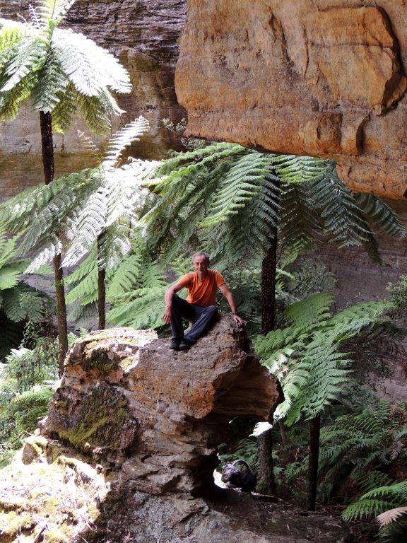
Sphinx Chamber
Is located within the Coach Galleries, 1.1km north east of Glowworm Tunnel. This chamber comprises a large overhang featuring a 2.5m high internal sculpture resembling an Egyptian Sphinx. A group cluster of giant bright green Tree Ferns behind it provides a brilliant background for photographs. Named by Yuri Bolotin and Brian Fox on a bush walk 23 December 2016.
Spiracle Pass
Is a bush walking pass 1.7km east, north east of Mount Budgary, that leads into Budgary Creek. Named by Michael Keats, 5th August 2009. This pass and Lanceolate, Ocellus, Pheromone and Frenulum Passes, all near Mount Budgary, are named after an anatomical part of a Moth. Michael had encountered a large numbers of Moths during his walks on Mount Budgary Plateau.
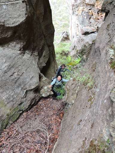
Split Rock Pass
is located 3 km south east of Birds Rock Trig, road access via Sunnyside Ridge Road. This pass gives walking access from the cliff lined eastern side of Sunnyside Ridge to Carne Creek and Cosmic Cave. Named by Brian Fox and Yuri Bolotin on a bushwalk, 28 November 2015.
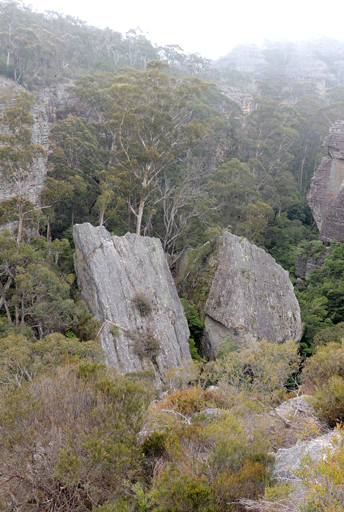
Split Rock Point
is located 3 km south east of Birds Rock Trig, off Sunnyside Ridge. A pagoda on this point rises 58 m above a cliff line to the west, and on the eastern side and below is Carne Creek. On the valley floor on the western side is a massive rock split in half. Named by Brian Fox and Yuri Bolotin on a bushwalk, 28 November 2015.
Springvale Creek
Is a multi stemmed dendritic drainage system spread over 2km, rising on the western side of Marrangaroo Ridge. It flows generally in a north west direction for 4.5km till it joins the Coxs River near Wallerawang Power Station. The name is derived from the locality, Springvale, in which the creek flows.
Stage Cave
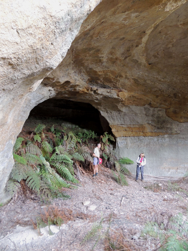
Is located near the northern end of a ravine, 900m south of Kangaroos Creek Road and Beecroft Firetrail, between Clerestory Spurs 4 and 5. This cave has a clean level floor and a perfectly semicircular stage backdrop filled with ferns. Named by Michael Keats on a Bush Club walk, 6th October 2010.
Stairway to Heaven
Was named by Yuri Bolotin on Bush Club walk, 7th September 2015. So named as the walk / climb up the eastern side of Point Hatteras at Airly was a very hairy experience and felt like heaven to be on top.
Stargate Point
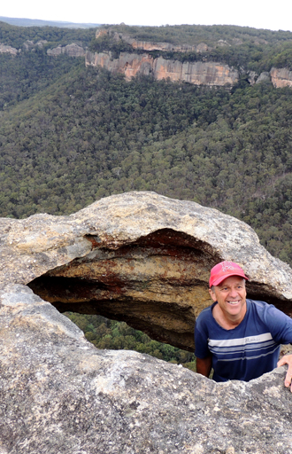
Is an exposed point of pagoda crested rock located on top of the eastern cliff line 350m south of Mount Jamison and 1.8km east of Baal Bone Gap. Views down and across the Wolgan Valley. So named by Brian Fox and Michael Keats on a Bush Club walk, 1st February 2016 as Stargate Tunnel is 600m south, south west of this point.
Stargate Slots
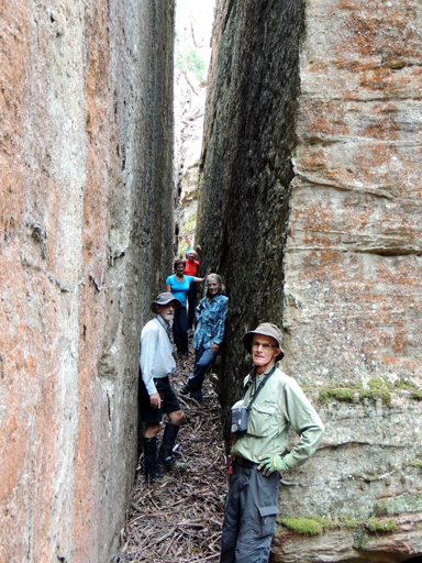
Is a series of slots near the cliff line on the south western side of Mount Jamison. One of the slots gives an easy access from Stargate Trail to the top of Mount Jamison. The main slot, some 40 m in length, has 10 m high, almost parallel walls and averages 50 cm in width. Subsidiary slots, generally disposed at right angles to it, are much shorter and have less spectacular geometry. So named by Michael Keats and Brian Fox on a bushwalk walk, 1st February 2016.
Stargate Trail
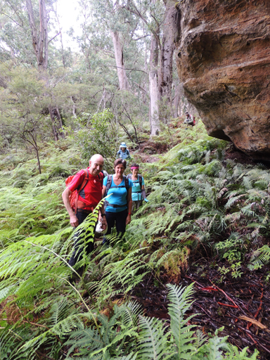
Is an undefined mid-cliffl edge track that starts at Stargate Tunnel eastern side and follows a serpentine and variable width ledge for about 700 m, where a natural pass, Stargate Slots, provides access to the southwestern side of Mount Jamison. So named by Harold Thompson on a bushwalk, 1st February 2016.
Stargate Tunnel
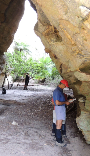
Is a short water worn canyon formed by the tilting of a large sandstone block creating a triangular tunnel over a shallow, sandy creek bed. The tunnel section is 21m long and it averages 7m in width. The height varies and is up to 10m. Located 100m south of McLeans Pass. Access from Lidsdale via Wolgan Road, The Bicentennial National Trail and ridge line (Great Dividing Range). A log book in an old biscuit tin records that this cave is regularly visited. The very first entry, dated Sunday 17th August 1975, reads, "Gary named this Stargate Tunnel. We stayed overnight and watched sunset from the cliffs overlooking Capertee Valley. And then we got up at 6:30 to watch the sunrise. Very cold but we consider it was worthwhile. John and Martin came too and we sprang around like callow youths.Terry Moesker." The four bush walkers were Gary Hansen (1943-1982), John Cameron, Terry and Martin Moesker.

Stargate Tunnels South
are located below the first cliff line between Cape Horn and Stargate Tunnel. A number of small overhangs and tunnel systems some 30 m in length are so named by Michael Keats on a Bush Club walk, 29th February 2016.
Starlight Canyon
Is also known Newnes Canyon and Wallaby Canyon. Access for the purists is via the Pipeline Track at the top of the main watershed, then by following a ridge to enter the tributary creek system. The canyon can also be explored by walking upstream from the junction with the Wolgan River at GR 474 269. It is possible to walk in the canyon as far as the internal waterfall. A torch is essential.
State Mine Creek
*
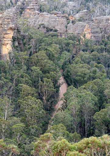
Flows most of its distance along the eastern side of State Mine Gully Road before coming under a bridge near the State Mine Railway Museum and hence into Farmers Creek.
State Mine Gully
*
Is a suburb about 3km north of Lithgow main township.