Flat Bottom Creek
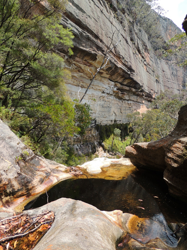
Has its headwaters between Fire Trails No. 7 and 8 off Sunnyside Ridge Road.This creek flows generally north for 7km to its junction with the Wolgan River.Named by Michael Keats on a Bush Club walk, 18th July 2007. A motor bike trail crosses the headwaters of this creek at GR 360 118.
Flat Bottom Creek Tunnels
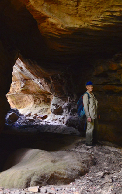
Are located on Flat Bottom Creek just before this creek plunges over the cliff line. Named by Michael Keats on a Bush Club walk, 22nd November 2013.
Flat Top
Is as the name suggests. Located on the ridge north of Dumbano Tunnels. This is a flat scrubby area of about half a square kilometre above 1020m. Named by Peter Fox, National Parks Association bushwalker, 1995-1998.
Flying Carpet
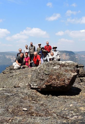
As that was what it felt like when we stood there. A flat projecting rock platform midway (about 60m) up the eastern cliff face of Carne Creek, between the features known as, The Gurgler and Long Zig Zag Pass. Named by Yuri Bolotin on a Bush Club walk, 9th May 2014. Yuri recods, "Stood on the top and looked down. 50m below between the tight, almost vertical narrow walls, the Tree Fern crowns looked miniscule."
Footprint of the Minotaur
Forge Point
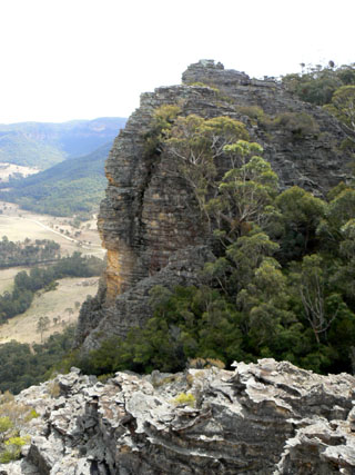
Is located 1km north, north west of the Glowworm Tunnel on the cliff line, where the old Wolgan Valley Railway Line at the base of this cliff line changed direction from north west to north east. Ref: Eardley, G H. and Stephens, EM. The Shale Railways of NSW, 1974, p. 139. This name relates to a forge used to fabricate the railway lines.Herbert Sidney Rosewarne records,"Forge Point was also called Cable Point. Cable was the employed railway construction ganger."Ref: Stephens, Eric. Wolgan Railway Notebook, 1934-1937.
Fort Ridge
Trends in a generally north west and northerly direction from above Airly Creek in the south, having the Hut Trail along its spine from the Glen Davis Road. Its northern extent traverses what is known as The Fort (from which the ridge derives its name) to the south western side of Mount Airly. The southern section is within the Gardens of Stone National Park, whereas the northern section is in Mugii Murum-ban State Conservation Area. Named by Yuri Bolotin and Peter Medbury on a bushwalk 14 June 2021.
Fossil Ridge
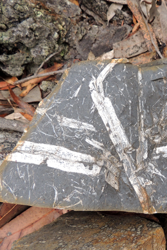
Trends in a generally north south direction for 2.2km from the Great Dividing Range at the intersection of Moffitts Trail and Murdocks Creek Trail. Named by Brian Fox on a Bush Club walk, 21st January 2013 due to the abundance of plant fossils in the rocks along this ridge.
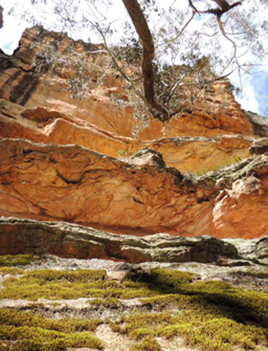
Four Level Cave
Is so named as four distinct sandstone overhangs are located one above the other. The top two are impossible to access, the lower two can be walked. Located 1.9km north east of Invincible Trig Station. Named by Yuri Bolotin on a Bush Club walk, 2nd August 2013.
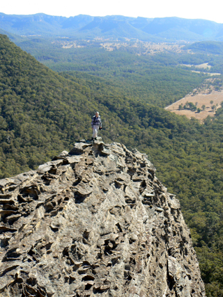
Foxs Wedge
Is a 50cm wide crest to the ultimate high point on a wedge shaped rock jutting out and overlooking the Wolgan Valley. Located 1.2km south east of Cape Pinnacle. Named after Brian Fox, who walked out to the tip of this seemingly impossibly narrow promontory, by Michael Keats on a Bush Club walk, 27th June 2011.
Frenulum Pass
Is a bush walking pass 1.5km north, north east of Mount Budgary which leads into Budgary Creek. Named by Michael Keats, 5th August 2009. This pass together with Lanceolate, Ocellus, Pheromone and Spiracle Passes, all near Mount Budgary, is named after an anatomical part of a moth. Michael had encountered large numbers of moths during his walks on Mount Budgary Plateau.
Freshwater Creek
*
Is a non perennial stream that, rises about 4km south east of Glen Davis. It flows generally north east for about 4km into the Capertee River. Freshwater Creek name was approved by the GNB on 30th October 1970. The name does not appear on any parish maps and was first used on the 1st edition topographical map of Mount Morgan.
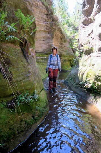
Friday Canyon
Is a ‘wet’ canyon, about 150 meters in length, a tributary that flows into Wollangambe River. Located 1.5km near due south of Goochs Crater. Namedby Freda Moxom, Nick Collins and Paul Ma during a bushwalk, Friday 11 March 2016.
Galadriel Gorge
Is just one of the many side canyons located on the northern side of the junction of the Great Dividing Range and the Ben Bullen Range. At the head of this gorge there is an exquisite chamber, called the Hall of Galadriel. Galadriel is a key character in the Lord of the Rings. She was the beautiful Elven Queen and the mother of Celebrian. Played in the film by Cate Blanchett. Named by Yuri Bolotin on a Bush Club walk, 26th July 2013. Yuri named it so in keeping with the theme of Lord of the Rings that inspired him to name other features in this area.
Galah Mountain
*
Is an insignificant hill on Daniels Ridge located between Deanes Creek and Rocky Creek. 1040m in height.
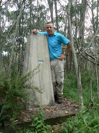
Galah Mountain Trig Station
*
Is now known as Galah Trig Station. Elevation 1042.30m. Located on a small basalt hill, on the southern side of Galah Mountain. Accessed via GlowwormTunnel Road and Galah Mountain Road. Established by the Royal Australian Survey Corps, 1930. Ref: Trig Summary Cards, Department of Lands, Bathurst. Two trig stations in this area are named after the local birdlife; the other one is Cockatoo Hill Trig Station.
Galaxies Gully
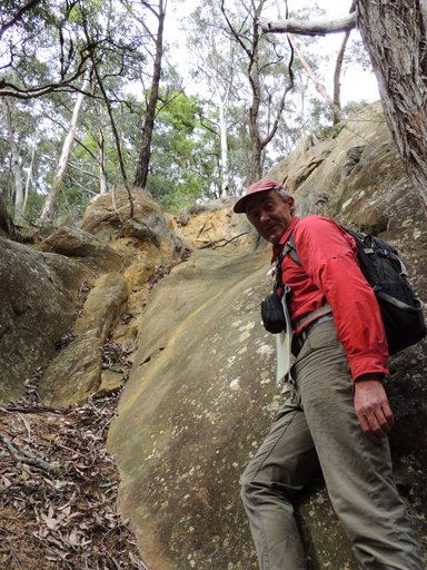
Galaxies Gully is located on the southern side of the Wolgan River and the eastern side of the Newnes industrial site. This gully has remains of the buildings and a cave house which were in use during the period when Newnes was in operation as an oil shale town (1907-1920). This gully has its headwaters on the far western side of Island Mountain and is a double pronged gully which flows south for 1.5km to join the Wolgan River. The eastern branch gives access to Galaxies Traverse. Named by Yuri Bolotin and Brian Fox on a Bush Club walk, 1st July 2016.
Galaxies Gully East Pass
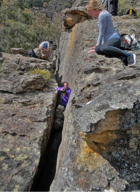
Is accessed via the Wolgan River Trail, Newnes. It is a useful way of route to the top of the ridge, leading to Firefly Point, as well as Looking Glass Canyon. This pass was shown to Yuri Bolotin by Tom Brennan on 19 February 2017. Named by Yuri in keeping with the name of the gully where the pass is located on a walk of 8 September 2017.
Galaxies Traverse
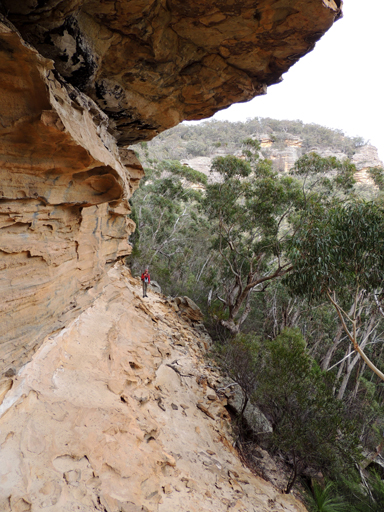
Galaxies Traverse is a ledge between two cliff lines above the Wolgan River. Located 2km from the locked gate on the ruins side of the Wolgan River at Newnes. The ledge runs for over two kilometres and is accessed via a gully on its western side. The name was coined by Brian Fox and Yuri Bolotin on a Bush Club walk, 1st July 2016 after the name of the main cliff line known by the rock climbing fraternity as Exploding Galaxies.
Gandalf Slot
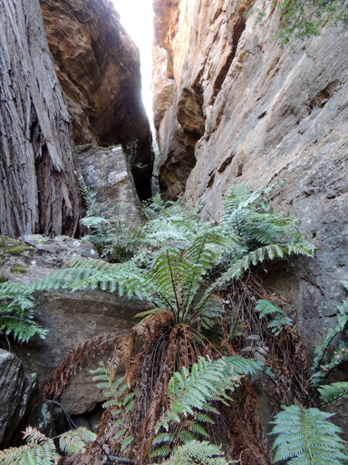
Is a beautiful dead end slot. Gandalf is a good wizard in the Lord of the Rings and you probably need to be a wizard to be able to climb this slot all the way to the top. Named by Yuri Bolotin on a Bush Club walk, 15th August 2013, in keeping with his Lord of the Rings themed names in this area. Located 1.3km north east of Invincible Trig Station.
Gang Gang Canyon
Is about 500m long, its width varies between 5m to 25m. The cliffs on either side vary from 20 to 40m. The creek and canyon were named by Michael Keats on a Bush Club walk, 12th November 2012.
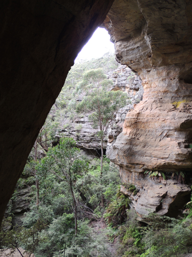
Gang Gang Caves
Are located within Gang Gang Canyon, part of Gang Gang Creek so named for a number of hemispherical chambers in this section of the creek. One cave in particular had a steep sloping floor and measured 30m wide, 35m from the back wall to the drip line and an estimated height of 60m. It also features an inaccessible second storey. Named by Yuri Bolotin and Brian Fox on a Bush Club walk, 16th January 2016.
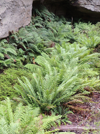
Gang Gang Creek
Has its headwaters on the eastern side of Carne Creek and western side of Gang Gang Road. This road was named by Eric Lane, former Newnes State Forest foreman in the early 1980s, due to the large flocks of Gang Gang Cockatoos,Callocephalon fimbriatum, in this locality. Gang Gang Creek flows in a generally north east and northerly direction for 4.9km to its junction with Carne Creek.
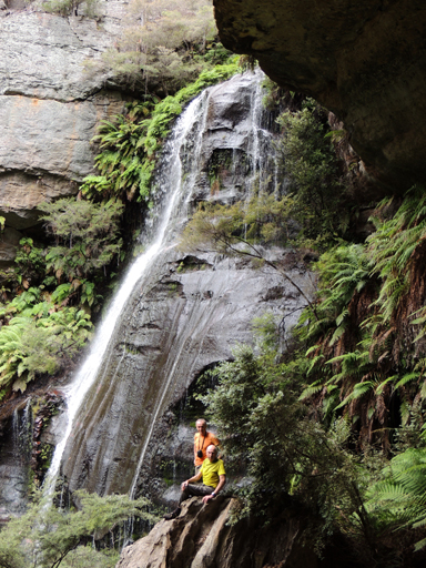
Gang Gang Falls
Are located within the eastern tributary of Gang Gang Creek, 380m upstream from Gang Gang Tunnels. About 40m in height the water flows over the rock face like a bridal grown. Named by Brian Fox, Michael Keats and Yuri Bolotin after the creek in which they are located, 24th July 2015.
Gang Gang Minor
Refers to a rising side canyon on the eastern side of Gang Gang Canyon. This side canyon contains a huge hemispherical chamber with a steep sloping floor. This chamber is 20m high, 20m deep and the opening about 20m across, an almost perfect sphere. Named by Michael Keats on Bush Club walk, 12th November 2012.
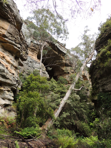
Gang Gang Playground
Is an area encompassed by the mid section of Gang Gang Creek. Named by Michael Keats on a Bush Club walk, 27th April 2012 after the road and creek with this name and the playground of the pagoda bedecked cliff line and views.
Gang Gang Swamp
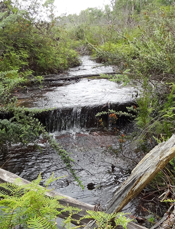
Is located on the creek tributaries within the radius of Gang Gang Road. 2km north north east of Bungleboori Camping Ground.
Gang Gang Tunnels
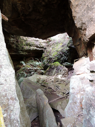
Are located within Gang Gang Creek, access via North Ridge Road via Bungleboori. It would appear that at least two very large creek side sculptured pagodas had partly collapsed across the creek, falling in such a way as to provide caverns and slots. Named by Brian Fox, Michael Keats and Yuri Bolotin after the creek in which they are located, 24th July 2015.
Gannon Cave
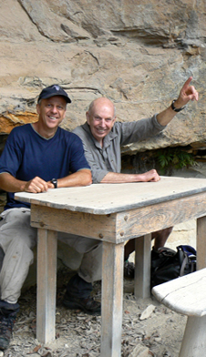
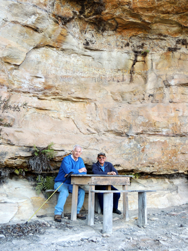
Is located at Hassans Walls, Lithgow and is the first rock overhang on the lower track (Undercliff Track) on the right hand (western) side of Hassans Glen. Named after Samuel Hodge Gannon (1834-1913), who was a very active member of the Lithgow community. Within this overhang is the seats and table like an old school desk placed there in 1915. Ref: Lithgow Mercury, 14th May 1915, p. 4.
Gap Creek
*
Is a non perennial stream rising on the eastern slopes of Mount Airly. It flows generally north, north east for about 4km into Genowlan Creek. The name is descriptive for this creek that flows between Mount Airly and the cliff line of Point Hatteras. This creek also flowed through the former Town of Airly.
Garage Cave
Is located halfway up the steep section of a 4WD track between Genowlan Creek and the south west end of Genowlan Mountain. Named by Colin (Col) Maxwell Ribaux, former local land owner, in the l990s.
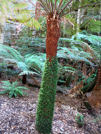
Garden of Eden
Is a feature within Coach Wood Forest. At its entry, it is almost totally filled with the Soft Tree Fern, Dicksonia antarctica. Within this enchanted forest, there is a mature Anchor Vine,Palmeria scandens, that has a girth of 20cm and has wrapped itself around a tree very tightly so it formed a spiral ribbed tube nearly one metre high, before it climbed 20m plus into the tree canopy above. This amazing natural sculpture has been dubbed The Serpent. Both features named by Michael Keats and Brian Fox on a Bush Club walk, 20th August 2012. This ravine is located 500m south east of Galah Trig, access via Galah Mountain Road.
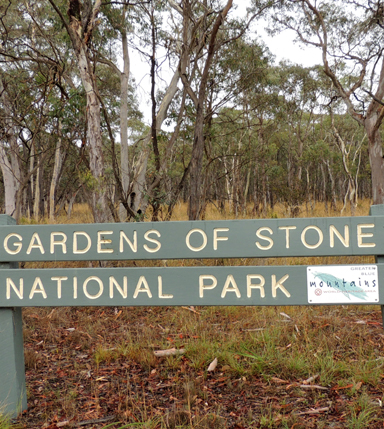
Gardens of Stone National Park
*
Covers 15,080ha. The irregular boundaries roughly extend in the north to the Glen Davis Road, eastern boundary with the Wollemi National Park, western side to Castlereagh Highway at Ben Bullen and southern side, Sunnyside Ridge Road. The majority of the park is located on the Ben BullenTopo Map. Described by the NPWS as, "Pagoda rock formations cluster near sandstone escarpments, where erosion has sculpted bee hive shaped domes and other forms. Banksia, dwarf casuarinas and other wind pruned heathland plants give the area its garden like appearance. This park forms an important part of the Greater Blue Mountains World Heritage Area." Stage one of the Gardens of Stone National Park was created on the 29th November 1994. Stage two was proposed by the Colong Foundation in 2005 and is yet to be approved. It will cover an additional area of nearly 40,000ha. Credit is given to Rodney Falconer for coining the name, Gardens of Stone, November 1984. Ref: Correspondence with Rodney Falconer and David Blackwell, March 2010."I gave it the name Gardens of Stone, which stuck, following an October trip during which the place became a flowery garden studded with rock statues (mint bushes and banksias were particularly prolific that season and the scent of massed flowering Calytrix tetragona shrubs was so overwhelming that you were walking through honey coated air for hours on end. As Haydn Washington was in South America at the time, David Blackwell was frantically busy with work and I was in the process of moving to Canberra, we passed it onto the Colong Foundation (of which both Haydn and I were or had been Directors at the time) who did the longer term leg work and saw it into fruition, particularly thanks to Keith Muir with Peter Prineas and Alex Colley giving great support as well." Ref: Correspondence to Michael Keats from Rodney Falconer, 15th March 2010.
Gardiners Gap
*
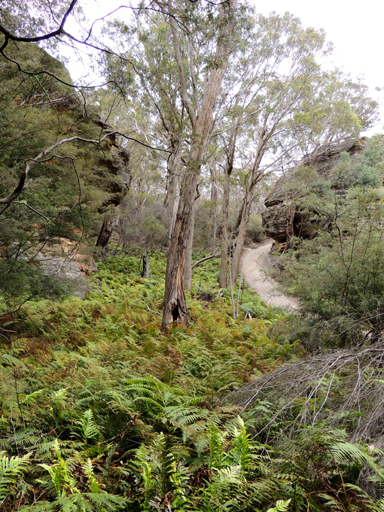
Is a break in the Great Dividing Range about 3km north west of Wolgan Gap and about 5km due east of the town of Cullen Bullen. Gardiners Gap is shown on the map Parish of Ben Bullen, 1885. William Wolf Gardiner (c1809-1887) took out a Conditional Purchase for 40ac in this area on the 28th February 1867. Later his grandsons, Thomas William Gardiner (1866-1940) and Charles Livingstone Gardiner (1886-1952), purchased land in 1883 and 1913 respectively. Ref: Survey Plans 719, 1411, 1502, 1832, 1870 and 3753- 1496. NSW BDMs. Gardiners Gap was the quickest way for drovers to move cattle and sheep from Ben Bullen to Bell, simultaneously avoiding the toll at Blackmans Flat from 1876. Ref: Brown, Jim.Bent Backs, 1989, pp. 275-276. Wilson, Alex. Map showing the various attempts to find the best route from Mount Victoria to the Western Country NSW, 1914. This map shows a dotted line from Gardiners Gap to Newnes Junction (connects to Bells Line of Road). Text reads,"Route suggested by delegates of Richmond Committee for road Mudgee to Wellington Valley." Also text, "stock route Cullen Bullen to Bells Line opened by Thomas Maddox. "
Gardiners Hill
*
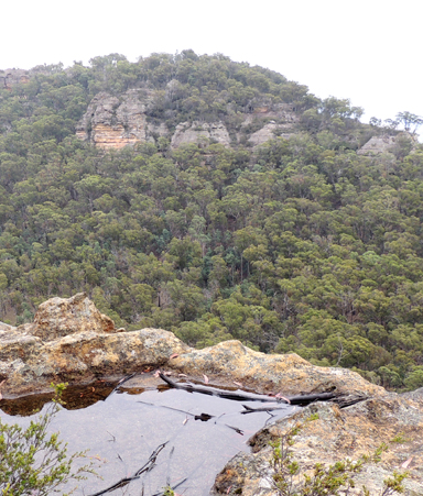
Is a hill about 4.2km south east of Ben Bullen that has Jews Creek on its western and southern side. Platform Rock is on the southern end of Gardiners Hill.
Gardiners Point
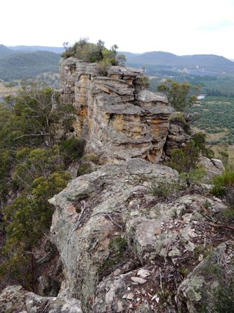
Is a point of land off a narrow spur, having the last 200m consisting of a rocky bluff which overlooks Jews Creek and Baal Bone Colliery. Named by Michael Keats after Gardiners Hill which is 600m to the west, on a Bush Club walk, 14th March 2016.

Gaudis Sentinel, Gaudis Stairs.
This isolated sandstone pinnacle on the southern side of Gaudis Wall and a nearby negotiable natural staircase were also named after Antoni Gaudi. Access via Ben Bullen, Moffitts Trail.
Gaudis Wall
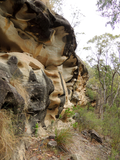
Is a 300m long three dimensionally sculptured cliff face. It was given this name by Graham Conden on a Bush Club walk, 21st January 2013. Graham likened it to the work of Spanish architect, Antoni Gaudi. Located 2.6km north north east of Ben Bullen Railway Station. Access via Hutchinson Road and Moffitts Trail.
Gemini Cave
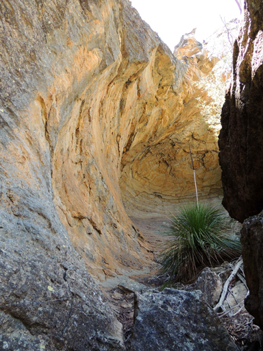
Also see Michelangelo Cave. This large twin overhang was named by Bob Whiting in December 2009. Ref: The journal of The Sydney Speleological Society, 2011, 55 (3): 64. Not being aware of this former name, Michael Keats named this cave Michelangelo Cave on a Bush Club walk, 16th January 2012.
Genowlan Canyon
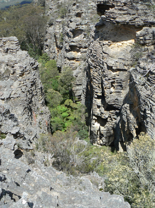
Is located 2.4km north east of Genowlan Trig and 2.5km south east of Point Hatteras. It is about 50m deep, 200m long. Genowlan Canyon was named by Brian Fox and Michael Keats on a Bush Club walk, 27th October 2010. Described by Michael as follows,"Stood on the top and looked down. 50m below between the tight, almost vertical narrow walls, the Tree Fern crowns looked miniscule."
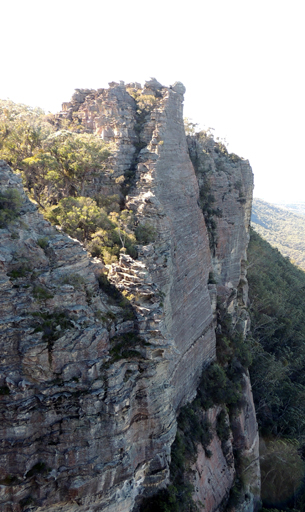
Genowlan Castle
Is located 700m north east of Genowlan Trig. It is a massive grouping of pagodas likened to a wall of battlements immediately below a top turret. Named by Michael Keats on Bush Club walk, 1st June 2015.
Genowlan Creek
*
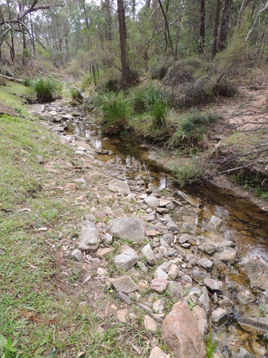
Is a non perennial stream rising at Genowlan Trig Station. It flows generally north, east and north east for about 12km into the Capertee River. Genowlan Mountain and Genowlan Creek are shown on the Parish of Morundurey 1894 Map. Survey Plan R1164.1496, dated 1873, shows it as Genowlan Peak. Genowlan Mountain was also known as Morandurey Range. Ref: Eardley, G H. and Stephens, E M. The Shale Railways of NSW, 1974, p. 88. The name Genowlan has similar syntax with the word Jenolan, which in turn was an Aboriginal name meaning "high place". Ref: Cook, Samuel. The Jenolan Caves, 1889, pp. 14-15.
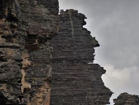
Genowlan Guardian
Is located on the eastern side of Genowlan Mountain, 1.9km south of Genowlan Point. Named by Yuri Bolotin and Brian Fox on a Bush Club walk 22 December 2017 because of the prominence of this giant pagoda jutting out over the top cliff line and the profile of a human head on top; it is clearly visible from all directions.
Genowlan Mountain
*
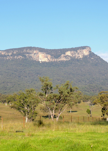
Is located on the northern side of a large mesa between the Capertee River and Coco Creek, 3.5km north east of Airly. Genowlan Mountain and Genowlan Creek are shown on the Parish of Morundurey 1894 Map. Survey Plan R1164.1496, dated 1873, shows it as Genowlan Peak. Genowlan Mountain was also known as Morandurey Range. Ref: Eardley, G H. and Stephens, E M. The Shale Railways of NSW, 1974, p. 88. The name Genowlan has similar syntax with the word Jenolan, which in turn was an Aboriginal name meaning "high place". Ref: Cook, Samuel. The Jenolan Caves,1889, pp. 14-15.
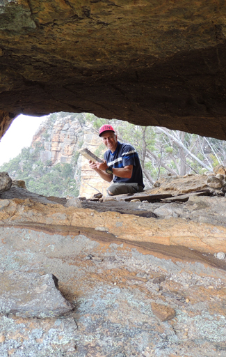
Genowlan Oculus
A pagoda rests precariously on the cliff edge above the norther side of the area known as The Hammer. That is nothing unusual. What is unusual is the huge horizontal, cylindrical perforation, large enough to crawl through. The views looking east are unique. Named by Michael Keats on a Bush Club walk, 21st March 2016.
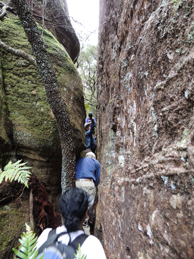
Genowlan Pinch
Is a narrow defile is only 300mm wide and 10m long. Located 340m due west of the communication tower at Airly and 30m south of Airly Frustum. Named by Michael Keats on a Bush Club walk, 16th November 2015.
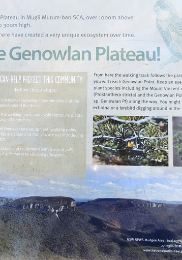
Genowlan Plateau
Signage erected by NPWS on the track to Genowlan Mountain, 2km south of Genowlan Point reads,“You are now standing on the top of Genowlan plateau in Mugii Murum-ban SCA, over 1000m above sea level, surrounded by sandstone cliffs up to 300m high.”
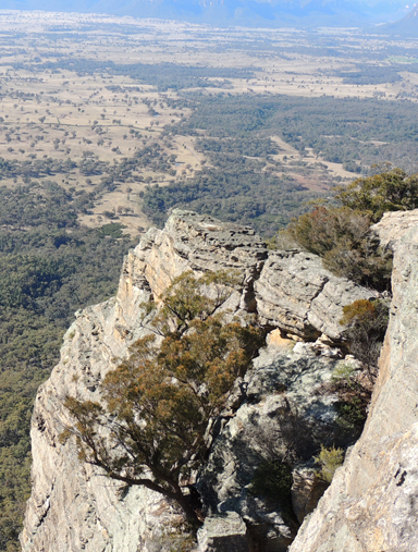
Genowlan Point
*
Is on the northern extremity of the escarpment of Genowlan Mountain.
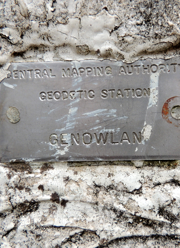
Genowlan Trig Station
*
Is a trigonometrical station on same mesa, elevation 1040m, and is 3.8km south, south west of Genowlan Mountain. Established by the Department of Lands, 1912. Ref: Trig Summary Cards, Department of Lands, Bathurst.