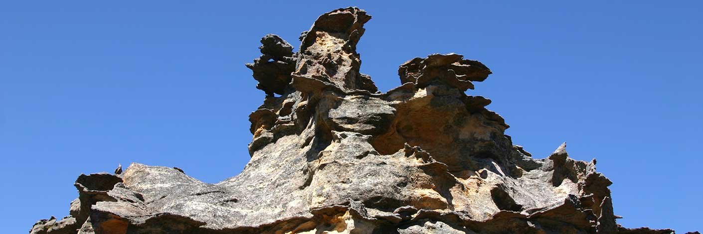
Is located 20 metres north of the base of Crack of Doom Two. It was named by Geoff Fox on a bushwalk on 11 September 2018, because he thought only a fool would enter it as it has a tight squeeze and an awkward convex boulder climb and is not negotiable.
Bush Explorers Encyclopaedia
Is an easy pass that leads through the cliff line south of The Crater. Located 300m west of where the Pipeline Track traverses the cliff line above the northern side of the Wolgan River, Newnes. Crater Pass starts as a tumble of easily negotiable broken rock, crosses a small sloping rock face then becomes a series of easy, well graded ramps interspersed with large boulders, all the way up to the top. This pass gives access to the feature known as, The Crater. Named by Yuri Bolotin, Michael Keats and Brian Fox on a Bush Club walk 16th June 2017.
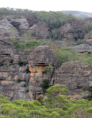
Trends generally south from Waratah Ridge, 300m east of the boundary of Blue Mountains National Park, GR 482 026, to above the Bungleboori Creek. Crisscross Spur is a complex series of parallel, dissected, interstitial ridge like structures that feature canyons and slots. Named by Yuri Bolotin on a Bush Club walk, 15th June 2012.
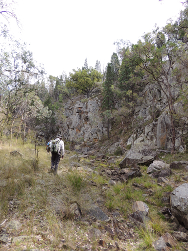
Is a partly perennial stream rising at Baal Bone Gap. It flows generally north, north east for about 15km into Coco Creek.
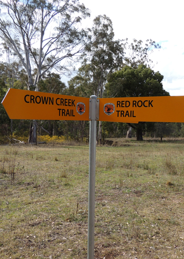
Crown Creek Trail extends from Baal Bone Gap, GR 280 290. It follows and criss crosses Crown Creek to its junction with Glen Davis Road at Crown Swamp, GR 307 299. The word "crown" referred to ownership by the Crown. Before the area was settled, all land belonged to the Crown / Government. Alternatively the name "crown" may have referred to Pantoneys Crown. Crown Creek Trail and Red Rock Trail have both had new signage erected by NPWS mid 2015.
Is the northern section of Crown Creek, Crown Flat is shown on Carne, Joseph, Geological Map of the Capertee and Wolgan Valleys, 1901.
A very old name, it referred in the 1840s to that part of Glen Davis Road between Coco Creek and the junction of Crown Creek Trail. The name has also been associated with that part of the Great Dividing Range having Crown Ridge Creek on its western side and on its northern extremity, Blackmans Crown. The name Crown Ridge was recorded on the Survey Plan B688.691, dated 25th September 1847.
Is located on Crown Creek about 5km north east of Pantoneys Crown and where Crown Creek Trail crosses Crown Creek. Crown Swamp was recorded on Survey Plan C146.1507, dated 5th February 1856 and County Land Sales within the Sydney Morning Herald, 11th May 1858, p. 3.
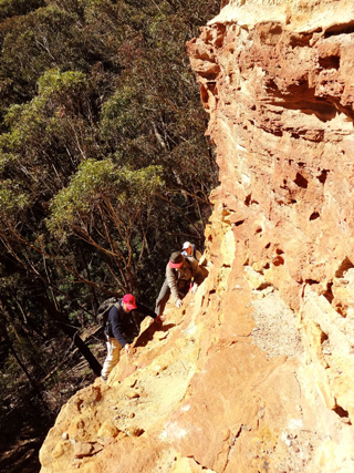
Is so named as this 200m ledge consists of crumbling, porous rock which leads around a small bluff. Located 1.1km north east of Invincible Trig Station. Named by Yuri Bolotin on a Bush Club walk, 15th August 2013.
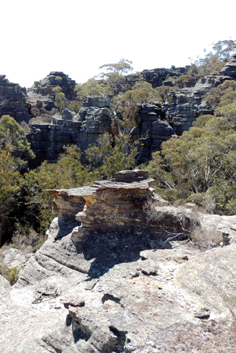
On the eastern side, is an elevated, almost circular depression with outlier pedestal pagodas giving 360 degree views of the area. All these features were named by Yuri Bolotin on a Bush Club walk, 4th October 2013, in keeping with the named Indiana Jones movie themes for this area.
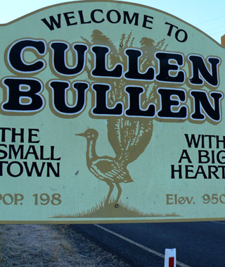
Is a small village located on the Castlereagh Highway between Lithgow and Capertee. Cullen Bullen Railway Station opened as Carsons Siding on 1st May 1889 and closed on 6th March 1976. School opened in December 1875. Hoddle's diary, 13th February 1825, states,"I have stopt at Messrs. Robt. and Lawrence Dalhunty's from Bath (their grant was called by the natives Cullen Bullen). Living in a cottage made of turf ......are now living romantically, shepherd like." Ref: Colville, Berres Hoddle. Robert Hoddle Pioneer Surveyor 1794-1881, 2004, p. 74. Robert Venour Dulhunty (1802-1853) with his brother Lawrence arrived in Sydney in March 1824. Robert applied for a grant of land on the 23rd March 1824. This grant of 2000ac was selected and called Cullen Bullen. An 1828 census recorded that he had cleared 500ac and owned 75 cattle and 600 sheep. Ref: Dulhunty Papers. The Australian, 5th May 1837 records the marriage of Robert Dulhunty of Cullen Bullen to Eliza Julia Gibbs. Cullen Bullen is shown on Mitchell, Thomas. Map of the Colony of New South Wales, 1834. Both the names Cullen Bullen and Ben Bullen have Aboriginal origins, different suggestions have been put forward for their meanings but as yet there is no substantiation of their exact meanings. Geographical Names Board reference is, "Place where many waters meet or Lyrebird." This aboriginal name according to Helen Riley, Wiradjuri Elder and Sharon Riley, Wiradjuri representative is named after the Lyre Bird. and that the word Bulla refers to, two. Ref: Oral history 3rd May 2016.
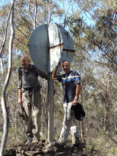
Elevation 1066m, was established by surveyors from the Forestry Commission of NSW in the 1960s. It is located on Tyldesley Hill within Ben Bullen State Forest, 2km north, north west of Cullen Bullen.
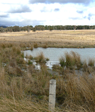
Is a watercourse rising about 3km south east of Cullen Bullen. It flows generally north west for about 6km into Dulhuntys Creek. Named after the village of Cullen Bullen.
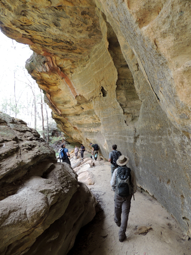
Is a small valley filled with some huge toppled rocks. It was as though a giant force had taken several dozen, house size cubes of sandstone and scattered them like dice into this small valley. Over time these cubes have softened in outline with some being draped in mosses and lichens, while some developed dry sandy caves and deep pocks with narrow orifices to provide birds and bats with exclusive homes. Short, secret passageways, narrow slots and stunning sculptures are all there. Named by Michael Keats on a Bush Club walk, 22nd November 2013.
is easily negotiated both up and down and gives access to the lower section of the southern side of the Pentafid. Named by Brian Fox on a bushwalk of 11 February 2016, because of a one-eyed rock formation visible high up on the far cliff face, and because it is the access up to Cyclops Watch.
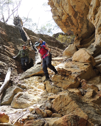
Is located 2.6km north east of the barrier at the southern end of the Old Coach Road. Walking access is generally north on the track towards Tiger Snake Canyon. This watch tower is an isolated rocky pinnacle accessed via a twisting corkscrew slot with views south over the Pentafid basin and beyond to Rock Island. Named by Yuri Bolotin and Michael Keats on a Bush Club walk, 1st May 2015.
Is now known as Angus Place Trail. Prior to the 1930s it was known as Dando's Firetrail. Harry Dando owned what is now part of Angus Place Colliery. The fire trail joined Wolgan Road to Beecroft Firetrail. Ref: Correspondence Danny Whitty local resident and historian, 3rd June 2014. Harry was employed by the Vale mine at Lithgow for more than 30 years, retiring in 1947. Ref: Newcastle Morning Herald and Miner's Advocate 18th September 1947, p. 7.
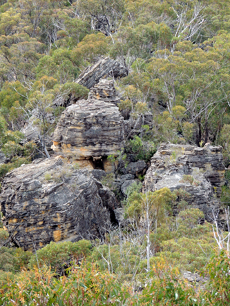
Is located at the northern end of Daniels Ridge. Named by David Warren Noble after Edward (Ted) James Daniels (1930-2008). Ted led many trips in this area on behalf of the National Parks Association and the pass at the end of this ridge was pioneered by him.
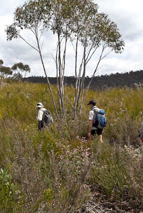
Has its southern end at Galah Trig Station and Galah Mountain. This ridge trends in a north, north east direction for 6km to a cliff line above Rocky Creek. It is here that Daniels Pass gives access to Rocky Creek.
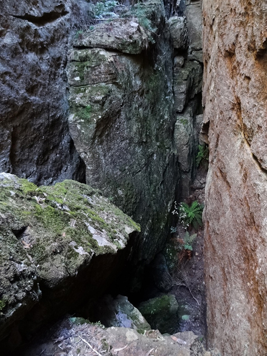
1.3 km south south west of Nobles Canyon car park. The cliff face has fractured and hence created two major parallel slots with a cross fracture, in plan view it looks like a lower case "h". Over 250 m in length and at least 30 m deep. Named by Michael Keats, Brian Fox and Yuri Bolotin on a Bush Club walk, 19th May 2014.
Is a suburb of Lithgow and was assigned as such by the Geographical Names Board on 11th July 1997.
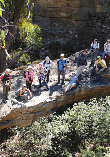
Is a natural sandstone arch, it has a length of 14m, a width of 8m and a height of 9.3m. Located 900m north, north east of the intersection of Bells Line of Road and Valley View Road, Dargan. Access is via Sandham Road, Bell.
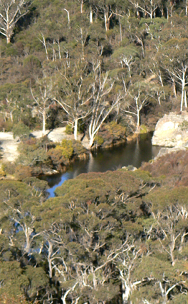
Is a watercourse about 6.5km long. It rises 3km south west of Bald Trig Station and flows generally east then south into the River Lett. Wollangambe, Lithgow and Hartley Topo Maps,headwaters GR 445 918. Dargans Creek is recorded in the Sydney Morning Herald 15th January 1846, p. 3 in reference to a stock route through to the Mudgee Road at Jews Creek. Also shown on the Survey Plan C346.1507 dated 1866. Thomas Dargin (note various spellings), born in the Hawkesbury area in c1801, married John Howe's step daughter, Eliza Kennedy, in 1821 and later Howe's daughter Mary. He also owned three hotels in Windsor. In1819, Thomas was a member of John Howe's successful expedition to the Hunter region. Ref: Macqueen, Andy. Somewhat Perilous, 2004, p. 111. Dargan was a pioneer drover in the district. Ref: Morgan, MacLeod. A short history of the Wolgan Valley, 1959. RAHS Journal, Vol. 45, Pt. 2, p.90. "Thomas Dargon (sic), John Howe's son-in-law and fellow explorer, who had charge of its herd of cattle." Ref:Rolls, Eric. A Million Wild Acres, 1981, p. 77. This was in 1821. The Map of the Village of Newnes shows one of the unformed roads named Dargan Street. Thomas Dargan purchased 640ac, Portion 1, Parish of Hearne, 1836 and Portion 3, 640ac, 1839. Ref: Survey Plan B.305.691 and B.583.691. Note, one Survey Plan has both the spelling of Dargan and Dargin.
Is a natural pass linking the top of the cliff line to Newnes, 700m west of the old Newnes Hotel. Described and named by Michael Keats on a Bush Club walk, 9th April 2008."Dave (David) Dash found one that looked possible. It resolved into one of the most beautiful canyon descents I have experienced anywhere. It was richly endowed with Tree Ferns and Epiphytes." Named after David (Dave) Macdonald Dash (1943-2021)
was named after Daves Pass. Daves Pass is a natural pass located at the rear of Newnes Hotel. It extends to the top of the cliff line. Daves Slot is located almost exactly opposite Daves Pass on the other side of the spur line. It is a narrow 170 m long slot giving access from the top of the cliff line down towards Glen Day Gully and Little Capertee Creek. Named by Yuri Bolotin and Brian Fox on a bushwalk, 28 August 2020. Named after David (Dave) Macdonald Dash (1943-2021)
Is located 420m north north east of Mount Dawson on the Capertee / Wolgan divide. It is a more of sheltered location between the rocks as an ideal place to camp. Also known by the name Mount Dawson Caves by bushwalkers from early 2000.
Headwaters of Carne Creek, near the junction of Beecroft Firetrail and Sunnyside Ridge Road. Ref: Correspondence with Danny Whitty, 3rd July 2010. Local usage name c1960s.
Is an ironstone tube 2m in length and 50cm in diameter. When viewed from the right angle, it appears as a scroll of pastry or paper. In keeping with the heavenly themed features in this area, Michael Keats named this rock sculpture the Dead Sea Scroll on a Bush Club walk, 7th June 2012. Located above the northern side of Bungleboori Creek, 2.9km south, south east of the road intersection of Two Trees Road and Waratah Ridge Road.
See The Pondage and Newnes Pondage.
is a hemispherical overhang, calculated as 25 m deep, 70 m high and more than 80 m in width. This overhang consists of layer upon layer of glorious honey coloured sandstone. The floor, however, is a disappointment, sloping at roughly 35 degrees. A sandy pool at the base of a dry (at the time of recording) waterfall measured at more than two meters in depth. Located on the eastern side of Deanes Creek and 500 m north east of Rock Island. Named by Yuri Bolotin on a bushwalk of 19 December 2013.
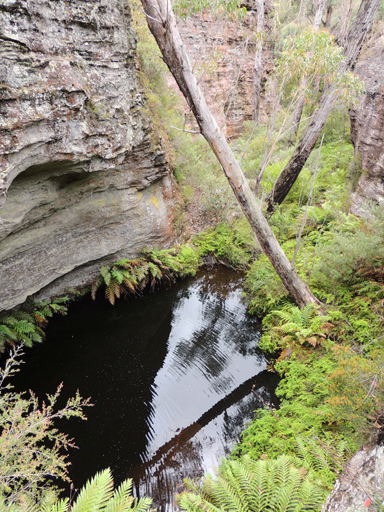
Is a perennial stream rising on the north east side of the junction of Glowworm Tunnel Road and Galah Mountain Road. It flows generally north and north east for about 18km into Rocky Creek, about 10km south, south east of Glen Davis. Named after Henry Deane.
Henry Deane (1847-1924), Engineer-in-Chief of NSW Railways, and consulting railway engineer to the Commonwealth Oil Corporation. He was also as a keen photographer and botanist. Eucalypt deanei, located in the Blue Mountains, is named after him, as well as Boronia deanei, which is found on the Newnes Plateau.
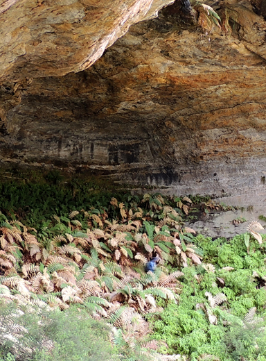
Refer to six unique caverns, hollowed deeply into the eastern side of the cliff walls above Deanes Creek. Each has a centrally disposed waterfall which is recessed into the top overhang giving a keyhole or horseshoe effect when viewed from below. Dimensionally five of the caverns are incomplete hollowed out spheres, of the order of 35m to 50m in diameter. Named by Michael Keats and Brian Fox on a Bush Club walk, 13th February 2015.
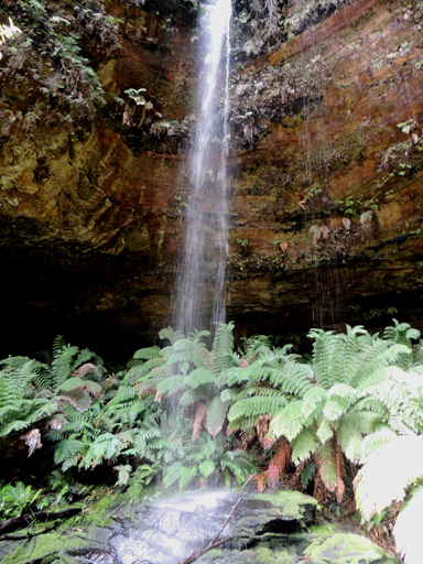
Located 1.35km west north west of the locked gate on Deanes Creek Trail via Galah Mountain Road. These falls drop more than 40m through a twisting slot from a deep and complex "C" shaped canyon up on the plateau above. Named by Michael Keats and Brian Fox on a Bush Club walk, 13th February 2015.
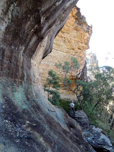
Is a series of very large overhangs on the eastern side of Deanes Creek and 500m north east of Rock Island. It also includes an amazing collapsed and tilted rock which has formed a walk through tunnel. It is some 20m long and has a fine, level, washed sandy floor. Named by Brian Fox on a Bush Club walk, 19th December 2013.
Is possibly named by David Warren Noble. David also had heard it called The End of the World by local Lithgow people who had previously taken 4WD vehicles into the area. Ref: Correspondence with David Warren Noble, 14th October 2009. Ref: Yah Hut Log Book, 27th July 1981.
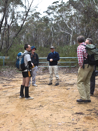
Central to this plateau is Deanes CreekTrail. Murrays Mount is also located on this plateau. The western side is bounded by Deanes Creek and the eastern side by Rocky Creek. The north eastern point is known as Deanes Lookout or The End of the World.
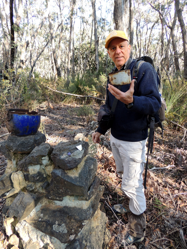
Is now a locality about 4km north of the junction of Glowworm Tunnel Road and Galah Mountain Road. When the Wolgan Valley Railway was operating, Deanes Siding was an important stop for adding additional locomotive power to enable trains to haul products out of Newnes. Deanes Siding was named after Henry Deane, consulting railway engineer to the Commonwealth Oil Corporation, by Donald Alexander Sutherland, Consulting Engineer and General Manager of The Commonwealth Oil Corporation Ltd, in 1906. Ref: Deane, Henry. The Wolgan Valley Railway - Its Construction, 1910, reproduced by the Australian Railway Historical Society, 1979. It was at Deanes Siding that the Wolgan Valley Railway gradient dropped as it neared the Wolgan Valley. Henry Deane (1847-1924), Engineer-in-Chief of NSW Railways, was a keen photographer and botanist. Eucalypt deanei, located in the Blue Mountains, is named after him, as well as Boronia deanei, which is found on the Newnes Plateau.
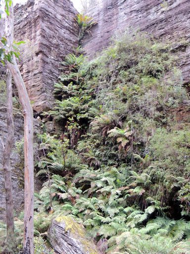
Death Trap Canyon is accessed via Galah Mountain Road. Ref: Jamieson, Rick. Canyons Near Sydney, 5th edition, 2012, p. 50.
See Death Trap Cave, Death Trap Rock

Is located about 100m on the eastern side of Rocky Creek and 900m west of Mount Budgary. The cave measures 47m across the mouth, 19.2m deep and 23m high. It has a sloping floor, which does detract from its otherwise impressive dimensions.
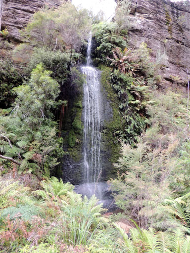
Is a double tier waterfall, a simply beautiful, perfectly symmetrical waterdrop. The name Death Trap Rock Falls is consistent with other names as part of Death Trap Canyon but does not reflect the displayed elegance. Accessed via Galah Mountain Road. Ref: Jamieson, Rick. Canyons Near Sydney, 5th edition, 2012, p. 50.
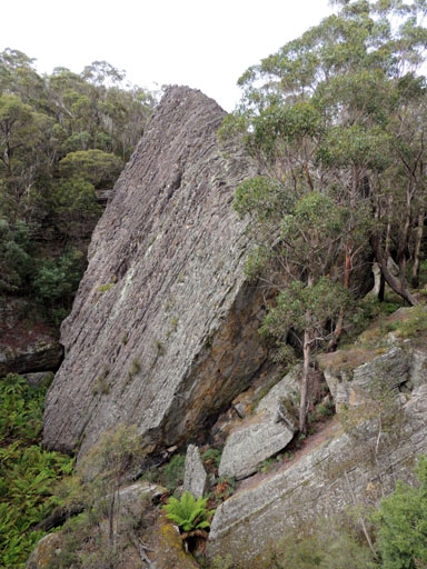
Can be viewed from a ledge at GR 463 109, where this spectacular formation can be photographed. This very large rock within Rocky Creek has cleaved away from the western cliff line, tilted and fractured in the process, but somehow managed to maintain overall integrity.
Has its headwaters on the northern side of the road junctions, Chifley Road and Bells Line of Road, Bell. It flows in a north and easterly direction for 6km to join the Wollangambe River at 510 914. Named by Ian Thorpe 17-18th December 2005. .
located 800 m west of the Glowworm Tunnel car park, is a beautiful dry canyon with lots of twists and turns and great photo opportunities. About ten metres downstream beyond the original discovery point, the canyon appeared to become a real challenge requiring a succession of ‘ropes essential’ descents. The 500 m creek and canyon end above the cliff line overlooking the northern end of Donkey Mountain in the Wolgan Valley. Named by Michael Keats on a bushwalk, 10 January 2014.
Named after the nearby Deception Canyon. Deception Point is a small but spectacular promontory on the eastern cliff edge of the Wolgan River with commanding views of the Wolgan Valley, Donkey Mountain and the Wolgan - Capertee Divide. Located 900m west of the Glowworm Tunnel car park. Named by Michael Keats and Brian Fox on a Bush Club walk, 15th November 2014.
Is a saddle, about 300m west of Mount Norris on the western end of Railmotor Ridge. Access is via Glowworm Tunnel Road, Eastern Boundary Road and Deep Pass Trail. Deep Pass is shown on the map Parish of Rock Hill, 1st edition, 1882. Deep Pass was assigned as a Rural Place by the Geographical Names Board on 11th July 1997.
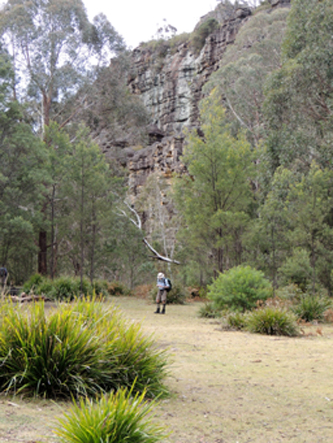
Road access via Glowworm Tunnel Road, Eastern Boundary Road and Mount Cameron Trail. From the barrier a walking track mostly down hill for 900m leads to the open flat area. NPWS has provided toilet.
Is a descriptive name, being "deep" in terms of the surrounding area and also being a narrow gorge dividing two creek systems. Two brothers, Alan and Russell May, and John Norris built a hut at Deep Pass in the late 1940s. The hut has since been destroyed. The chimney foundations can still be identified. The trio may have had some sort of lease in the area. Ref: Correspondence with David Warren Noble, 14th October 2009. See also Mount Norris. Oral history from Ken Poppett, 24th February 2012, as he recalls, "One hut was built / owned by Morris Reginald Hayden (1929-1997), a timber cutter. Later,"bikies"reportedly extended the hut and added a large structure they called a hall. Later again, the whole thing was removed by the NPWS."
Has its headwaters on the southern side of Deep Pass saddle, between the Blue Mountains National Park barrier and Mount Norris. This small creek of 2.1km flows in a southerly direction to its junction with Dingo Creek. This name is derived from the natural and locality name, Deep Pass.
Is about 5km in length from its junction with Eastern Boundary Road, to the road barrier. The remaining 250m walk leads down the hill to the level flat camping area, Deep Pass Camping Ground.
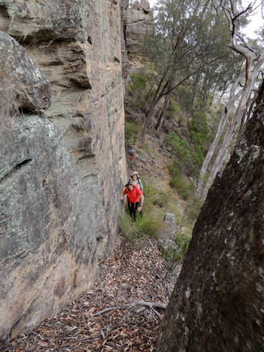
Refers to the access to below the cliff line above the eastern side of Carne Creek 1.3km east, south east of the Carne Creek and Wolgan River junctions via Delusional Slot. So named by Brian Fox on a Bush Club walk, 19th May 2014.