Pandoras Ravine
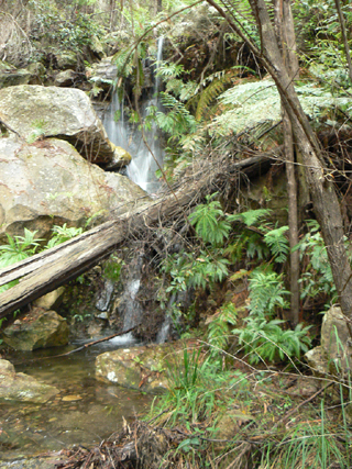
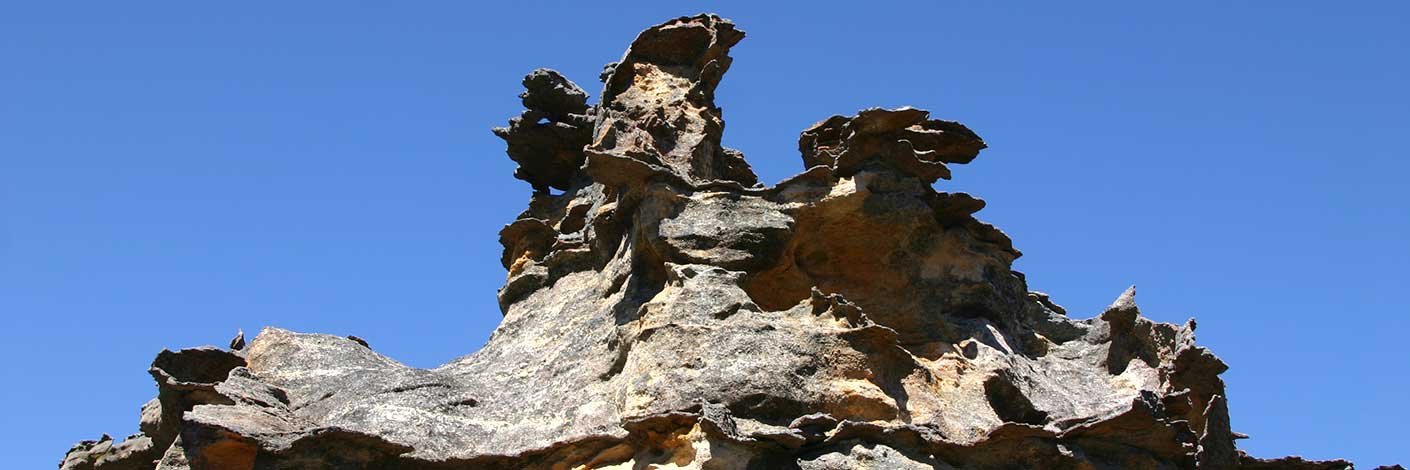
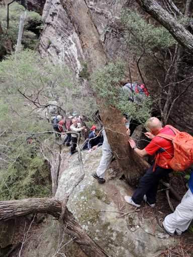
Is a long, continuous ramp through about 60m of vertical descent from Witches Watch near the western side of the track to Mount McLean down into Hecates Cauldron. At the base and to the north of it, a 3m long tunnel leads into a chamber with five amazing, separate, hidden, almost dry waterfalls / ravines which feed into it. Michael Keats on a Bush Club walk, 5th March 2011 named both these features, the latter, Pandoras Box.
Panoramic Hill
Has a height 1180m, on which Bald Trig Station is located, is now known as Bald Hill. Named by Surveyor Robert Hoddle, 20th October 1823. Ref: Colville, Berres Hoddle. Robert Hoddle Pioneer Surveyor 1794-1881, 2004, p. 43.
Panther Gully
Is a short 400m tributary on the eastern side of Coopers Creek, which in turns flows into Dumbano Creek. Peter Fox, a member of the National Parks Association, named this gully at a time in the late 1990s when the supposed sightings of Lithgow Panther grabbed media attention.
Pantoneys Crown
*
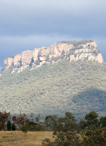
Is a spectacular isolated sandstone mesa 7.5km north east of Ben Bullen. Having a height of just over 1020m, it rises over 300m above its surroundings. The closest road is Crown Creek Trail, 2km to the east. Geographical Names Board notes on 27th August 1970 record, "District surveyor advises it is locally referred to and abbreviated as, The Crown. Shown on the map Parish of Goollooinboin, 1884 as Pantony's (sic) Crown or Tower Mount. Named after William Lee (Pantoney) (1794-1870), son of William Pantoney and Sarah Smith, convicts. William married Mary Dargin in 1821 and they had 4 daughters and 6 sons. Ref: Bathurst Pioneers. It was the Aborigines that were employed by Lee who guided him to the Capertee region; they also showed him other promising pastures. Lee established a sheep grazing property in the Capertee area in 1823. Ref: Gresser, P. J. The Aborigines of the Bathurst District. Harvey, Jan and Gerald. The Glen Alice School Centenary, 1884-1984, 1984, p. 57. He was known as William Pantoney Junior until c1817, when he changed his name to William Lee. His early years were spent on Norfolk Island. He lived at Windsor in 1814 and was issued with government cattle in 1816. In 1818, he was one of the first settlers to receive a 50ac land grant at Bathurst. William Lee became a prominent Bathurst figure and in 1856-59 sat in the first Legislative Assembly as Member for Roxburgh. Ref: NSW Parliament, former members website.
Pantoneys Crown Nature Reserve
*
Geographical Names Board name assigned on 2nd September 1977. Placed on National Estate Register on 21st October 1980. Pantoneys Crown Nature Reserve comprises about 3,230ha surrounding Pantoneys Crown. On the 22nd December 1995, this reserve was added to the Gardens of Stone National Park.
Pappys Pass
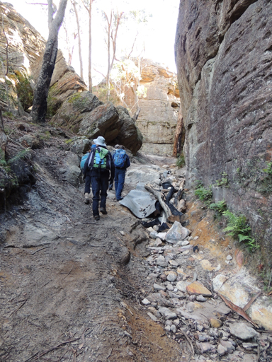
Is a pass and a 4WD track that lead from the headwaters of Genowlan Creek to the top of Genowlan Mountain. Named after Colin (Col) Maxwell Ribaux, former owner of this land, by his sons. Ref: Correspondence with Karen McLaughlin, 30th November 2009.
Parish of Airly
*
Is a lands administrative division within the County of Roxburgh. Eastern side of the Glen Alice Topo Map and western edge of the Upper Turon Topo Map.
Parish of Barton
*
Is a lands administrative division within the County of Cook. Edwin Barton (1833-1876) was employed by the NSW Railways as Engineer in charge of Trial Surveys. During the years 1857-1860, he was involved in the proposed route for the western railway line via the Grose Valley. In 1865 he married Georgina Lyon Wolgan Walker. Georgina's father James owned 2000ac in Wallerawang dating back to 1823. Edwin purchased many parcels of land in the Wolgan Valley. A Survey Plan C210.1507, dated September 1863, is just one example of his many early purchases.
Parish of Capertee
*
Is a land administrative boundary within the County of Cook. The Parish Map of Capertee, dated 1898, records, Capertee or Bogee River. A part of the Capertee River was also known as The Nile.
Parish of Coco
*
Is a land administrative district within the County of Roxburgh. Also see Coco Creek.
Parish of Cook
*
Is a land administrative district within the County of Cook. Also see Cooks Creek and County of Cook.
Parish of Cullen Bullen
*
Is a land administrative district within the County of Roxburgh.
Parish of Gindantherie
*
Is a land administrative district within the County of Cook. Also see Gindantherie
Parish of Glen Alice
*
Is a land administrative district within the County of Hunter.
Parish of Goollooinboin
Is a land administrative district.
Parish of Rock Hill
*
Is a lands administrative division within the County of Cook.
Parish of Wolgan
*
Is a lands administrative division within the County of Cook.
Parish of Wollangambe
*
Is a lands administrative division within the County of Cook. Sydney Morning Herald, 1st March 1858, records the Wollangambe Creek (sic) was part of the boundary for the Hartley Police District.
Parish of Wollemi
*
Is a lands administrative division within the County of Cook.
Parkers Grotto
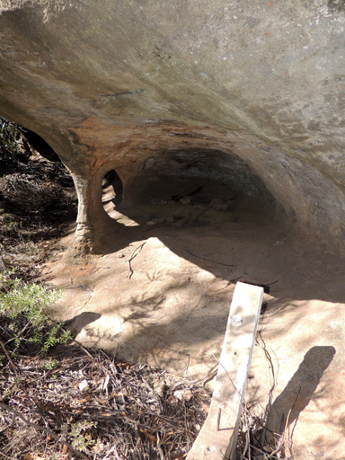
Was named by Keith Painter in 2016. The Lithgow Mercury, 3rd November 1937, p. 4, records, “ Mr. Parker is preserving intact a peculiar rock formation alongside the road. It is [a] grotto, and a rounded pillar helps to support the overhanging mass. Mr. Parker declares that the rock face, which looks out to the west and thus has felt the effect of westerlies for centuries, has been sand blasted into this curious shape. In years to come many a motorist and pedestrian will halt to observe Nature's handiwork." Located off Hassans Walls Road approximately 100m towards Browns Gap from the signposted junction to Hassans Walls Lookout.
Pavilion Gully
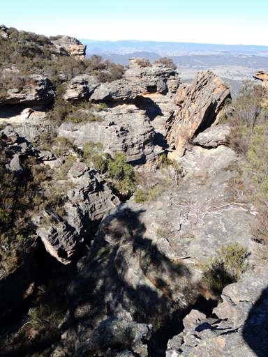
Is located on the western side of Hassans Walls Lookout and below the communication towers and shelter shed at Hassans Walls, Lithgow. A track down this gully used to connect with the walking track below. An old fireplace is near the top of this very overgrown track. Lithgow Mercury, 8th December 1916, p. 6. Pavilion Gully was actually mined under as late as 1970 onwards by Lithgow Valley Colliery, who were granted a mineral lease (ML20) under the reserve in March 1970.
Peak Harvey
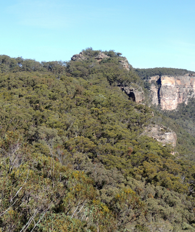
Is located 950m south west of Mount Harvey and 2.7km north east of Hughes Defile within the Gardens of Stone National Park, at an elevation of 970m. So named on a memorial walk to Peter (Pete) Kristen Harvey (1982–2013) by the Sydney University Bushwalkers, 11-12 May 2013. Part of their track notes record, “In the morning we struck out early for Mt Harvey but due to the large group size, pathological pagodas, and a misplaced scrambling rope, wemade it only so far as the large rock structure…This is a sublime spot with magnificent views not only of Mt Harvey, but of the Red Rocks, the Crown, Tayan Pic and the Capertee to the north. We held a quick group discussion and unanimously decreed the point as Peak Harvey, named after the man whom we chased up so many a peak. We installed a logbook and shared a terrible sombre too-early farewell to our dear friend, in a beautiful beautiful part of the world”. Peter had served the club in many roles including a term as president.
Pearsons Lookout
*
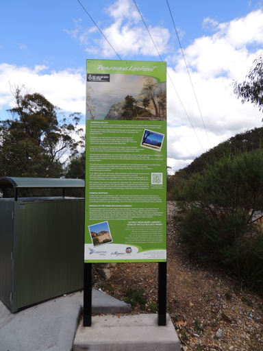
Is one of the finest vantage points to view the southern end of the Capertee Valley. Located on the eastern side of the Castlereagh Highway, 2.5km south east of Capertee and 6.7km north west of Ben Bullen. The panorama (on a clear day) from left to right is Mount Airly, Genowlan Mountain, Cottage Rock, Mount Innes, Mount Iris, Mount Gundangaroo, Mount Canobla, Point Anderson, Red Rocks, Point Nicholson, Mount Dawson, Mount Harvey, Mount Stewart, Mount McLean and Mount Jamison. It is highly likely that this lookout was named after John Westall Pearson. He was listed as Director and Chairman of the Commonwealth Oil Corporation, 1919. He was involved in commercial aspects of the mining at Blackmans Crown (near opposite Pearsons lookout), as well as at Newnes and Glen Davis. Ref: Oil and Petroleum Manual, 1920, p. 54. SMH, 25th December 1912, p. 12.The State Library of NSW holds a photo titled Capertee Valley from Pearsons Lookout, dated December 1937. A directional plaque was erected at this lookout but has long since disappeared. Major road upgrades to this lookout were completed in June 2013.
Pegasus Rock
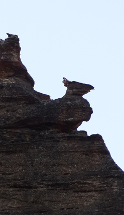
Was named by Michael Keats on a Bush Club walk, 30th August 2103. Michael recorded,"I looked up at the pagodas and there is a special piece of magic in stone, a flying horse no less, riding / flying and silhouetted against the sky". Located on the top of the cliff line, 1.3km north east of Invincible Trig Station.
Penrose Cave
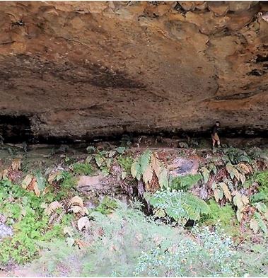
Is located underneath the eastern cliff line of Penrose Gully, 1.5m east, south east of the propertyKoopartoo. The overhang is in the shape of a semicircle with a 30m radius, and about 30m high at the drip line. It has a flat balcony level, about 3m wide, that runs all the way along the back wall, and a sloping floor level underneath it. Named by Yuri Bolotin on a bushwalk on 30 September 2017.
Penrose Creek
And / or Gorge are now known as, (see) Tunnel Creek and Bells Grotto respectively. The name Penrose Gorge referred to the gorge on the southern side of the Glowworm Tunnel. The names Penrose Creek and Penrose Gorge were the names used by Henry Deane in his reports on the construction of the railway to Newnes in 1906-1907. Ref: Deane, Henry. The Wolgan Valley Railway - Its Construction, 1910, reproduced by the Australian Railway Historical Society, 1979, p. 17. See Penrose Gully re origin of the name Penrose.
Penrose Gully
*
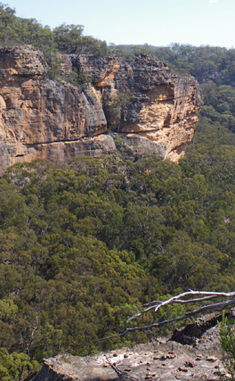
Is a non perennial stream rising about 6km south of Newnes in a cliff lined ravine. It flows generally north and north west for about 2.5km into the Wolgan River. Charlotte Mackay (c1830-1903) at the age of 18 immigrated to Sydney in 1848. She was married to Thomas Penrose (d1901) at Bowenfels in 1850 by the Rev. Colin Stewart. All their children were born in the district, and both Thomas and Charlotte were buried at Wallerawang. Thomas took out a Conditional Purchase of 40ac fronting the Wolgan River in 1869. Ref: Survey Plan 386.1507. It appears that they purchased at least five other parcels of land and placed them in their children's names (Edwin, Robert and Herbert). Ref: Survey Plans 464.1507; 598.1507; 613.1507. Shipping records and BDM's. Also see Sinnamon Creek
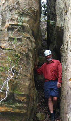
Penrose Slot
Is the easternmost entry point into Penrose Gully, access is via Old Coach Road. Penrose Slot was described by Michael Keats on a bushwalk, 29th March 2010 as,"It is a perfect staircase followed by a chock stone tunnel section."
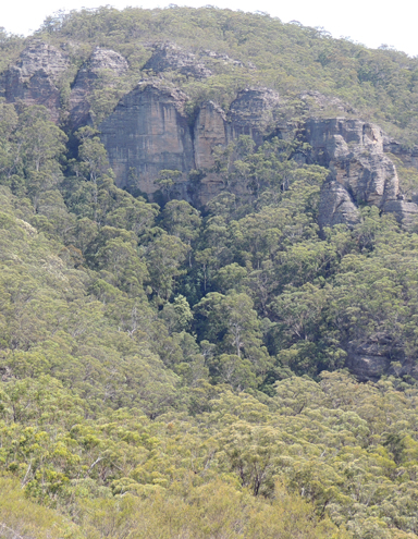
Pentafid
Refers to headwaters of an unnamed creek which feeds from the west into Deanes Creek 1.4km south west of the junction of Deanes Creek and Constance Gorge. The Pentafid is the junction of five tributaries. So named by Michael Keats, 25th November 2009, Michael applying the botanica lname for "cleft into five". Walking access from Glowworm Tunnel Road and Old Coach Road.
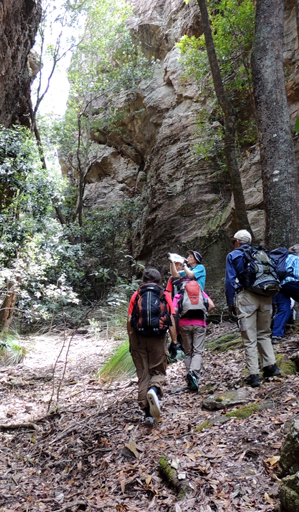
Pentafid Defile
Is a ramp like slot on the eastern side of the north rim of the Pentafid which gives access to the top of the cliff line overlooking Deanes Creek. Road access via Old Coach Road and Tiger Snake Canyon Track. So named on a Bush Club walk by Brian Fox, 30th October 2015.
Peoples Palace
Refers to the cliff line above the northern side of the Wolgan Road, opposite and between Penrose and Zobels Gully. Name recorded in Taylor, Pete and Penney, Andrew. The Wolgan Guide, 1984, p. 150 and 165. This area has been climbed from 1978.
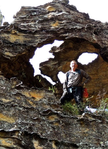
Perforated Dome
So named as a dozen natural stone windows grace the top of this pagoda. The dome is about 3 m in diameter. Located 1.4 km south east of the barrier (Newnes State Forest and Blue Mountains National Park) on Waratah Ridge Road. Named by Michael Keats on a Bush Club walk, 21st August 2014.
Perforated Spur
Is a short 700 m spur on the southern side of Waratah Ridge between Zig Zag Spur and Scatters Ridge. The start is 1.2 km from the barrier at 489 022, and it extends south to 490 015. Named by Yuri Bolotin on a bushwalk, 12th June 2015 after the feature, Perforated Dome, located at the end of this spur.
Permafrost Gully
Is generally a south facing gully, 1km in length, located 1.5km north of the State Mine Museum. The State Mine was also within this gully. The gully is exposed to the biting winds, severe frost and, in harsh winters, ice that does not melt during the day. This gully in which the State Mine was located was locally known by a number of other names which included Snake Gully , Steak Knife Gully, Dobbs Drift and The Drift. Ref: Stephen Imrie, correspondence of 6th January 2010.
Petries Balcony
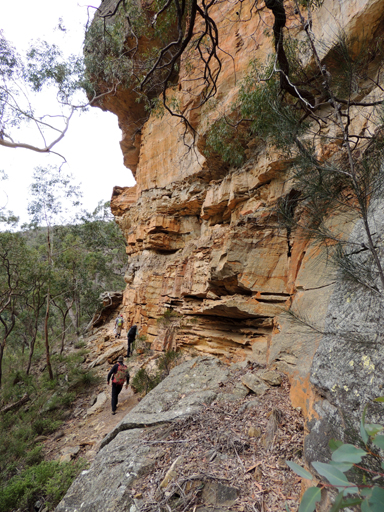
Refers to a 800 m ledge between two cliff lines above and on the eastern side of Petries Gully. Access to the ledge, which varied from one to ten metres wide, is via a rock climbers chain, GR 439 269. Named by Michael Keats, Brian Fox and Yuri Bolotin on a bushwalk, 22nd August 2016.
Petries Gully
*
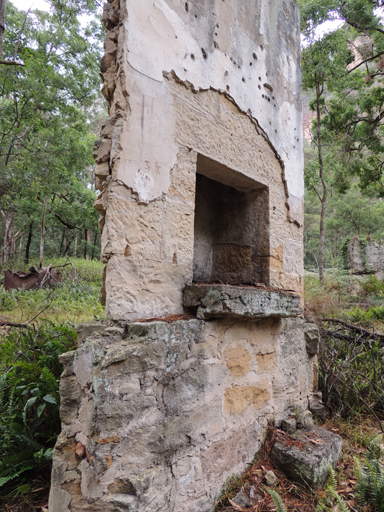
Is a watercourse rising about 3.5km south west of Glen Davis. It is about 3km in length and flows generally south, then south east into the Wolgan River.This gully has also been referred to as Shale Gully. Ref: Shown on Carne, Joseph. Geological Map of the Capertee and Wolgan Valleys, 1901. James Ramsay Petrie (1851-1924) and his brother William (b1845) were born in Fifeshire, Scotland. James was the manager of Pumpherston Oil Works, Mid Lothian, for 25 years. In 1910, the Commonwealth Oil Corporation was formed in London to work the vast oil shale deposits at Newnes. James was employed by the company as director and advisor in the manufacture and distillation of oil at the Newnes site. William Petrie was employed as a retort superintendent and works manager. Ref: The Sydney Morning Herald, 22nd August 1924, p.11 and Local History Library, Blackburn, West Lothian, Scotland.
Petries Gully Cliffs
Refers to the cliff line above the junction of the Wolgan River and Petries Gully. Named by Thomas Ebersoll, owner of the old Newnes Hotel, and shown on his hand drawn map The Newnes Area, 2005.
Petries Point
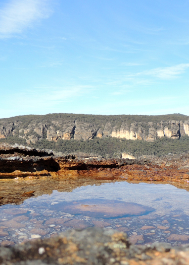
Is located directly above the the junction of Wolgan River and Petries Gully at 800m. Extensive views of Petries Gully and Wolgan Valley. Named by Yuri Bolotin on a Bush Club walk 14th July 2016.
Petries Slots
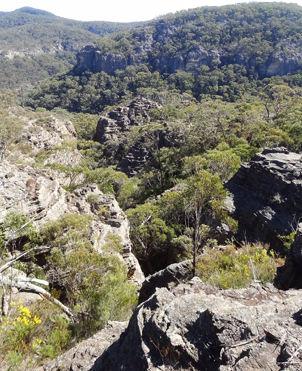
These east-west trending features form a cross cut saw pattern over much of the narrow plateau between the eastern side of Petries Gully and the Pipeline Track. They are not shown on the topographical map as they are too small for the scale of the map, but delineated in the aerial photograph on the reverse side of the current map. Named by Yuri Bolotin on a bushwalk, 7th March 2016. One pass within this area is known as Petries Slots Pass (see separate entry).
Petries Slots Pass
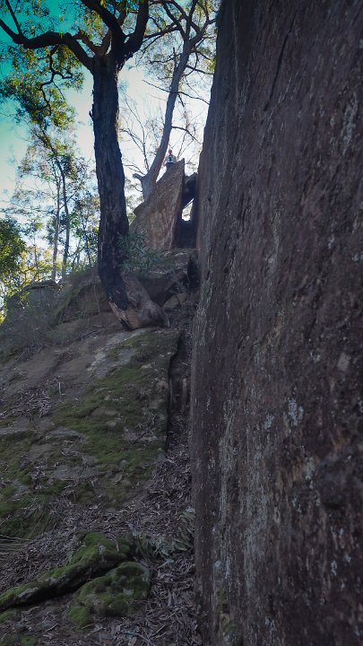
This pass was named by Yuri Bolotin on a Bush Club walk 18th August 2016. This pass provides an eastern access from Petries Gully to the network of slots (Petries Slots) on the narrow plateau above and hence a return via the Pipeline Track. Described by Michael Keats as, “ a pass within a geometrically precise parallel sided slot complete with a chockstone. Climbing in it required good chimneying skills and some patience as the options for gripping the sides were minimal.”Leading to the pass and at the top of the pass, there are multiple stone cairns, all very old, as mosses and dirt had built up around them.
Petrolea Vale
(From Petra = rock and Oleum = Oil), also see Hartley Vale During the period when oil was being extracted from shale oil (torbanite) between 1865 to 1870 Hartley Vale was known as Petrolea Vale. Ref: Pells, Philip and Hammon,Philip. The Burning Mists of Time, 2009, p. 35. The Goulburn Herald and Chronicle 25th November 1865, p. 5. At Hartley Vale two companies were launched within months of each other in the second half of 1865, first the Hartley Kerosene Oil and Paraffine Co. Ltd., then the Western Kerosene Oil Co. The HKOPCL made the initial running, establishing the Petrolea Vale retorts and refinery in the valley and marketing Star brand kerosene. By 1868 the company had sixty employees mostly living in a sizeable private village and a new bench of retorts of a more advanced shape was installed. The Petrolea Vale retorts and refinery closed down in 1870. Ref:www.environment.nsw.gov.au/heritageapp/ViewHeritageItemDetails.aspx?ID=1960033
Pheromone Pass
Is a bush walking pass 2.3km north east from Mount Budgary which leads into Budgary Creek. Named by Michael Keats, 5th August 2009. This pass, along with Frenulum, Ocellus, Lanceolate and Spiracle Passes, all near Mount Budgary, is named after an anatomical part of a Moth. Michael had encountered a large numbers of Moths during his walks on Mount Budgary Plateau.
Philosophers Cave, Philosophers Stone
Are located on a walking track laid out by Thomas Ebersoll and accessed via Little Capertee Creek Camping Ground towards the base of Old Baldy. A large tilted boulder forms a protected dry area that Thomas has named, The Philosophers Cave, and within it, a flat stone, suitable for sitting on and becoming contemplative, in which he refers to as Philosopher’s Stone.
Phil Reed Pass
Is a means of access from the top of Zobels Gully to the top of the eastern cliff line that leads south to the Old Coach Road or north to Constance Point. Phil was a member of Upper Blue Mountains Bushwalking Club who led a walk using this pass in 2008.
Phyllis Creek
Is part of the upper southern tributary of Penrose Gully; it crossed the old railway line. Ref: Name recorded on the original linen tracing for the Wolgan Valley Railway.
Picnic Point
Is a sandy/grassy area on private land on a bend in the Wolgan River below the Corn Paddock. A local name coined by the Winchester–Coates family. It was a location for many of the family picnics. A huge Oak Tree on this site was planted by the family in the 1880s.
Pillans Lookout
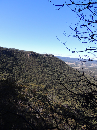
Is an overhang located within Hassans Glen, Hassans Walls Reserve, Lithgow. Access via ledge in Sandford Cave which leads around to small narrow overhang. Sandford is the first cave from the top of the glen. Above this rock is the original location of Braceys lookout and Natural Throne. Named after Robert Pillans (1860-1941) who was the Mayor of Lithgow in 1911-1918 and 1923-1927. Lithgow Mercury, 14th May 1915, p. 4.
Pinch Point Circle
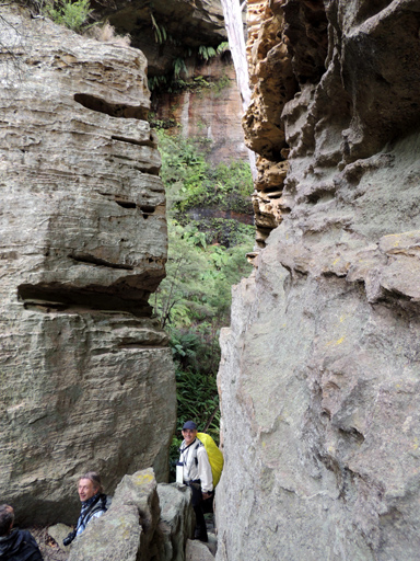
Refers to huge section of cliff that has been separated from the end of Tagine Point and then partly toppled over towards the opposite, southern side, creating hollows and arched walkways. Within this narrow part of the curving canyon, there is a real pinch point, the walls close right in to less than 20m apart, the cliffs tower more than 40m. Named by Michael Keats on a Bush Club walk, 16th May 2013.