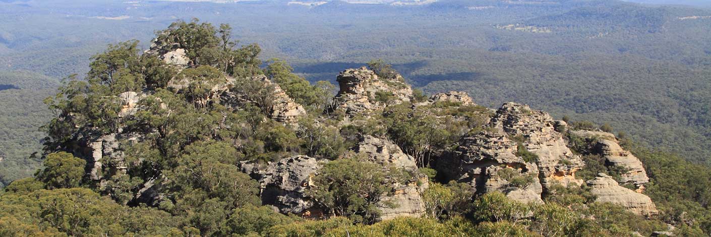
Is shown on the map The Gardens of Stone Stage 2 Proposal State Conservation Areas and National Park Extensions. Compiled by Karen McLaughlin for Blue Mountains Conservation Society and Colong Foundation for Wilderness, December 2010, previously and officially named as (see entry) Sunnyside Ridge. Cullen Bullen and Lithgow Topo Maps, northern end GR 375 156, southern end GR 375 022.
Bush Explorers Encyclopaedia
Is a short 500m gully that links the Wolgan River to the saddle containing Pagoda Lookout and thence onto Green Gully. Named after the Pipeline Track which traverses this gully and connects the villages of Newnes and Glen Davis. Numerous examples of old infrastructure of the former pipeline still exist in the gully.
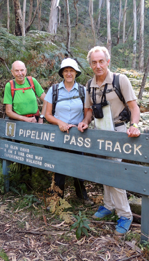
Pipeline Track is the name of a rough walking track linking Newnes to Glen Davis via the Wolgan River and Green Gully. In early 1906 The Commonwealth Oil Corporation (COC) operated kerosene shale mines at both locations and built a telephone service between the Gullies (Glen Davis, Capertee) and Wolgan (Newnes) along with a 6 mile road over the Wolgan Capertee divide, joining the two valleys. In 1906 there were up to 100 men working in Newnes but there was no general store so “a cart carrying items for sale travelled twice a week from The Gullies (Glen Davis) to Wolgan (Newnes)”. Ref: ‘Airly’ Rylstone Express 25th May 1906 p. 5.
The section of track most people walk today from GR 448 264 to GR 447 273 to the east of the original track is the route used in 1937 by National Oil Pty Ltd. (NOP) to install the petrol pipeline from Glen Davis to Newnes Junction. The authors have walked and documented the section of the original road and telephone service. The original road has a particularly steep section where it makes a sharp turn at GR 448 263. The 1905-6 road would have been negotiable by horses.
Historical references include
1 The Survey Plan M13826, dated 9th May 1908, records on the eastern side of Green Gully, ‘Horse Track to Glen Alice’.
2 Ref: Interview with Dick Bird, 29th January 2010, local usage name 1940s & 50s, The Bridle Track.
3 In Carne, Joseph, Geology and Mineral Resources of the Western Coalfield, 1908 there is a picture, facing page 225 of men and horses ‘on the bridle track near Greens Gully, Capertee Valley looking west through Canobla Gap’.
4 In 1937, National Oil Pty Ltd was set up at Glen Davis to produce petrol from kerosene shale. A four inch diameter pipeline was constructed from Glen Davis to Newnes and onto Newnes Junction on the Main Western Line to transfer the petrol to rail. Ref: Skidmore, J A. Mineral Oil Industry in NSW, 1995, p. 254.
Signage placed by the NPWS at various sections of the track have used different spellings, such as The Pipeline Track, Pipeline Track and Pipeline Pass Track. Ref: sighted 13 January 2010.
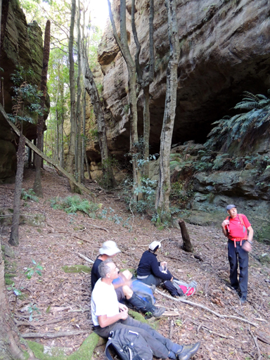
Refers to a defile oriented north south between Little Rock Island and Rock Island. It is filled with ancient Tree Ferns and fallen logs. What light does get through has to compete with a dense canopy of Coachwood and Sassafras. The sandstone walls are a rose pink, the air cool and the ambience church like. Within this defile is a semicircular embrasure, maybe 6m high, and equally as wide and deep, with a centrally disposed, very fine dripping water source. This mineral rich water has built a magnificent dark red stalagmite about 50cm high. It has a small depression in the top and is in active growth phase. All around the skirt of this single feature is red flowstone. Name coined by Brian Fox and Michael Keats on a Bush Club walk, 20th October 2011.
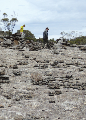
Is an area of rock formations located 400m north, north west of Mount Jamison and 700m south west of Wolgan Trig Station. Named by Rodney Falconer, who was one of the major players in the creation of the Gardens of Stone National Park, November 1984. Rodney named it after a sweeping expanse of bare rock, covered by the scattered remains of ironstone bands as if broken pottery was scattered across it. Other name recorded is The Exploded Pagoda. Ref: Tom Brennan's photo gallery, October 2010.
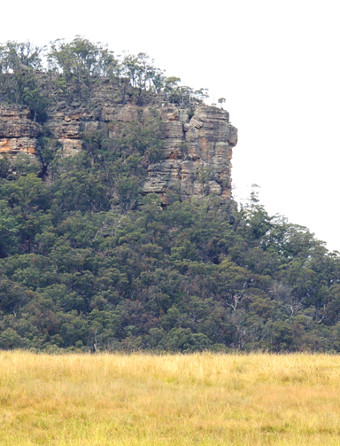
Is a flat rock on the southern side of Gardiners Hill, 4.4km south east of Ben Bullen and 2.5km north of Baal Bone Colliery. This is a descriptive name. Name appears on the 1:63 360 Wallerawang Topo Map,1935. Name assigned by Geographical Names Board, 30th May 1975.
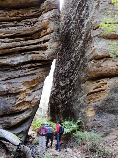
Is an 800m canyon located 400m north west of the northern extremity of Birds Rock Trail No. 2, via Sunnyside Ridge Road. Named by Rick Jamieson. This canyon has rock walls covered by the epiphytic rock Felt Fern,Pyrrosia ruprestris. The canyon ends at the cliff line that has wonderful views of Carne Creek. Ref: Jamieson, Rick. Canyons Near Sydney, 2012, 5th ed. p. 67.
Is located in the area known as The Barnacles. In keeping with this nautical theme an undercut ledge on the south west side of The Barnacles was called the Plimsoll Ledge. An upper ledge became The Gunwale. Some of the fretted sandstone was delicate beyond belief being similar to very fine porcelain. It extends from GR 494 906 to GR 495 904 before the ledge runs out as a bluff above Bell Creek. Named by Michael Keats and Yuri Bolotin on a Bush Club walk, 14th September 2015.
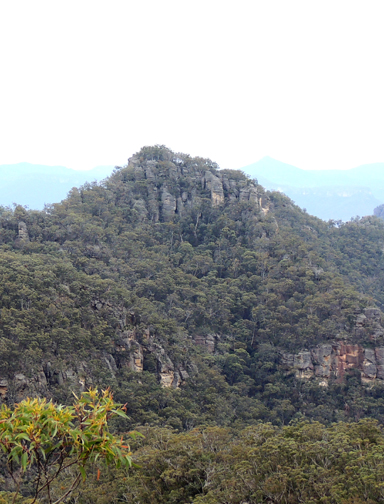
Is a point of land on the escarpment 2km south of Mount Canobla and 3.5km north west of Newnes. Shown on the map Parish of Goollooinboin, 1884. The Sydney Gazette, 15th October 1831, p. 2 records the arrival of Scottish immigrants that included Patrick Anderson and his wife. The Survey Plan B351.691 dated 1837 shows 640ac applied for by Robert Anderson and Lessee Patrick Anderson near Blackmans Crown. NSW Government Gazette, 13th April 1839, p. 455 also records the lease at 20 shillings per acre.
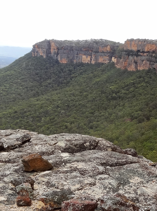
Located 1.1km north west of Mount Davidson and Wolgan Trig Station, and 3.8km south east of Pantoneys Crown. Shown on Carne, Joseph. Geological Map of the Capertee and Wolgan Valleys, 1901. In 1892, John Cameron via Conditional Lease held Portions 2, 3 and 11 bounded by the Wolgan River that have a total area of 250ac. Ref: Survey Plan 1930, 1931 and 1932. 1507. Allan Cameron (1812-1898) is buried at Glen Alice Cemetery.
Refers to the large series of overhangs and the cave at Point Cameron. Ref: Correspondence with Rodney Falconer, 3rd May 2010. Rodney remembers this as the Point Cameron Hotel. Named c1984.
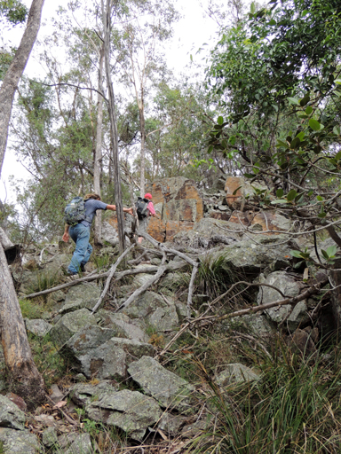
Has walking access from the Capertee Valley to Wolgan - Capertee Divide via Point Cameron. It is a pass only to be used for keen and fit walkers. Named by Michael Keats on a Bush Club walk, 15th March 2013.
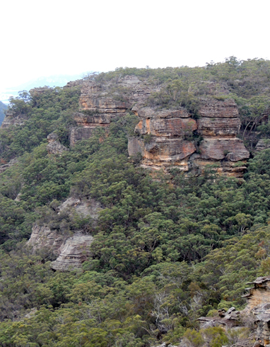
This double headed bluff overlooks the headwaters of Red Rock Creek, 2.2km south of Mount Harvey. Shown on the map Parish of Wolgan, 1st edition, September 1884. The parish map shows the name refers to the total bluff that looks directly down Red Rock Creek between Point March and Mount Harvey.
It appears that the name Cornell is misspelled and that the location was possibly named after John Connell (1851-1889). The Australian Town and Country Journal 1st September 1883, p. 23. SMH 17th August 1883, p. 6. Evening News 17th August 1883, p. 2. Record that a property of 640 acres shared by John Connell, Peter Wallace and James Loneragan as a Mineral Lease, that good quality Kerosene Shale was discovered. This area was in the vicinity of Ben Bullen Range and described as, “7 miles from Capertee 4 miles from the railway”. In 1888 John Connell also made another discovery of kerosene shale in the Marrangaroo Range, 6 miles from Lithgow Ref: SMH 17th July 1888, p. 8.
Other names that were misspelled include Collett Gap, should be Collitt and Mount Horne which is Mount Horn.
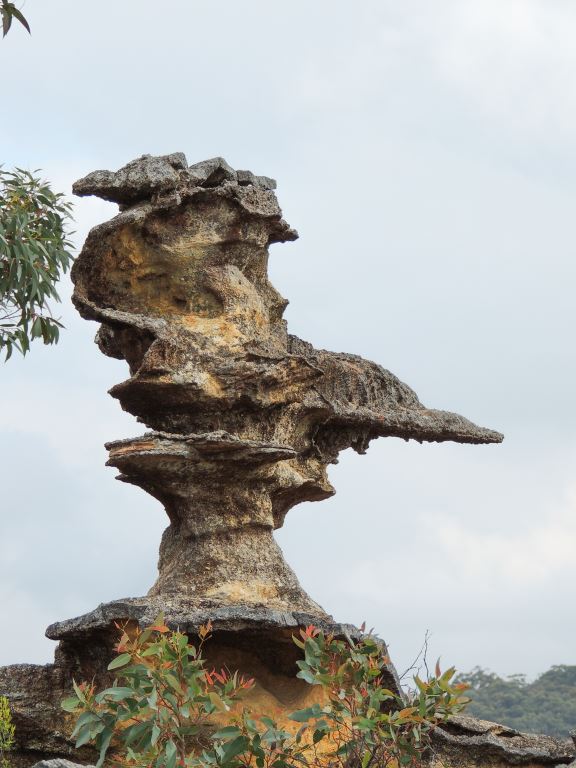
Is an elegant plinth that looks like it has been made by a master stonemason; on top of it, is a giant intricately carved sandstone pointer, 1m high, 50cm wide and 1.5m long, its sharp needle end turned towards the natural pass that leads down to Koopartoo Ravine. Located on top of the northern cliff line above the Wolgan River, 1.4km north west of the propertyKoopartoo. Named by Yuri Bolotin and Brian Fox on a Bush Club walk, 22nd May 2017.
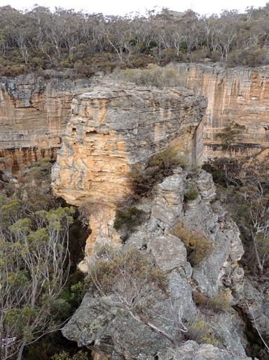
is a pagoda-studded rocky outcrop at the end of a narrow spur (Greens Spur) directly above the Wolgan River, immediately west of Wolgan Loops; it has the Wolgan Falls directly below on the eastern side. Richard Green, a renowned Australian landscape and nature photographer, tragically died in a helicopter crash in November 2015. This spectacular point above the Wolgan Falls with 360-degree views was one of the last major areas that Richard photographed in late June 2015 for the Gardens of Stone: In Focus photographic competition. Named by Yuri Bolotin in honour of Richard’s achievements on a bushwalk, 20 November 2015. Cullen Bullen topographic map, GR 348 101. Newnes State Forest/Gardens of Stone SCA.
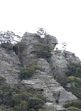
Is the northernmost point of a bluff, 2.7km east, north east of Mount Airly and 1.8km south west of Genowlan Mountain. The name was first recorded as Cape Hatteras on the Parish of Morundurey, 1916, 4th edition and changed to Point Hatteras on the 1950, 6th edition. The word cape applied to a landform on the coast. It may have been Cape Hatteras which is the easternmost point on United States coastline. But no official origin has been recorded. Changing the name from cape to point is in accordance with the naming of an inland feature.
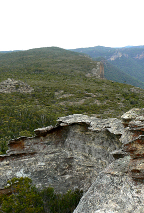
Is a point of land on the western side of the escarpment,1.7km south, south east of Mount Harvey and 1km north east of Point Cornell. John March (1801-1879) purchased 40 acres under Conditional Purchase on the western side of Glen Alice on the 21st March 1878. Ref: Survey Plan R1565.1496. Inscription, Glen Alice Cemetery. Shown on the map Parish of Goollooinboin, 1884.
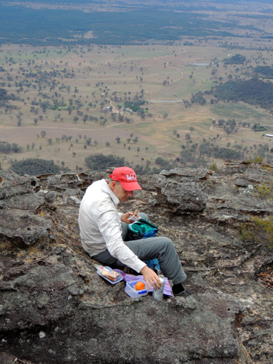
Located on the escarpment 4.2km west, north west of Newnes and roughly midway between Point Anderson and Gindantherie Pinnacle. Shown on the map Parish of Goollooinboin, 1884. Alexander (1818-1888), Christina (1815-1899) Nicholson and family at the instigation of the McLeans immigrated to Australia in 1857 and settled in the Glen Alice area. Ref: Staff, Bill. Rylstone Area History of Settlement, 1983, p. 68 and inscriptions, Glen Alice Cemetery. One of their sons, Samuel Donald Nicholson, (1843-1944), purchased Portions 80 and 81 in the Parish of Goollooinboin, County of Cook on the 13th and 20th March 1879. Ref: Survey Plan 1061.1507. Another son, John (b1855), held Conditional Purchase on Portions 82-84 in 1878-1879. Ref: Survey Plan 1131.1507. Samuel Nicholson opened the Genowlan Mine near Capertee in 1883. Ref: Carne, Joseph. The Kerosene Shale Deposits of New South Wales, 1903,p. 38.
is located at a height of 820 m at the end of a short spur line on the eastern side of Koopartoo Mesa, near a giant solitary rock. There are 180-degree views above the Minotaur Lair Gully to the north west, and to the towers of Minotaur Watch to the south east. Named by Yuri Bolotin on a bushwalk, 10 August 2018, after his grandson Sol Bolotin who was born on the 9 August 2018. Sol means sun which was also a fitting name for the sunny disposition of this point of land.
Donald Sutherland was a Consulting Engineer and General Manager of The Commonwealth Oil Corporation Ltd mine and refinery at Newnes in 1906 at the time when the Wolgan Valley Railway was being constructed. The point of land refers to the cliff line above the railway, north of the Glowworm Tunnel and that overlooks the Wolgan Road and the property,Koopartoo , 7kms south of Newnes. Ref: Photo; Lithgow Library, titled, "Wolgan Point Sutherland from Zobels old camp." c1907.
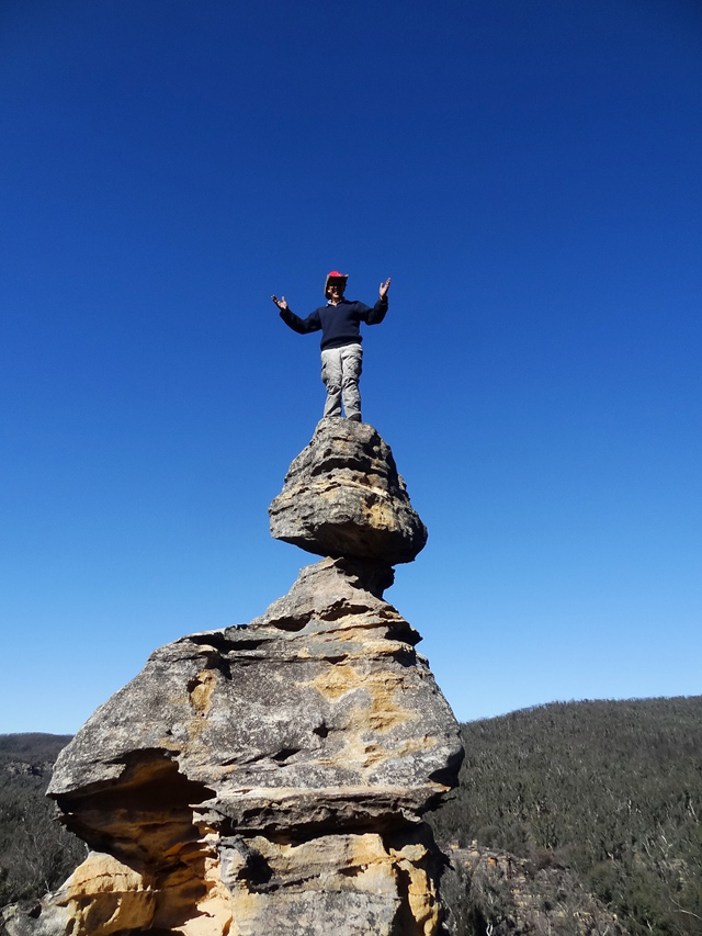
Is a boulder balancing on the top of a pyramid shaped rock, from a distance it looks like the smallest push would topple it. Located 1.3km east, south east of Dumbano Tunnels. Named by Yuri Bolotin while leading Bush Club walk, 9th February 2014.
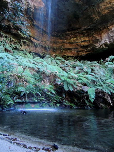
Is a shallow, crystal clear, 10m diameter pool of water, fed by a 30m waterfall. Located 2.9km east, south east of Cockatoo Hill Trig Station. Access via Deep Pass Trail. Named by Michael Keats on his Bush Club walk, 31st October 2007. Michael described the area as, "shakespearean Romantic, vast and grand, decked with ferns and waterfall."
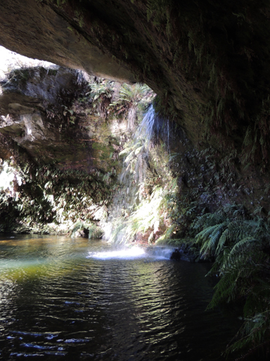
This pool and overhang / canopy is about 40m in diameter. The pool itself is about 30m across and at least 2m deep. The height of the roof above the water surface is approximately 12m. Nearly two thirds of the pool area is under the rock canopy. The uncovered part of the pool is wedge shaped, with the apex dominated by the discharge point of the waterfall. Located 2.5km south east of Cockatoo Hill on a side tributary on the southern side of Dingo Creek. Michael Keats saw this pool on a Bush Club walk, 28th April 2010; named by Yuri Bolotin on a Bush Club walk, 27 July 2012.
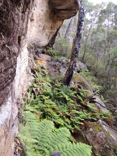
Is a small permanent pool below a small cliff line, overshadowed by tree ferns. Above this pool and small rock face is a tunnel and slots. Located on the western side of Henry Creek 2.4km north, north east of the junction of Glowworm Tunnel Road and Old Coach Road. Named by Michael Keats on a Bush Club walk, 17th August 2012.
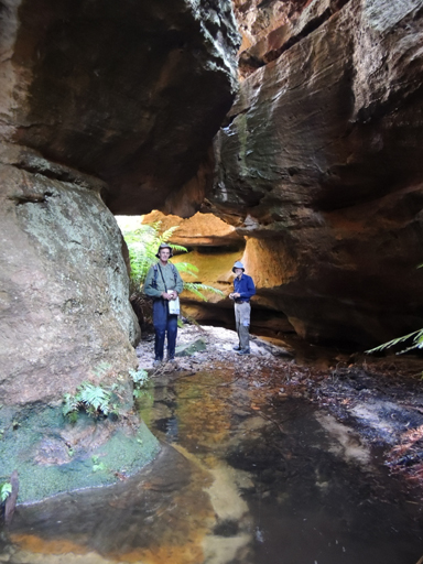
Has its headwaters on the northern side of Waratah Ridge, 700m east of the end of the vehicular road. This creek flows generally north east for about 3.5km, with many convolutions, into Dingo Creek.
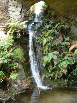
Are located midway along Popeye Creek. They have a height of 8m, flowing into a sandy bottom pool. Both names are derived from the canyon name within this creek, Popeye Canyon.
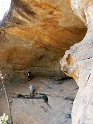
Is located 500m north west of Mount Clarence and Clarence Trig Station. It is named after Ken Poppett by his granddaughter Kallie Poppett in 2010. Within this cave are anumber of names and the date 1944. Also a drawing of a kangaroo (non indigenous). The cave is 20m wide, 8m deep and approximately 10m high.
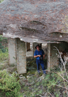
Refers to a natural pagoda, located on the cliff top directly above the Main Western Line, between Tunnels No. 9 and 10. This pagoda has been underpinned by eight brick columns to prevent it collapsing onto the railway line below. Named by Michael Keats on a Bush Club walk, 6th February 2012. Caryatids are sculpted female figures serving as architectural supports taking the place of a column or a pillar. One of the best known examples is a porch annex to the Parthenon on the Acropolis in Athens, Greece.
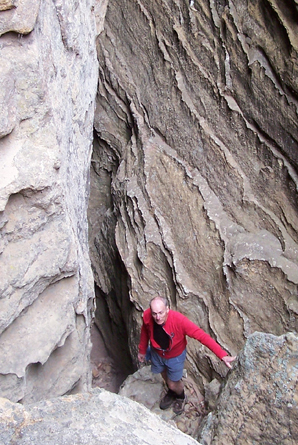
See Donkey Mountain, north east section
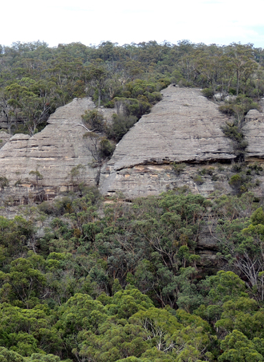
Is a north south trending ridge complex on the south side of Moffitts Trail, between Hades Ridge on the east and Zeus Ridge on the west. The central ridge is Poseidon Ridge. Named by Michael Keats on a Bush Club walk, 16th April 2010. Poseidon was a Greek god of the sea. One of the unusual pagoda formations resembles a Sea Horse, GR 228 187. Near the Sea Horse, there is The Bath of Aphrodite, an almost perfectly circular structure with an elevated rim of ironstone. The Wings of Icarus, delicate, double curved parallel sheets of ironstone, are at GR 229 183. Phoenix Rising is a very delicate formation perched on the edge of the cliff. Other names given to features on this ridge are Hannibals Elephant, a weathered rock formation resembling a dead elephant lying upside down with all four feet in the air, the Walls ofJerusalem, Footprint of the Minotaur,Thors Watch GR 281 122, Toe of Zeus GR 282 186, Orpheus and Eurydice Pagodas GR 289190, Chariot Rock GR 290 188 and Mercurys Boot GR 290 187.
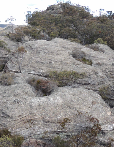
See Poseidon Arena
Is located off the northern end of Deanes Plateau above Deanes Creek. Named after Alex Pryjma of Lithgow, who walked with National Parks Assosiation. Ref: Correspondence with David Warren Noble, 14th October 2009.
Located near Clerestory Spur No. 1, 900 m south east of Beecroft Trig and accessed via Beecroft Fire Trail. Named by Michael Keats on a bushwalk, 13 June 2014, in keeping with the church architecture terms of this area. This cliff face is about 35 m high and overlooks a deep gorge.
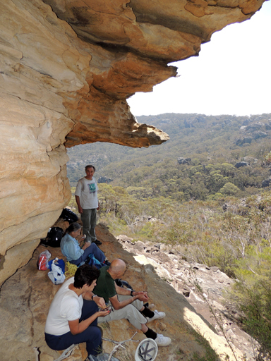
Michael Keats wrote, "A little higher up, there is a very large almost cubic rock, cleaved from the main top pagoda, with a cave hollowed out under its northern side. This is where we sheltered from the wind and rain previously to have lunch. Today, while we had lunch, it provided protection from the sun and a cool breeze. I have called this rock Providence Rock". Located above Capertee Creek 2.7km south west of Newnes. Named by Michael Keats on a bushwalk, 1st November 2013. Elevation of 926 m.
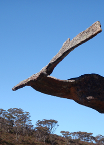
Refers to an unusual sculptured winged rock formation on the northern side of an isolated pagoda on the eastern tributary of Bungleboori Creek, 1.6km south, south east of Mount Horne. So named by Michael Keats on a Bush Club walk, 24th August 2011.
Was the local swimming hole near the former township of Newnes. The Pump House was located on the northern side of the Wolgan River at Newnes. Ref: Interview with Dick Bird and Ron Bourke, 29th January 2010. Local usage name by Dick and Ron in the 1940s.The Pump House supplied water from the Wolgan River for Newnes shale works,some distance away.
Is about 10m long by 10m wide and about 3-5m high. Located near what used to be the original water supply pump for the Newnes Oil Shale operation and close to the water hole known as the Pump Hole on the Wolgan River. Named by Erik Halbert, Sydney Speleo Society, 16th March 2014.
Was the farthest point reached by Surveyor Robert Hoddle, in October 1823. He recorded,"reached a Hill, distant 25 miles from Encampment. The summit was a sandstone rock, in the form of a Pyramid, whose base was 70 feet wide and 50 feet high, which I named Pyramid Hill". Andy Macqueen suggests the hill Hoddle climbed was Birds Rock , via Sunnyside Ridge Road, certainly the highest point in this locality at 1181m. Ref: Macqueen, Andy. Assistant Surveyor Robert Hoddle's 1823 Excursion in the Gardens of Stone - and a Dark Secret? Blue Mountains History Journal, Issue No. 6; December 2015.
Is a natural pass giving access from the cliff line down the western side of Carne Creek near opposite Pyramid Rocks, the huge triangular shaped rocks within Carne Creek gorge. Named by Yuri Bolotin during a Bush Club walk, 22nd May 2014.
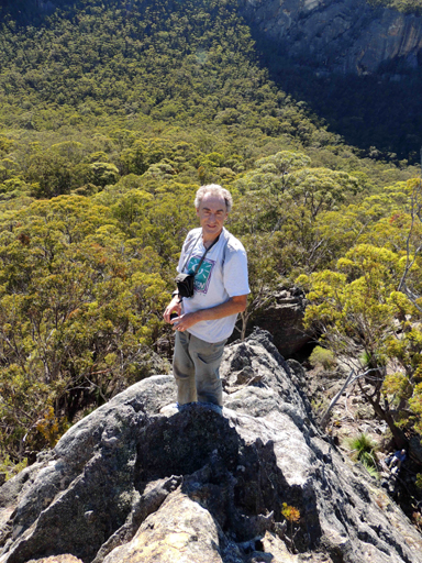
Are isolated rock formations on the eastern side of Carne Creek 1.5km west, south west of road intersection of Glowworm Tunnel Road and Firetrail No. 6. This is a descriptive name coined by Michael Keats on his Bush Club walk, 5th March 2008. The largest of these isolated pyramid shaped rocks is the Great Pyramid. The view from the top is stunning.Two spectacular features in this complex are Cleopatra Needle and Mark Anthony Slot. The GR's are the same as for Pyramid Rocks. All these were named by Michael Keats on a Bush Club walk, 31st January 2014.
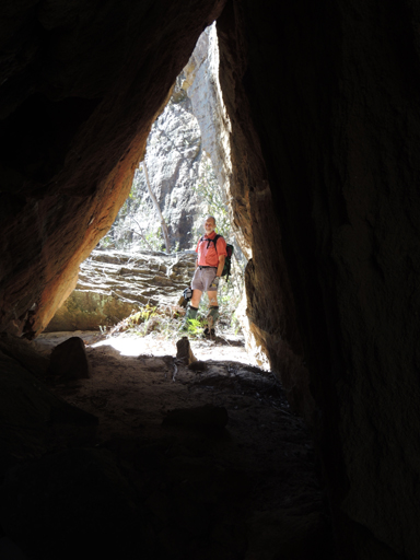
Is a light filled tunnel with a perfectly proportioned triangular profile and aperture. Located on the eastern side of Henry Creek, 2.8km north east of the junction of Glowworm Tunnel Road and Old Coach Road. Named by Michael Keats on a Bush Club walk, 17th August 2012.
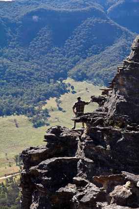
See Donkey Mountain, south west section
See Donkey Mountain, north east section
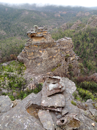
Refers to the unusual rock formation which has two 90 degrees slots and appears as though a giant has taken a huge knife and sliced through the rock, then moved a quarter segment out of it some distance. Located on the western side of Ascension Point, and above the northern side of Bungleboori Creek, 3.3km south, south east of the road intersection of Two Trees Road and Waratah Ridge Road. Named by Michael Keats on his Bush Club walk, 7th June 2012.
Is a rock formation in the shape of an arm chair on the western side of Blackmans Crown. Stephen Imrie on 10th June 2012 recalled,"this is a favourite spot with the locals."
Is located within Lost Ark Ravine, 400 m north east of Temples of Doom. This slot is 80 m long and varies in width from 1.5 m to nearly 4 m; in places, the walls are 18 m high. In keeping with local nomenclature, Yuri Bolotin named it Raiders Slot on a bushwalk, 4 September 2015.
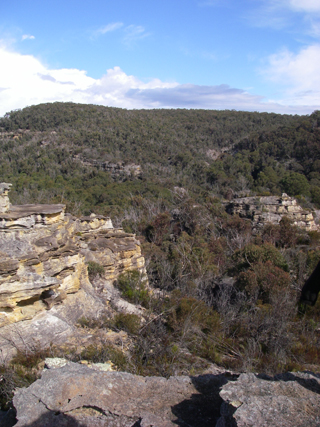
Trends east west for about 26km, having Mount Norris on its western end, GR 499 069, and the Wollangambe River on the eastern end, GR 670 043. The spine of this ridge marks the boundary between two national parks, Blue Mountains National Park on the south and the Wollemi National Park on the north.
Is a series of overhangs on the Wolgan - Capertee Divide above Petries Gully, Newnes. The honeycomb weathering is a sculptor's delight and the palette of colours - a painter's dream. Named by Michael Keats on a Bush Club walk, 4th May 2012.
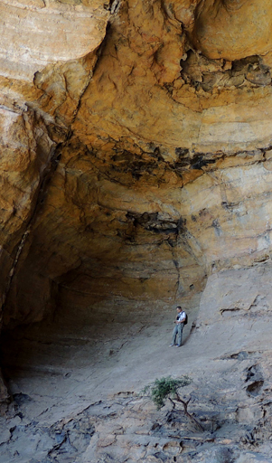
Is 40m wide, 20m high overhang located off the Glowworm Tunnel Road and Firetrail No. 7. It was first discovered by rock climber Frey Yule on a rainy weekend, c1995. Rain Cave has been described as, "No matter how hard it rains - climbing is always possible at this spot." Named in Pircher, Martin. Blue Mountains Sport Climbing Crags, 1998, 1st edition, pp. 106-107. This overhang was surveyed by Ross Ellis and Erik Halbert on 18th October 2006. Ref: The Journal of the Sydney Speleological Society, 2007, 51 (5); 136.
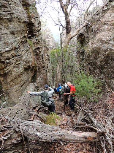
Yuri Bolotin suggested that given the acceptance of Zorro Canyon as a place name then this one should be called Rapier Slot, the rapier being one of the two weapons of choice wielded by Zorro. Located 60m west of Zorro Canyon. Yuri named it on a Bush Club walk, 20th January 2014.