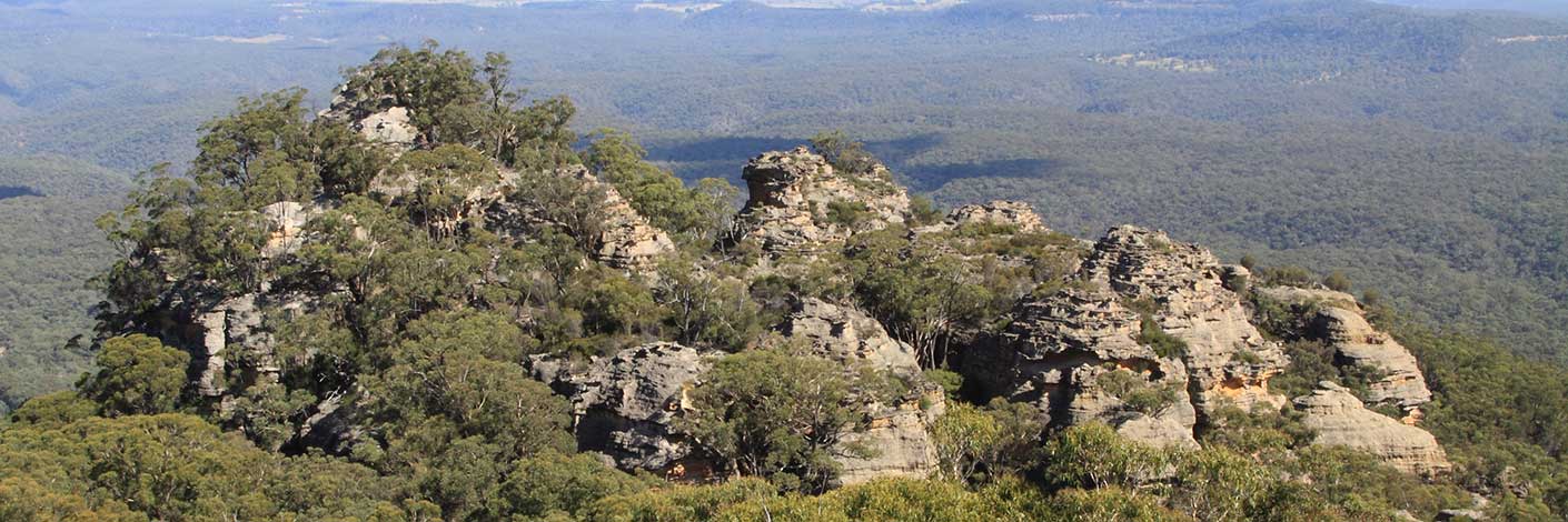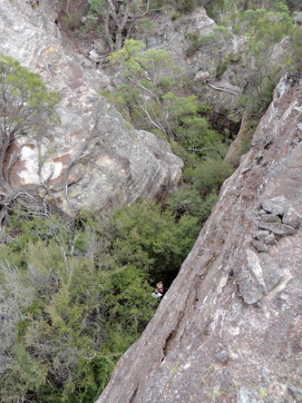
Located within the feature (northern end) known as The Five Ladies. Walking access via Waratah Ridge Road. Named by Hugh Speirs, 3rd March 2014, in recognition of Harold Thompson from his Bushrangers walking group.
Located within the feature (northern end) known as The Five Ladies. Walking access via Waratah Ridge Road. Named by Hugh Speirs, 3rd March 2014, in recognition of Harold Thompson from his Bushrangers walking group.
Is traversed by the Hartley Vale Road, giving access from Hartley Vale to the top of the Darling Causeway. This pass also is the site of several abandoned coal and shale oil adits.
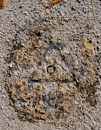
Is located on a side track and accessed via Browns Gap Road and Hassans Walls Road. This trig is recorded on the Parish of Lett, 2nd edition, 1889. On the 1st January 1930 the Royal Australian Survey Corps repositioned the trig. It has an elevation of 1141.278m. All that remains of this trig is just a shape of a triangle and drill hole in the rock next to the old shelter shed. Ref: Lands Department SCIMS Survey Mark Report.
During the period when oil was being extracted from shale oil (torbanite) between 1865 to 1870 Hartley Valewas known as Petrolea Vale uring the period when oil was being extracted from shale oil (torbanite) between 1865 to 1870. Ref: Pells, Philip and Hammon, Philip. The Burning Mists of Time, 2009, p. 35. The Goulburn Herald and Chronicle 25th November 1865, p. 5. At Hartley Vale two companies were launched within months of each other in the second half of 1865, first the Hartley Kerosene Oil and Paraffine Co. Ltd., then the Western Kerosene Oil Co. The HKOPCL made the initial running, establishing the Petrolea Vale retorts and refinery in the valley and marketing Star brand kerosene. By 1868 the company had sixty employees mostly living in a sizeable private village and a new bench of retorts of a more advanced shape was installed. The Petrolea Vale retorts and refinery closed down in 1870.
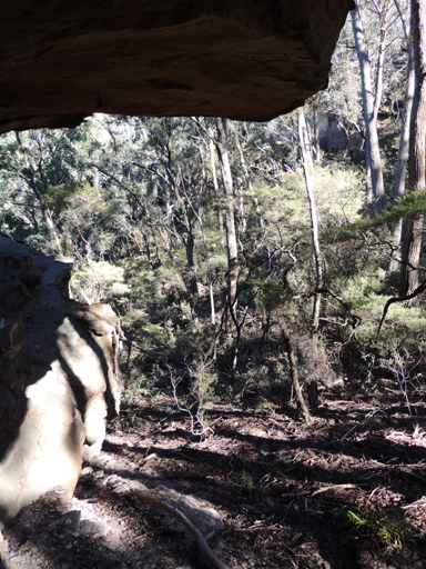
Is a gully near the turnoff to the Hassans Walls Lookout, Lithgow. A walking track commences a few metres north east of the sign at the turnoff. Lithgow Mercury, 8th January 1915, p. 6, records,"After some discussion a name was given to the new beauty spot. ... it was decided to call it "Hassan's Glen," on the suggestion of Mr. Langlands."Hassans Glen contains Sandford Cave, Braceys Lookout (1915), Pillans Lookout, Dooleys Lookout, Hoskins Cave, Ryan Cave, Gannon Cave, Cook Cave and a track to King Georges Head and Anzac Ridge.
Is a locality name, Hassans Walls is shown on the map, Sketch of the Road to Bathurst marked out in 1830 according to a sketch made in 1827. Ref: SRNSW: AO Map No. 5027. The Survey Plan 41.691, dated 9th October 1832 shows two allotments of land sold and buildings for the ‘Bridge Party’, the road labelled as Major Mitchells Road. A post office was establishedin 1834 as a midway point between Penrith and Bathurst, the mail being delivered twice a week. Ref: Sydney Gazette and NSW Advertiser 8th July 1834, p. 2. The Travellers Inn was in operation by 1835. Ref: The Sydney Morning Herald, 20th July 1845, p. 2.

is the name given to the line of cliffs on the southern side of Lithgow between Browns Gap and South Bowenfels. Possibly named by Governor Macquarie during his official tour over the Blue Mountains to Bathurst in April 1815 as it reminded him of when he was stationed in Hassan, India; the mountains there were called the Walls of Hassan. Survey Plans, dated 1832 show land ownership near Hassans Walls. Ref: Sydney Gazette and NSW Advertiser, 23rd August 1832, p. 1. Names within this area were listed as separate entries and included: Padleys Pedestal, Padleys Pedestal Trig Station*, The Dukes Head / King Georges Head, The Ridges: Anzac, Wilton, Clwydd, Cooerwull; Lookouts: Finnigans, Braceys, Pillans; Glens and Gullies: Rutherford, Hassans, Pavilion, Caves: Cook, Gannon, Hoskins, Ryan, Hur1ey, Ronald and Sandford. Tracks: Undercliff Path / Track, Hay Steps, Heffernan Pass and Padleys Pass. See Gardens of Stone National Park and beyond, Book 7, Walk 7.21, for detailed Track Notes.
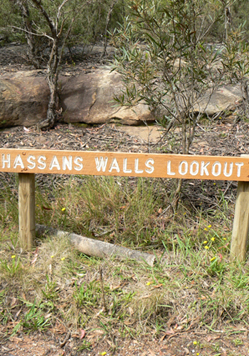
See Hassans Walls
Refers to the main lookout area and highest point, 200m north of Padleys Pedestal Trig Station. Access via Hassans Walls Road, Lithgow. Shown on the Katoomba Topo Map 1:63360, 1935 at 3723ft (1135m). Ref: Lithgow Mercury, 4th February 1910, p. 3.
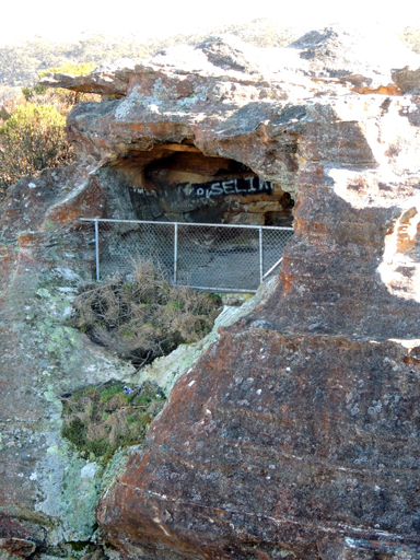
Is a small cave on the edge of the cliff. It is accessed by a hole that has been cut in the back wall of the cave. About 50m west of Padleys Pedestal Trig Station. The opening is about 80cm wide, 1.25m high and leads into semi spherical chamber about five metres wide, four metres long and over two metres high. A chain link fence protects the visitor from the 50m drop. Ref: The Journal of the Sydney Speleological Society, Vol. 60; No. 4, April 2016, pp. 108,110-115.
Includes an area of over 780ha. The northern perimeter of the Reserve abuts Lithgow’s residential and industrial areas, while the Reserve’s southern boundary adjoins the Great Western Highway. Hassans Walls Road provides access to the Reserve from either Lithgow township or via Browns Gap Road. This reserve has been added to from the first Gazettal Notice, Notified 15th November 1882 to the present day size in 1978. Trustees were appointed from 1892. Ref: Parish of Lett, 2nd edition, 1889.
Refers to the long cliff line on the eastern side of Wolgan Gap Trig Station which overlooks the southern part of the Wolgan Valley. Name recorded in Taylor, Pete and Penney, Andrew. The Wolgan Guide,1984, p. 110 and 125. So named by Mike Law and Pete Taylor after the "hassle" to walk there in scorching heat from the valley floor, c1975.
Is a very small 200m spur east of Capstan Spur within the area known as The Barnacles, it was named by Michael Keats on a Bush Club walk, 14th September 2015. This spur ends as an abrupt rock face with a concealed cave at the southern end. This cave can be entered from the top just like the hatch on a vessel and hence named The Hatch, and the spur, Hatch Spur. Also at the southern end of the spur is a large block like feature and given its shape and disposition was named by Yuri Bolotin as The Rudder , GR 492 907. WollangambeTopo Map.
Is a rock balcony located on the northern tip of Point Hatteras with amazing views to the north. Named by Michael Keats on Bush Club walk, 7th September 2015.
Refers to the highly unstable section of the cliff line below Point Hatteras at Airly. Named by Michael Keats on Bush Club walk, 7th September 2015.
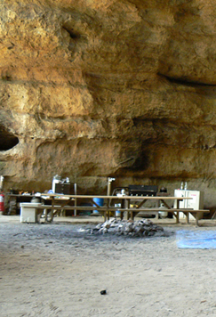
Overlooks Monkey Creek. Access 800m south east of the road intersection of Valley View Road and Bells Line of Road. Postal address is 213 Chifley Road, Bell. This huge sandstone cave has a height of 25m and a depth of 20m. Hatters Cave is set out with lighting, cooking, tables and chairs and is available for renting out. It is approved as accommodation site by Lithgow City Council. Named by the owner, Mark O'Carrigan, in 1981, when he was exploring the area. In a previous career, Mark was a professional hat maker. Note, this cave is on private property.
Maybe the stone steps or stone slabs of the top section of Pavilion Gully in the vicinity of the communications tower at Hassans Walls, Lithgow. There is a Hay Street, Lithgow which was named after Robert Hay (1857-1909) who was the manager of Oakey Park Colliery. Lithgow Mercury, 8th January 1913, p. 2 records a Mrs Hay who was Robert’s wife and who lived in Hassans Walls Road.
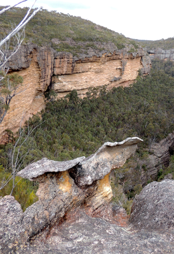
Has its headwaters on the western side of Galah Mountain. It flows generally in north, north eastern direction for about 7.5km till it joins Rocky Creek. Within this creek is the canyon called Heart Attack Canyon. It was entered in early 1976 by a party led by Chris Cosgrove. The name was coined because the party was woken in the morning at the former Bell by someone wanting to use the phone to report a person having a heart attack. Ref: Kameruka Magazine, September 1977, Vol. 15. No. 1, p. 10.
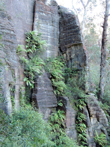
Refers to the pagoda studded area on the northern side of Bungleboori Creek, accessed via fire trails from Waratah Ridge. This area includes named features, Dead SeaScroll, Angels Window and Ascension Point. The view from this area to the south includes Holts Heaven. Named by Michael Keats on a Bush Club walk, 25th June 2012, in keeping with the heavenly named themes of this locality.
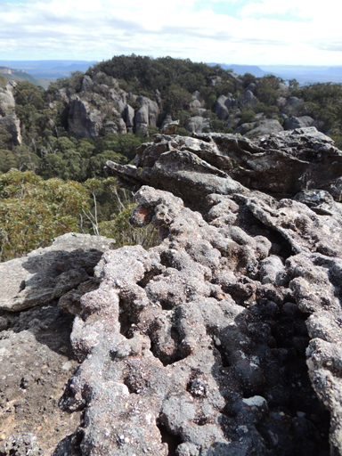
Is an area of land on the western side of the Great Dividing Range and south of the Baal Bone Gap - Mount McLean ridge line. Hecate is a Greco-Roman goddess associated with magic and crossroads. Named by Michael Keats of The Bush Club, June 2010. Michael describes it as, "This country is another world - a world of soaring rocky pagodas, tens of metres high, joined by fern filled chasms and slots and peppered with large Eucalypts."
Runs along the spur line from the western end of Hassans Walls towards Old Bowenfels. Name suggested by James Padley to the Lithgow Progress Association after Benjamin Alfred Heffernan (1875-1937), Engineer, Blaxland Shire Council who had graded the track. Ref: Lithgow Mercury, 4th June 1915, p. 6. This track is shown on the Hartley Topo Map.
Is a natural pass south east of Hagar Castle from Rocky Creek to above the cliff line. Name suggested by Michael Keats on his Bush Club walk, 1st October 2008. This name followed the description and naming of Hagars Castle by Ian Thorpe. In the comic strip, Helga is Hagar the Horrible's dominating wife.

Henry Canyon is within Henry Creek which has its headwaters on the eastern side of Glowworm Tunnel Road near Deanes Siding, it flows in a generally northern direction for about 5km until it joins Deanes Creek. Named after Henry Deane by Michael Keats on a Bush Club walk, 22nd July 2012. Within Henry Creek is a delightful, fern filled canyon, named Henry Canyon by Michael Keats
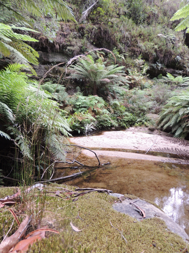
Has its headwaters on the eastern side of Glowworm Tunnel Road near Deanes Siding, it flows in a generally northern direction for about 5km until it joins Deanes Creek. Named after Henry Deane by Michael Keats on a Bush Club walk, 22nd July 2012. Within this creek system, from GR 435 160 to GR 436 172, is a delightful, fern filled canyon, named Henry Canyon by Michael Keats.
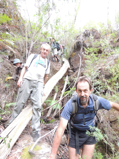
Gives walking access from the Old Coach Road down into Henry Creek and Henry Canyon. Named by Michael Keats and Brian Fox on a Bush Club walk, 25th January 2013.
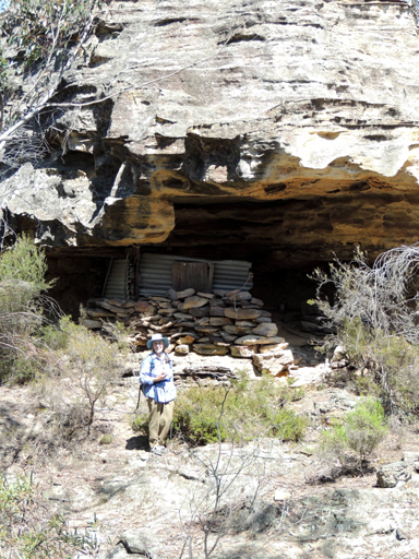
Is located on the eastern side of Neubecks Spur, overlooking Neubecks Creek. It is about 900m long. Named by Brian Fox and Michael Keats on a Bush Club walk, 19th October 2012. A cave on the end of this short spur has been modified and converted into rough accommodation.
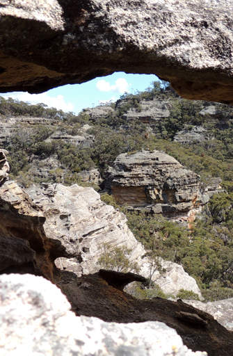
Hero Pass is the pass from the eastern side of Mount Stewart and traversing the spur line on the eastern side of Hughes Defile, to Hero Point. Hero Ravine is the next deeply incised ravine to the east of Hughes Defile and headwaters of Sapling Flat Creek, 329 219 to 330 215. Named by Michael Keats on Bush Club walk, 21st September 2015.
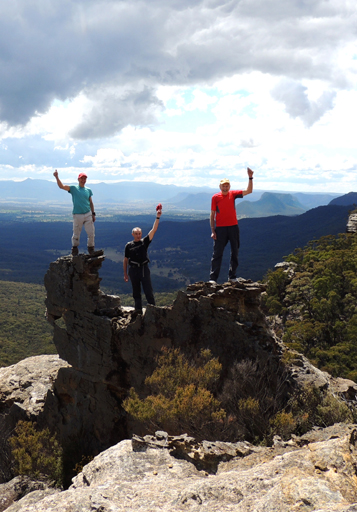
Refers to the high point of rocky outcrop on the western end of a narrow spur on the eastern side of Hughes Defile with uninterrupted views overlooking the Capertee Valley. Named by Michael Keats and Yuri Bolotin. Hero Pass is the pass from the eastern side of Mount Stewart and traversing the spur line on the eastern side of Hughes Defile, 327 219 to 328 218 to Hero Point. Hero Ravine is the next deeply incised ravine to the east of Hughes Defile and headwaters of Sapling Flat Creek, 329 219 to 330 215. Named by Michael Keats on Bush Club walk, 21st September 2015.
Hero Ravine is the next deeply incised ravine to the east of Hughes Defile and headwaters of Sapling Flat Creek. Named by Michael Keats on Bush Club walk 21st September 2015.
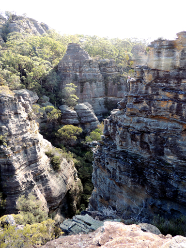
Is a cliff lined, pagoda topped, narrow tributary of Genowlan Creek, 500m north, north east of Genowlan Trig Station. This narrow defile is orientated north south and 400m in length. Named by Dr Haydn Washington, November 1984. Ref: Correspondence with David Blackwell, 27th April 2010 and Haydn’s map.
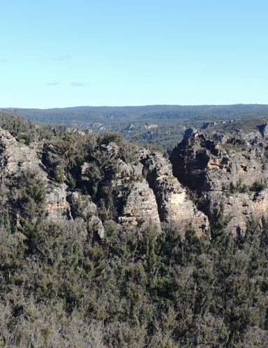
Is a pagoda filled area located some 500m above and on the southern side of Bungleboori Creek. Named by Peter Fox on a National Parks Association bushwalk, July 2003 after his friend, Michael John Holt who was one of the walkers on the day. Michael had seen something interesting on an aerial photograph in this area prior to the walk.
Is a tight, narrow and relatively deep, short, dry canyon on the southern side of the Wolgan River, 1.4km east of Wolgan Gap. Before and above the cliff line, the canyon ends in a rectangula rroom, some 10m x 40m, surrounded on all sides by soaring cliffs and, centrally disposed in this room, is a clump of 12 Brown Barrel Gums. Michael Keats on a Bush Club walk, 4th October 2013, named this feature The Covenant Room and the ravine, Holy Grail Ravine. Names chosen were in keeping with Indiana Jones movie themes for this area.
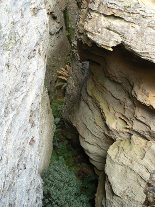
Is a 600m long canyon, generally orientated north south, having its southern entrance near the intersection of the GlowwormTunnel Track and the Pagoda Track. It was first explored by Andrew Valja and Dave Lockwood in 2001.
Are 10m high and are located 300m north of Mount Dawson, in the same vicinity as the Infra Red Spectrum Cave. Named by Steve Murray on a Bush Club walk, 12th September 2009. So named due the semicircular shape.
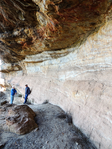
Is the first rock overhang on the upper track on the right hand (western) side of Hassans Glen, within Hassans Walls Reserve, Lithgow. Named after Charles Henry Hoskins (1851-1926). In 1907, Charles took over the Sandford steelworks and in 1919-20 Charles bought his brother's share and formed Hoskins Iron and Steel Co. Ltd. He gave the 50,000 pounds to build the Hoskins Memorial Church (Presbyterian) at Lithgow. Ref: Lithgow Mercury, 14th May 1915, p. 4. Forty metres further along from Hoskins Cave is Ryans Cave.
Refers to the hill immediately behind (west) of the old Newnes Hotel. Named by Thomas Ebersoll, owner of the old Newnes Hotel and shown on his hand drawn map The Newnes Area, 2005.
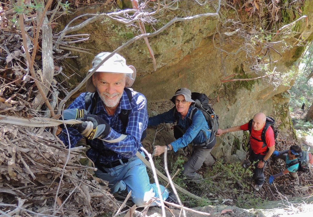
Is a way of route from Wolgan Road which breaches the Wolgan Valley cliff line opposite Donkey Mountain,1.4km east of Collett Gap. Ross Howard owns the property where permission must be gained to cross from Wolgan Road to the Wollemi National Park boundary. Named by Yuri Bolotin, Michael Keats and Brian Fox on a Bush Club walk 6th March 2017.
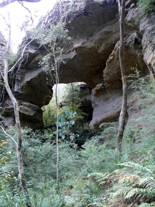
Is accessed via Glowworm Tunnel Road, Eastern Boundary Road and Deep Pass Trail. It is approximately 750m south west towards and above Dingo Creek. Described by Michael Keats as,"Upstream of the arch is a very large, almost circular void, 30m in diameter, 35m - 40m deep, with the gully at the back, delivering a small waterfall into the void.The arch aperture is roughly rectangular, about 35m high and about 15m wide.The "roof" of the arch is very solid, possibly 5m thick. On the downstream side, the western cliffs are close to vertical, visually exaggerating the scale of the site."Named on 19th July 2010 by Brian Fox. This arch was shown to us by Karen McLauglin and Andrew Valjia, who had also seen a reference to this arch in an article dated 1957. So named as it is in the locality of the "wild dog" names - Dingo Creek, Cerberus Creek and Little Cerberus Creek.
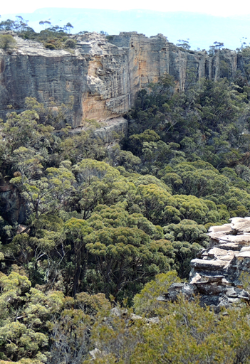
Is a deep saddle connecting the Capertee and Wolgan Valleys. The northern end is located at the head of Sapling Flat Creek, about 1km south of Mount Stewart and 1.5km north east of Wolgan Trig Station. The Geological Map of the Capertee and Wolgan Valleys by Joseph Carne, 1901, shows a bridle track through Hughes Defile. Shown on the map Parish of Wolgan, 1884. Joseph Hughes was born on 2nd July 1840, the second son of Edward Hughes, a convict transported to Sydney in 1823. In 1832, Edward Hughes was sent to work for James Walker on his property, Wallerawang. Two months before Joseph was born, Edward received formal pardon. However, being the son of a convict meant limited job opportunities, so Joseph became a bullock driver. After marrying Agnes Eager Black, he settled at Wolgan Gap. Ref: Edward - Anne Hughes Reunion, Black Springs, 27th November 1988, compiled by Josie Noonan, Lithgow and District Family History Society. Joseph Hughes selected his first 40ac in the Wolgan Valley on the 1st April 1869. Ref: Survey Plan CP1038-69 (about 3km south, south east of Hughes Defile). He went on to purchase three other 40ac parcels of land. Ref: Survey Plan C403.1507 and CP3767-70. Joseph's sisters Rebecca and Julia both married into the Murray family who had the earliest connections with the Wolgan Valley through their grandparents, Edward (Ned) and Rosannah (Rose) Murray. Ref: Murray family tree. John McLean owned extensive land holdings in the Capertee Valley and leased the property Wolgan after James Walker's death. John McLean had cut a pass to allow access to both the Capertee and Wolgan Valleys for the ease of agisting his stock. Ref: Coxon, Betty. Not Lost but Gone Before. A Family History of the McLeans of Capertee, 1999, p. 20.
Note: The Survey Plan 403.1507 dated 12 June 1869 records as Capertee Gap.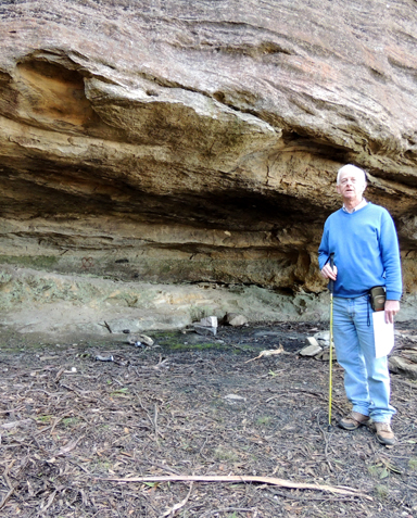
Is located on the eastern side near the top of Rutherford Glen within Hassans Walls Reserve, Lithgow. Named after John Hurley (1844-1911) MLA for Hartley. Ref: Lithgow Mercury, 18th May 1917, p. 6.
Extends from Glen Davis Road, 4.5km from Capertee, and follows a ridge line for 3km in a south east direction, ending above Airly Creek. A hut used to exist about 100m south of the junction with Glen Davis Road. A few shards of pottery, glass and rusting tin are all that remains of this hut.
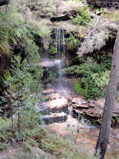
See Ida Falls Creek
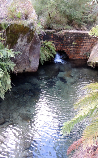
Rises above the Bells Line of Road between the Zig Zag Railway Line on the east and Scenic Hill on the western side. It flows for about 3km generally north by west into Farmers Creek. Ida Falls within this creek have quite a few old names and dates written on the surrounding cliff faces, several dating to 1893. The Australian Town and Country Journal, 13th January 1894, p. 31; col. 2, records,"Lithgow-favourite holiday resorts...The most noteworthy of these are...Ida Waterfalls. The last mentioned, strange to say, although but 2 1/2 miles from the town, were only discovered by some old fossicker, I believe, a few months ago."
Yuri Bolotin’s description of the challenge of reaching the Impossible Cave is worthy of repeating, “Idecided we should all climb up the rock face and have a look, as that would be about the right height to access Geoff’s Impossible Cave on Donkey Mountain. A sharp but straight forward scramble brought us to the ledge above, which continued around a protruding cliff face and into another, very steep gully. This gully contains a big cave-like space of probably 20m on all sides. A little bit further up it turns into a very tight canyon slot. Ev managed to squeeze through and climb some distance in it but was stopped by sheer cliffs. We concluded that this large space is in fact the Impossible Cave”. Geoff Fox started to use this name to describe the cave in 2010. (Personal communication with Geoff Fox 24th May 2018).
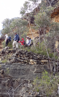
Refers to a cave and constructed pathway, situated on the Wolgan - Capertee Divide, with old internal infrastructure that was seen by a bush walking party led by Barry Higgins on the 3rd October 1977. Barry had likened it to the cliff trails of the South American Inca people and hence named it so. Ref: Track notes from Wilf Hilder's collection held by Stephen Imrie. David Warren Noble was also on this walk.
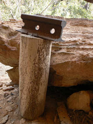
David Warren Noble added this name on his map of the area. A Bush Club walk on the 19th May 2012 to this location resulted in a much more extensive find and research results. The Newnes Investigation Committee had employed surveyor Reginald Henry Pocock, who in 1933 compiled contour surveys for works and township sites (future Glen Davis) and also trial lines for a railway and/or aerial ropeway from Newnes to Glen Davis, if required. Pocock also recorded that the survey party used a cave to sleep in, to avoid the steep walking daily to and from camp. Ref: Pocock, R. H. Every Day a Picnic. A Surveyors Story. Reproduced within Stateworks, January / February 1987, pp. 28-32. Extensive dry stonewalling extends from this cave for about 300m in a generally northerly direction.
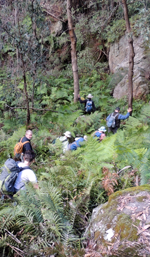
Is a 400m gorge, filled with a carpet of green bracken; it consists of side overhangs, slots and isolated pagodas. Indiana Slot is just one of these side slots being about 40m in length and for the most part 50cm in width. The gorge is located on the southern side of the upper Wolgan River cliff line and on the northern side of the junction of Blackfellows Hand Trail and Fire trail No. 5. Named by Yuri Bolotin on a Bush Club walk, 22nd July 2013, in keeping with the named theme, The Temples of Doom, which are located about 800m south west.
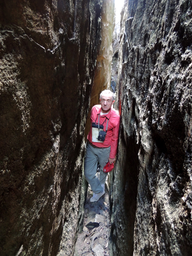
See Indiana Gorge
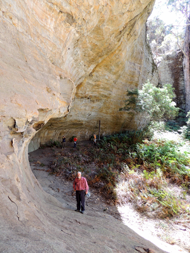
Are five near inaccessible, huge, orbicular overhangs on the western side of Endorphin Gully subtended beneath towering rock blades capped with pagodas. Named by Michael Keats on Bush Club walk, 3rd February 2014,
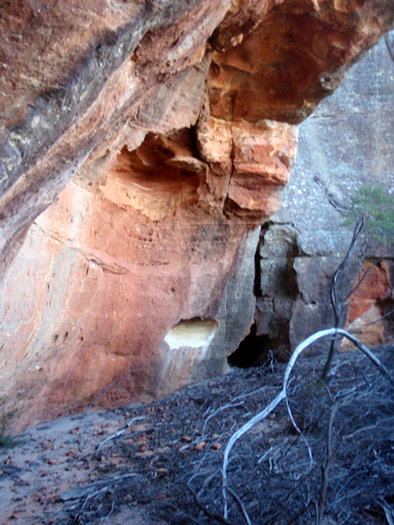
Is located 300m north of Mount Dawson. This large cave near the top of Mount Dawson Pass could accommodate perhaps six tents, having a good, flat, sandy floor. Named by Michael Keats on his Bush Club walk, on 12th September 2009, due to the yellow, orange and red spectrum of colours within the sandstone walls.