Invincible Trig Station
*
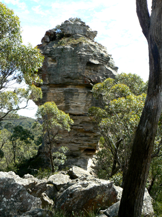
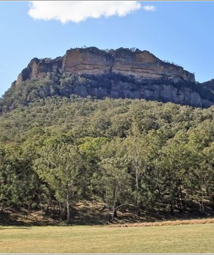
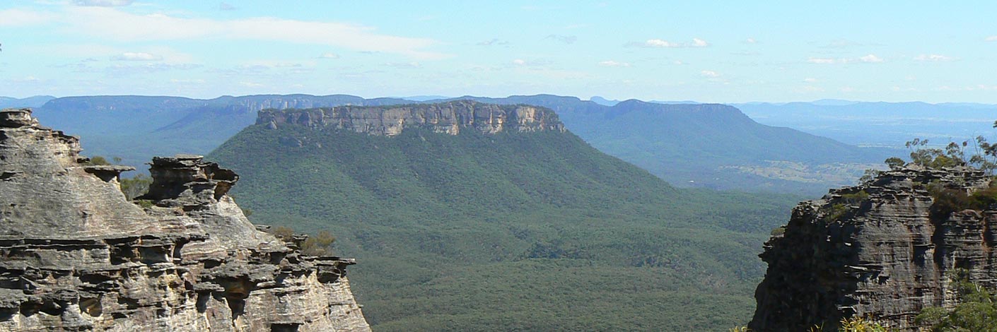
Elevation 1060m, is located on the Great Dividing Range, overlooking Invincible Colliery. It lies 3.5km south, south east of Cullen Bullen. This section of the Great Dividing Range is the boundary of the parishes Cox and Cullen Bullen. A fire trail along this range gives access to this trig station.
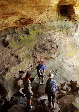
Invincible View Cave
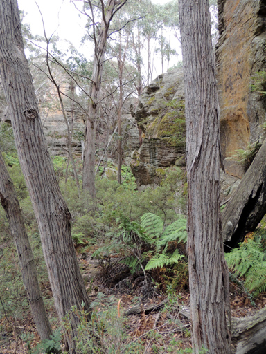
Is estimated as having a 20m long drip line, and being 15m deep and 10m high. It also has graffiti. Two examples are decipherable, G. Rutherford and T or J Wilson. Named by Yuri Bolotin on a Bush Club walk, 30th August 2103, due to it having a view across the gully to Invincible Trig Station, 600m to the south west.
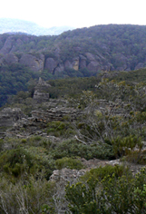
Island Mountain
Is not so much a mountain but rather an elevated area bounded on three sides, west, north and east, by a huge loop of the Wolgan River. The southern side is Deanes Creek. This proscribed area is about 24sqkm. The Sydney Morning Herald, 10th January 1906, p. 7, ProposedTramway Route, records engineering difficulties in crossing Constance Gorge and Island Mountain. Other References; Tramway from Wolgan to Clarence. Survey Plan M12435. Surveyed by John Haydon Cardew, Licensed Surveyor, 13th December 1905.
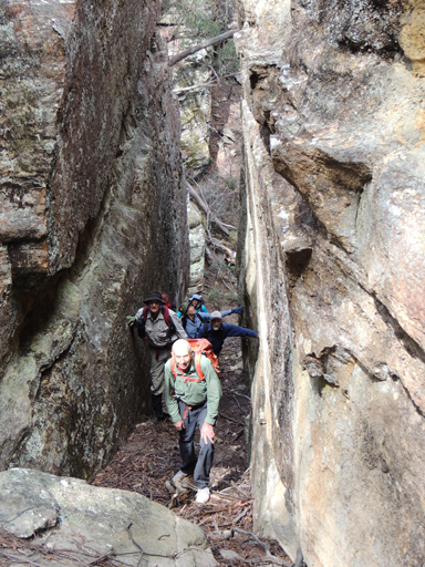
Jackass Gap
Is a name shown on a mud map of part of the Airly region prepared for the Cowie family reunion in 1984. A walking track shown on the map records walking access from the valley floor GR 239 329 south of the property now known as Rock Bottom up a creek system and through a gap in the cliff line, Jackass Gap to the top of the mountain 245 326.
Jacks Camp
*
Is a locality name near the Wolgan River and Wolgan Road,about 7km north of Wolgan Gap. Accessed via Wolgan Road. Originally Jacks Camp was set aside as a Water Reserve No. 22, of 25 acres. It was notified in the NSW Government Gazette on 19th January 1875. The reserve was revoked on the 12th April 1935. The Survey Plan, 5-2062, Parish of Wolgan, dated 1874, shows the text, " Crossing place" (across a swamp) and the words, "Jack's Camp". Named after the adjacent property owner, Jack Lamb. Ref: Joe Bird (who owned land in this vicinity),oral account to Brian Fox, 15th June 2009. A number of the Lamb family members held land in this area - Frederick, William and Albert Lamb. Ref: Survey Plan 495, 518, 612, 1856 and 1858.1507.
Jaimes Lookout
Is located on the top of the cliff line and on the western side of Genowlan Mountain. Named after Jaime Plaza Van Roon, a professional photographer for the Royal Botanic Gardens. Jaime walked a number of times with the proponents of the Gardens of Stone, Dr Haydn Washington, Rodney Falconer and David Blackwell, c1984.
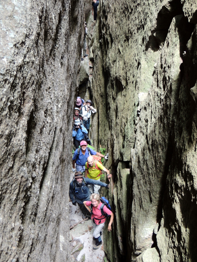
Jamison Pass
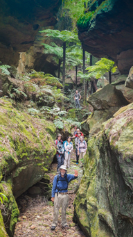
Refers to the huge cleft on the northern side of Mount Jamison on the Wolgan - Capertee Divide. This pass has a width varying from 1 to 20m and sandstone walls between 10 to 20m in height, its length is about 300m. The pass, though not easy in the middle section, gives access to top and bottom of the main cliff line. Named by Michael Keats on a Bush Club walk, 30th September 2013.
Note:- The top section has also been known as, The Chasm
Jamison Pass South
Jamison Pass South is a natural pass on the southern side of Mount Jamison on the Capertee / Wolgan Divide. This pass gives access from the divide down into the Wolgan Valley via the headwaters of Barton Creek. Named by Yuri Bolotin on a bush walk 11 January 2019.

Jedi Point
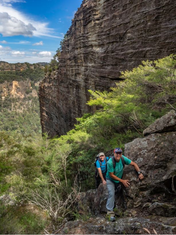
Is located on the top of the Wolgan Valley’s highest cliff line, 1.3 km east of the propertyKoopartoo and above Kenobi Canyon. Named by Yuri Bolotin on a bushwalk on 30 September 2017 in sympathy with Kenobi Canyon below it and because this is a spot that any Jedi Master, such as Kenobi, would be proud to stand on whilst talking to the young Initiates. A Jedi (J-E-D-A-I) is a member of Jedi Order of key protagonists of the Star War movies. They use the Force to uphold peace and justice in the Galactic.
Jedi Slot
Is located 1.1km due east of the property Kooparartoo and gives access up the final cliff line to the feature known as Jedi Point. Named by Yuri Bolotin on a bushwalk on 1 March 2019 after Jedi Point.
Jenny Craig
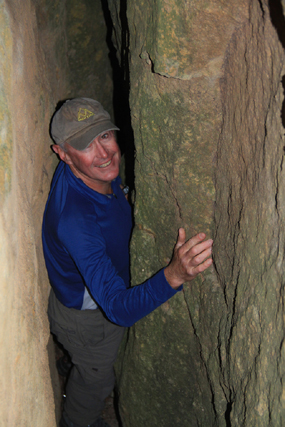
See Donkey Mountain, north east section
Jews Creek
*
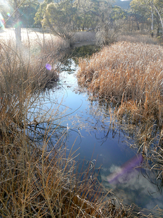
Has its many tributaries on the Great Dividing Range, 5.5km east of Ben Bullen and 2km west of Baal Bone Gap. It flows for about 14km generally south west, then west and north into the Turon River. The Sydney Gazette, 10th August 1844, p. 1, records that at Jews Creek there was a boiling establishment. One of the by products was to extract tallow from sheep fat to make candles. The Maitland Mercury, 3rd August 1844, p. 3, records,"The Boiling Establishment at Jews Creek is now in full operation, capable of boiling down 3,500 sheep or 300 head of cattle per week." Jews Creek was most likely named due to the Jewish owners nearby. Ref: Rolls, Eric. A Million - Wild Acres, 1981, p. 146. Lang, John Dunmore. An Historical and Statistical Account of New South Wales, 1875, p. 221 records, "Kuen Guen, or Jew's Creek."

Jim Percys Seat
Refers to a natural seat like formation on top of the cliff line overlooking Carne Creek. Located 3.3km north east of Birds Rock Trig. Access via eastern end of Birds Rock Trail off Sunnyside Ridge Road. Jim in his 80s has led many walks for the Blue Mountains Conservation Society, the Sydney Bushwalkers and NPWS. To honour Jim's involvement in the bushwalking leadership this feature was named by Hugh Speirs when leading a Conservation Society walk, 3rd August 2013.
Johns Rock
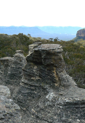
Is accessed via Wolgan Road and Blackfellows Hand Trail. It is located about 700m east, north east of Blackfellows Hand Rock and has views to the north over the Wolgan Valley. Named after John Eric Noble (1924-1995), it is a special place visited by the Woody Pear Walking Group. It is here that the ashes of John Noble were scattered, July 1995. Ref: Olive Noble's track notes and interview, 27th August 2010.
Joseph Creek
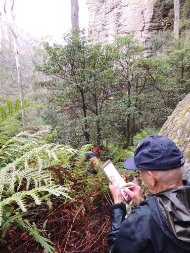
Has its headwaters between the road intersection of Glowworm Tunnel Road and Firetrail No. 5. It flows south, south west for 1.2km into Carne Creek. Named by Michael Keats on his Bush Club walk, 16th February 2007 after Joseph Edmund Carne (1855-1922), a brilliant geologist, Curator of the Mining and Geological Museum and Government Geologist in 1916.
Junction Swamp
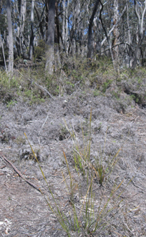
Is near the junction of Blackfellows Hand Trail and Beecroft Firetrail. This is the headwaters of the Wolgan River. Known by this name from at least by 2001 by consulting environmentalist Ray Mjadwesch. By 2014 this swamps vegetation dead.
Jurassic Gorge
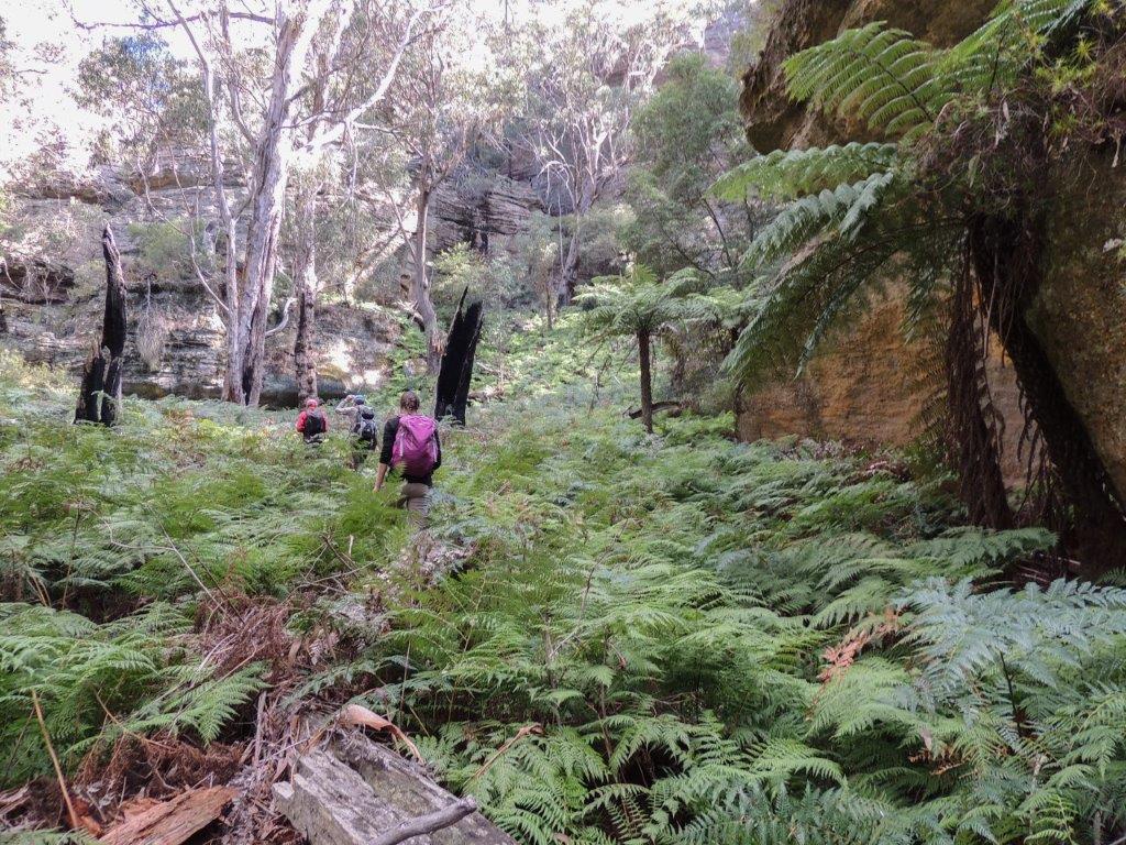
Was named by Yuri Bolotin on 30 July 2018. He records, “By 1402, we reached Genowlan Creek in the area known as Jurassic Park. As everywhere else we had been today, this location was in the grip of severe drought. Still, it retained the pre-historic feel that must be responsible for its name – giant Tree Ferns line the creek banks covered in smaller ferns and Bracken. One could imagine it would look so much better and more luxuriant after a bit of rain. I thought it would be appropriate to name the wild gorge we had followed from the tops (Paddys Mountain) all the way here, Jurassic Gorge.”
Jurassic Park
Is located near the headwaters of Genowlan Creek,1.4km north east of the communication tower at Airly. Named by Colin (Col) Maxwell Ribaux, former local land owner. The descriptive name comes from Steven Spielberg's 1993 movie, Jurassic Park.
Kangaroo Corner Creek
*
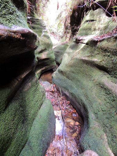
Is a partly perennial stream rising on the western slopes of the Blue Mountains Range about 1.5km north west of Bell. It flows generally south, south west and west for about 4km to meet Dargans Creek and become the River Lett. The descriptive name comes from the Kangaroos seen and located in the corner of this valley.
Kangaroo Creek
*
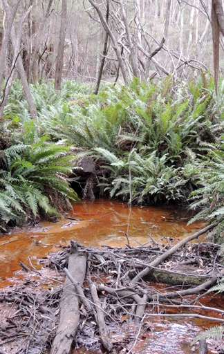
Is a watercourse rising about 6.5km east of the village of Lidsdale. It flows for about 9km generally north and west into Long Swamp, which is the headwaters of the Coxs River. Name recorded on the Survey Plan C210.1507 dated 11 September 1863.
Kangaroo Flat
Is located at the headwaters of Kangaroo Creek. This flat area has the headwaters of the Wolgan River on the north side. Marrangaroo Creek headwaters on the south side and Kangaroo Creek headwaters on the western side. It is also the road junctions for the Blackfellows Hand Trail and Beecroft Firetrail. Ref: Name via correspondence with Danny Whitty, 3rd July 2010. Local usage name c1960s. Edward Murray (see Murrays Swamp ) died 3rd February 1862 at Kangaroo Creek, his granddaughter Rosanna Noon was born 8th March 1854 at Kangaroo Creek. Ref: Descendants of Edward Murray and Rosannah McConvil, prepared by EanJones. Name shown on Survey Plan 210.1507, dated 11th September 1863. It would have been so named due to the Kangaroos in this region. Kangaroos Creek Road joins Beecroft Firetrail and midway crosses Kangaroo Creek.
Kangaroos Creek Road
Heads north from Beecroft Firetrail and links Blackfellows Hand Trail. So named as it crosses Kangaroo Creek. The name is unusal to call a road, as all other roads in this area are referred to as Fire trails.
Kenobi Canyon
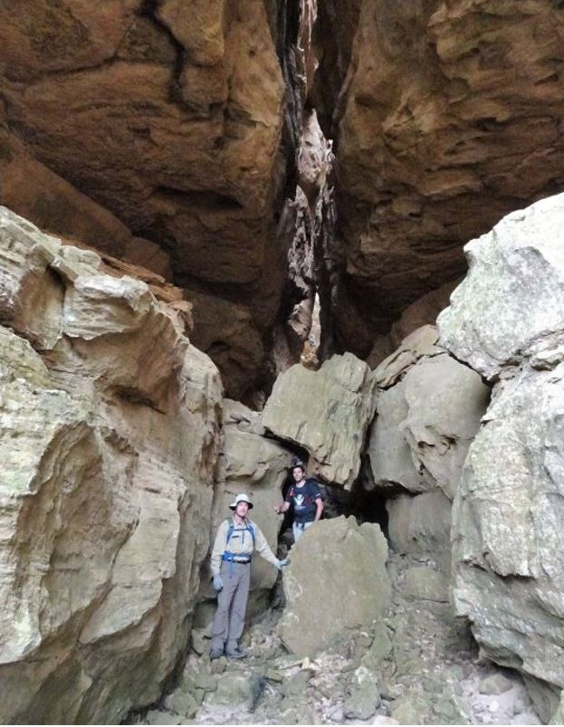
Is located underneath the Wolgan Valley’s top cliff line, 1.3km east of the propertyKoopartoo. The canyon entrance is a huge, diamond shaped slot of grey and brown sandstone, devoid of any vegetation, some 40m high and 10m wide at the cliff line. It has two chambers. The first quickly tapers into a narrow passage, with a large boulder obstructing the view. The second chamber also has a chock stone blocking the gap but once through the constriction, the canyon suddenly opens into a hall of grand proportions. Craig Flynn found the canyon in May 2016, whilst exploring in this area with his friends, by abseiling in it from the top. He named it Kenobi Canyon for the legendary Jedi Master Obi-Wan Kenobi, a character from the Star Wars movies.
Kerosene Vale
*
Is a rural place and a valley located 2km east of Lidsdale. It has the creek system, Sawyers Swamp, flowing through it. Dr Walter Fawkes Mackenzie (1835-1886) applied for a Mineral Lease of 240ac at Sawyers Swamp in 1866. Ref: Survey Plan C290.1507. In a few short years, his holdings in this area had increased to 691ac (279ha). It was due to the shale, also referred to as Torbanite, mined in this locality for its oil content, which produced, when processed, kerosene. The mining in this area resulted in the locality being called Kerosene Vale. At present, this area is used as a repository for the dry ash generated by the Wallerawang Power Station. Constructed in 1960, it was filled with a combination of by product ash from the Wallerawang Power Station and mining spoil.
Kevins Watch
Refers to a smooth, conical pagoda located west of the north end of McLeans Pass,overlooking the Capertee Valley. The name derives from a similar feature described in a mythological story, The Chronicles of Thomas Covenant, The Unbeliever, by Stephen Donaldson. Named by Dr Haydn Washington, November 1984."Kevins Watch is an eyrie / lookout ever so high over the plains below and nearly impossible to climb. A place for profound contemplation." Ref: Correspondence with David Blackwell, 27th April 2010.
Kew Slot
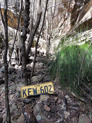
Is located 800m north east of InvincibleTrig Station. Named by Brian Fox. While photographing this area, he came across a NSW vehicle number plate with the letters KEW.

Keyhole Slot
Is a natural slot in the cliff face located at the northern end of Rockflower Creek Passage, and the eastern side and southern end of Cape Pinnacle. This 50m north south narrow slot ends with a 90 degree slot giving access to the top of the cliff line. So named by Yuri Bolotin on a Bush Club walk, 5th September 2011 in which the normal leader would have been Michael Keats. With a play on words, Keyhole is an acronym of,"Keats eat your heart out looking envious."
King Georges Head
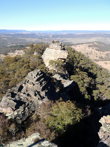
Is a prominent rocky pinnacle that can be seen from the Great Western Highway and that resembles the features of a human head. Located south of Padleys Pedestal Trig Station within Hassans Walls Reserve, Lithgow. Louisa Anne Meredith on a journey to Bathurst in 1839 described the rock formation as, Duke of Wellington. Ref: Notes and Sketches of NSW, 1844, p. 79. Charles Godfrey Mundy in 1846 described it as,The Dukes Head. Ref: Our Antipodes, 1852. The Illustrated Sydney News 7th February 1889, p. 8, records, “a curious isolated rock, called ‘King George’s Head,’ from its outline supposed to resemble that of the face of the English Monarch.” Also called Iron Dukes Head. Ref: Lithgow Mercury 26th May 1903, p. 1.St. Georges Head. Ref: Lithgow Mercury, 26th August 1935, p. 6.
King Minos Hall
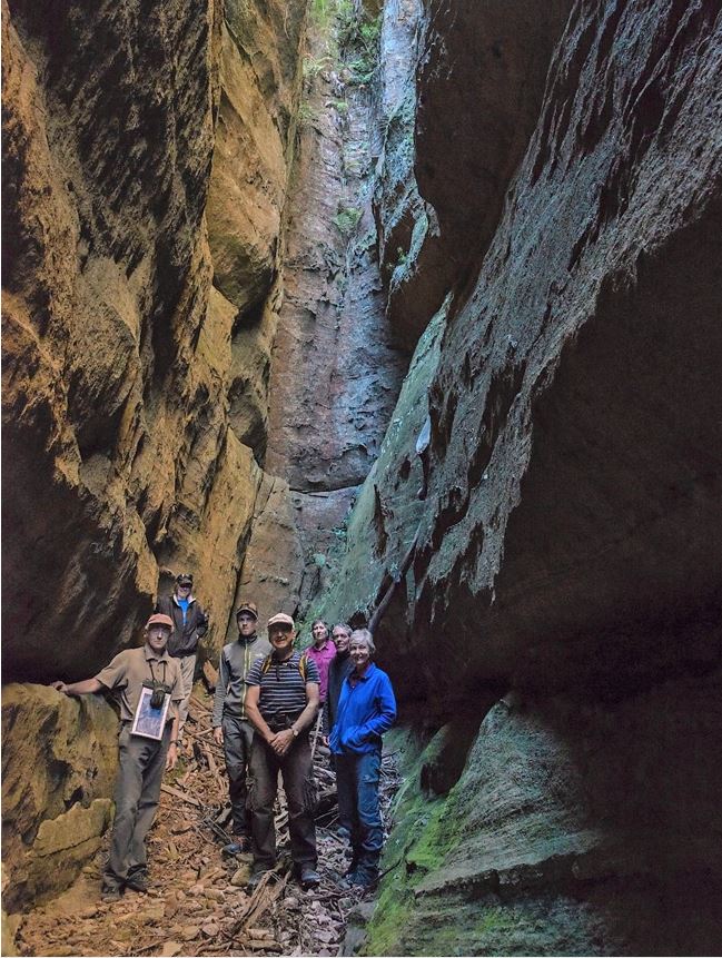
Is is part of the Koopartoo Mesa complex. Located 1.3 km west of the Wolgan River and Zobels Gully junction. This rock-encircled room is about 40 m long and 2 m wide. Positioned next to Ariadne Thread and Theseus Slot. Named by Yuri Bolotin on a bushwalk, 22 August 2017 in keeping with the mythology theme of these names, ie Minotaur Lair, Ariadne Thread, etc. King Minos was the King of Crete and the father of Ariadne; he built the labyrinth to house the Minotaur.
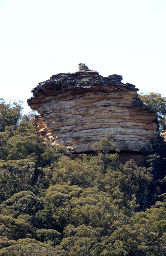
Kings Chair
Refers to a rocky outcrop on the skyline as viewed from the Castlereagh Highway, on the eastern side, one kilometre north of Cullen Bullen. Ref: Elaine (Lucy) Devigne, oral history 20th September 2012. Lucy had known this feature by this name from 1947.
Kirbys Hill
*
Is located 2km north west of Tyldesley Hill and 3.5km north west of Cullen Bullen. Kirbys Hill is 999m above sea level. Elizabeth Kirby married William Walker in 1828 at St Andrew Scots Presbyterian Church, Sydney. They had nine sons and two daughters. On the 17th May 1839, William received a grant of 1000 acres in the Wolgan Valley. This area is now the site of the Emirates Resort. Ref: Wolgan Valley Homestead Complex -Conservation Management Plan, prepared by Conybeare Morrison International, 2006, p. 8. NSW BDM: Marriage Rego No. V182880 73A/1828. The Conditional Purchase Register Book records George Kirby (junior), Cullen Bullen, 29th January 1903, having 125ac (51ha) and 150ac (61ha) of land.
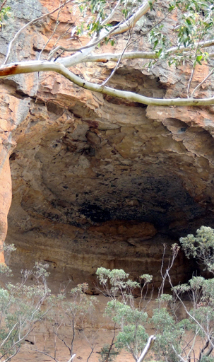
Koan Cave
is a significant cave, being 25 m across the mouth, 20 m high and 20 m deep. Located on the eastern cliff line above Carne Creek 1.5 km north west of Deanes Siding. Access is either via Koan Pass or The Gurgler. This overhang features an irregular band of creamy white flowering Epacris crassifolia up to 50 cm high around much of the back wall. When on a bushwalk of the 3 November 2014 a name was being decided for this cave, it was unanimous by the bushwalking group to celebrate with the leader on the day, Yuri Bolotin, whose grandson, Koan Bolotin, was born 48 hours previously. This cave is an inspirational and contemplative place, so Koan (means a story or dialogue) is absolutely perfect.
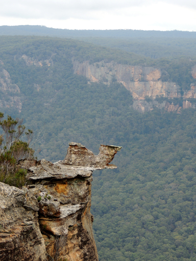
Koan Chair
is a special rock formation. It looks mysterious and mythical, half hanging over the cliff line. Located 200 m south of Koan Cave. Named by Yuri Bolotin on a bushwalk of 3 November 2014.
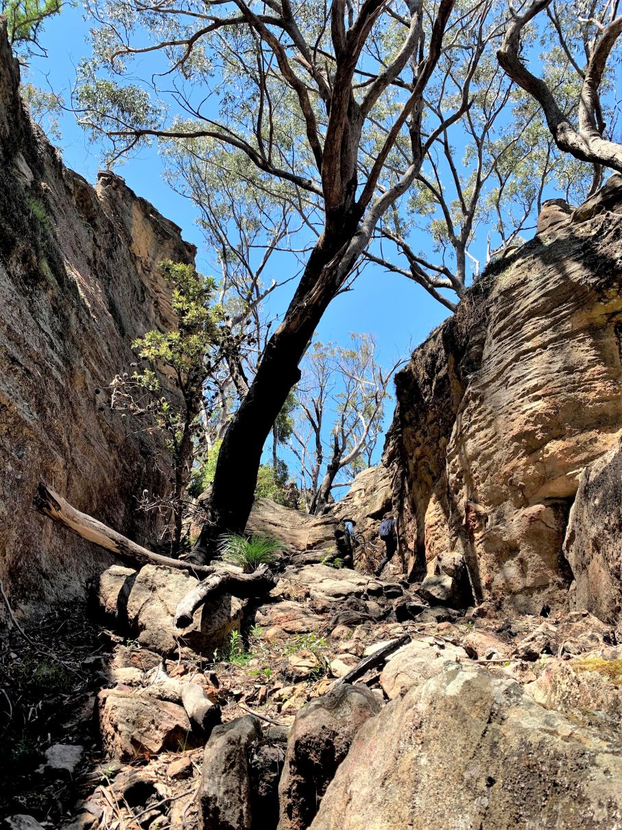
Koan Pass
is an easy natural access ramp to Koan Cave, 100 m to the north, and to the lower cliff line above Carne Creek. Named by Yuri Bolotin on a bushwalk, 3 November 2014.