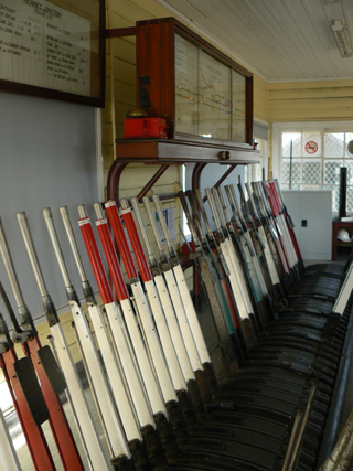
Was a railway station on the Main Western Line. It is about 1km east of Clarence Railway Station and about 3km south, south east of Bald Trig Station. It was at Newnes Junction where the Wolgan Valley Railway joined the Main Western Line.
Was a railway station on the Main Western Line. It is about 1km east of Clarence Railway Station and about 3km south, south east of Bald Trig Station. It was at Newnes Junction where the Wolgan Valley Railway joined the Main Western Line.
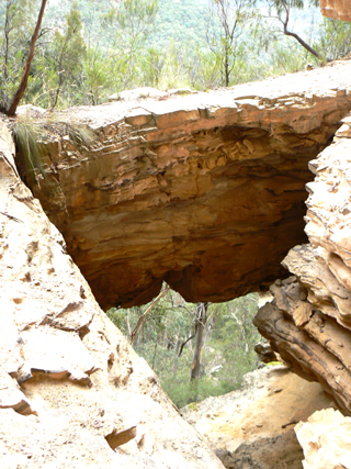
Is located on the western side of Little Capertee Creek Camping Ground at Newnes, half way up (240m) the side of the steep hill, overlooking the camping ground. This arch is one metre wide and about five metres in length, but what makes this arch so special is that the arch spans a large sandstone overhang and the top of the arch is about ten metres from the base of the sloping cave. Shown on map within Penney, Andrew & Taylor, Pete. The Wolgan Guide, 1984, p. 184, recorded as "natural arch".Full name recorded by Brian Fox, 13th June 2011.
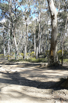
The name is misleading as it refers to the area south of Newnes and extending back to Clarence that also contains the Newnes State Forest. A central point of the plateau is Bungleboori, (what was a picnic ground) and an important road junction. The Newnes Plateau is approximately 200sq km in area and has a general elevation between 1100 and 1180 metres.
See also The Pondage. The name Newnes Pondage has been recorded by Dug Floyd within his on line track notes in 2005. Also known as Dead Tree Camp.
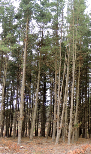
Was dedicated on 21st May 1920. Original approximate size was 30,000 acres (12,140ha). Since then, various extensions have been added.
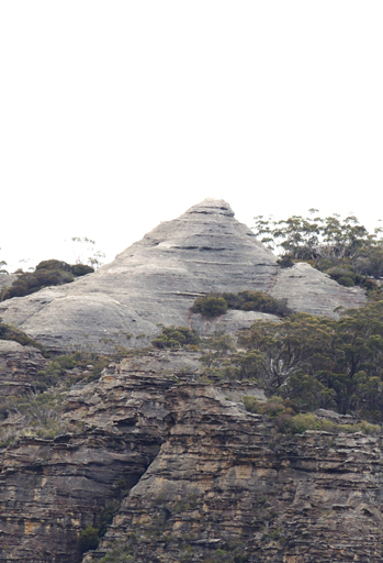
Is the distinctive, high, pointed pagoda on the top of Point Cameron, located 700m north west of Mount Davidson and Wolgan Trig. This Wiradjiri name means "Nipple". It is also the property name of Dominic Dellalibera that has the "nipple view" of Pantoneys Crown. The Wiradjiri people have endorsed this name.
Is now known as (see) Bungleboori Creek. Nine Mile Creek was the local and previous name for the south branch of Bungleboori Creek. The north branch used to be called North Branch Bungleboori Creek. The name Nine Mile was derived from the (mileage) distance from Newnes Junction.
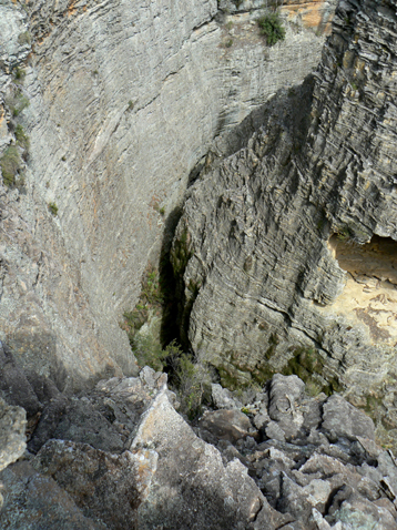
Starts 3.3km north of the road intersection of Glowworm Tunnel Road and Old Coach Road. A 700m track in westerly direction leads to this canyon. As part of the TAFE Outdoor Guide course, c1984, students explored this canyon. They collectively decided to call it Nobles Canyon, after two members of the group, Olive and John Noble. Ref: Correspondence with Olive Noble, 25th March 2010. Also known as Wolgan View Canyon and Dry Canyon. An easy, dry canyon, close to Glowworm Tunnel Road. Car park GR 409 166.
North Branch Bungleboori Creek
Now known as (see entry) Dingo Creek.
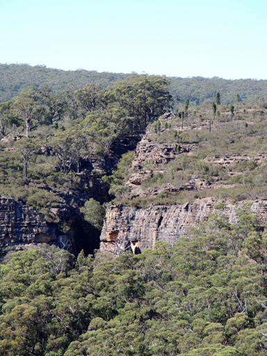
Is a narrow parallel sided slot that completely slices the north east section of Rock Island. The slot is about 240m in length, the centre of the slot rising towards the top. Negotiating one section needs rope for security. Located 2.1km nearly due south of Constance Gorge and Deanes Creek junction. Named on a Bush Club walk, 18th February 2013, by Michael Keats and Yuri Bolotin.
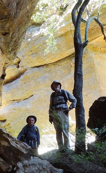
Is located on the north western side of Deanes Plateau. An overhang develops into a tunnel that then becomes a short stub canyon. Positioned on the top cliff line above and on the eastern side of Deanes Creek. So named by Yuri Bolotin on a Bush Club walk, 8th February 2016, as the North East Split on Rock Island is opposite and 1km to the north.
Has its headwaters on the southern side of Railmotor Ridge, 3km due east of Deep Pass. This creek flows generally south for 3km to join Dingo Creek at GR 527 048. This name is derived from the name Nosedive Canyon, a canyon that is located in the lower section of the creek. Ref: Jamieson, Rick. Canyons near Sydney, 1993, p. 39.
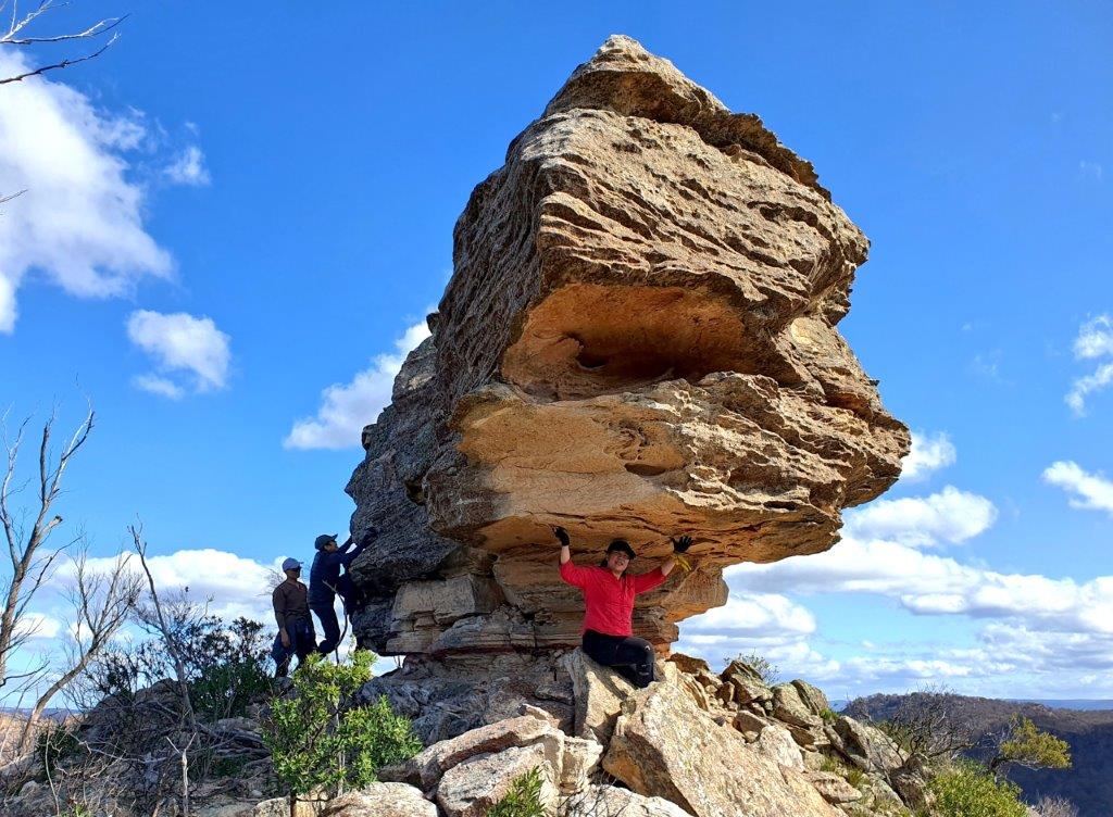
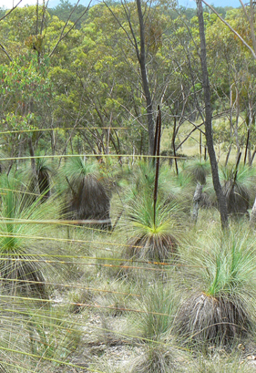
Is a non perennial and scrubby watercourse about 2.5km long flowing generally south east into Coco Creek. It rises on the southern side of Glen Davis Road about 5.5km north by west of Pantoneys Crown. So named due to the gold nuggets once found within this gully. Nuggety Gully was discovered by a shepherd known as Scotch George in 1864. Ref: Carne, Joseph. The Kerosene Shale Deposits of New South Wales, 1903, p. 132. Shown as Nuggetty Gully on the map Parish of Coco, 1883.
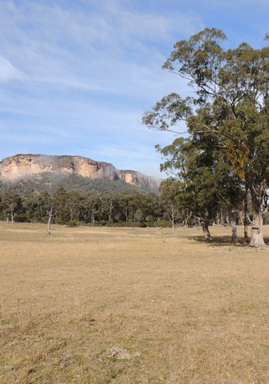
Numietta used to be the name of the locality 2km north east of Glen Alice and the flat expanse east of Mount Innes. The name still applies to Numietta Creek, Numietta Road and Numietta homestead. Peter Grant Ogilvie assistant surveyor to Surveyor General Thomas Mitchell first recorded this Aboriginal name on his map 31st January 1830. Ref: State Records, Surveyor Generals Maps, 2509.
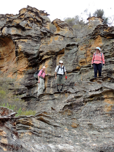
Is a 5km long ridge running off the Blue Mountains Range, which separates Lambs Creek from Kangaroo Creek. The Oaks family were early settlers in this area.This old local timber cutter name was in use when the bullockies pulled timber from the area. The name was in use up to the 1950s. Ref: Oral history, local historian, Ossie O'Brien, 20th April 2012.
Is a partly perennial creek rising about 5km north west of McDonalds Mountain. It flows generally south east and north east for about 15km into the Capertee River. The Casuarinas growing along the creeks, known as River Oaks, have given rise to this creek's name. The spelling as Oakey Creek is shown on the map Part of New South Wales, The Interior from Sir Thomas Mitchell's Map and the Coastline from HMS Acheron 1851. The map Parish of Airly, County of Roxburgh, 1st edition, 1884, records on the same sheet two spellings, Oakey Creek and Oaky Creek. All subsequent maps record the spelling as Oaky Creek.
Is a natural spring near the headwaters of Genowlan Creek. 1.6km north, north east of Genowlan Trig. Named by Col Ribaux during his diamond mine construction period, c1967. Ref: Report to Department of Mines 6th October 1967, letter from Col to Capertee Valley Alliance, March 2011 and oral history from Col, 4th April 2016.
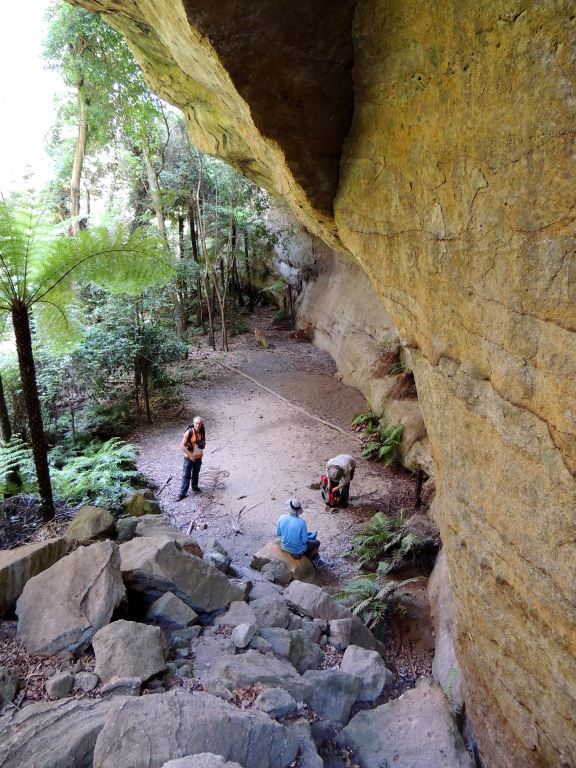
Is a beautiful camping cave, surrounded by rainforest. Located in the headwaters of Penrose Gully, 1.7km north east of the Glowworm Tunnel. It is about 30m long by 9m wide by 15m high, with a perfectly level floor of tightly packed sand. In the middle of the cave floor and at its northern end, stands an obelisk, a single, 1.2m high spearhead shaped shard of grey rock that looks completely like someone had carved it and installed it here on purpose. Named by Yuri Bolotin and Brian Fox on a bush walk 23 December 2016.
Yuri records “What we now stared at was in fact one of the best views of the Wolgan Valley and the Wollemi I had seen. The breath-arresting 360-degree panorama included the thick pagoda forest crowning the Watch Tower Spur to the immediate west; the striking stone pyramid of Alcatraz, just below our eye level and some 200m away; the dramatic, sharp, rocky edge of Woolpack Rock close to the south east; further to the west, there was Red Rock Creek and Capertee Valley, and to the east – Donkey Mountain, Mount Wolgan, the endless stretch of Wolgan Valley rimmed by high cliffs, with Sunnyside Point and Cape Pinnacle jutting out in the far distance; Cape Horn could be seen closer to us to the south west; in the far north, the outlines of Mount Coricudgy and the high mountains of the Wollemi Wilderness appeared in a blue haze.”
Named by Yuri Bolotin on a bushwalk on 17 August 2018.
Is a bush walking pass 2.8km north, north east from Mount Budgary which leads into Rocky Creek. Named by Michael Keats, 5th August 2009. This and Frenulum, Lanceolate, Pheromone and Spiracle Passes, all near Mount Budgary, is named after an anatomical parts of a Moth. Michael had encountered a large numbers of Moths during his walks on Mount Budgary Plateau.
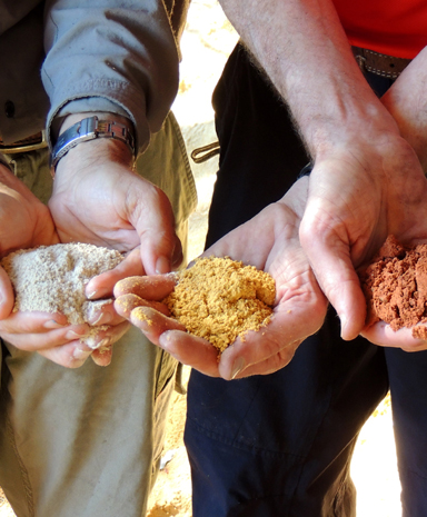
Breaches the top of the western side of the Wolgan cliff line. Located 560m south, south east of the track junction, Long Swamp Road and The Bicentennial National Trail. Named due the very different colours of ochre so close together in the ledge near the top of the pass. Named by Michael Keats and Brian Fox on a Bush Club walk, 16th February 2015.
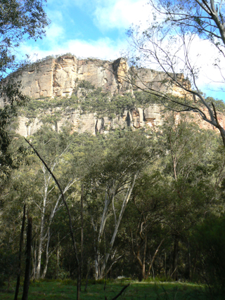
Is a name given by the rock climbers to a cliff face 1.3km north east of Newnes. It consists of towering 360m sheer cliffs. And overlooks Newnes camping ground. First documented climb, July 1960. Ref: Taylor, Pete and Penney, Andrew. The Wolgan Guide, 1984, p. 25 and 61.
Is a very narrow, steep slot, on the eastern side of Old Baldy, 1.1km north east of Newnes Camping Ground. The slot initially is only 30cm wide, leading to a short scramble, after which it gradually expands to a couple of metres. The first section is about 50m long. Within 20m, it is followed by another section, slightly wider and at 90 degree angle to the first one, which leads all the way to a wonderful flat platform above the cliff line. Outstanding views of the Wolgan Valley can be seen from the top. Named by Yuri Bolotin and Brian Fox 14 July 2017, as this very useful bushwalking twin slot breaches the top cliff line giving access to the top of Old Baldy.
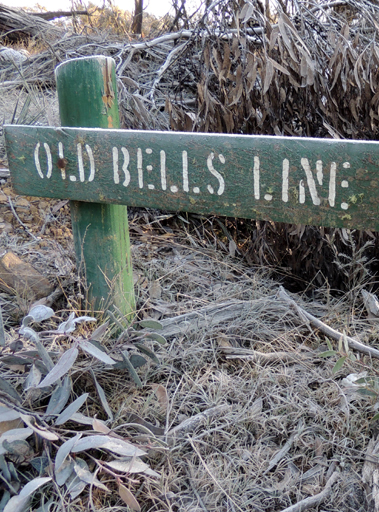
See Bells Line of Road.
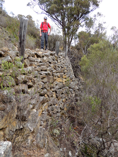
Was constructed between Clarence and Newnes and closely follows the route of the former Wolgan Valley Railway line from Clarence. The road is still in use today (from near Deanes Siding, GR 424 140, to the information board at GR 425 180) and is maintained by the National Parks and Wildlife Service in case access is required to fight bushfires. Alongside a part of this road can be seen steel stanchions and steel bars, which were used to support the petrol pipeline from Glen Davis to Newnes Junction. Cullen Bullen and Ben Bullen Topo Maps.
The Lithgow Mercury 8th June 1906, p. 4 records “ the road from Clarence to Wolgan is now 21 miles from Clarence, among the gorges. A good road has been found down Penrose Gorge…should be through to Wolgan in a few weeks”.
This road was used in part to deliver construction materials for the Wolgan Valley Railway line (April 1906 -1907) and also to provide access to the new township of Newnes. Ref: Parish of Barton, 1915, notation LB07.921. (Note: LB07 refers to Land Board 1907).
A map dated 10th April 1907, which accompanied an application for a Post Office at Greens Camp (near the present day Glowworm Tunnel), shows the name Coach Road.
The term ‘Old Coach Road’ was recorded in Stephens, Eric. Wolgan Railway Notebook, 1934-1937 and Lithgow Mercury 2nd May 1934, p. 4. The railway coach used on the railway line consisted of a general passenger compartment to seat 30, guard’s compartment, a special compartment at the end with folding table and lavatory. The coach was constructed by Metropolitan Amalgamated Railway Coach Works, Lancaster, England.
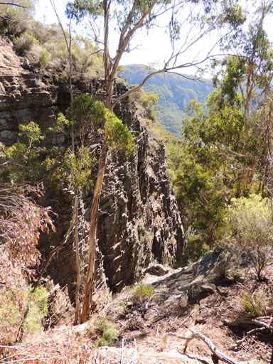
Is located at the apex of a cliff lined, V shaped gully, a southern tributary of Capertee Creek on the western end of the property,Red Cliffs, Newnes. Named by Brian Fox and Michael Keats on a Bush club walk, 6th May 2016, as the leader Yuri Bolotin said at the walk brief, there is only a one percent chance of finding a way to the top of the cliff line via this gully.
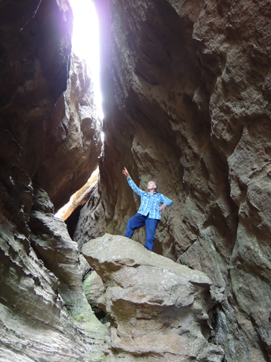
Is a slot within the northern rim of the Pentafid. Giving access from the base to the top of the cliff line. Road access via Old Coach Road and Tiger Snake Track. So named by Yuri Bolotin on a bushwalk, 30th October 2015, as within this slot there is a rostrum-like rock.
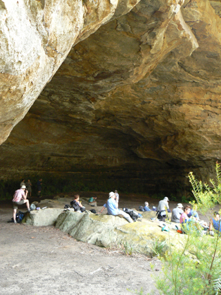
Is a very large cavern 31m wide, 25.5m deep and 12m high at the front. It is located on a side creek on the eastern side of Rocky Creek, 950m north west of Mount Budgary. Michael Keats on his Bush Club walk, 25th March 2009, recorded, “the floor is almost dead level and large enough to contain a complete symphony orchestra.”
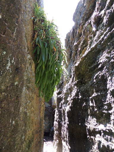
Is located within the upper headwaters of Little Capertee Creek, Newnes. Named by Graham Conden on a Bush Club walk, 31st August 2006, due to the profusion of three species of orchids encrusting the walls, Dendrobium speciosum, D. striolatum and Liparis reflexa.
See Poseidon Arena.
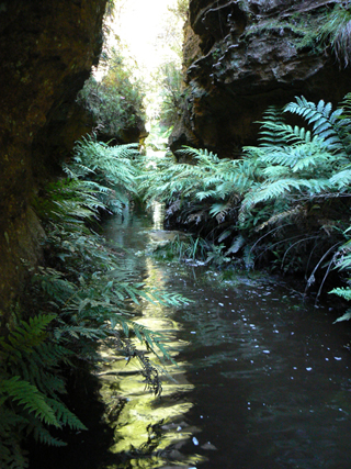
Has its headwaters near the junction of State Mine Gully Road and Old Bells Line of Road about 4km north west of Bald Trig Station. It flows in a north east direction for about 3.5km into Bungleboori Creek. Shown as Paddys River on the Blue Mountains Burragorang Valley Tourist Map, 1932 and within Stephens, Eric. Wolgan Railway Notebook, 1934-1937. Before Bungleboori Creek was named, the whole of this drainage system was known as Paddys River. Lithgow Municipal Council Minutes, 12th January 1942, record the name Paddys Creek. Patrick (Paddy) Mullens (c1831-1876) had placed advertisement in the Town and Country Journal, 26th September 1872, "To Drovers, a new track has been discovered which avoids the Toll Gates," There was a toll gate at Blackmans Flat. The track went from Bell to Ben Bullen. The Lithgow Topo Map shows the main access road near Bungleboori and Paddys Creek as Old Bells Line of Road. Ref: Brown, Jim. Bent Backs, 1989, pp. 275-276. The spring within Paddys Creek would have been used by the drovers to water their cattle and sheep.
Is located near the junction of Paddys Creek and Bungleboori Creek. Named by Michael Keats on his Bush Club walk, 24th October 2007.
Paddys Mountain. An old ‘mud map’ compiled for the Cowie family reunion in 1984 shows a ‘Track to Paddys Mountain’. Paddys Mountain was the name the locals of Airly Town used for what is now the segment of the mesa between Gap Creek and Genowlan Creek, which includes spot height 1031. The mud map also shows the track extending from Jackass Gap, just below the cliff line.
Is located at the headwaters of Paddys Creek on the eastern side of GlowwormTunnel Road. Ref: Wilson, Alex. Map showing the various attempts to find the best route from Mt Victoria to the Western Country NSW, 1914.
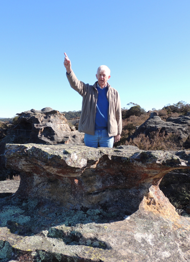
Refers to the area where the Padley Memorial Pavilion was located, at Hassans Walls Reserve. This is now the location of Sir Joseph Cook’s Boardwalk. James McMillian Padley (1851-1918) was the driving force behind the development of Hassans Walls. Lithgow Mercury, 14th February 1944, p. 2. Pillars under Padleys Lookout were in doubt due to mining subsidence activity. Ref: Lithgow Mercury 4th July 1945, p. 2. Hartley Topo Map, GR 353 882. Remains of Padley Memorial Direction Dial are at the right hand side at the end of the boardwalk. Padleys Pedestal Trig is at the end.
See Undercliff Track
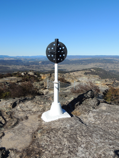
Is located at Padleys Lookout on the southern point of Hassans Walls, Lithgow. Named after James McMillian Padley (1851-1918). Constructed on 1st January 1932 by the Royal Australian Survey Corps. Height 1129.902m. Ref: Lands Department SCIMS Survey Mark Report.
See Undercliff Track
Is located on Citadel Spur above Amphitheatre Pass, 400m south west of GenowlanTrig. This circular space, about 50m across and surrounded on all sides by soaring pagodas. The floor of this space is tufted with bright green grasses and occasional Xanthorrhoea. Named by Michael Keats on a Bush Club walk, 2nd March 2015.
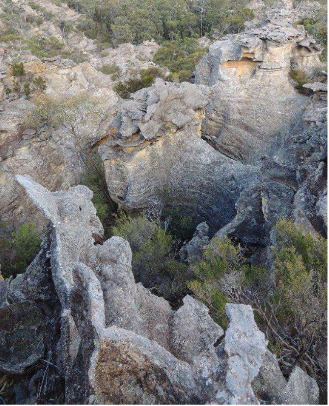
Is a magnificent pagoda studded area on top of Mugii Murum-ban State Conservation Area. Located midway between Genowlan Trig and Genowlan Mountain at the edge of the escarpment. It extends approximately 400 m to the east of Genowlan Mountain Trail between GR 267 and GR 271 (eastings), and for 600 m south between GR 333 and GR 327 (northings) Named by Yuri Bolotin and Brian Fox on a Bush Club walk, 4 May 2018.
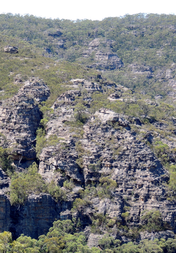
Is located on the highest point of the saddle that divides the Wolgan and Capertee Valleys and 50m to the east from the Pipeline Track.The signage is recorded as September 1987 in Lord, Stephen and Daniel, George. Bushwalks in the Sydney Region; Volume 1, 1989, p. 52.
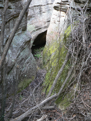
Consists of two parallel arms of pagoda studded ridges surrounding a deep ravine that drops 140m from the highest northern edge down to the southern edge and the Moffitts Trail. The highest concentration of pagodas is in the north east sector. Located 1.6km south east of Rowans Hole. Access via Moffitts Trail. Named by Michael Keats on a Bush Club walk,16th February 2010. Michael records,"Everywhere on this crest the pagodas crowd one another. The slots are convoluted and exciting."
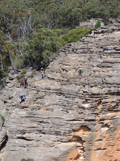
Is located on the top of the Wolgan - Capertee Divide above the headwaters of Little Capertee Creek, 300m north of Gindantherie Pinnacle. When you approach it from the north, it does look like a death defying pagoda climb. However, when you actually get to it and start climbing, it is fairly easy, with many handy steps available. Named recorded by David Noble on a bushwalk, 22-23rd September 2007.
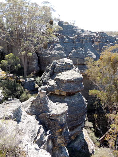
Was named by Peter Fox and Michael Holt on a bush walk, 28th September 2013. Michael records, "Even though most of these pagoda systems are usually disjointed, we thought there was enough long distances of contiguous stone to warrant the name."This undulating ridge line of pagodas starts from spot height 1054, 2km north, north west of Gardiners Gap and continues in a northern direction for 1.6km.
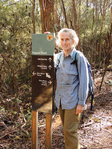
Is a 700m walking track that links the southern side of the Glowworm Tunnel Track to the Old Coach Road.
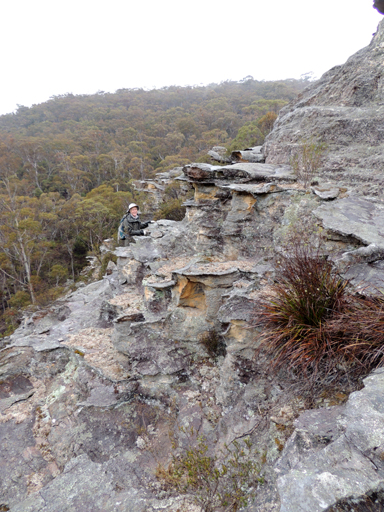
Was named by Yuri Bolotin on a Bush Club walk, 6th September 2013. Yuri named it so as,"it is a castellated wonder land, where pagoda after pagoda filled your scope of vision."Located on the southern side at the end of Fire Trail No. 4, off Sunnyside Ridge Road, Newnes Plateau.
Are on the eastern cliff face of Cleft Point peninsula. This near vertical sandstone wall some 700 m long and 50 m high has weathered to a palette of red orange and fawn colours. Named by Michael Keats on a bushwalk, 22nd November 2013.
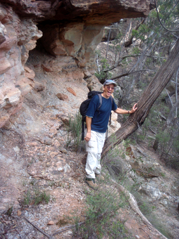
Is a rocky out crop on the Great Dividing Range overlooking Coco Creek and Rowans Hole, 300m north, north west of Tarpeian Rock. Named by Michael Keats on a Bush Club walk, 16th February 2010. As it is in close proximity to the previously named Tarpeian Rock, Michael called it Palatine Rock after the Palatine Hill that adjoined the Capitoline Hill, on which the Tarpeian Rock was located in ancient Rome.
Is a non perennial stream rising 3.5km south east of Genowlan Mountain. It flows generally south, south east for about 3km into Dog Trap Creek, which in turn flows into Coco Creek. A descriptive name from a wooden fenced cattle yard located in the area. Shown on Carne, Joseph. Geological Map of the country in the vicinity of Capertee, 1900.