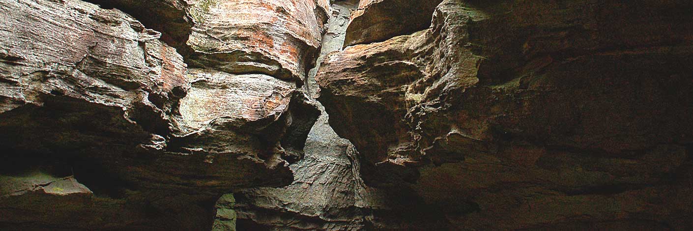
See Permafrost Gully.
Bush Explorers Encyclopaedia
See King Georges Head
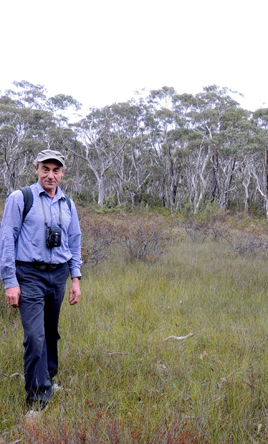
Is a short, 2km ridge that has its northern end above the junction of Bungleboori Creek and Stick Canyon, and its southern end joining Ant Hill Ridge. Named by Peter Fox, National Parks Association bush walker, in 1995-1998.
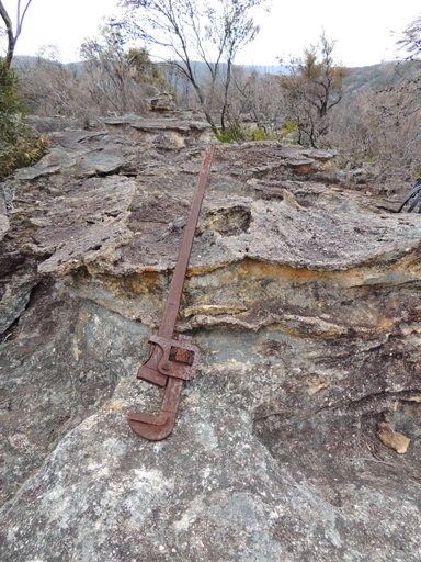
Trends generally north south for one kilometre and has the northern end joining Crisscross Spur, which in turn trends off Waratah Ridge. So named by Michael Keats on a Bush Club walk, 20th July 2012, due to the find there of a large, 36" Stillson wrench.
There are two of these huts in the Wolgan Valley, one located below Wolgan Gap near the base of the hill and the other south of Wolgan Road opposite the cattle yards and close to the former Wolgan Cemetery. These huts were both built by Ray Fitzpatrick, 1951-1953. At the time Fitzpatrick owned 6,000ac in the valley, and both these huts were on his holding. Ref: Ian Coates, Wolgan Valley, telephone correspondence to Brian Fox, May 2016
Is an unusual rock formation located on the north west side of Mount Budgary. Named by Michael Keats on his Bush Club walk, 25th February 2009. So named as the 3D erosion pattern gives the appearance of a wild, stormy sea.
Is so named after the Stringybark Eucalyptus in this area. Named by Col Ribaux during his diamond mine construction period, 1961-1975. This small valley (gully) is a tributary of Genowlan Creek. 1.7km north east of Genowlan Trig. Ref: letter from Col to Capertee Valley Alliance, March 2011.
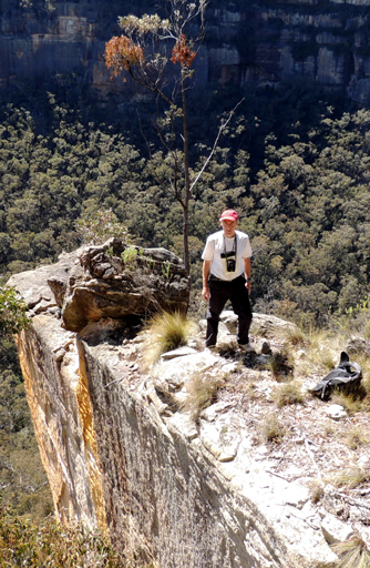
Striolata Ravine is a 1.1km non perennial watercourse 2.5km north east of Birds Rock Trig. The last 200m before the cliff line contains a frieze of thousands of Orchids,Dendrobium striolatum.Above and on the northern side of this ravine, a wing like protrusion from the cliffs forms another major viewing point, Striolata Point. Both features named by Michael Keats on a Bush Club walk, 10th October 2013. The orchids were in full flower on that day.
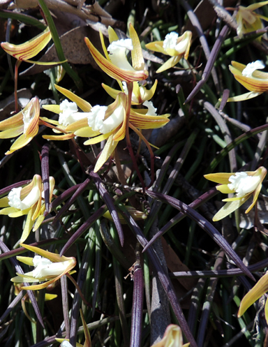
Is a 1.1km non perennial watercourse 2.5km north east of Birds Rock Trig. The last 200m before the cliff line contains a frieze of thousands of Orchids,Dendrobium striolatum. Above and on the northern side of this ravine, a wing like protrusion from the cliffs forms another major viewing point, Striolata Point 414 107 . Both features named by Michael Keats on a Bush Club walk, 10th October 2013. The orchids were in full flower on that day.
See entry Centre of the Universe
Is the name given to a group of prominent pagodas 3.2km south east of Goochs Crater. Marked on the topo map as spot height 994. Known by this name by bushwalkers prior to 1990s. Graham Conden records the name in 1999 as Submarine Rocks, because when walking in from the Bells Line of Road, he felt as though you were on the conning tower of a submarine in the middle of the ocean.
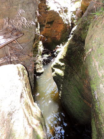
'suboir" is a phonetic rendering of SUBW, Sydney University Bushwalkers. The SUBW archive records, that this canyon within Dumbano Creek was visited on the 30th March 1962, but it was not until 19-20th August 1995 that it was given the name Suboir Canyon. It is also known as Dumbano Tunnels or the Dumbano Dungeons.
Refers to a trail marked with subsidence warning notices running north south off Clarence Firetrail on Girdwood Ridge. Named by Peter Fox, a member of the National Parks Association, in the late 1990s.
See Donkey Mountain, south west section
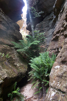
Is located off Sunnyside Ridge Road via Fire Trail No. 8. This gully flows into Bushrangers Creek and above the western side of Sunnyside Canyon above the cliff line is the feature known as, Foxs Wedge.
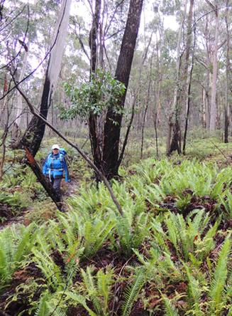
Is located at the headwaters of Carne Creek between Sunnyside Ridge Road and Fire Trail No. 1. The southern part was originally known as see Dead Dog Swamp.
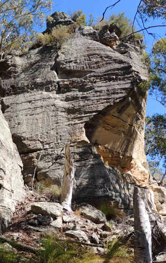
Is located between Sunnyside Point and Wolgan Pinnacle. It has its headwaters at the northern end of Fire Trail No. 7 on Sunnyside Ridge and generally flows north and north east for 2.6km to its junction with Carne Creek. Named by Michael Keats on a Bush Club walk, 11th July 2007.
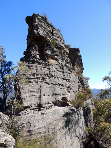
Is the most northerly point reached on Sunnyside Ridge via Fire Trail No. 7. This isolated rocky point (918m) has a commanding 360 degree view of the Wolgan Valley. An impressive viewing location within the Gardens of Stone National Park off Sunnyside Ridge Road. Named by Brian Fox on 6th August 2013.
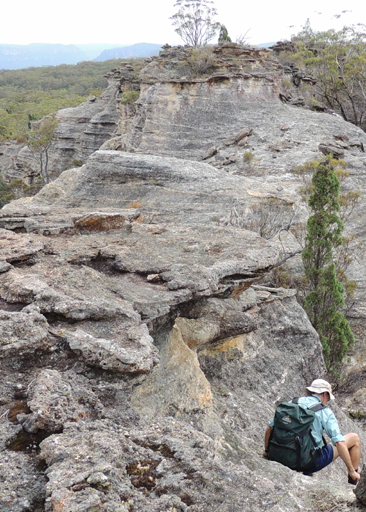
This ridge is about 12km in length, trends generally north off the Blue Mountains Range. It divides the watersheds of the headwaters of the Wolgan River and Carne Creek. Highest point along this ridge is Birds Rock Trig Station at 1181m. Its northernmost point along Fire Trail No. 7 is at Sunnyside Point. Sunnyside was the previous name of Birds Rock Trig Station. The Trig name was in existence from 1930, so the name Sunnyside is prior to this date. Sunnyside Ridge was so named as this part of the ridge trends north south and hence the eastern side obtains the morning sunlight. Ref: Danny Whitty, Aboriginal descendant of this area, 19th February 2010.
Is located at the headwaters of the Wolgan River between Campbells Road and Sunnyside Ridge Road.
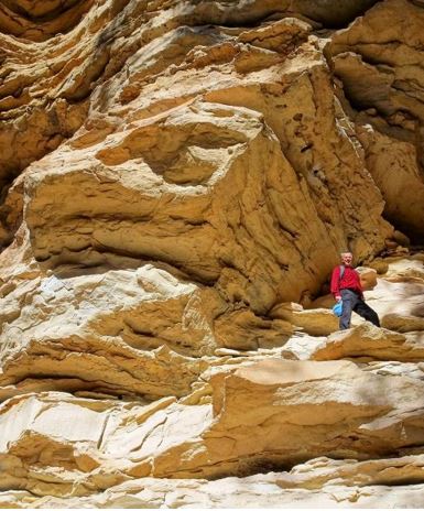
Is located 900m north east of Little Capertee Creek Camping Ground and 200m in height above the Wolgan River. It is a spectacular high cave, glowing in the sun, with rich, multi-layered, intricate sandstone decorations soaring 40m or more towards the blue sky above. Named by Yuri Bolotin and Brian Fox on a bushwalk 14 July 2017 as “It looked absolutely stunning in the morning light, and such a contrast to the shaded areas that preceded it. Such outstanding feature needed a name, so we decided to call it Sunshine Cave.”
Has its headwaters and tributaries on the eastern side of Deanes Plateau and western side of Heart Attack Brook. It flows generally in north east direction for about 5.5km till it joins Rocky Creek. Within this creek is the canyon called Surefire Canyon. So named asTom Williams suggested they did, "a surefire canyon", but mechanical problems and rain caused the trip to be postponed to the 1976 / 1977 canyon season. Ref: Kameruka Magazine, September 1977, Vol. 15. No. 1, pp. 10-11.

Is located 400m south east of Genowlan Trig. A section of cliff line has parted from the main cliff and moved out about 30 to 50m. About 200m long this great block has a suspended floor about 80m down from the top. Walking access from the top is not possible. Named by Michael Keats on Bush Club walk, 1st June 2015. A barbican is, an outer fortification to a castle or town, a watchtower guarding a gate or drawbridge.
See Altar Room
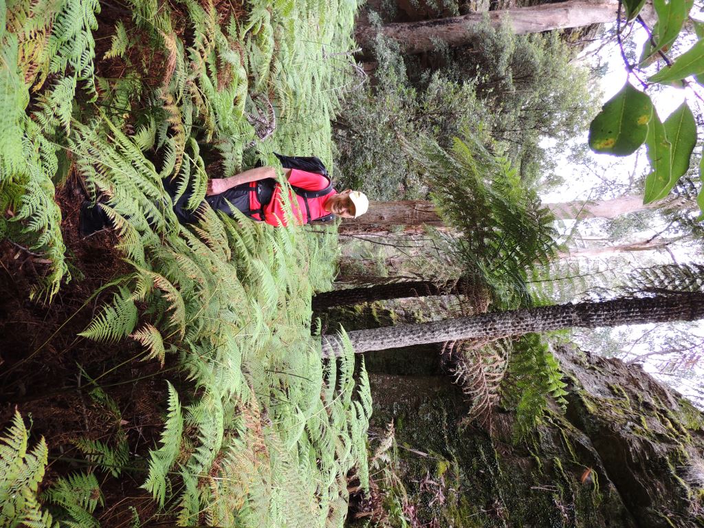
Rises on the western side of Tiger Snake Canyon Track and 1km east of the Glowworm Tunnel. It flows for 2.5km generally north west through Coach Galleries over the Pagoda Track and railway alignment and into the Wolgan River. This gully dissects the plateau from the Glowworm Tunnel in the south and Point Sutherland on the north. Donald Sutherland was a Consulting Engineer and General Manager of The Commonwealth Oil Corporation Ltd mine and refinery at Newnes in 1906, at the time when the Wolgan Valley Railway was being constructed. Named on a Bush Club Walk by Michael Keats, Yuri Bolotin and Brian Fox, 27th January 2017.
Is immediately south of the location of the former hut on Mount Cameron, where permanent water could be found. This creek flows in a generally southerly direction for 1.7km into Nayook Creek. Ref: Interview with Dick Bird, 29th January 2010. Dick's father Jim held the lease in 1960s.
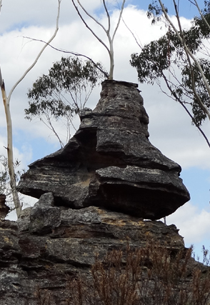
Is located 2.6km south east of Birds Rock Trig Station. Michael Keats recorded on 13th March 2013," Looking at the last pagoda, a residual erosion piece, has reminded us of an oversize Moroccan tagine or cooking pot. It was so big, two of us could sit in it - great for pictures. This strange piece also had an irregular pair of narrow horizontal slot windows that could be used as picture frames. I have named this amazing place Tagine Point."
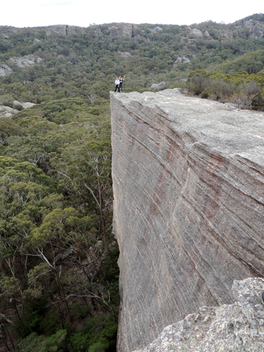
Is located at the top of Tara Slot an impressive narrow rocky projection above a right angled smooth sided cliff face. 900m south of Mount McLean. Named by Yuri Bolotin on 13th April 2013.
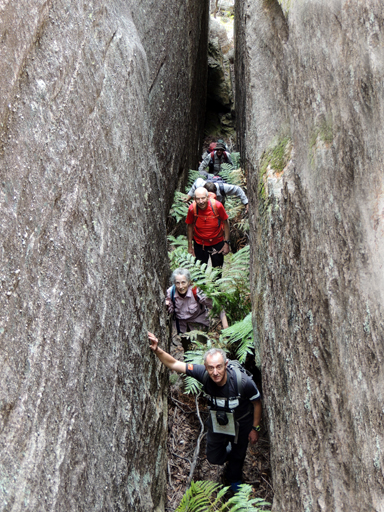
Was named by Yuri Bolotin on 13th April 2013, when walking out from Hecates Cauldron towards Mount McLean Trail. Tara Cameron, an avid bushwalker and Vice President of Blue Mountains Conservation Society, found this incredible slot through the impossible cliffs that led us to a jaw dropping lookout, and then out on to the main ridge. Located 900m south of Mount McLean.
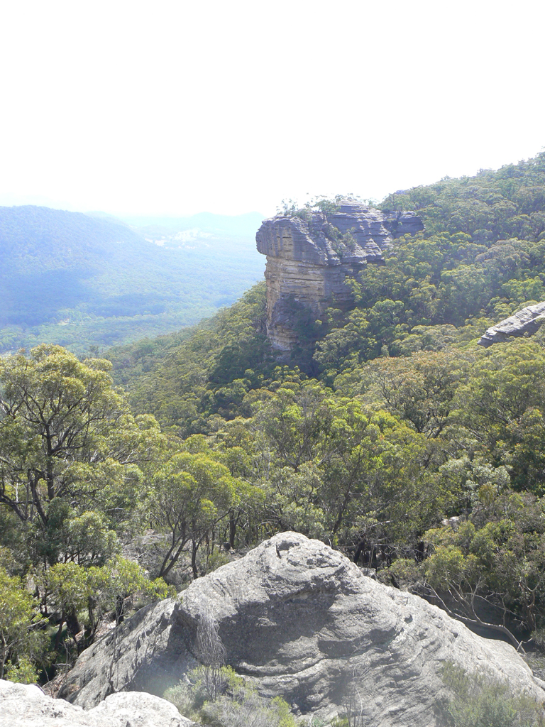
Is a high and projecting isolated rock, 4.5km east of Ben Bullen and 1.1km south east of Rowans Hole. This name may have been derived from John Savery Rodd (1806-1870), who was one of the earliest land holders in the Capertee Valley; he purchased 640ac near Glen Alice in 1830. His Sydney residence at Potts Point was called Tarpeian. Ref: Palmer, Freda and Scurrah, F L. Tour of Rylstone and Capertee Valleys,1969, Pt: 2, p. 10. The name Tarpeian is associated with Tarpeian Rock; Capitoline Hill, Rome, Italy. Shown on the Parish Map of Ben Bullen, 1885. That aside, there is a similarity between the vertical faces of both the Tarpeian Rock in Rome and the Tarpeian Rock above Rowans Hole.
William Mylecharane (1832-1917) licensed surveyor, in 1892 recorded the Aboriginal name for River Lett at Hartley as, Tarrapalat. An 1913 article has the spelling as, Tarapalet. The 1892 definition implies that the whole of the River Lett was called Tarrapalat while the 1913 article restricts this placename to a smaller section of the river at Hartley, about 2 km upstream of the River Letts junction with the Cox River.
Gundungurra language authority Jim Barrett believes that the appropriate spelling of Therabulat would be, Dhurrabulat, which meanstwo rivers. He concluded that the two rivers referred to would be Coxs River and River Lett, and that the name properly applied to the Coxs River at, and locally below, the junction.
Ref: Smith, Jim. Does the Cox River have an Aboriginal name? Blue Mountains Historical Society, Hobby’s Outreach Vol. 28; No. 3, June – July 2016.
The Sydney Mail and New South Wales Advertiser, 12th December 1896, p. 1250, col. 4 records…..”the name Therabulat….according to Mr. James Neale, was corrupted by the whites to “The River Lett” and as such applied to a tributary of the Cox at Hartley”.
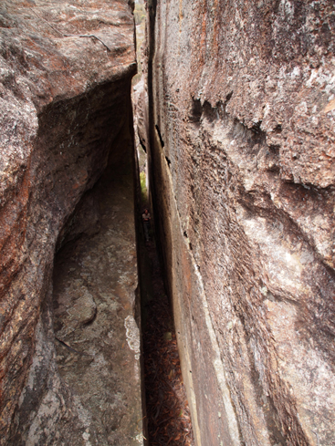
Was named by Yuri Bolotin on a bush walk, 9th March 2013.This amazing, 50m long, narrow, deep slot is located on the western side of Zeus Ridge in Poseidon Arena. Yuri so named it in keeping with the Greek mythology theme of this area. Tartarus was a very deep and dark place in Greek mythology, just like the slot itself.
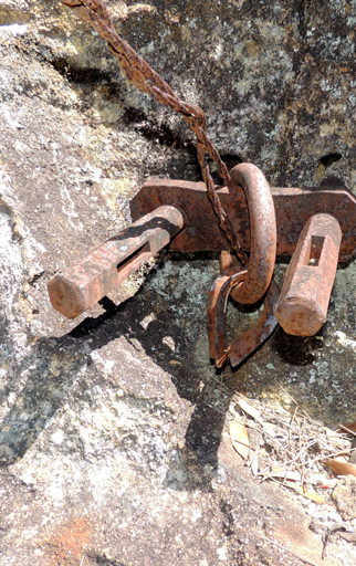
Gives access from the headwaters of Zobel Gully near the saddle with Constance Gorge to the top of the eastern cliff line. Located at the top of the pass on the base of a pagoda is the steel anchor point used to hold the telephone cable which was strung across the top of the gorge c1906. Named by Brian Fox on a Bush Club walk, 11th March 2016.
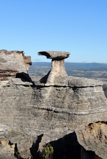
Is a natural ironstone tube horizontally mounted on a plinth above a pagoda, overlooking the valley below. It is located 1.5km north east of Invincible Trig Station. Named by Yuri Bolotin on a Bush Club walk, 15th August 2013.
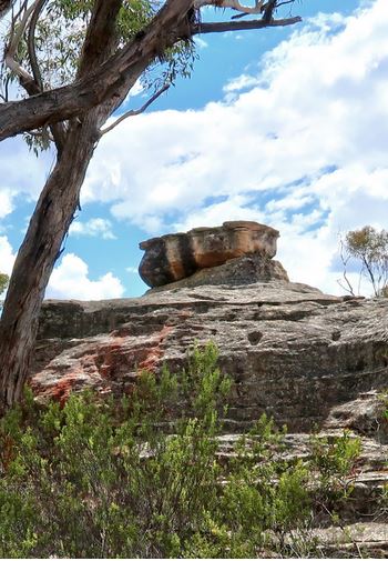
Refers to a rock like feature that looks like a bath. Located 60m on the northern side of Blackfellows Hand Trail within the area known as the Temples of Doom. Named by Freda Moxom in keeping with the Temple of Doom nomenclature on a bushwalk, 1 December 2016.
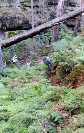
Has its headwaters on the western side of The Temples of Doom and flows generally north, north east for 1.6km into the Wolgan River. Before this small non perennial creek flows over the cliff line, it passes through the features named, The Sacristy and The Catacombs. Named by Michael Keats on a Bush Club walk, 4th October 2013.
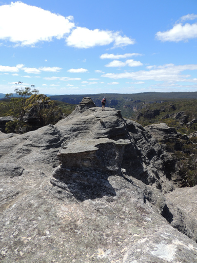
Is located on the northern side of Wolgan Road and 3km from the Wolgan Road and Blackfellows Hand Trail intersection. One of the taller pagodas located about 200m north of the road, GR 332 092, was given the name Temple of Doom by Haydn Washington, after the 1984 adventure film Indiana Jones and the Temple of Doom, directed by Steven Spielberg. Bushwalkers now refer to this whole area of the spectacular smooth, rocky pagodas in the plural, The Temples of Doom
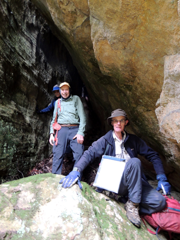
Located 500 m north west of the Temples of Doom, above Temple Creek and on a large, centrally disposed pagoda, which has been cleaved down the middle by a natural slot no more than 30 cm wide. The length is about 60 m and the depth over 30 m. The parallel sided walls curve in and out. Named by Harold Thompson on a bushwalk, 26th April 2016.
Is a sculptural rocky pagoda like feature rising from the cliff lined face 100m south, south east of Mount Dawson. It was given the name Tenochtitlan by Oliver Crawford and members of the Sydney Bushwalkers Club. They have known this feature since the 1980s. The upper section has a sheltered spot for a campsite.Tenochtitlan was a major Aztec city in Mexico, now in ruins.
Is a 50m long slot where the width varies from 50cm to 3m; it gives access to the top of the mesa between Canobla Creek and Little Capertee Creek, Newnes. Located 1.1km south east of Point Nicholson. Named by Yuri Bolotin on a Bush Club walk, 20th April 2017, as Yuri mentioned to fellow bushwalkers, “According to the aerial map, this slot should not work either; I would give it a 10% chance, but we better have a look at it.” The slot is crowned by a series of pagodas, richly decorated with ironstone erosion residual sculptures. They offer spectacular views south into the Little Capertee Creek system and south west towards the Wolgan-Capertee Divide.
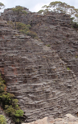
See Donkey Mountain, Entry under Middle Donkey Mountain section
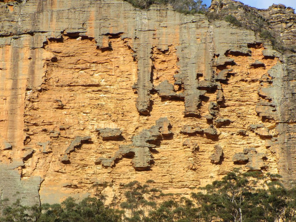
Is located on the western cliff face of Zobels Spur, 850m north, north east of the Wolgan River and Zobels Gully junction. The weathering on the cliff face has resulted in an amazing embossed patchwork of shapes and patterns. Named by Erik Halbert on the 15th October 2016 as it reminded Erik of a mathematical construction.
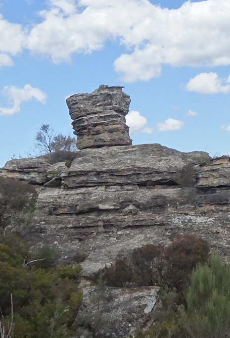
Refers to a rocky square platform, 2m high, located at the end of Fire Trail No. 2 off Glowworm Tunnel Road. This is another location where one can be inspired by the natural beauty of sandstone erosion residuals. Named by Michael Keats on a Bush Club walk, 28th February 2007 due to the shape resembling an Old Testament Biblical altar. See also Lurline Jack Lookout.
Is located 1.6km north east of Invincible Trig Station. Named by Yuri Bolotin on a Bush Club walk, 15th August 2013. Michael Keats recorded in his notes, " It was an amazing compound cliff and terrace area, ninety nine percent open eroded sandstone. The terrace had an apron like appearance that was readily climbable to the base of the cliffs."
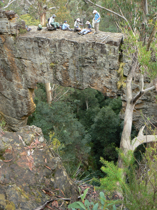
Accessis via Waratah Ridge Road and then by walking from the National Park barrier in a general easterly direction for 6.5km to the top of Arch Canyon. The arch, located about 100m above the junction of Arch Creek with the Bungleboori Creek, is massive and uniquely positioned parallel to Arch Creek. It has not been formed by water erosion but by internal block collapse. Behind The Arch is a perfectly rectangular void, making it a singular structure with well defined, almost geometric lines. The Arch is 30m from the top of the arch to the ground beneath, the opening is 15m wide; the almost level top is 1.5m wide while the connecting span of the bridge is 2.5m thick.
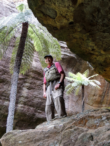
Refers to the headwaters of Petries Gully, Newnes and the canyon like, fan array of cliffs which encompass this gully. Named by Thomas Ebersoll, owner of the old Newnes Hotel, 2011.
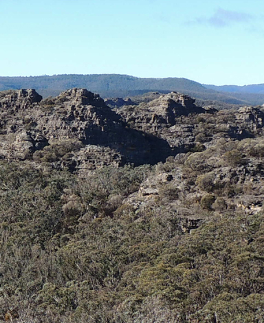
Were so named by Ian Thorpe 27th November 2010, as the studded line of pagodas resemble barnacles on the side of a ship. Located above the southern side of December Creek, 3km north east of Bell. Approaching The Barnacles from the west and seeing them as a continuous line across the ravine from the Lesser Barnacles 491 908 the view is a panorama made more spectacular by the vertical cliff lines on the western edge.
See Poseidon Arena.
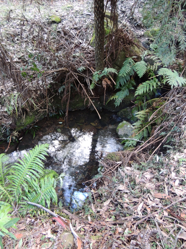
Located at the base of Cathedral Pass / Canyon this small waterhole has been dubbed, The Bathtub by Thomas Ebersol owner of Newnes old Hotel and cabins.
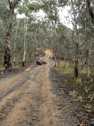
The Bicentennial National Trail.
Guidebook No. 9, Barrington Tops to Jenolan Caves, pp. 60-65, details the trail within the area of our interest, from Glen Alice via Pantoneys Crown, Baal Bone Gap to Lidsdale. The Australian Trail Horse Riders Association (ATHRA) was formed at a meeting in Gatton, Queensland in 1972. One of the objectives of this new organisation was to develop a trail that linked up the stock routes along the Great Dividing Range, thus providing an opportunity to legally ride and live the free lifestyle of drovers who once frequented the stock routes. The route was opened in November 1988. Ref: www.bicentennial nationaltrail.com.au.
See Mutiny Spur