Ascension Point
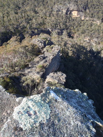
Is the end of a small spur. In keeping with the heavenly themed features in this area, Yuri Bolotin named it on a Bush Club walk on 7th June 2012. Located above the northern side of Bungleboori Creek, 3.3km south, south east of the Two Trees Road and Waratah Ridge Road intersection. Other features in this area include Holts Heaven, Angels Window and Angels Rest.
Axehead Cave
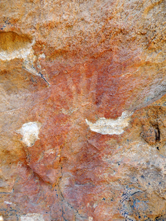
Located above the upper reaches of Bungleboori Creek has a width below the drip line of about 17m. The depth is about 13m as is the height at the front. The most visible sign that it is a significant Aboriginal site is the solitary quite large red ochre hand and forearm stencil on the left hand side wall of the cave. The assessment of the stone which gives the cave its name, was that it looks like a basalt stone core that has been well worked judging by what appears to be numerous flake scars on its surface, but it could have once been an axe, given its form.
Baal Bone
Is a locality name. The first land grant of Cullen Bullen, (2000ac), was taken up by Robert Venour Dulhunty. His brother Lawrence Vance Dulhunty also took a large grant of land nearby. Robert Dulhunty was at one stage Commissioner of Disputed Land Claims in Queensland. Robert's son, Lawrence Joseph Edward Dulhunty, moved to Queensland, where he held extensive properties and was a well-respected and influential person. Dulhunty Plains and Dulhunty River were named after his family. The Dulhuntys took an interest in Aboriginal names of the Tambo area. An Aboriginal name for water and drink in the Norman River area was "baal". Locally, Baal Bone Gap is the only easy accessible means through the cliff line to the headwaters of the Baal Bone Creek and further south to the headwaters of the Coxs River. The coining of the word, "bone" as in "pointing the bone" adds direction via this gap. Ref: Indigenous word lists compiled by Smyth and Curr. Dulhunty Papers.The Brisbane Courier, 26th March 1881, p. 7. This aboriginal place according to Helen Riley, Wiradjuri Elder and Sharon Riley, Wiradjuri representative is for, Mens Business, and they would go no where near it. Ref: Oral history 3rd May 2016.
Baal Bone Creek
*
Is a non perennial stream rising at Baal Bone Gap. It flows generally west, southwest for about 4km into Jews Creek.
Baal Bone Creek Trail
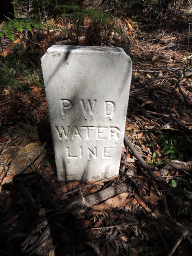
Is a NPWS signed trail named on the Ben Bullen topographic map with extensions to the south west being shown but not named on the Cullen Bullen topographic map. Taken at its greatest extension, it stretches from the Wolgan Road near Lambs Creek, GR 302 082,crossing through Gardiners Gap, passing east of the Baal Bone Colliery and terminating where it joins The Bicentennial National Trail about 1km south of Baal Bone Gap at GR 290 179.
Baal Bone Gap
*
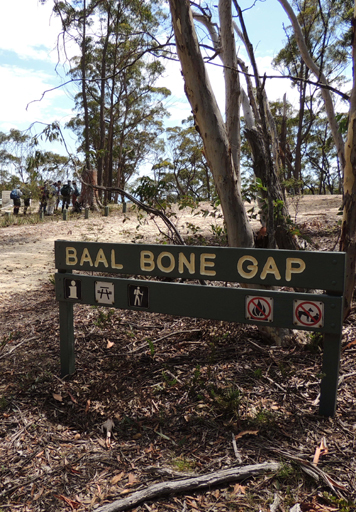
Was first shown on the map Parish of Ben Bullen, 1885. Baal Bone Gap is a saddle 1km west of Mount McLean. The Bicentennial National Trail crosses this gap.
Baal Bone Point
*
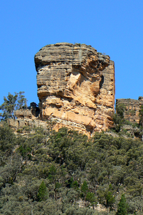
Was also first shown on the same map as Baal Bone Gap. Baal Bone Point is the terminal point of land at northern end of the escarpment 2.5km south west of Pantoneys Crown.
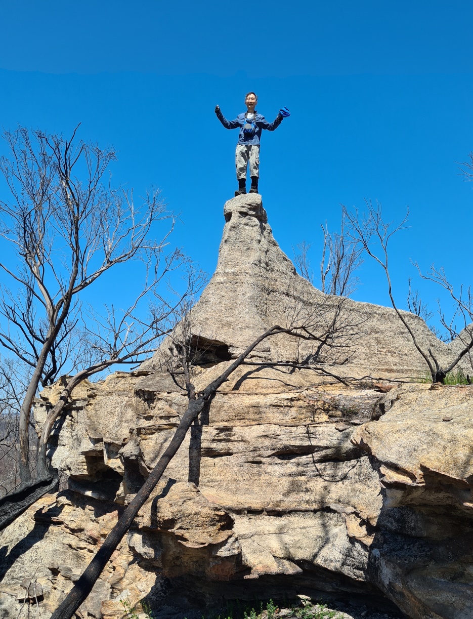
Baal Sphinx Rock
It is an interesting rock that looks like a Sphinx. Located 2.25 km north north west of Baal Bone Gap; exactly halfway between Mercurys Boot and Baal Bone Point. If you walk along the ridge from Baal Bone Gap to Baal Bone Point, you won't miss this rock. Named on a bushwalk led by Paul Ma on 15 October 2020, with Harold Thompson, Freda Moxom and Nick Collins.
Bald Hill
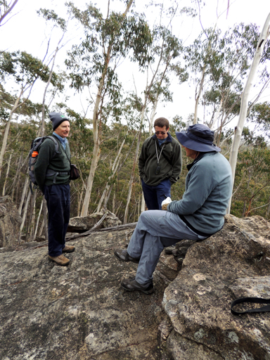
is a descriptive name for the hill on which Bald Trig Station is positioned. One of the most extensive views in this region is seen from this vantage point. Bald Hill. The name was described in the Lithgow Mercury 12th March 1908, ….Bald Hills greet the sight. These hills are well named, for they are indeed bald. The name is shown on the map Mount Victoria to the Western County, 1914. The previous name for Bald Hill was Panoramic Hill. Named by Surveyor Robert Hoddle, 20th October 1823. Ref: Colville, Berres Hoddle. Robert Hoddle Pioneer Surveyor 1794-1881, 2004, p. 43. The former Wolgan Valley Railway skirted Bald Hill on the eastern side.
Bald Ridge
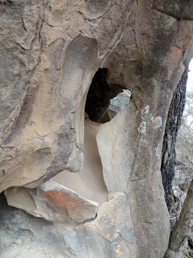
Was an older name for where the present Bald Hill and Bald Trig is located. Ref: The Lithgow Mercury 21st November 1902.
Bald Trig Station
*
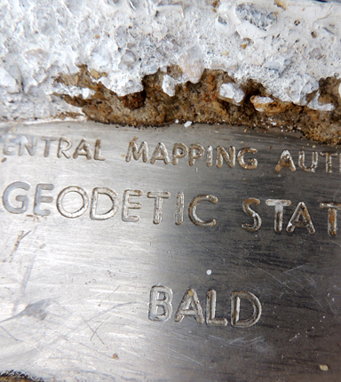
Is a trig station, at the elevation of 1180.70m, located on the ridge between the Bungleboori Creek to the north and north east and the Wollangambe River to the south and south east. The supporting stepped concrete base for this trig is over 2m high. The trig station was constructed in 1878-1879. Ref: Trig Summary Cards, Department of Lands, Bathurst.
Bandamora, Parish of
*
A lands administrative division within the County of Roxburgh. It appears that the current spelling of the parish is incorrect as the earlier references show it spelt as Bandanora. The Sydney Gazette, 5th January 1832, p. 1 records land sale, 640 acres at Bandanora, about fifteen miles from Cullen Bullen. The property, Bandanora, is shown on the map NSW, The Surveys of the Australian Agricultural Company, 1833. A written history by William Corlis who lived at the property Bandanora from 1851 recalls the station was always called Bandanora, but he did not know the origin or meaning of the word. Ref: Jefferys, Bruce. The Story of Capertee, 1982, pp. 16-17.
Banksia Slot
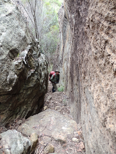
Was so named by Brian Fox on a Bush Club walk 29th April 2016 as it contained four very fine healthy examples ofBanksia serrata. Located above the cliff line overlooking Canobla Creek and would be a pass through the cliffs to Canobla Gap Trail. Access via Newnes, Little Capertee Creek Camping Ground, Cathedral Canyon and the end of the northern spur.
Banner Drop Lookout
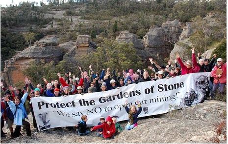
Is located on the western end of a short spur line off Gardiners Gap Trail within Ben Bullen State Forest 1.3km north, north west of Invincible Trig. So named after a protest in 2011 to stop open cut coal mining in this area. Name shown on Karen McLaughlin’s 2nd edition The Gardens of Stone Stage 2 Reserve Proposal Map, August 2016.
Barcoo Swamp
Is an old, disused name. Barcoo is an Aboriginal name meaning, "Ice on Water". Barcoo Swamp forms the headwaters of Deanes Creek. Barcoo Swamp is located on the north east side of the Glowworm Tunnel Road and Galah Mountain Road intersection. Cullen Bullen Topo Map, GR 438 111. Ref: Barcoo Swamp shown on Tramway from Wolgan to Clarence. Survey Plan M12435. Surveyed by John Haydon Cardew, Licensed Surveyor, 13th December1905. Stephens, Eric. Wolgan Railway Notebook, 1934-1937. Records, "Track to Barcoo Hut". The first land grant of Cullen Bullen (2000ac) was taken up by Robert Venour Dulhunty. His brother Lawrence Vance Dulhunty also took a large grant of land nearby. He was at one stage Commissioner of Disputed Land Claims in the Tambo, Barcoo district in Queensland. Robert's son Lawrence Joseph Edward Dulhunty, moved to Tambo, Queensland and it was here that some of his children were born. The Barcoo River runs past Tambo. Ref: Dulhunty Papers, The Brisbane Courier, 26th March 1881, p. 7. Carne, J E. Field Book, State Records, 2/663, 11th January 1906, records, "Barcoo Hut".
Baroque Spur
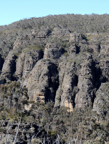
Is located on the western side of Deep Pass 1.3km south, south west of Deep Pass.Cliff lined on two sides, it contains the most intricate delicate erosion sculptures, incuding a window. So named by Michael Keats on a Bush Club walk, 24th August 2012. Michael chose the name, Baroque Spur, as the rocky features reminded him of the lavish architectural and artistic style of the baroque period.
Barton Creek
*
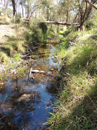
Is a non perennial stream rising at McLeans Pass and Mount Jamison. It flows generally east by north for about 10km into the Wolgan River.
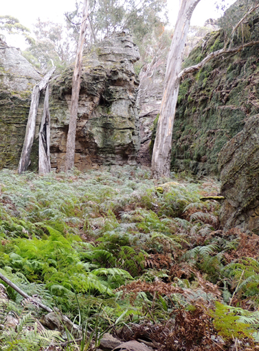
Barton Glen
is located above the cliff line 1.5 km north, north west of the Wolgan Road and Emirates One&Only Resort road intersection. This glen is about 450 m long and has a flat floor of about 50 m wide. On either side, there are great rows of pagodas with concealed slots; they are encrusted with Epiphytes. Named by Michael Keats, Brian Fox and Yuri Bolotin on a bushwalk of 24 March 2016.
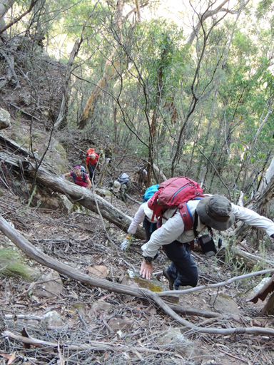
Barton Pass
Is a natural inclined ramp that gives access from the base of the first cliff line to the top of the southern point, Chimera Point, and plateau which overlooks the Wolgan Valley, Donkey Mountain and the property, Penrose below. Named by Brian Fox on a Bush Club walk, 24th March 2016.
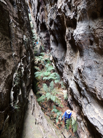
Barton Slot
Is located above the cliff line 1.5km north west of the Wolgan Road and Emirates intersection. This slot the about 200m long. In places it is 70m deep and varies in width from 50cm to 2m. Having a general gradient of 30 degrees except where a drop of 6m would entail a rope descent. Named on a Bush Club walk 28th August 2015 by Brian Fox, Yuri Bolotin and Michael Keats as it is located on one of the tributary creeks of Barton Creek.
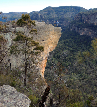
Beagle Head
Is located 400m south east from the locked gate off Wolgan River Trail at Newnes. But with an elevation difference of 280m. This huge undercut part of the top cliff face jutting out over the Wolgan when viewed from the north east resembled the head of a Beagle dog. Named by Brian Fox on a bush walk 28th July 2014.
Beecroft Firetrail
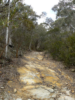
Is a NPWS signed track about 8km long. It commences in Masons Lane north of Lidsdale at GR 296 045 and tracks generally east to join the Blackfellows Hand Trail close to the headwaters of the Wolgan River, GR 358 026. Beecroft Firetrail was from 1876 a shortcut for drovers moving their cattle and sheep from Bell to Ben Bullen via Gardiners Gap. Ref: Brown, Jim. Bent Backs, 1989, pp. 275-276. Henry Beecroft (1852-1935) first held a Conditional Purchase, 29th January 1876, then in 20th February 1881, 69ac. Later purchased Portion 100, Parish of Lidsdale, 40ac in1903; Portion 101, 84ac in 1908. Ref: Survey Plan 936.1507 and Certificate of Title Vol. 1560, Fol. 154. The land was passed down jointly to his son, Norman Edley Searl Beecroft (1894-1982), and in 1937 to another son Joseph GeorgeBeecroft (1878-1953) and his wife Annie May Beecroft (1876-1962) who held it until 1954. Joseph George Beecroft also held two Conditional Purchases at Mount Cameron from 1903-1947. Ref: Survey Plan C2098 and 2099.1507.
Beecroft Trig Station
*
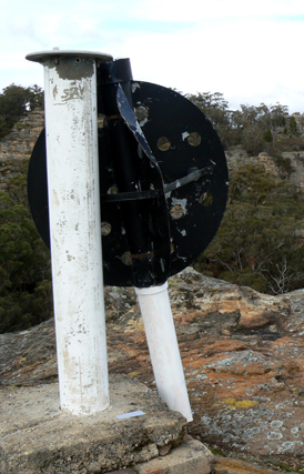
Was constructed by the Royal Australian Survey Corps in 1930. Ref: Lands Department Bathurst Trig Summary Cards. It is located at the elevation of 1025m on the southern side of Beecroft Firetrail, 2.5km north north east of Lidsdale.
Bell
*
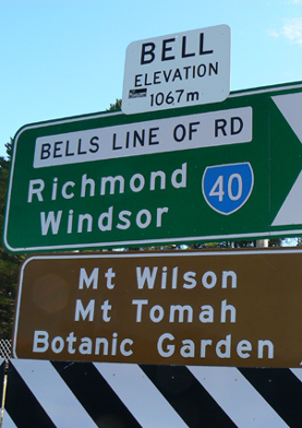
Is the locality on the north west extremity of the Grose Valley where the Darling Causeway joins Bells Line of Road. The railway station was originally named as Mount Wilson in May 1875 as it was here that travellers got off the train to continue their journey by horse and buggy to Mount Wilson. The name was changed to Bell Railway Station on the 1st May 1889, so named after Archibald Bell. The locality also taking on this name by default.There was a surveyed but unformed street in Newnes named Bell Street as well as seven families with the surname, Bell, appearing on the electoral roll as living in Newnes between 1906 -1922.
Bells Grotto
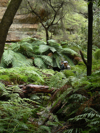
A beautiful Tree Fern filled grotto, is part of Tunnel Creek and is located on the southern side of the Glowworm Tunnel. This grotto by passes the tunnel. It was also referred to as Penrose Gorge. Eardley, G H. and Stephens, E M. The Shale Railways of NSW, 1974, p. 136, record, "The more hardy adventurous passengers left the train during the watering operation and walked the narrow footpath through the beautiful Bells Grotto." Ref: Deane, Henry. The Wolgan Valley Railway - Its Construction, 1910, reproduced by the Australian Railway Historical Society, 1979, p. 13, shows a map with Bells Grotto.
Bells Line of Road
Archibald Bell made a successful attempt of finding a passage from the Hawkesbury River to the Coxs River in September 1823. Surveyor Robert Hoddle was dispatched by Surveyor General John Oxley to survey this line just one month later, in October 1823. The name was referred to as Bell's Road, Ref: Government Notice, The Sydney Gazette and New South Wales Advertiser, 4th June 1829, p. 3. However, later the name was known as Bells Line of Road, Ref: Land sale advertisement in The Sydney Monitor, 18th June 1838, p. 3. The Lithgow Topo Map shows two sections of the Old Bells Line of Road. From Clarence to the junction of Glowworm Tunnel Road, and a small section of named road from Bungleboori Camping Ground in what is now known as Blackfellows Hand Trail. This was so named as it was part of Robert Hoddle's survey of Bell's Line, even though Archibald Bell did not traverse this area.
Ben Bullen
*
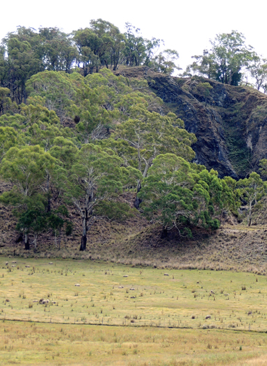
Is a village located about 9km north of Cullen Bullen and 21km north by west of Wallerawang. Its boundaries are within the Lithgow Council administrative area. On John Lang's second visit across the Blue Mountains in 1834, he recorded stopping at the property,Ben Bullen, owned by Thomas Cadell, J. P., who with his family had arrived from Sydney in 1832. Ref: Lang, John Dunmore. An Historical and Statistical Account of New South Wales, 1875, pp. 218-221. The Sydney Gazette, 3rd August 1844, p. 3, records a boiling down establishment for the production of tallow from sheep at Ben Bullen. The NSW Geographical Names Board records Ben Bullen as an Aboriginal derived word. Two meanings have been given: high, quiet place and Lyrebird. Endacott, Sydney J. Australian Aboriginal Words and Place Names, 1961, p. 11.
Ben Bullen Creek
*
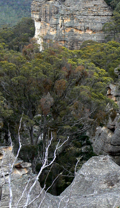
Is a watercourse rising about 3km west of Wolgan Gap Trig Station. It flows generally north north west for about 6.5km into Jews Creek.
Ben Bullen Pillars
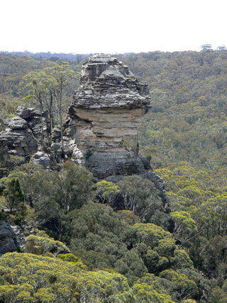
Are two very special prominent pagodas which can be seen from the Wolgan Road when passing through Angus Place. Both are subject to underground coal mining and one has a massive 45 degree split through it. Name given to them by Michael Keats and Brian Fox on a Bush Club walk, 21st December 2011.
Ben Bullen Railway Station
*
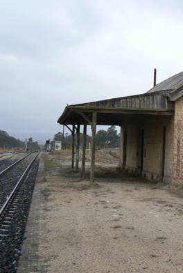
Opened on 15th May 1882 and closed on 1st June 1974. The Ben Bullen public school opened in January 1878 and closed in December 1949. Ben Bullen Post Office opened 1st November 1889, closed 6th March 1965.

Ben Bullen Range
*
Extends from the Great Dividing Range, 2.6km south west of Gardiners Gap. It trends generally north west for about 5km and finishes about 1km south east of Kirbys Hill. It was first shown on the Survey Plan 58.14996, dated 5th October 1853.
Ben Bullen State Forest
*
Is located in the Bathurst Forestry District. It has an area of approximately 19,220 acres (7,778ha). Ben Bullen State Forest was dedicated on 20th May 1938.
Benbys Pinch
*
Is a steep section of the old road way on the south side of the Wolgan River about 1km east of the Village of Newnes. Earliest map reference, Surveyor Edgar Harris on his survey of Wolgan River, October 1890. Ref: Survey Plan Misc. 111. Oe. R. One possible origin of the name is in recognition of William Benby. He arrived in Sydney from Brisbane on the steam ship Governor Blackall on 2nd June 1882. Another plausible suggestion is that the name was originally spelt incorrectly and that instead of Benbys it should have been Bendys Pinch as this pinch of land (tight constriction) is located where the Wolgan River takes a right hand turn from generally flowing south to north to west to east. This common descriptive name also fits with the common generic name of the named pinch further downstream, Devils Pinch.
Big Bell
Is a large bell shaped pagoda near the end of Point Cameron. Named by Dr Haydn Washington. Ref: Correspondence with Haydn Washington, 30th May 2010.
Big Foot Canyon
Was discovered by Ted Hartley on a Kameruka Bushwalking Club trip in 1977. It is located on the southern side of Island Mountain and accessed via Zobels Gully and Telephone Pass. It is a moderate grade three canyon with deep wades but no swims. It discharges into Deanes Creek.
Bindu
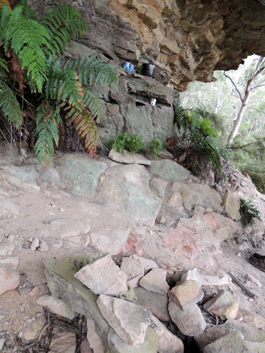
Is an overhang on the upper reaches of Kangaroo Corner Creek on the property Glastonbell. It is an old camping/ picnic site with old billies and mugs. GR withheld due to it being on private property.
Binnings Gap
Described by Surveyor, Joseph Carne, c. 1901, “as a well worn track that leads to a pass through the lower cliff line at a break to the right of the main gully.” Andy Macqueen, Wayfaring in Wollemi. pp 33-34 plus map reports, “The pass is steep and exposed. Above the pass the track appears to sidle for 140m until it intersects with the creek. It continues up the left hand side for 300m. The section from the creek to the small gully, although overgrown, was once laboriously benched and cleared of boulders and rocks.”
Binnings Hole
Is to be found at the junction of Annie Rowan Creek and the Wolgan River. It is first shown on Carne, Joseph. Geological Map of the Capertee and Wolgan Valleys, 1901. Carne, Joseph. Geology and Mineral Resources of the Western Coalfield,1908, p. 95. Alexander Binning (c1810-1863), a stonemason by trade, was a sub-inspector in charge of convicts working on Victoria Pass in the 1830s; he constructed Glasgow Arms Inn at Bowenfels and designed St Bernard's Church, Hartley, c1843. Ref: Cuneo, William Rev. Hunters of God, 1979, p. 26. Morgan, MacLeod. A short history of the Wolgan Valley, 1959. Jenkins, Yvonne. Bowenfels, 2008, p. 28. Survey Plan 491.691. Plan of 2 Portions applied for to purchase (Bowenfels), dated 1838. Alexander Binning also constructed Eskbank House, Bennett Street, Lithgow, in 1842, for Thomas Brown. This building is now a museum. It is most likely that Binnings Hole was named by Thomas Brown who had a selection of 80 to 90 acres there prior to 1899. Ref: Bathurst Free Press and Mining Journal, 28th April 1899, p. 3. Also see Rowans Hole, for geological description of the term 'Hole'.
Binnings Hole Neck
Is a 230m high basalt hill named by Joseph Carne, 27 October 1904, In his ‘Geology and Mineral Resources of the Western Coalfield, 1908,’ Carne writes “on south bank of Wolgan River, within the channel gorge. Apex at foot of southern escarpment of Hawkesbury Sandstone cliffs, extending thence to the river bank as a narrow, steeply falling ridge. Contacts well developed. Small channel down western slope exposing excellent sections of tuffs and agglomerates, GR 539 237. Ridge formed of olivine basalt. Patch of Coal Measure shales caught up in centre”.
Birds Cave No. 2
See Birds Caves
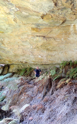
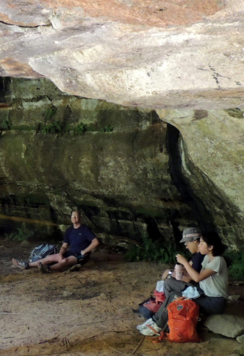
Refer to 3 caves along Birds Rock Creek. GR 402 083. The first and most significant is approximately 18m wide, 12m deep and 6m high with flat foor. The other two caves are located at GR 409 086, dimensions 25m wide, 10m deep and 10m high and at GR 410 086 a cave that is about 30m long and is effectively a two storey cave. It is proposed to name these caves Birds Caves after brothers James and Richard Bird. It is their names which was given to Bird Rock Trig. Station. Named by Yuri Bolotin and Michael Keats on a Bush Club walk 27th December 2013.
Birds Caves
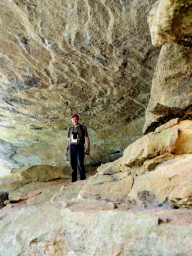
refer to three caves along Birds Rock Creek, GR 402 083. The first and most significant is approximately 18 m wide, 12 m deep and 6 m high, with flat floor. The other two caves are located at GR 409 086, dimensions are 25 m wide, 10 m deep and 10 m high; and at GR 410 086, a there is cave about 30 m long and is effectively a two-story cave. Birds Caves were named by Yuri Bolotin and Michael Keats on a bushwalk of 27 December 2013, to commemorate the brothers James and Richard Bird, after whom Bird Rock Trig Station was named.
Birds Caves No. 3
See Birds Caves
Refers to 3 caves along Birds Rock Creek. GR 402 083. The first and most significant is approximately 18m wide, 12m deep and 6m high with flat foor. The other two caves are located at GR 409 086, dimensions 25m wide, 10m deep and 10m high and at GR 410 086 a cave that is about 30m long and is effectively a two storey cave. It is proposed to name these caves Birds Caves after brothers James and Richard Bird. It is their names which was given to Bird Rock Trig. Station. Named by Yuri Bolotin and Michael Keats on a Bush Club walk 27th December 2013.
Birds Rock Creek
Is located within Birds Rock Flora Reserve. Having its headwaters off the eastern side of Birds Rock Trig Station, it flows generally east for 4.5km into CarneCreek. James (Jim) Lancelot Bird (1895-1978) and his brother Richard Edward (Bert) Bertrum Bird (1891-1961) during the 1920s used horse teams to log the area on top of Newnes Plateau. Jim also worked for the surveyor Lieutenant Colonel Clews when Birds Rock Trig Station was constructed in 1930 by the Royal Australian Survey Corps. Ref: Joe Bird (son of Jim) oral history to Brian Fox,15th June 2009. Lands Department Bathurst Trig Summary Cards. Survey Plan 2811 and 2812.1507 records James Lancelot Bird having a special lease of 339ac (137ha) between the years 1934 and 1961 within the Wolgan Valley.
Birds Rock Flora Reserve
*
Is roughly elliptical in shape and lies to the east of Birds Rock Trig Station within Newnes State Forest. About 16km north, north east of Lithgow. Access is via Sunnyside Ridge Road and Birds Rock Trail. Birds Rock Flora Reserve has a total area of 415ha. Originally accepted for preservation in 1966 but not gazetted until 23rd September 1988. A number of Eucalyptus species are in this reserve, including the Blue Mountains Ash,Eucalyptus oreades. Ref: Birds Rock Flora Reserve No. 126; Newnes State Forest No. 748, Working Plan.
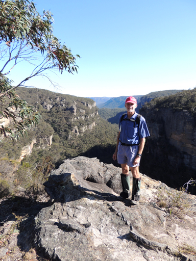
Birds Rock Lookout
Is a dramatic cliff edge lookout where the eastern end of Birds Rock Trail terminates less than 10m from a 150m drop into Carne Creek. Named by Brian Fox on a Bush Club walk, 10th October 2013. Access via Sunnyside Ridge Road.
Birds Rock Trail
Three numbered vehicular tracks that join Sunnyside Ridge Road carry this name.
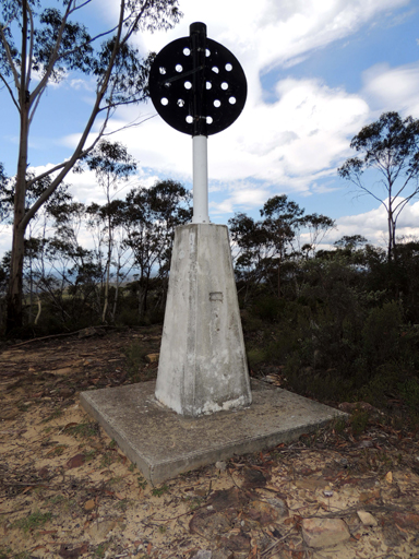
Birds Rock Trig Station
*
At the elevation of 1181m, is located about 6km south west of Deanes Siding and about 600m north, north east of the intersection of Sunnyside Ridge Road and Birds Rock Trail. T. S. No. 6278. Previously known as Sunnyside.
Birth Canal
Is a 180 degree bend below a spherical cavern within Kangaroo Corner Creek, 1.4km west of Bell. So named by a previous owner ofGlastonbell in the early 1990s.