Tunnel 55
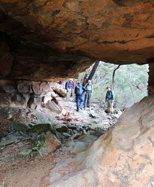
is located 1.7 km due west of Angus Place below the cliff face on a projecting spur of land. Nature has eroded out a tunnel and circular platform that in turn features at its centre a huge boss that supports a massive semi-isolated pagoda. Tunnel dimensions are 8 m long, 4.5 m wide and 3 m high. Named by Brian Fox on a bushwalk, 20 June 2016. The reason for naming is also that it is the location of an exceptional example of the surveyor’s craft, where three strokes symbolising the Broad Arrow with the number 55 below have been executed in bas-relief in sandstone. Research by Brian Fox confirms that the engraving is related to the eastern boundary of Portion 55, Parish of Cox, County of Cook. The original Survey Plan C1376-1507 is dated 15 November 1886. The perfection of this assemblage of the surveyor’s mark and numbers after 145 years is breathtaking. To make the discovery even more significant, the site also includes an original hand-built low rock wall or ‘lock spit’, which was part of the tradition of surveying at the time. Few examples of such craftsmanship still remain.
Tunnel Creek
*
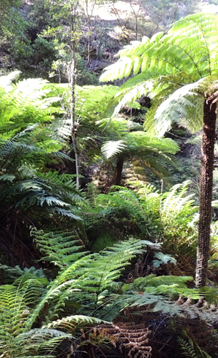
Is about 4km in length. It rises about 4.5km east, north east of Wolgan Pinnacle and flows generally north west into the Wolgan River. The Glowworm Tunnel is located midway along Tunnel Creek. This creek was originally named (see) Penrose Creek.
Tunnel Hill
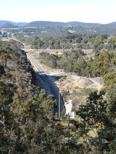
is located on the eastern side of the Castlereagh Highway overpass at Marrangaroo. A communication tower is on top of this hill. Named after the old railway tunnel at Marrangaroo that was opened in 1870. It closed when the railway line deviated in 1923.
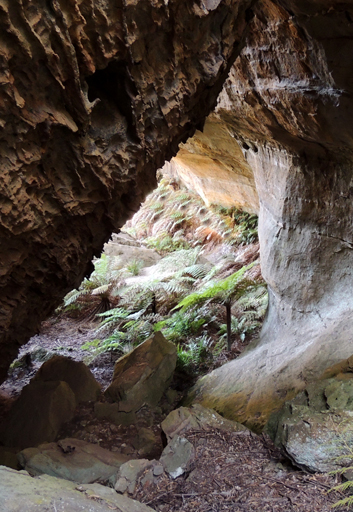
Tunnel Labyrinth
is located within Tunnel Creek, 900 m south east of the parking area/barrier at the end of the Glowworm Tunnel Road. This creek, named after the Glowworm Tunnel, just happens to have at its headwaters a number of tunnels, the largest being a long curving tunnel with its own tumble of dry rocks. It is over 30 m high and 10 m wide. The length is over 70 m. Named by Yuri Bolotin on bushwalk, 11 January 2016.
Tunnel of Love
Located near Point Nicholson. Ref: Tom Brennan's photo gallery, 1-2nd June 2013.
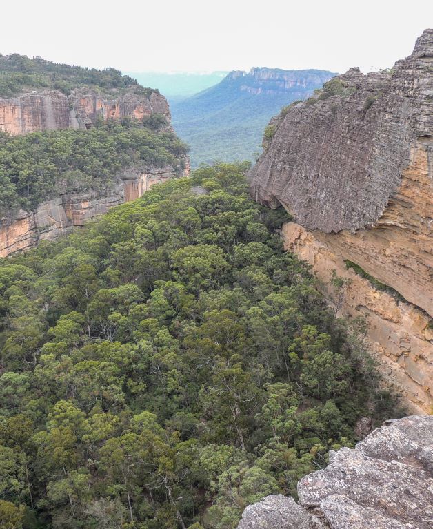
Tunnel Point
is a point of land on top of the cliff line directly above the northern side of the Glowworm Tunnel, Newnes. This natural edifice commands views over Tunnel Creek to the west, which are framed by multi-tiered amphitheatre-like walls that in turn frame a view of Donkey Mountain set in harmony in the Wolgan Valley. Directly below and beyond sight are the residual remains of the Wolgan Valley Railway and the entrance of the Glowworm Tunnel. Named on a bushwalk, 3 February 2017 by Michael Keats, Yuri Bolotin and Brian Fox.
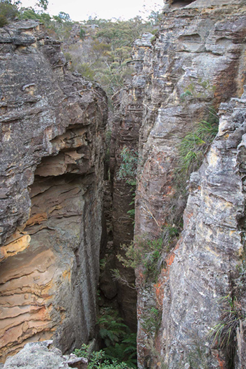
Tunnel Terrace Gorge
is a cliff-lined gorge and north-south tributary of Tunnel Creek, located above and on the northern side of the Glowworm Tunnel, Newnes. Named by Peter Medbury on a bushwalk he led in the area on 10 January 2009. Peter records, "Tunnel Terrace Gorge is a large blind canyon behind the Glowworm Tunnel. The gorge was eroded by a tributary of Tunnel Creek. The western walls of the gorge are sheer cliffs topped by fabulous platy pagodas. The eastern wall is a low cliff line decorated with another set of pagodas. Erosion under the western cliffs has created an amazing series of overhangs and terraces along almost the entire length of the gorge. The floor of the gorge is covered with beautiful forest. The northern end of the gorge is dominated by a single tree that towers above the forest and cliff walls. The gorge looks like there is no easy way in or out. On the eastern side, not far from the northern end of the gorge, there is a narrow hidden slot that leads up out of the gorge. "
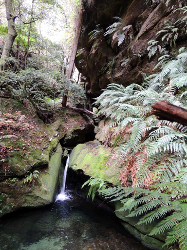
Turquoise Pool
is a blue/green pool with striking reflections of the surrounds. Located 2.1 km east, south east of the junction of Waratah Ridge Road and Two Trees Road. Named by Yuri Bolotin and Brian Fox on a bushwalk, 13 March 2014.

Turret Terrace
Is located 350m north east of Airly Turret and 270m south of the communication tower, Airly. This relatively flat ledge (terrace) extends for 300m within an overhang 15m below the top cliff line and 30m above the forest floor. Named on a bush walk, 17 April 2021, by Yuri Bolotin and Peter Medbury after the nearby feature, Airly Turret.
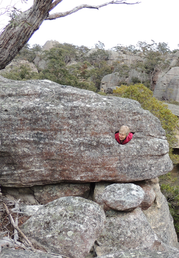
Turtle Rock
Is a natural erosional rock which has given this beast an eye socket and a quizzical smile. Located above and south of Pandoras Box within Hecates Cauldron, Named by Yuri Bolotin, 29th August 2015.
Twilight Cave
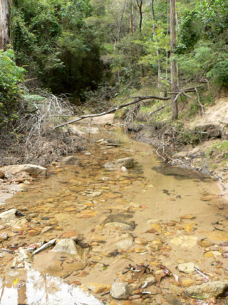
Twilight Creek
Rises on the eastern side of Island Mountain between the Devils Pinch and Rocky Creek. This creek flows generally north east for 3km to its junction with the Wolgan River. The name was derived from Twilight Canyon which is near the top of this creek system.
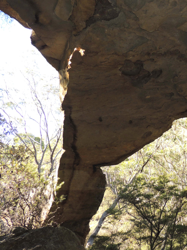
Twin Arch Cave
Also known as Double Arch Cave or Ronald McDonald Cave, is located on the northern side of a small gully above the main cliff line, 160m south, near the end of Fire Trail No. 7, which in turn is off Glowworm Tunnel Road. It was accidentally discovered on 20th March 2013 by a bushwalker who misinterpreted information received from rock climber Karen Coghill. He gave it the descriptive name Twin Arch Cave due to a natural arch dividing this overhang in two.
Twin Heads
Relates to a huge outcrop of rocky cliff line and pagodas. Located 2.5km north west of Blackfellows Hand Trail and Kangaroos Creek Road. Named by Hugh Speirs 15th June 2013.
Twlight Cave
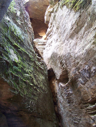
Two Storey Cave
See Donkey Mountain, north east section
Two Towers
are two very high smooth pagodas within Hecates Cauldron. The one to the west is an easier (but still quite challenging) climb. The view north from the top of the Hecates bubbles is arguably the finest in this area. Named by Yuri Bolotin on a bushwalk of 29 August 2015.
Tyldesley
*
Is a locality name that comes from Tyldesley, Lancashire, United Kingdom, where Tyldesley Coal Mine was operating from the 1850s. The village of Tyldesley via Cullen Bullen came into existence to house the employees of the Great Western Colliery from 1904. In 1916, Tyldesley Coal Mining Co. Ltd took it over. The village ceased to exist by the early 1960s. Tyldesley Public School opened in May 1922 and finally closed in December 1963. Ref: Christison, Ray. History of Tyldesley Village, 2003. Today, Tyldesley is a rural place 2km north west of Cullen Bullen, accessed via Tyldesley Road.
Tyldesley Colliery Siding
Opened on 27th August 1909 as Great Western Colliery Siding; by 1960, the siding was abandoned.
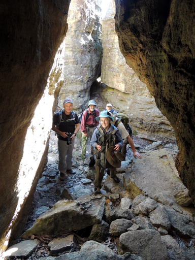
Tyldesley Grikes
Refers to the many very deep grikes or slots on the north eastern side of Tyldesley Hill. Named by Michael Keats on a Bush Club walk, 2nd November 2012.
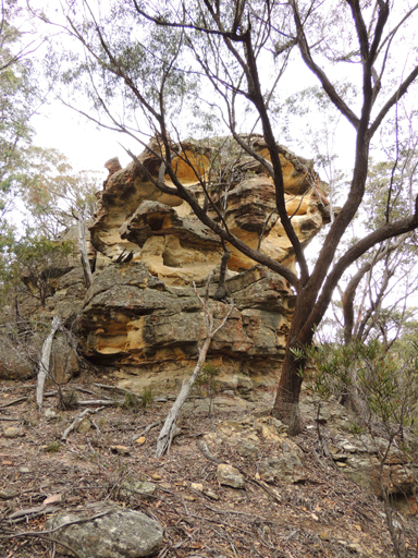
Tyldesley Hill
*
Is located on Ben Bullen Range between Castlereagh Highway on the east and the railway on the west. It is 1.9km north, north west of Cullen Bullen. The top of this hill is surmounted by Cullen Bullen Trig Station at 1066m. Tyldesley Hill takes its name from this village.
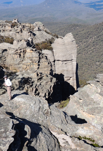
Ultimate Chute
Is an unbelievable slot partly seen from the Ultimate View which gives access to the eastern side of Airly, from the headwaters of Dog Trap Creek and Glen Davis Road to the top of the cliff line. Located 300 m south east of Genowlan Trig. This almost 100 m high slot (no ropes required) was named by Daryl Watson on a Bush Club walk, 10th August 2015.
Ultimate Slot
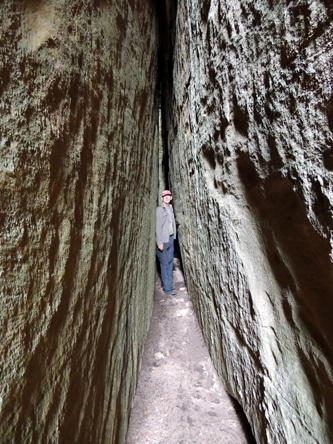
Was so named by Brian Fox on a Bush Club walk, 2nd March 2015 after the experience of viewing the Ultimate View. Located 700m north, north west from Genowlan Trig. This slot is 50cm to 3m wide, 55m long and 80m high. The walls are parallel all the way to the top and the lateral displacement is constant. High above where light can enter, four chock stones are positioned at regular intervals.
Ultimate View
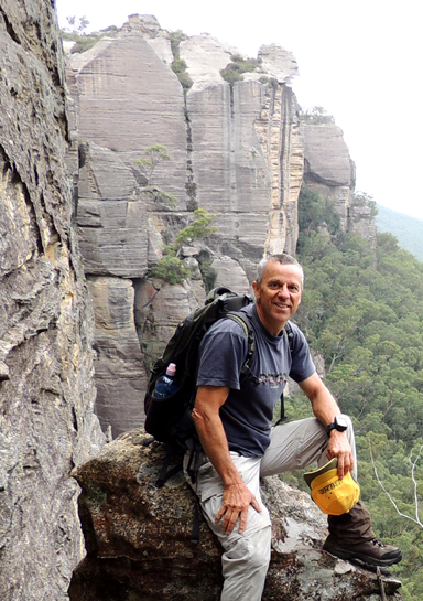
Refers to the most stupendous outlooks from the top of Citadel Spur 480m near due south of Genowlan Trig . Views across the Capertee Valley and the peaks of all the surrounding mountains, plus the majesty of Pantoneys Crown . Named by Sheila Zaman on a Bush Club walk, 2nd March 2015.
Undercliff Path
Undercliff Track
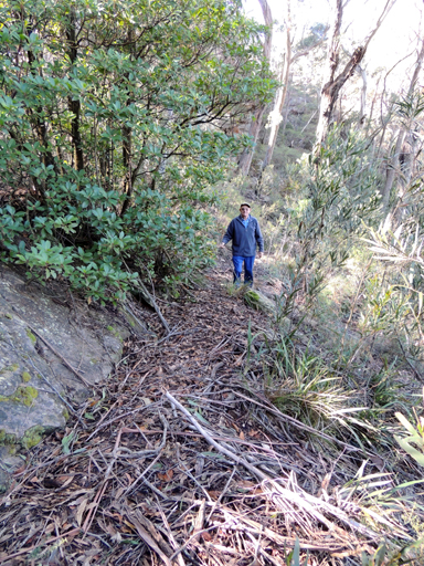
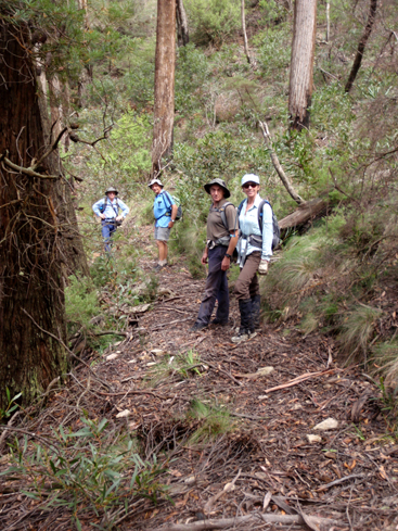
This track roughly follows underneath the top cliff line of Hassans Walls Reserve, from Hassans Glen to above the cliff line at Heffernans Pass. This track over time has been closed due to rock falls and neglect. The Lithgow Mercury, 5th May 1916, p. 6, records, “The Shire Engineer, Mr G. F. Allman….had surveyed the track under the cliffs at Hassan’s Walls for a length of 50 chains(one kilometre)…site of the new Undercliff track.” Graham Holbeach, records, “I have an association with Padleys Pass (the Undercliff Track) which was constructed between 1915 and 1920…..Jim Smith had come across a single photo labelled something like “The Undercliff Track at Hassans Walls.” I think this is the first he had heard of it. The two of us went to look for it. He figured it would probably be somewhere near the main lookout. From the look out, I spotted a benched track heading down a gully. Except where the track crossed coal mining induced landslides, it was easy to follow, as the area was very dry. We found four entry tracks including a magnificent buried set of cut stone steps, as well as caves, rock seats and a bush table and seat. Jim, the late Wilf Hilder and I overhauled the track system and completed the unfinished western section. I did the heavy work of creating the sections across the landslides using a sledgehammer and mattock. I took two sickies and camped beside the track to finish it by the 'deadline'…… He (Jim) …produced two maps plus a two page info sheet with time line for the reopening on 24/11/90 by the Lithgow mayor. We had over 100 attending”. Jim Smith also records that Bernie Wilkes was part of the team which helped restore the track. Ref: The Journal of the Sydney Speleological Society, Vol. 60; No. 7, July 2016; No. 725, p. 185.
Under Cliff Track
Upper Hades Ridge
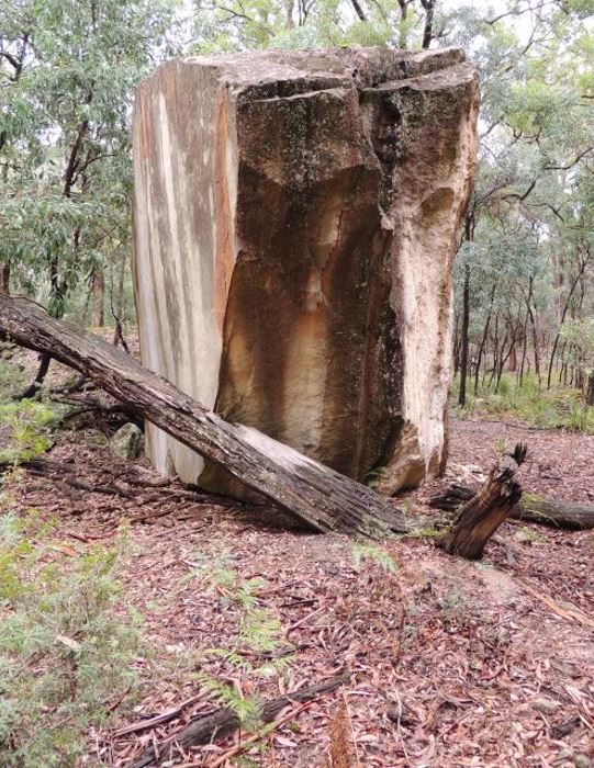
Upturned Giants Table
is located on the Philosopher’s Walk. It is accessed via Little Capertee Creek Camping Ground by walking towards the base of Old Baldy. Named by Thomas Ebersoll, owner of the Newnes Holiday Cabins, due to a very large upturned rock with one surface almost ‘billiard table-like’ flat. Fortuitously, the surface is orientated in such a way that no moss, lichens or epiphytes grow on it. The analogy to a table top is perfect.
Utopia Room
Has an overall length of over 80m, and there are two distinct sections, one narrow and one wide with a vertical wall at the end. Located on the northern side and above the headwaters of Canobla Creek, 1km south, south east of Point Anderson. Named by Yuri Bolotin on a Bush Club walk, 20th April 2017. Yuri recorded, “When during our previous trip, we had been standing above the slot and peering down into it, we were enthralled by the vision of long parallel walls, framing a rectangular space of almost perfect proportions; green, luxuriant tops of ferns and rainforest trees completed a beautiful, immaculate, somewhat utopian vision of a hidden paradise.”
Vale of Clwydd
Governor Macquarie named the Vale of Clwydd on 29 April 1815. After leaving the base of Mount York he described his party’s route along Cox’s Road:“we pursued our journey in the carriage over a fine plain verdant country of open forest land through a beautiful extensive vale of five miles which I have named the Vale Clwydd after the vale of the same name in Wales". William Mylecharane (1832-1917) licensed surveyor in 1892 recorded the Aboriginal name for, The Vale of Clwydd as, Tuiwon. Ref: Smith, Jim. Does the Cox River have an Aboriginal name? Blue Mountains Historical Society, Hobby’s Outreach Vol. 28; No. 3, June – July 2016.
Valley of the Caves
Is within a small valley 900m south east of Beecroft Trig and south of Beecroft Firetrail. The base of the cliff line is studded with numerous overhangs. Named by Michael Keats on Bush Club walk, 16th June 2014.
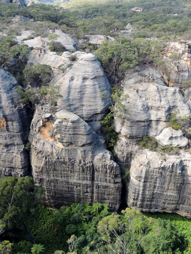
Valley of the Dinosaurs
Refers to a narrow, deep canyon which forms part of the headwaters of Genowlan Creek. It is located 500m north, north east of Genowlan Trig Station. Named by Bruce Mullaney, a bushwalker with the Central West Bushwalking Club, in 2001. When he gazed down from the top rock platform into this hidden canyon, it looked prehistoric. Note this feature had been previous named as (see) Hidden Valley.
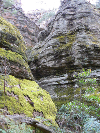
Valley of the Kings
Is a pagoda lined tributary in the upper reaches of Genowlan Creek. Located 1km north east of Genowlan Trig Station. The western end of this ravine has a 10m drop. Named by Dr Haydn Washington, November 1984. Ref: Correspondence with David Blackwell, 27th April 2010 and Haydn’s map.
Valley of the Swamps
*
Is located in the Blue Mountains National Park, 7.2km east, south east of Deep Pass and about 6km south, south east of Rock Hill. Name shown on the 1:63 360 Army Survey Corps Wollangambe Map. Named by Lieutenant Colonel Clews, Royal Australian Survey Corps, survey party, 1930. Ref: Gough, Noel R. "The Major" Lt. Col. Hugh Powell Gough Clews.
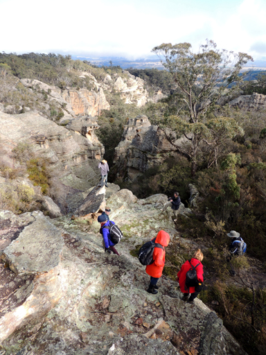
Vertigo Slot
Is located 1.8km north east of Invincible Trig. Named by Yuri Bolotin, June 2013. Yuri recorded, looking at it from the top, it is so steep and narrow, and it gives you a sense of vertigo.
Wallerawang
*
Various spellings have been recorded for Wallerawang: Walerawang, 12th November 1823, Surveyor James McBrien, native name of the creek, (Coxs River). Ref: Field Book 205, State Records: NRS 13889 [SZ205]. Wallerawang, 1830. Ref: Survey Plan 8.691 by James Byrne Richards. Wallerawang, 1833. Ref: The Surveys of the Australian Agriculture Company, published 1st September 1833. Wallerowong, 1856. Spelling as per grave stone erected by Archibald James Walker "in memory of Bobby and the Wallerowong Aborigine Tribe". Same spelling recorded by Archer, Thomas. Recollections of a Rambling Life, 1897, p. 14. Wallerrawang, 1875. Ref: Lang, John Dunmore. An Historical and Statistical Account of New South Wales, 1875, Vol. 2, p. 201. Note: the present spelling is the same as the 1830 and 1833 reference. Colloquially by the locals, the village is referred to by the diminutive "Wang". This aboriginal name according to Helen Riley, Wiradjuri Elder and Sharon Riley, Wiradjuri representative means 'Place of Wood and Water. Ref: Oral history 3rd May 2016.
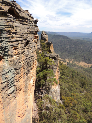
Wall of Teeth
Is a narrow rocky outcrop on the north south spine between Red Rocks and Mount Dawson. Named by Dr Haydn Washington, c1984. It is aptly named for the serrated projecting ironstone ledges that from below give it the appearance of either dragon's back or a buzz-saw blade, depending on your point of view. Ref: Correspondence with Haydn Washington, 30th May 2010.
Walls of Jericho
Refers to the cliff line on the southern side of the Wolgan River midway between Devils Pinch and Rocky River. Name recorded in Taylor, Pete and Penney, Andrew. The Wolgan Guide, 1984, p. 25.
Walls of Jerusalem
Wall Wall
Is the Aboriginal name for Blackmans Crown. Ref: Smith, Jim. Wywandy and Therabulat. The Aborigines of the Upper Coxs River and their association with Hartley and Lithgow, 1990. Smith records that Wall Wall is a Gundungurra name.
Wangcol Creek
*
Is about 7km in length rising north west of the town of Wallerawang. This creek was named after the name, Wallerawang Colliery. The word, "Wang" is the slang name for the locality. The colliery closed about 1985. Its headwaters are on the northern side of the Mount Piper Power Station and flows generally south east into the Coxs River. The name was assigned by the Geographical Names Board, 7th May 1993.
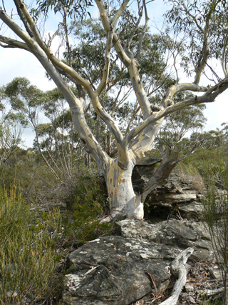
Waratah Ridge
*
Trends from the Blue Mountains Range 3.5km west of Mount Horne in a generally eastern direction for about 13km. This is a descriptive name, as each year many Waratahs flower there from around October. A part of this ridge is traversed by Waratah Ridge Road.
Watch House Creek
*
is a non perennial creek rising on the eastern slopes of the Great Dividing Range 3.5km south, south east of Mount Alloway. It flows generally north and north east for about 4km into Alloway Creek. So named after the Watch House (police lockup) that was located on the southern side of Capertee. Ref: The Sydney Gazette, 12th August 1837, p. 4 which records tenders called for erecting a watch house at Roxburgh. Shown on the map Parish of Coco, 1883.
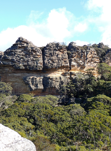
Watch Towers
Is a conjoined group of pagodas above the cliff line, 400m south west of Woolpack Rock and 1km south east of Hughes Defile. This viewing location has extensive views across the Wolgan Valley, hence its name. Named by Michael Keats and Brian Fox on a Bush Club walk, 27th May 2016.
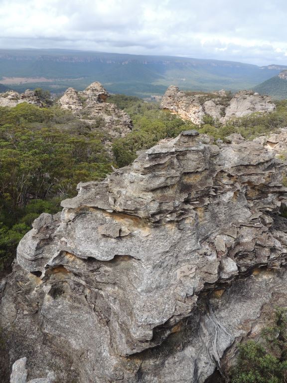
Watch Tower Spur
Is a significant spur that runs diagonally across an area known as Alcatraz at an altitude of over 1000m; it has the feature called Watch Towers on its southern end. The spur offers spectacular 360 degree views along most of its length. Located 300m to the west of Woolpack Rock. Named by Yuri Bolotin, Michael Keats and Brian Fox on a Bush Club walk on 27th February 2017.
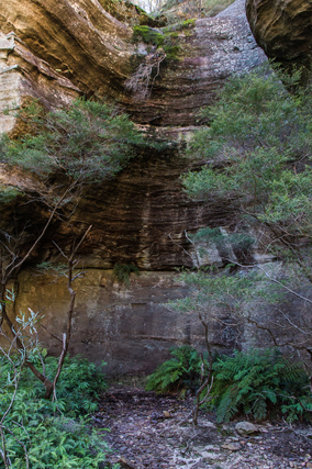
Waterfall Ledges
Were named by Yuri Bolotin on a Bush Club walk, 15th August 2013. Located 1.3km north east of Invincible Trig Station, these successive ledges can be walked and explored. The top ledge of variable width trends for some 60m into a hook shaped arc, where there is a small waterfall.
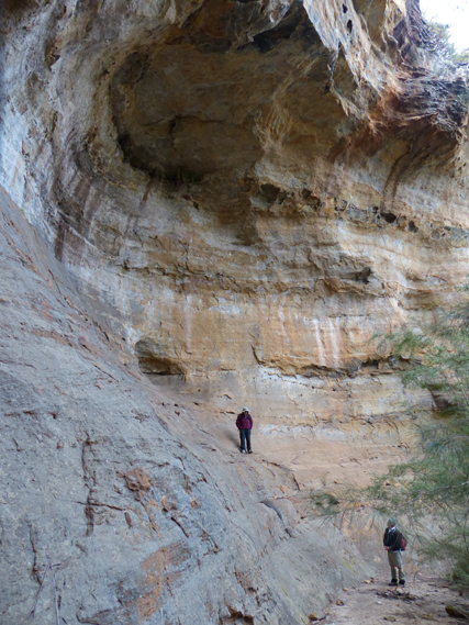
Weather Cave
Is located off Glowworm Tunnel Road and Fire Trail No. 7. It is a long, narrow overhang running up the side gully adjoining and on the northern side of Rain Cave. This overhang was surveyed by Ross Ellis and Erik Halbert on 18th October 2006. Ref: The Journal of the Sydney Speleological Society, 2007, 51 (5); pp. 134-138.
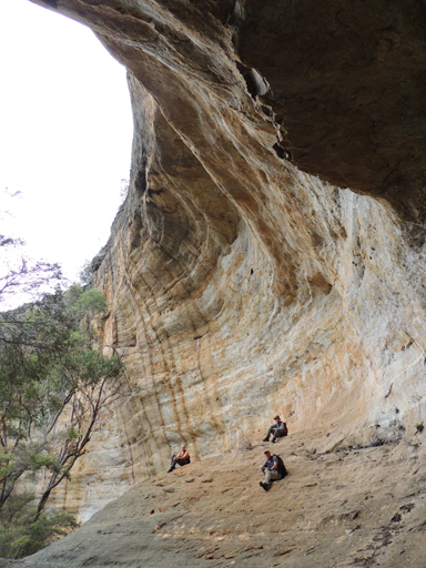
West Side Chamber
100 metres north of West Side Falls, a weathered cavern of eroded red brown sandstone over 100m in length. Both features are 2.6km west of Cockatoo Hill. Named by Yuri Bolotin on a bush walk, 22nd May 2015. .
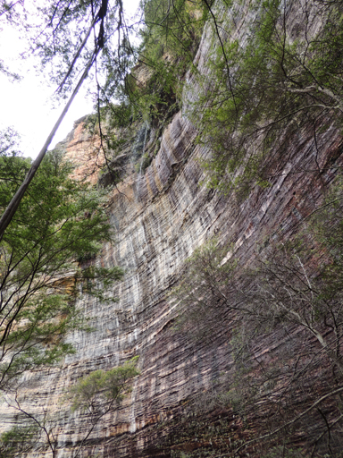
West Side Falls
Is a beautiful finely dispersed waterfall dropping about 50m as a single drop and onto a dome shaped mound. Located on the western side of East Creek and 700m downstream of East Creek Falls. Named by Yuri Bolotin on a bushwalk, 22 May 2015.