The Slip Rails
Is a narrow ridge line between two drainage patterns on Mount Cameron Trail, 2.7km west, north west of Mount Cameron. Ref: Correspondence with Danny Whitty, 3rd July 2010. Local usage name, prior to 1980s. This would have been an ideal location to construct slip rails across this narrow ridge to control stock movement.
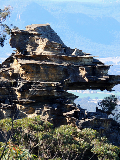
The Sphinx
Is a singular rock structure on Tresure Point, that when viewed from a particular angle, resembles an Egyptian Stone Sphinx. Located on the south east extremity of the Valley of the Kings. Name created by the original three who were jointly responsible for the name, The Gardens of Stone National Park, proposed by Rodney Falconer. The three were, Rodney Falconer, David Blackwell and Dr Haydn Washington, November 1984.
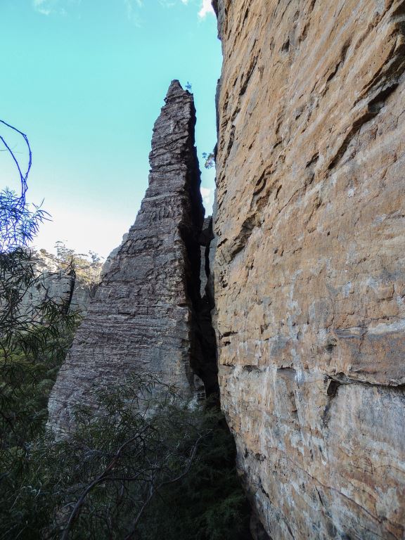
The Spire
Is a huge 40m high rock tower of ribbed grey sandstone, which has separated from the main cliff line. It is square at the bottom and tapered to a sharp point at the top. Located on the southern side of Donkey Mountain below the saddle that separates the The Columns from the eastern section of Donkey Mountain. Named by Brian Fox and Yuri Bolotin on a Bush Club walk 7th July 2017.
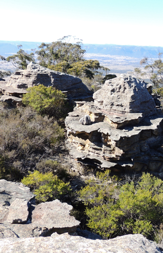
The Three Hundred Sisters
Refers to the hundreds of spectacular rock formations on Genowlan Mountain. The name is a "take off" of The Three Sisters at Katoomba, as in, 'Just three', at Genowlan there are three hundred. Name was coined by Dr Haydn Washington. Ref: National Parks Journal, October 1998.
The Towers
Are a line of rocky pagodas rising like towers from the tree canopy below. Located midway between Mount Airly and Blacks Corner. Best viewed from the western end of Airly Tramway Trail. Named by Dr Haydn Washington c1984.
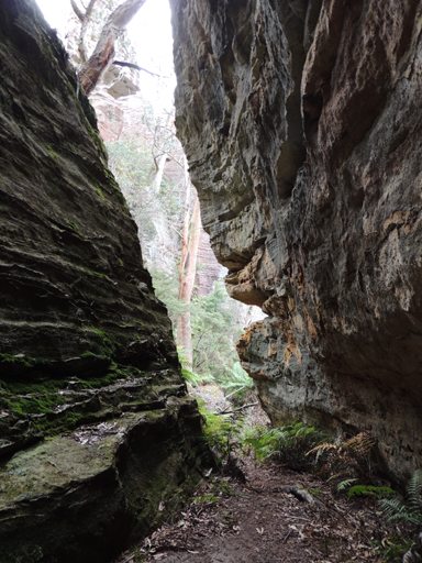
The Trapdoor
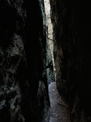
So named by Yuri Bolotin, 29th August 2015, as a deep narrow parallel sided passageway has occurred due to a block of great dimensions that has moved out from the cliff face. The glide path is at 45 degrees from the point of detachment, so the passageway is the same width both before and after it has taken a 90-degree turn. Located below the cliff line within Hecates Cauldron.
The Triangle
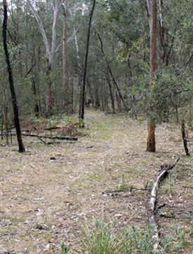
See note within Constance Locomotive Depot.
The Trident
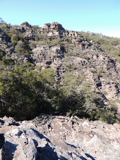
Was so named as three heavily dissected and pagoda encrusted ridges form a triple prong shape. Located above the headwaters of Koopartoo Ravine on the Koopartoo Mesa. Midway between Capertee Creek and Wolgan River. Named by Yuri Bolotin and Michael Keats on a Bush club walk, 6th May 2016.
The Wall
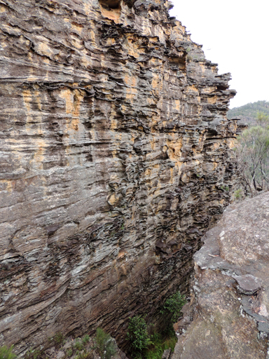
Is a highly eroded almost vertical rock face within a narrow canyon that is accessed via Glowworm Tunnel Road and Waratah Ridge Road. It is located 3.3km south, south east of the junction of Waratah Ridge Road and Two Trees Road and 200m to the north of Bungleboori Creek. Named by David Blackwell, 19th September 2010.
The Watchtower
Yuri Bolotin named this huge pagoda, located on the edge of the City in the Sky, at GR 2566 3240, 983m, on 7 August 2017.
The Whale
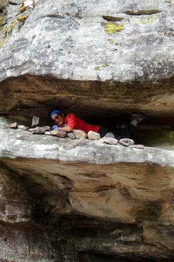
Is a rock formation on the track to Nobles Canyon. This distinctive rock with its wide open mouth and bulbous head has had many a photo with a person in its mouth. Brian Fox has referred to this name since 2010, but invariably has been known by similar names, ie The Shark.
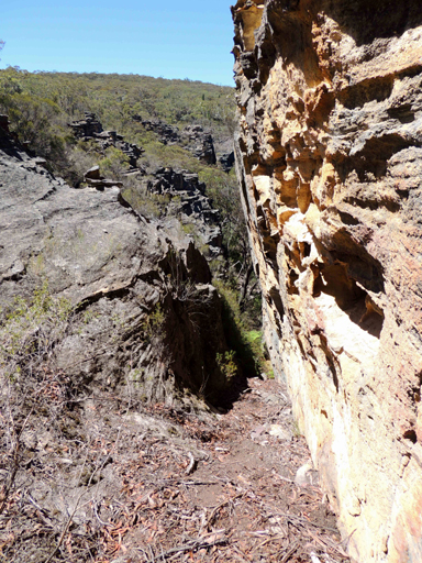
Thom Slot
A slot with an easy grade internal ramp. Named by Brian Fox to give recognition to Surveyor William Stronach Thom (1871-1918). Employed for 30 years in the NSW Government Railways. Deane, Henry. The Wolgan Valley Railway – Its Construction, pp. 5-6, records, “The new surveyors included Mr. Thom who had previously held an appointment under me in the Department of Works….Mr Thom was instructed to work up the Sunnyside route….1906.”
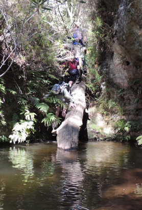
Thorpes Constriction
Is a 2m drop in which water passes through a narrow slot, 1.9km east, south east of the junction of Waratah Ridge and Two Trees Roads. Named by Michael Keats on a Bush Club walk, 15th February 2009, after The Bush Club member, Ian Thorpe.
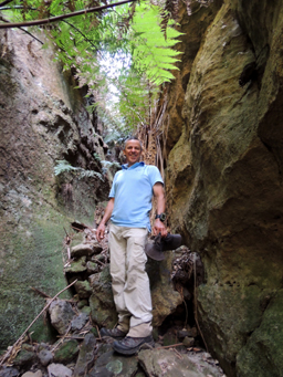
Thorpes Folly
Located 400m south west of Derailment Hill, was named by Caro Ryan in 2008 after Ian Thorpe suggested that it would be an easy walk across from the current location to the cliffs some 100m further north. It proved to be anything but easy.
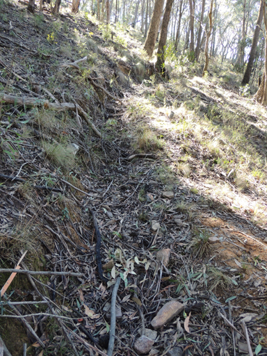
Three Foot Track
Appears to be the original walking track from the Lithgow township to Hassans Walls. It ends at the top of Rutherford Glen.
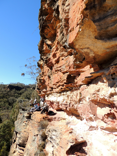
Three Level Cave
Encompasses three levels, the top level being one to three metres wide, with the valley floor about 40m below. Located on the northern side of the junction of the Great Dividing Range and Ben Bullen Range. Named by Michael Keats on a Bush Club walk, 26th July 2013.
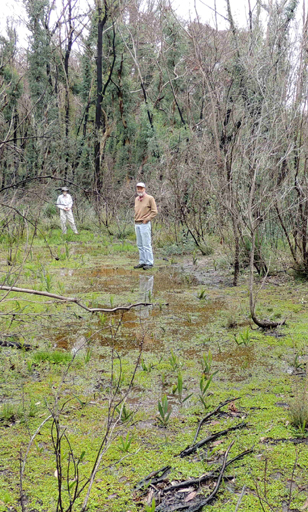
Three Mile Siding
Used to be a railway siding on the Wolgan Valley Railway, about 300m north east of Bald Trig Station. The railway (now road) wound around the eastern side of Bald Trig. Ref: Jacobi, C R. The Railway and Tramway Magazine, A Trip to Newnes Junction and the Wolgan Valley, 2nd May 1921.
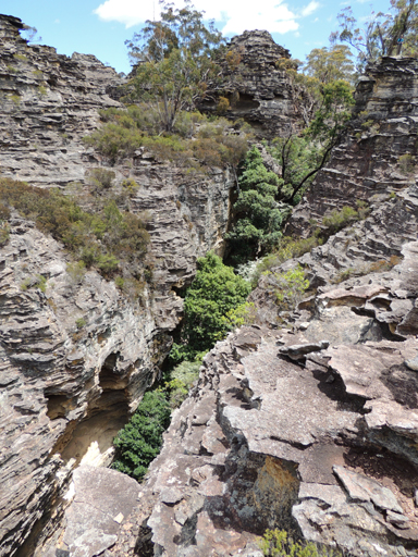
Tiger Snake Canyon
The bottom section was discovered by a Sydney University - Ramblers trip in September 1977. When walking up this creek, they encountered a Tiger Snake. The day after when finalising a map of the area the name was coined by David Noble and Keith Maxwell. Ref: Map and correspondence Keith Maxwell 13th February 2016. Canyons Near Sydney by Rick Jamieson, 4th ed, p. 50.
Tiger Snake Canyon Track
Is accessed via Glowworm Tunnel Road and 4.2km along the Old Coach Road to a parking area and NPWS signage. The start of the track is on the east over a barrier and a couple of logs on an old firetrail. This track gives access to the such locations as the, Pentafid, Tiger Snake Canyon, Constance Point, Rock Island and Deanes Creek. Originally this track carried the Newnes Industrial Complex pre Wolgan Valley Railway telephone line to Newnes, c1905.
Tiger Snake Creek
Is a non perennial creek, 1km in length. It flows generally in an easterly direction into Deanes Creek. The creek junction is 400m south of Deanes Creek and Constance Gorge junction. Its name is derived from the name of the canyon.
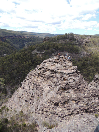
Tiger Snake Point
Is the highest pagoda above and on the eastern side of Tiger Snake Canyon. It is also above the junction of Constance Gorge and Deanes Creek. Named by Yuri Bolotin on a Bush Club walk, 8th January 2016.
Tindalls Swamp
Is an area of swampy ground on the Wolgan River, 2km upstream of the Wolgan Falls. It is named after an old local timber cutter. The name was in use when the bullockies pulled timber from this area, up to the 1950s. Ref: Oral history, Ossie O'Brien, 20th April 2012.
Titanic
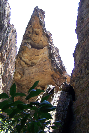
See Donkey Mountain, north east section
Tootie Arch
*
test text for new name text text text
test test test
Too Tight Crevasse
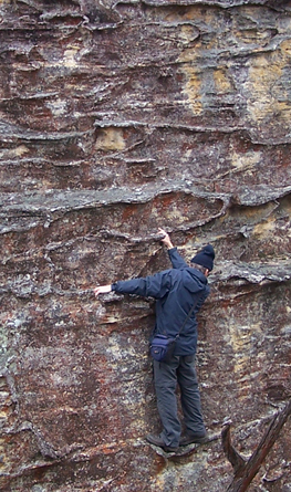
See Donkey Mountain, north east section
Top of the Town
The highest area in the City in the Sky, GR 2569 3246, 990m. Named by Yuri Bolotin on 7 August 2017.
Top Slot
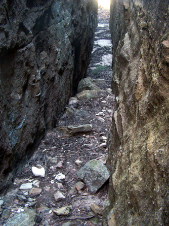
See Donkey Mountain, north east section
Torbane
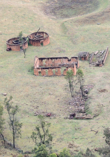
Was a private village, constructed in 1889 for employees working the retort complex that processed kerosene shale transported by various means from the mines in the adjoining eastern valley of Airly. Torbane School opened in October 1899 and closed in September 1920. Torbane in NSW was named after a village of that name in Scotland which came to be associated with the Boghead Deposits discovered in 1844. At the time, the mineral Torbanite became known as Boghead Mineral. Commercial extraction of oil on the shores of the North Sea dates back to 1851, when James Young retorted oil from Torbanite. Ref: Eardley, G H. and Stephens, E M. The Shale Railways of NSW, 1974, p. 99.
Torbane Balcony
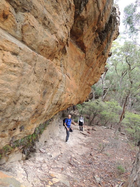
Is located on the western side of Mount Airly, below the line of pagodas known as the Great Wall of China. The balcony seems to exist due to a soft band of shale, very possibly an extension of the Mount York Claystone band that features throughout much of the area. It has eroded much faster than the sandstone and created a more or less continuous convoluted bench for a little more than 300m. Named by Peter Medbury, 16th December 2016.
Torbane Blade
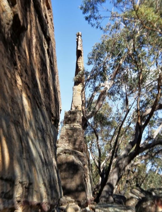
Is located 750 m west of Mount Airly, below Torbane Balcony. Named by Yuri Bolotin and Peter Medbury on a bushwalk 14 June 2021. Yuri recorded, "The opposite (northern) side of the blade is even more impressive, as it tapers down to an almost single point. Dimensionally, this feature is about 8 m high, 20 m long and has a variable width of 1 m to 20 cm; it is separated from the cliff line by a slot 1.5 m wide at one end and 30 cm wide at the other.".
Torbane Creek
*
Is a non perennial stream rising on the western slopes of Mount Airly. It flows generally north, north west for about 6km into Oaky Creek.
Torbane Platform
Was a railway platform, opened on 4th June 1900, closed on 21st September 1974. Ref: Forsyth, John. How and Why of Station Names, 2nd ed. 1982, p. 220. Carne, Joseph. Geological Map of the country in the vicinity of Capertee, 1900 shows Torbane Platform, Private Village of Torbane and Torbane Creek as Wallaby Oaky Creek.
Torbane Railway
Opened as a siding for the Australian Kerosene Oil and Mineral Company on 14th May 1897, from the Mudgee Line to Torbane Siding. It ceased to operate on 4th September 1897.
Torbane Slot
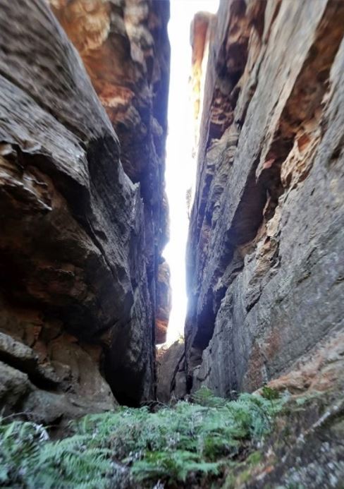
Is located on the north western slope of Mount Airly, 800m from the top and below the northern section of Torbane Balcony. Named by Yuri Bolotin and Peter Medbury on a bushwalk 14 June 2021. Yuri recorded, "The almost parallel 50 m high walls stood only 1-2 m apart... The first 50 m nearly flat and covered in green Ferns, mostly Blechnum sp.".
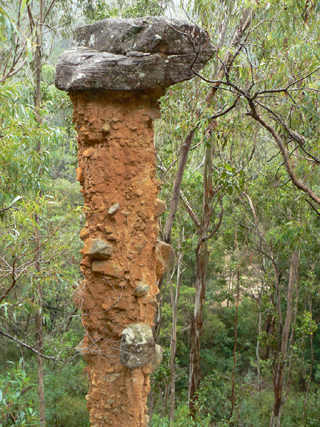
Totem Pole
Is a loosely consolidated rock column with a protective natural capstone. It islocated 240m upstream of the junction of Houstons Creek and Wolgan River and 45m above the southern bank of the Wolgan River. Measuring 6m in height, it has a circumference at the base of 3.4m and a capstone of 1.5m in width. This 6m high pinnacle was recorded in Joseph Carne's field book, 1907. A captioned photo taken records it as "Earth Pillar, the Pinnacle, Wolgan Valley", c1908. Ref: Department of Primary Industries and State Records. Named as the Totem Pole by Joseph Mack in 1975. Ref: Correspondence from Joseph Mack, 3rd March 2009.
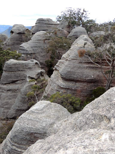
Tower of Hope
Located within Hecates Cauldron, is accessed from The Dungeon and gives one of the best iconic views of the Greater Blue Mountains National Park. Looking north, there are magnificent massive smooth and rounded pagodas, with further views over the Capertee Valley and Pantoneys Crown. Named by Yuri Bolotin, 29th August 2015 as the symbol of hope for protection of the entire Gardens of Stone area.
Town of Airly
*
Was settled in the 1880s, following the discovery of shale oil in 1883. Proclaimed as such on the 4th September 1897, by the 1920s, it was a ghost town. The first lease on the southern portion of the Airly shale deposit was taken up by the original prospecting party of Messrs Melliday, Massey, Bulkeley, Nicholson and Larkin and was known as the Genowlan Mine. This group failed to meet the necessary labour conditions and the lease lapsed. A new lease of 420 acres was taken up by Mr D. Wilson in late 1890, in turn, this lease was purchased by a German owned syndicate called the Genowlan Shale Company. A more fulsome account of the changes in ownership of the various mining leases and the interlocking relationship between Airly with the adjoining village of Torbane is documented by Mills, and also by Taylor, Greg. J. The Glen Davis Story, History of the Capertee Valley Shale Oil Project. Undated, p. 4.
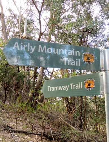
Tramway Trail
Located at Airly and has been designated by the NPWS, and so chosen as it roughly approximates the horse drawn tramway which linked the North Hartley Mine output to an aerial ropeway in a south westerly direction over the cliff edge to the retorts at Torbane, c1885. The trail sign was erected in 2014. The trail starts at the intersection of the Airly Mountain Trail. No end point is designated. This road ends at GR 218 350, unbelievably at the cliff edge.
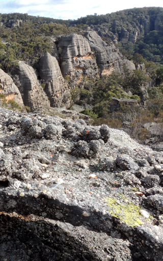
Treasure Chest Spur
Is located at Airly it trends in a north east direction from GenowlanTrig to above a tributary of Genowlan Creek. So named by Brian Fox on a Bush Club walk, 27th July 2015 after the nature's mastery of a treasure trove of pagodas and views. Also in keeping with the name Treasure Point to the east.
Treasure Point
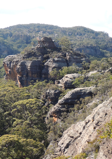
Is located 1.2km north east of GenowlanTrig Station, Airly. Named by Brian Fox on a Bush Club walk, 27th March 2013. This high point show cased the natural treasure of God's creation in the multiple pagodas; also, in the morning before starting this walk, Brian had photographed Col Ribaux's sample of diamonds found on this plateau.
Tree Fern Waterfall
Is located within Nayook Creek downstream of Deep Pass and The Slot. It is part of the Green Room. This is a descriptive name coined by the Woody Pear Walking Group in 1994. Ref: Olive Noble's track notes, 23rd May 1994.

Trident Pass
after Neptune’s Trident, is a triple complex of passes located in one wide gully that allows access from the western side of the Wolgan cliff line. Located 700 m due south of Wolgan View Lookout. Named by Michael Keats on a Bush Club walk, 16th February 2015.
Trolls Bridge
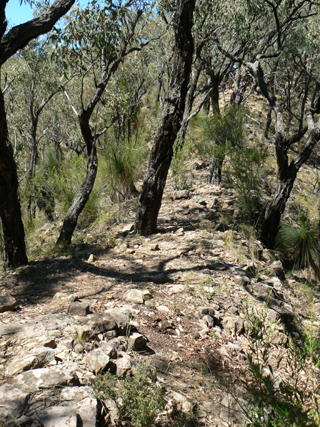
Is a very narrow saddle located on the north east side of Pantoneys Crown that gives access from Dominic Dellalibera's property, Ngamperi, to the base of Pantoneys Crown. Named by Dominic as he felt no other creature could have devised such a magical formation.
Tuiwon
William Mylecharane (1832-1917) licensed surveyor in 1892 recorded the Aboriginal name for, The Vale of Clwydd as, Tuiwon. Ref: Smith, Jim. Does the Cox River have an Aboriginal name? Blue Mountains Historical Society, Hobby’s Outreach Vol. 28; No. 3, June – July 2016.