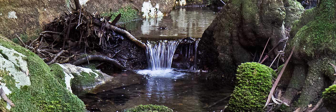
is positioned on the north side of the Wolgan Valley, opposite Donkey Mountain. William Lamb (1852-1936) discovered loose kerosene shale here c. 1885. Ref: Carne, Joseph. The Kerosene Shale Deposits of NSW, 1903, p. 179.
Ignatius Wall took out a Mineral Lease on 24 July 1906 for the purpose of shale and coal. The mining survey, completed on 10 December 1908, shows Lambs Tunnel at the southern part of the 640 ac lease. The plan also has the sum recorded of £87. Ref: Plan of Portion MP 44, Parish of Goollooinboin and Wolgan, County of Cook. S1891.
A number of Lamb family members held land in the Wolgan area: Frederick, William and Albert Lamb. Ref: Survey Plan 495, 518, 612, 1856 and 1858.1507. Albert Lamb’s occupation was listed as ‘Miner’. Note: Ignatius Wall for whom Walls Cave, Blackheath is named, held a number of mining leases, one such was on Narrow Neck, Katoomba. Ref: Keats, Michael & Fox, Brian. The Passes of Narrow Neck, 2008, p. 71. Lambs Tunnel is located below Collett Gap and above the Wolgan Road on private property.
Bush Explorers Encyclopaedia
Is a bush walking pass 1.9km north, north east from Mount Budgary which leads into Rocky Creek. Named by Michael Keats, 5th August 2009. This pass, along with Frenulum, Ocellus, Pheromone and Spiracle Passes, all near Mount Budgary, are named after an anatomical part of a Moth. Michael had encountered a large numbers of Moths during his series of walks on Mount Budgary Plateau.
Refers to canyons and a cavern located on the eastern side of Genowlan Mountain, 2.1km south of Genowlan Point and 2.6km north east of Genowlan Trig Station. Named by Michael Keats on a Bush Club walk, 9th - 11th November 2010. Described as a, "tight, confined stream and canyon, about 3m wide, which opened into a huge cavern about 25m wide and high."The exit is called The Dragons Mouth.
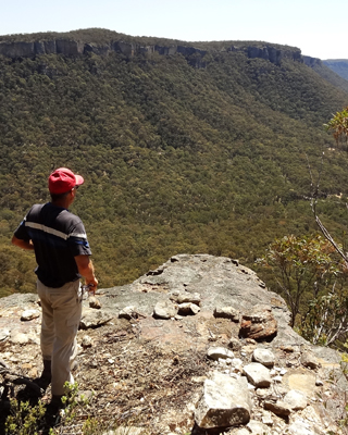
Last Crusade Ravine is a small non perennial creek rising on the northern side of Blackfellows Hand Trail, 900m east of Wolgan Gap. It flows generally north for 1.2km to join the Wolgan River at GR 322 108. Last Crusade Point hasspectacular views down the Wolgan Valley and is located on the eastern side and top of the main cliff line, Also Crusade Rocks,on the eastern side, is an elevated, almost circular depression with outlier pedestal pagodas giving 360 degree views of the area, GR 322 097. All these features were named by Yuri Bolotin on a Bush Club walk, 4th October 2013, in keeping with the named Indiana Jones movie themes for this area.
Last Crusade Ravine is a small non perennial creek rising on the northern side of Blackfellows Hand Trail, 900m east of Wolgan Gap. It flows generally north for 1.2km to join the Wolgan River at GR 322 108. Last Crusade Point hasspectacular views down the Wolgan Valley and is located on the eastern side and top of the main cliff line, GR 320 102. AlsoCrusade Rocks, on the eastern side, is an elevated, almost circular depression with outlier pedestal pagodas giving 360 degree views of the area, GR 322 097. All these features were named by Yuri Bolotin on a Bush Club walk, 4th October 2013, in keeping with the named Indiana Jones movie themes for this area.
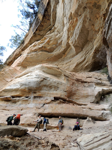
Is located below the main cliff face on the 900m contour on the western escarpment of the Wolgan Valley, 1.9km near due west of Cape Horn. Recent in terms of geology, a section of the cliff line has fallen away creating a huge opening and several tiered overhangs. Across the opening it is 30m+; the same from drip line to the back wall. It is an overpowering 50m high. The floor slopes at 45 degrees. The opening faces east. Vegetation is almost absent except for a white floweringEpacris crassifolia, seen and photographed high on northern back wall. Named on a Bush Club walk 11th June 2016 after Bill Lawler whose property is immediately below and bordered by the Wolgan State Forest.
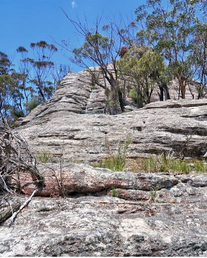
Is located on a sandstone pagoda, being the highest point in the Cape Horn plateau. Named in 2016 by Bill Lawler, whose property is immediately below and bordered by the Wolgan State Forest. Public access is via Wolgan Road, The Bicentennial National Trail and the fire trail towards Cape Horn.
See The Barnacles
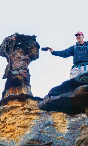
is a small rocky pinnacle containing an old post-mounted letterbox. Located 3 km south east of Birds Rock Trig and above Carne Creek. Named by Daryl Watson on a bushwalk, 2 June 2014.
We entered a very pretty circular room on the left-hand side of the main gorge. It is about 40m in diameter and is surrounded by high walls; on the ground, amongst a sea of ferns, stands a giant solitary Eucalyptus tree. At 1218, GR 3320 2025, 982m. This area is very similar to Liberty Chamber a little further downstream, which we had found, explored and named during our previous walk here on 08 December 2017. I (Yuri Bolotin) therefore propose to name both these rooms Liberty Chambers.
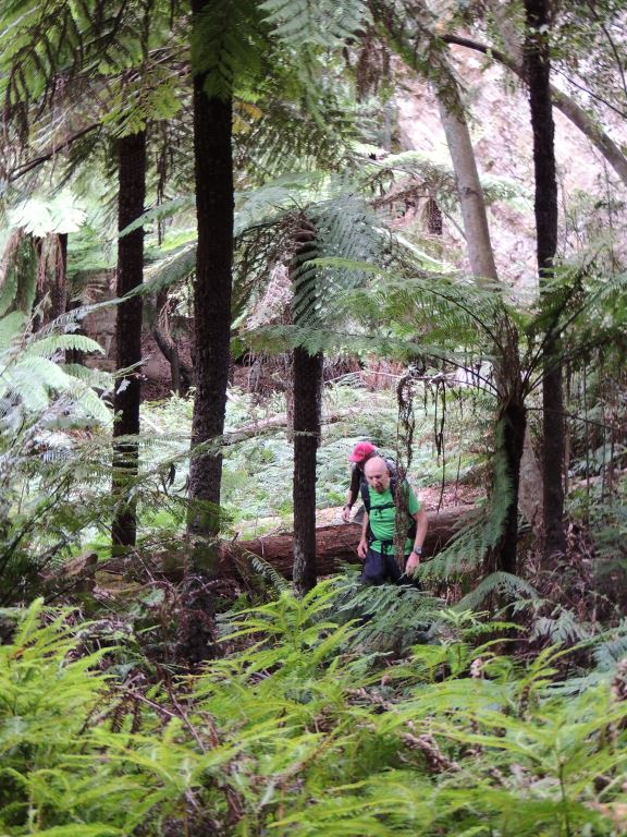
Has its headwaters within the area known as Alcatraz, 450m west of Woolpack Rock. This gully flows for 500m before it reaches the main cliff line, then a further 1.4km till it joins Barton Creek. Named by Yuri Bolotin, Michael Keats and Brian Fox on a Bush Club walk on 27th February 2017. Michael’s track notes record the top section of this gully,In the green heaven below are many species of fern, tree fern and huge Eucalypts. Rain forest tree species are numerous… Over twenty minutes was spent exploring. It was nowhere near enough. Brian and I climbed high and Brian found a way up through a slot to the north. We then returned to the floor of the gully with its exceptional carpet of green and honey coloured walls. This gully that we later proved is readily negotiable all the way through the top cliff line, Yuri, Brian and I have called it Liberty Gully. It is the antithesis of Alcatraz.
Is near the junction of Blackfellows Hand Trail and Beecroft Firetrail. This is the headwaters of the Wolgan River. Ref: Interview with Dick Bird, 29th January 2010, who recalled his father, Jim, cut timber for power poles in this area, 1940s. Correspondence with Danny Whitty, 3rd July 2010. Danny used the names Lightning Tree Swamp and Lightning Tree Gully. Also more recently known by the name Junction Swamp
is a natural pass which was enhanced by erection in 1906 of dry stone walling to give easy access from the spur line on the western side of Constance Gorge for the construction of the telephone line to Newnes. This pass gives walking access from the Wolgan River via Zobels Gully and Constance Gorge to Constance Point in the north, or to the Old Coach Road and Tiger Snake Canyon Track to the south. Named by Brian Fox on a bushwalk of 10 January 2016.
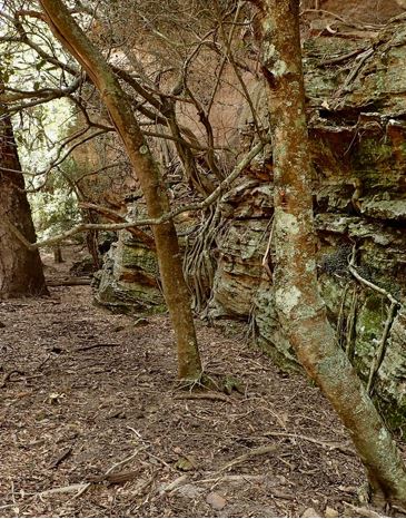
Is a deep gorge with almost parallel 30m high walls spaced 15m apart. The eastern wall forms the base of the feature known as Lion Rock. Located within the area known as The Three Hundred Sisters, 300m east of Genowlan Mountain. Named by Yuri Bolotin and Brian Fox on a Bush Club walk 24 November 2017.
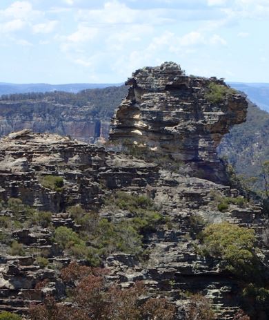
Refers to an isolated sculptural rock formation, which created in the mind a strong resemblance to a resting lion. Located within the area known as The Three Hundred Sisters, 300m east of Genowlan Mountain. Named by Yuri Bolotin and Brian Fox on a Bush Club walk 24 November 2017.
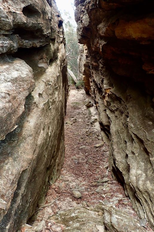
Is a 4m wide and 80m long slot in which the western wall forms the base of the feature known as Lion Rock. Located within the area known as The Three Hundred Sisters, 300m east of Genowlan Mountain. Named by Yuri Bolotin and Brian Fox on a Bush Club walk 24 November 2017.
Rises about 2km south west of Clarence. It flows for about 3km generally north by west into Farmers Creek. Assigned 30th May 1975, previously called Lithgow Valley Creek. Ref: Parish of Lett, 4th edition, 1st November1897.
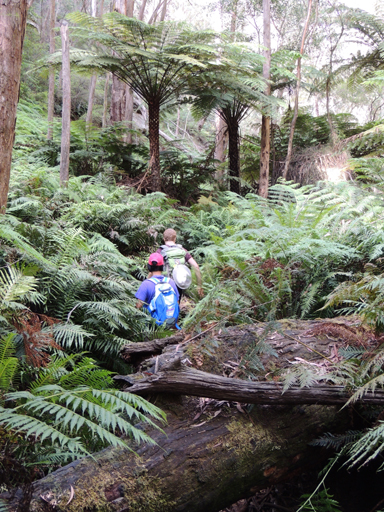
Is a non perennial stream rising on the north side of Mount Dawson. It flows generally north and east for about 6km into the Wolgan River north of Newnes. Ben Bullen Topo Map, GR 382 247, junction GR 425 261. Note: Little Capertee Creek is the next named creek to the north of Capertee Creek and both creeks are about the same in length.
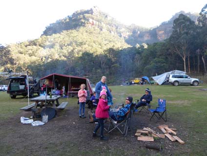
Little Capertee Creek Camping Ground
Lies within the Wollemi National Park, 400m beyond the old Newnes Hotel. The Wolgan River forms the south east boundary. Also simply known as The Flat. Ref: Interview with Dick Bird and Ron Bourke, 29th January 2010, childhood memories 1940s. Named after the township and valley of Capertee.
Also known as Little Capertee Camping Area, as per NPWS signage at the entrance to the camping area.
Refers to the cliff line on the northern side of Little Capertee Creek. Name was recorded with map in Taylor, Pete. The Wolgan Valley Rockclimber's Guide, 1st ed; 1974, p. 17. Shown as Little Capertee Cliffs on tourist hand drawn map titled The Newnes Area, 2005, by Thomas Ebersoll, owner of the old Newnes Hotel.

Is a projecting rock pagoda as seen to the north west 360m above Little Capertee Camping Ground, Newnes. Walking access is via the camping ground and Cathedral. Canyon. Spectacular views down and up the Wolgan Valley. Named by Yuri Bolotin and Brian Fox on a Bush Club walk 28 August 2017.
Rises on the northern side of Waratah Ridge and generally flows south for 2km to join Cerberus Creek. Named by Michael Keats on a Bush Club walk, 7th May 2010. Michael recorded, "At the foot of these cliffs, the dry sandy floor was covered in hundreds of dog footprints. Is that why the main creek is called Dingo Creek? This creek needed a name with dog connotations, and so Cerberus Creek was named." Michael named Little Cerberus Creek as it was smaller and flowed into Cerberus Creek.
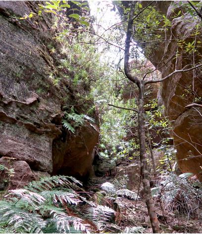
Is a narrow gully, about 70 meters in length, 800m near south of Dicksonia Forest Ravine. Named on a bushwalk by Paul Ma, 20 October 2016.
Is a knoll of 870m elevation and 250m above the Wolgan Road. Located 600 m north of Wolgan Cemetery and separated from Donkey Mountain to the east by a saddle of 670 m. Interview with Joe Bird, who was born and raised in the Wolgan Valley; his father Jim was the licencee of the Newnes Hotel from 1940 - 1946. His reply was,"Locals referred to the mesa as Big Donkey and Little Donkey". Ref: Joe Bird, oral history to Brian Fox, 15th June 2009. Ref: Dick Bird and Ron Bourke interview, 29th January 2010, both were born in the Wolgan Valley in the 1920s
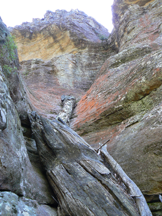
Little Rock Island is an isolated and elevated area, roughly kidney shaped, that has a top surface area of just over half a square kilometre. Like its bigger brother, it is essentially a large, prominent, isolated rock with little vegetation. It is located immediately south of Rock Island. Named by Michael Keats on a Bush Club walk, 20th October 2011.
is an isolated and elevated area, roughlykidney shaped, that has a top surface area of just over half a squarekilometre. Like its bigger brother, it is essentially a large, prominent,isolated rock with little vegetation. It is located immediately south of RockIsland. Named by Michael Keats on a Bush Club walk, 20th October2011. Ben Bullen and Cullen Bullen Topo Maps, GR 436 175 (central position). See Book 3, Walk 3.17, for detailed TrackNotes.
Is 2km in length and separates the Wolgan Road near Blackfellows Hand Rock from Lambs Creek. This old local timber cutter name was in use when the bullockies pulled timber from the area. It was in use up to the 1950s. The name derives from a log bridge over Lambs Creek. Ref: Oral history, local resident, Ossie O'Brien, 20th April 2012. The highest point is 1087m.
Is located near the junction of Beecroft Firetrail and Kangaroos Creek Road. Ref: Correspondence with local historian, Danny Whitty, 3rd July 2010. Local usage name, c1960s.
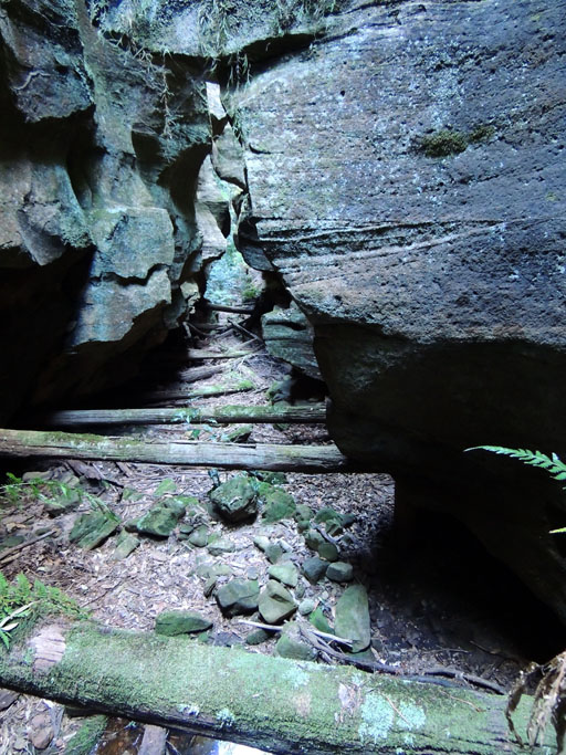
is located on the western side of Petries Gully, 700 m from the Wolgan River junction. Named so as it was probably used as a log slide by timber getters. Hand chiseled square holes can be found at one metre intervals on a constant slope down each side of the canyon. In places, carefully selected and measured logs still span the canyon. There are several examples of cross beams wired to each other as they collectively formed the support trusses for the deck of the slide. The detailed engineering is amazing. Named by Brian Fox, Michael Keats, and Yuri Bolotin on a bushwalk, 13 March 2015.
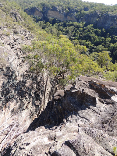
is located at the top of the Log Slide Canyon, where on the southern side there is an old cairn of rocks. The slot is an easy gradient all the way to the plateau top. This ramp is constrained by a parallel sided slot from 2 m to 5 m wide. The slot makes several doglegs and has sections covered in debris. This has been named Log Slide Slot by Yuri Bolotin on a bushwalk, 14 April 2016. On the eastern point above the slot, there is an old mining survey cairn called a lock spit, constructed in 1906, in the shape of the letter ‘T’ and orientated east west and north.
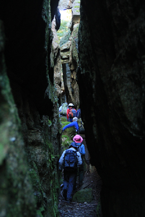
See Donkey Mountain, north east section
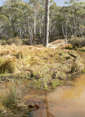
Through which the Coxs River flows, is parallel to the Wolgan Road and is 500m west of Angus Place. This is a descriptive name, as the swamp is 1.7km long and 50 to 300m wide. Swamp shown (no name) on Baker, William. Map of the County of Cook, c1843.
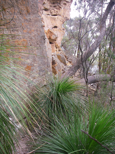
Is a natural pass giving access from the plateau off Glowworm Tunnel Road towards Carne Creek, 2.3km east of Wolgan Pinnacle. A descriptive name coined by Michael Keats on his Bush Club walk, 10th October 2007.
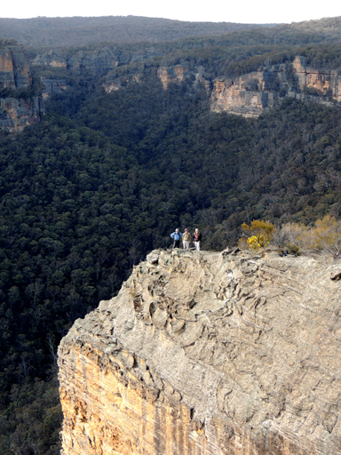
Is the most northerly point of the cliff that juts out over the southern side of the Wolgan River, 1.7km north east of Blackfellows Hand Rock. Named by Yuri Bolotin on a walk, 8th August 2013, in keeping with the named theme, The Temples of Doom, Indiana Gorge, etc., of other features nearby.
Commences as a small stream and breaches the cliffs above the Wolgan River. This name was coined by Michael Keats on a Bush Club walk, 19th August 2013 after the northern most point of land named as Lost Ark Point. Access via Blackfellows Hand Trail, 2.8km from the Wolgan Road.
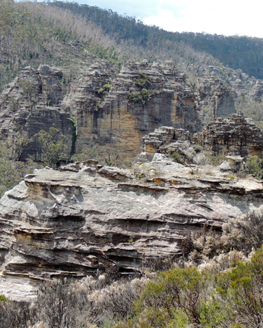
Is located 3km south west from Bungleboori Camping Ground. A 4WD vehicles is needed to negotiate the rough terrain to the end of the ridge. The end of the road overlooks Marrangaroo Creek and the old silted up dams on a side tributary. In the late 1980's probably around 1989 Victor (Vic) Widman, of Great Divide Tours, info@4wd.net.au visited this area and followed the dead end track which led to the unusual rock pagodas. At the time he was a freelance, writing for 4 x 4 Australia Magazine and an Express Publication known as 4WD Weekend Escapes. He coined the name, The Lost City, in these articles, Vic recalls making up the name for the articles based on the lost cities of the Incas in South America , and to his knowledge no one else at that time evercalled it the Lost City. The final descent to the Lost City was closed off by State Forests towards the end of 2002.
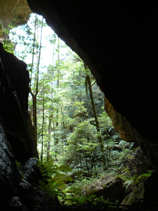
Is a 400m cliff lined ravine and a tributary on the southern side of Rocky Creek. It has roughly a north south configuration, 1.4km north of Mount Budgary. So named by Brian Fox and Michael Keats on a Bush Club walk, 17th April 2009, due to the intense feeling of entering the domain of the lost world of Jurassic Park (as per Steven Spielberg's movie).
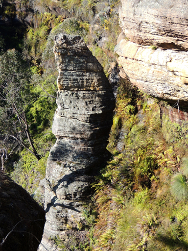
Is an amazing 20m isolated column near the headwaters of the creek between Gang Gang Road and North Ridge Road. Named by Michael Keats on a Bush Club walk, 24th July 2015. The biblical story is that Lot's wife was turned into a pillar of salt for disobedience.
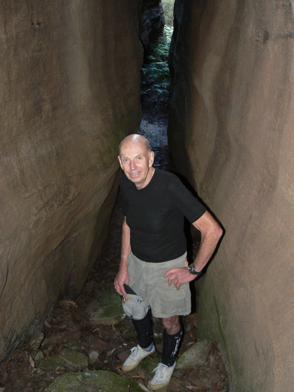
See Hades Ridge
See Hades Ridge.
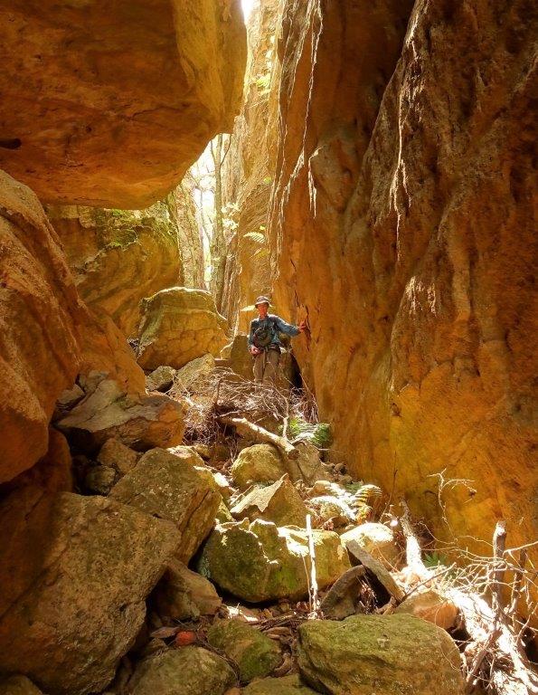
Is located above the main cliff line 200m north of Wolgan Rock and 600m south east of Collect Gap. It is a double slot that runs for about 100m from the top of the ridge in a south west direction. Its walls are about 30-40m high; they are 2-5m apart in one branch and less than 1m apart in another. Named by Yuri Bolotin on a Bush Club walk 6th March 2017.
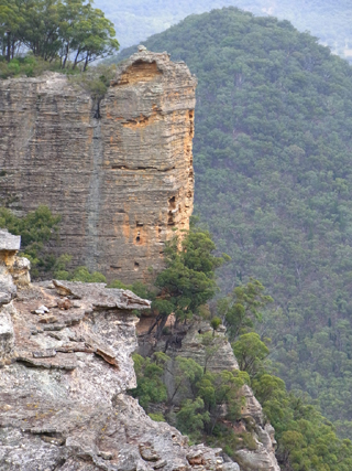
See Donkey Mountain, middle section
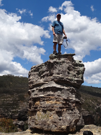
Is positioned on top of 50m cliff line and pagoda located at the western end of Firetrail No. 2 via Glowworm Tunnel Road. It has views overlooking Carne Creek to the west and Camp Creek to the east. AJ Jack placed a plaque at this location in 2002,"In loving Memory of Lurlene Jack 22/4/28 - 5/9/67" His mother had died aged 39, when AJ (christened Anthony Neil Jack) was only two years old. Lookout named by Karen McLaughlin and shown in her pamphlet, Short walks on the Newnes Plateau compiled for the Blue Mountains Conservation Society, June 2009. In research by Brian Fox and correspondence to AJ Jack, it was found that his mother's name was correctly spelt as Lurline.
When AJ Jack placed the plaque on this rock he also wrote the following poem.
Goodbye
I woke one day and you were gone
I cried but you could offer no comfort
Your ashes were cast to the winds
No plaque No stone
Just fleeting infant memories to show your time on earth.
But now a lone rock on a bare hill will carry your name
A simple reminder that you were here
And among the towering sentinels of sandstone
I can focus my thoughts on remembrance
And I can finally say goodbye.
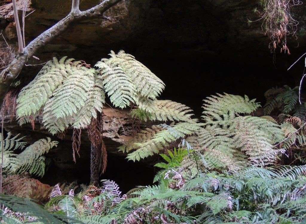
Is a narrow gully on the upper tributaries of Genowlan Creek. The start of the defile is from the 4WD track 1.1km north of Genowlan Trig Station; it extends 500m northwards from 860m to 1000m and gives easy access to Paddys Mountain from Genowlan Creek. Named by Rodney Falconer, who was one of the major players in the creation of the Gardens of Stone National Park, November 1984. Updated by Brian Fox and Yuri Bolotin after a bushwalk on 2 August 2019.
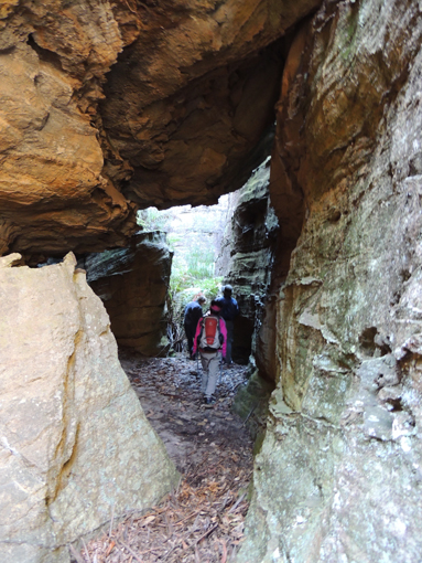
Is located 1.2km due south of the old Newnes Hotel above the main cliff line. Described by Michael Keats as follows: “ a small slot passage suddenly opened out into a glorious richly decorated natural room.”So named by Brian Fox, Michael Keats and Yuri Bolotin on a bushwalk, 12th September 2016. A recently vacated Lyrebird nest gave rise to this name.

Thomas Maddox opened up a stock route from Cullen Bullen to Bells Line of Road in 1870. His stock route was shorter and avoided the toll at Blackmans Flat. This line of road traversed up the spur line on the eastern side of Cullen Bullen (known as Maddoxs Pinch) along Ben Bullen Range and north east of the Great Dividing Range to Gardiners Gap. From Gardiners Gap the line followed Long Swamp Road south along the Wolgan Road and joined Angus Place Trail where the present Angus Place Mine is located. This route then joined the Beecroft Firetrail to the junction of the Blackfellows Hand Trail. From thence it followed a small section of the present Old Bells of Line Road, changed direction due south on the eastern side of the present motorcycle club at Happy Springs and looped around to the east before once again joining the Old Bells Line of Road. (Note: A section between Bungleboori and Happy Springs, from which the present road deviates, was the source of the water supply for the stock at Paddys Swamp and the sawmill site). Maddoxs Line then traversed south east through the present sand mining area, went north of the Main Western Railway loop and along the present road on the northern side of the railway line and joined Bells Line of Road about 1km west of Valley View Road, Dargan.
Ref: Map showing the various attempts to find the best route from Mt Victoria to the Western Country by Alex Wilson, 1914. On Maddox Line is also the notation, “Route suggested by delegates of Richmond Committee for Road Mudgee to Wellington Valley”. Also text, “Stock route Cullen Bullen to Bells Line opened by Thomas Maddox. ”
Survey Plan C513A.1507, dated 25th December 1875, with wording, "Maddoxs Line of Road for Travelling Stock.” County of Cook, Parish of Marrangaroo, 2nd edition, 1889. Spelt as (sic) Maddock’s Line.
Thomas Maddox had purchased 30ac on the Coxs River at Lidsdale in 1853. Ref: Survey Plan C38-1507. Maddox Lane in Lidsdale carries the family name.
Maiyin-gu Marra-gu or Mayiny-gu Marra-gu or Maiyingu Marragu.
See Blackfellows Hand Rock, Blackfellows Hand Trail.
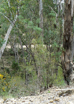
Is a non perennial creek rising south east of Mount Airly. It flows generally south, south west for about 3km into Reedy Creek. First shown on the map Parish of Coco, County of Roxburgh, 4th edition, 1918. To date, no research has unearthed the origin of who Malcolm was. Perhaps with Scottish names in this area, such as Airly and McLeans, it may have been named after King Malcolm of Scotland.
Joins Hut Trail at GR 221 301 and continues to Glen Davis Road at GR 234 314, and in doing so crosses Malcolms Gully, hence the name of this trail.
Is shown on Baker, William. Map of the County of Cook, c1843. Name recorded as Middle River or Marrangaroo Creek on the Blue Mountains Burragorang Valley Tourist Map, 1932. Flows generally west into the Coxs River